webshop.nl
Categorieën
  Sluiten

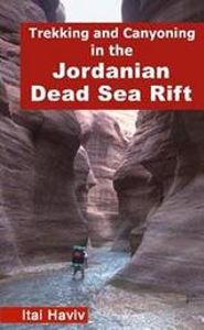
Wandelgids Trekking and Canyoning in the Jordanian Dead Sea Rift | Desert Breeze

Erg volledige gids en enig in zijn soort, over dit prachtige gebied op de westgrens van Jordanië, vol canyons, kloven, bergen, woestijn, waterbronnen en watervallen. De eerste gids waarin deze hoeveelheid tochten staat in dit gebied. De tochten zijn zeer divers en zowel voor de beginnende als geoefende wandelaar / klimmer, zowel dagtochten als meer...
20,95

Webshops met dit product

Webshop
Bezorging
Prijs

Anderen bekeken ook

Wandelgids Sinai Trekking Guide | Trailblazer Guides
Bijzondere gids over fantastische tochten in de Sinai: wandelgids met goede schetskaarten, veel praktische informatie. Onmisbaar voor zo'n tocht! Trek with the Bedouin and their camels and discover one of the most exciting new trekking destinations in the world. Egypt's Sinai peninsula is the small tooth of land between Africa and Asia, and the fabled Biblical setting of The Exodus. It's a region of high mountains and sweeping deserts, home to crumbling Egyptian temples, Byzantine monasteries and more. The millions that visit Sinai each year come mostly for its beaches and reefs but for a true adventure, the best way to see Sinai is to trek with the Bedouin. Walking with their camels gives access to the most remote and waterless parts of the peninsula and no other mode of travel immerses you so fully in your surroundings nor gives such a close feel for the desert - its freedoms and hardships. Trekking is becoming ever-better established and it's perfectly possible to arrive and organis…
21,95
Wandelgids Walks and Scrambles in the Moroccan Anti-Atlas - Marokko | Cicerone
Uitstekende wandelgids van dit geweldige gebied. goed beschreven met veel praktische informatie om de route te kunnen lopen, inclusief redelijke kaarten. The walks and scrambles in this guidebook explore the wild and rugged landscapes of the Anti-Atlas mountains of southern Morocco, with Tafraout and the Ameln Valley as the main base. 41 adventurous routes of between 3 and 40km include Jebel el Kest, Adra Mkorn and Ait Mansour, with an outline of a 1 week long-distance trek across the north-west Anti-Atlas. Walks are mainly moderate to difficult, and scrambles are Grade 1 to Grade 3+, with ropes being required for some sections. Often remote and challenging, the routes are suitable for confident walkers and scramblers with good navigation skills. Each route description is accompanied by mapping, with some photo topos to aid route finding in tricky sections. The guidebook also gives background information on the people, culture and history of the region, as well as a wealth of advice o…
24,95
Wandelgids The Kackar - Trekking in Turkey's Black Sea Mountains | Kate Clow
Engelstalige wandelgids met kaart met beschrijvingen van wandelroutes in het Zwarte Zeegebied van Turkije. In deze engelstalige gids worden 32 wandelroutes beschreven van dagdeel wandeltochten tot meerdaagse routes. The Kaçkar Mountains are part of the Pontic Alps, a glaciated, granite mountain range which hugs the south coast of the Black Sea, extending from the Caucasus towards Istanbul. The mountain range is lushly wooded on the north, with pines succeeded at lower levels by chestnut, hornbeam and beech trees, with tea plantations and hazlenut groves spilling down towards the waves. The contrasting southern slopes are patched by summer pastures where black bulls graze and lakes, springs and streams are plentiful and clear. This map and guidebook describes 32 trekking routes in Turkey’s Kaçkar mountains, ranging from half-day walks to multi-day treks. You can cross the passes between the granite spires by paved pack-horse routes or walk traditional footpaths between timeless villages…
22,95
Wandelgids Scrambles in the Lake District - South | Cicerone
Uitstekende uitgebreide wandelgids van een bepaald deel vsn het Lake District, één van de mooiste wandelgebieden van Engeland. De routes zijn goed beschreven, met prima kaartmateriaal. Zolang je niet van de route afwijkt is deze gids voldoende om de wandelroute te lopen. Dit zijn pittige tochten! Guide to 106 scrambling routes in the south of the English Lake District, covering Langdale, Coniston, Eskdale, Patterdale & High Street. A comprehensive collection of scrambles on crags and gills, which are linked together to form 24 first-class mountain days. The carefully graded routes range from scrambling grade 1 to climbing grade V Diff, so there is something for beginners as well as veteran mountaineers. Rock climbing equipment is needed for more difficult routes. Each scramble is clearly described with notes about grade, quality, aspect and approach, with colour maps and topos to aid navigation. There is information on safety and equipment, and listings of scrambles by location and gra…
26,95
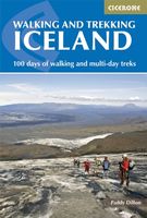
Wandelgids Walking and Trekking in Iceland - IJsland | Cicerone
Wandelgids met beschrijvingen, kaarten en praktische informatie zoals bussen, overnachten, etc. voor meerdaagse wandelroutes en dagwandeltochten op IJsland. A country of extraordinary beauty, Iceland’s incredible variety of volcanic and glacial landscapes makes it a unique destination for walking and trekking holidays. Its three national parks include the mighty Vatnajökull, largest national park in Europe.   The wide range of routes in this book introduce walkers and backpackers to this ‘Land of Ice and Fire’. There are 100 days of walking in this guidebook, stretching over 1722km, split between 49 day walks and 10 multi-stage treks. They climb mountains, cross glaciers, pass lakes and explore coastlines and geothermal areas, and range from easy nature trails to challenging treks. So, there is enough variation to satisfy all kinds of walkers. The routes are spread all around Iceland, grouped into twelve regions. Detailed information is given at the start of each route or trekking stag…
26,95
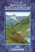
Wandelgids Trekking in the Silvretta and Ratikon Alps | Cicerone
Aanbevolen wandelkaarten bij deze gids: Schaal 1:60.000 Wandelkaart 14 Unterengadin | Kümmerly & Frey Wandelkaart 13 Davos - Arosa | Kümmerly & Frey Of schaal 1:25.000 Wandelkaart 26 Alpenvereinskarte Silvrettagruppe This guide describes three treks, between 5 and 8 days, in the Silvretta and Rätikon Alps starting near Klosters, and 12 half-day hut-to-hut routes. These contrasting ranges form a line on the borders of Switzerland, Austria and Liechtenstein. The Tour of the Silvretta, the Prättigauer Höhenweg and the Rätikon Höhenweg. Straddling the borders of Austria, Switzerland and Liechtenstein, the limestone Rätikon Alps reach into the snow-bound and glacier-hung Silvretta Alps to provide a richly diverse series of landscapes. The Tour of the Silvretta, the Prättigauer Höhenweg and the Rätikon Höhenweg, all within easy reach of Klosters, have been devised to help trekkers explore the best of the region. Given sifficient time they can also be combined to create a continuous 2-week to…
25,95
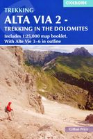
Wandelgids Alta Via 2 - Trekking in the Dolomites | Cicerone
Uitstekende wandelgids van een gerenommeerde Engelse uitgever. De tochten zijn met zorg beschreven en voorzien van allerhande nuttige informatie. Guidebook describing Alta Via 2, a challenging hut-to-hut trek through the Italian Dolomites. Stretching 174km from Bressanone (Brixen) to Feltre, the route involves some aided and exposed sections (although several can be bypassed) calling for a sure foot and a good head for heights. It can be walked in under a fortnight - although it is also possible to walk shorter chunks should you only have limited time, and the guide highlights potential exit routes and transport options. Also included are summaries of Alte Vie 3-6, which are more demanding and include remote terrain and stretches of via ferrata for which climbing experience is essential. On Alte Vie 3-6 some nights will be spent in unmanned bivouac huts, meaning trekkers must carry their own kit, although it is possible to walk shorter hut-to-hut sections. The easiest of the Alta Via r…
23,95
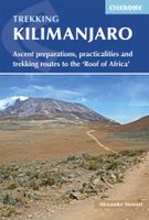
Wandelgids Kilimanjaro trekking | Cicerone
Goede trekking - wandelgids van de Kilimanjaro. Beklimmingen kunnen van alle kanten in vele vormen en vrijwel alle routes staan goed beschreven  in deze gids. Veel praktische informatie en een duidelijke routebeschrijving, duidelijke enigszins schetsmatige kaarten en een uitgebreide inleiding over wat je wel en niet moet meenemen, regelen en voorbereiden. At 5895m, Kilimanjaro is Africa's highest point and the highest freestanding mountain in the world, yet it is possible to reach its summit, Uhuru Peak, without any technical climbing ability. However, that is not to say that it is an easy undertaking: each year, many people fail in their attempt, often due to poor preparation or insufficient acclimatisation. Those who do make it to 'the Roof of Africa' are richly rewarded, enjoying outstanding views, the unique experience of being 'on top of the world' and, of course, a tremendous sense of achievement.   Guidebook describing all the trekking routes on Kilimanjaro (5895m), one of the S…
23,95
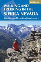
Wandelgids Walking and trekking in the Sierra Nevada | Cicerone
Uitstekende wandelgids voor de Sierra Nevada. Goed beschreven met veel praktische informatie om de route te kunnen lopen, inclusief redelijke kaarten. Aanbevolen wandelkaarten Wandelkaart NP Sierra Nevada met Alpujarras | Editorial Penibetica 1:40.000 of Wandelkaart Sierra Nevada en Alpujarras | Editorial Alpina - 1:40.000 Wandelkaart Sierra Nevada - la integral de los 3000 | Editorial Piolet 1:25.000   This guidebook presents 33 graded walks and 5 high mountain scrambles in the striking Sierra Nevada, the highest mountain range in mainland Spain and in western Europe outside the Alps. Easily accessible from Granada and Málaga, it is a world of soaring, snow-clad peaks and deep valleys, far removed from the crowded beaches of the Costa del Sol just two hours away. The routes are spread across the national park, with attractive towns and villages such as Trevélez, Lanjarón, Hoya de la Mora and Cumbres Verdes serving as potential bases for a walking holiday.   The walks have been careful…
20,95
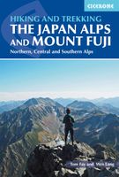
Wandelgids Walking and Trekking in the Japan Alps and Mount Fuji | Cicerone
This guidebook presents nine day-walks and thirteen treks of 2-8 days in the magnificent Japanese Alps, plus the four main routes up Japan's highest mountain, Mount Fuji (3776m), and a further route on neighbouring Mount Kurodake. The Japanese Alps stretch across the middle of the main island of Honshu and include several peaks over 3000m. Mount Fuji lies to the south: an active stratovolcano (though with minimal risk of eruption), it has become an iconic symbol of Japan and sees 300,000 visitors to its summit every year. The guide includes all the information you will need to plan a successful walking or trekking holiday, with a wealth of advice on travel, bases, accommodation and facilities. The Japan Alps and Mount Fuji boast a well-developed walking infrastructure, and the routes make use of the many mountain huts and campgrounds, full details of which are given in the guide. Some also include the opportunity to visit a traditional hot spring bath for a refreshing soak after your …
29,95

Klanten-reviews van Wandelgids Trekking and Canyoning in the Jordanian Dead Sea Rift | Desert Breeze

Er zijn nog geen beoordelingen voor dit productBen jij de eerste die een review plaatst?

Meer over Wandelgids Trekking and Canyoning in the Jordanian Dead Sea Rift | Desert Breeze

Productomschrijving

Erg volledige gids en enig in zijn soort, over dit prachtige gebied op de westgrens van Jordanië, vol canyons, kloven, bergen, woestijn, waterbronnen en watervallen. De eerste gids waarin deze hoeveelheid tochten staat in dit gebied. De tochten zijn zeer divers en zowel voor de beginnende als geoefende wandelaar / klimmer, zowel dagtochten als meerdaagse tochten. Soms is het aanbevolen een bedoein gids of een touw mee te nemen. The Jordanian Dead Sea Rift includes some of the world's most rugged and colorful desert landscapes. Its dramatic canyons are only now beginning to be revealed, offering the trekker untamed desert wilderness. Year-round streams, waterfalls and lush vegetation are all here to be found, dotting the desert with numerous oases. Rising above the canyons are mazes of sandstone domes and isolated cliffs with spectacular vistas. Bedouin nomads roam through the region, herding their goats and often still living in goat-hair tents, not far from world-famous archeological sites such as the Nabataean city of Petra. Treks in the Jordanian Dead Sea Rift include easy walks suitable for all, as well as challenging expeditions through remote areas, only rarely visited by either Bedouin or trekker. Descending several of the Rift's canyons requires abseiling skills and equipment. It is amazing that a region as spectacular as the Jordanian Dead Sea Rift remained unknown to hikers for so many years! The book describes 68 routes ranging from one to six days. Among the routes are easy walks for dayhikers as well as challenging treks. 12 canyoning routes demand abseiling skills. The book is 264 pages long including 35 detailed trekking maps, 3 true-color satellite images and 24 color pages. The vast majority of the routes were never described anywhere before! Voor meer informatie kunt u contact opnemen met De Zwerver.
Webshop.nl maakt gebruik van cookies. Ga je verder op onze website, ga dan akkoord met het plaatsen van cookies en de verwerking van deze data door ons en vermelde partners.