Wandelgids Tour of the Jungfrau Region - Berner Oberland | Cicerone

0
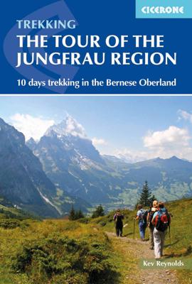
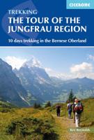
Trekkinggids met de gedetailleerde beschrijving van de klassieke Jungfrau-trek, maar ook varianten. Goede etappe-beschrijvingen met veel praktische info. The Tour of the Jungfrau Region is described as a clockwise hut-to-hut circuit, beginning at Schynige Platte and ending at Wilderswil, broken into 10 stages (with a number of alternatives offered...

Verkopers met dit product

Verkoper
Bezorging
Prijs
DeZwerver.nl logo
DeZwerver.nl
2,95
20,95

Anderen bekeken ook

Nieuw
Wandelgids Trekking in the Silvretta and Ratikon Alps | Cicerone
Aanbevolen wandelkaarten bij deze gids: Schaal 1:60.000 Wandelkaart 14 Unterengadin | Kümmerly & Frey Wandelkaart 13 Davos - Arosa | Kümmerly & Frey Of schaal 1:25.000 Wandelkaart 26 Alpenvereinskarte Silvrettagruppe This guide describes three treks, between 5 and 8 days, in the Silvretta and Rätikon Alps starting near Klosters, and 12 half-day hut-to-hut routes. These contrasting ranges form a line on the borders of Switzerland, Austria and Liechtenstein. The Tour of the Silvretta, the Prättigauer Höhenweg and the Rätikon Höhenweg. Straddling the borders of Austria, Switzerland and Liechtenstein, the limestone Rätikon Alps reach into the snow-bound and glacier-hung Silvretta Alps to provide a richly diverse series of landscapes. The Tour of the Silvretta, the Prättigauer Höhenweg and the Rätikon Höhenweg, all within easy reach of Klosters, have been devised to help trekkers explore the best of the region. Given sifficient time they can also be combined to create a continuous 2-week t…
25,95
Nieuw
Wandelgids - Reisgids The Mountain Hut Book | Cicerone
This book is a celebration of mountain huts, showcasing the the sheer variety and sometimes quirky nature of these buildings that allow walkers, trekkers and climbers to access remote corners of the mountains. Packed with entertaining stories that bring the places and people to life, it contains descriptions of the author's favourite huts in the Alps, along with suggestions for hut-to-hut tours of 3-13 days duration, including the Tour of Mont Blanc. It also traces the history of huts and how they have evolved from the most primitive of shelters to the often purpose-built, eco-friendly buildings of today. For the uninitiated, it unravels some of the mystery of huts and explains how to use them and what facilities to expect. Above all, it illustrates the way in which mountain huts can be truly sociable places, where like-minded people can spend a night or two in the most magical of locations and share a love of wild places. Reviews: [This book is] practical, interesting, and deserves a…
20,95
Nieuw
Wandelgids Trekking in Austria's Hohe Tauern. | Cicerone
Trekking-gids voor de Hohe Tauern in de Oostenrijkse oostelijke Alpen. Een vijftal tochten worden beschreven, vier tochten door de Glockner-, Venediger- en Reichengroepen. Eén tocht het het gehele Nationalpark Hohe Tauern. Although less well know than some other Alpine regions, Austria's Hohe Tauern National Park boasts spectacular mountain scenery, snow-clad peaks and a splendid network of attractive and welcoming mountain huts. It is also home to Austria's highest peak, the 3798m Gross Glockner.   This guide presents four short hut-to-hut treks in the Hohe Tauern region in the heart of the Austrian Tirol: the 7-day Reichen Group Rucksack Route, the 7-day Venediger Group Rucksack Route, the 8-day Venediger Glacier Tour and the 9-day Glockner Rucksack Route. Two other routes, linking stages of the main treks to complete a traverse of the Hohe Tauern National Park and an ascent of the Gross Glockner, are summarised in brief. Also included are multiple excursions to climb neighbouring p…
26,50
Nieuw
Wandelgids Tour of the Lake District | Cicerone
Engelstalige beschrijving van de mooiste wandeltocht in het Lake district. De gids voldoet aan alle verwachtingen die je kunt hebben, het enige dat je mist is een overzichtskaart. Inclusief gidsje met routekaarten van 1:25000 The Lake District National Park is England's most popular mountain region and is designated as a UNESCO World Heritage site. Suitable for most reasonably fit hillwalkers, the 145km (90 mile) Tour of the Lake District takes in the best of this beautiful region in a circular tour. The route is presented in nine stages, plus an optional 'prologue' stage from Windermere station to the start-point in Ambleside, and can be compressed into one week or extended over two weeks, giving time to visit many attractions on the way.   In addition to the main (non-waymarked) route, which links the main towns and valleys of the national park, five interchangeable high-level stages are also offered, enabling you to visit some of the region's most celebrated high peaks - including …
20,95
Nieuw
Wandelgids The Mountains of Romania - Roemenië | Cicerone
Guidebook to walks and multi-day treks in the Carpathian mountains of Romania. Includes routes in the Maramures and Bucovina regions, Piatra Craiului ridge, and the Retezat and Fagaras mountains. This guide describes 27 short treks of 2-6 days and 10 day walks in the mountains of Romania. Although there is a slight focus on Transylvania, most of the main massifs are included, with chapters covering the Mountains of Maramures, the Eastern Carpathians, the mountains around Brasov, the Fagara?, the region between the Olt and the Jiu, the Retezat, the mountains of Banat and the Apuseni. Also included is an ascent of Moldoveanu, Romania's highest peak at 2544m.   There is a wealth of advice to help you plan your trip and organise the logistics of your walk or trek. Some routes avail of the network of mountain huts; others offer opportunities to camp in attractive wild locations. Overviews and a route summary table make it easy to choose an appropriate excursion. Each route includes clear d…
26,50
Nieuw
Wandelgids 100 Hut Walks In The Alps | Cicerone
This guidebook has route descriptions for 100 day walks to suit alpine walkers of all abilities, with suggestions for some hut-to-hut tours. These routes take you through breathtaking scenery in the Maritime Alps, Julian Alps, Gran Paradiso, the Turnitzer Alps, Bernese Oberland, the Kitzbuheler Alps and the Dolomites of South Tirol. Extending in huge arc of more than 1000km (620 miles) from the Mediterranean coast near Nice to the low, wooded foothills outside Vienna, the Alps display the full gamut of mountain landscape features. All of the routes in this guide have been specially selected to show the amazing diversity of this wonderful mountain chain.   There are walks to suit every taste: gentle and undemanding, long and tough, and everything in between. Most of the routes avoid climbing of a technical nature except the odd scramble aided by a fixed rope. Glacier crossings where crevasses lurk for the unwary have also been avoided in the main, although just a small handful of walks…
22,95
Nieuw
Wandelgids The Swiss Alps | Cicerone
  The Swiss Alps are home to the highest and most spectacular mountains in Western Europe. This stunning guidebook describes each mountain area throughout Switzerland – the peaks, passes, valleys and bases – to help you identify the best destinations to plan your trip.   Questions such as ‘Where to walk, climb or ski?’, ‘What multi-day treks are available’ and ‘Where do they go?’, ‘Where are the mountain huts, what are their facilities, which peaks do they serve?’ And where are the most suitable valley bases?’ – all these and more are addressed in detail in this essential guidebook.   The Swiss Alps does not give detailed route directions but information is given about all the guides and maps available for every region.   The Swiss Alps by Kev Reynolds is the third book in Cicerone’s World Mountain Ranges series, which include The Pyrenees and Scotland.   descriptions of all the Swiss Alps, area-by-area from the Chablais Alps in the south west to the Silvretta in the north east classi…
34,95
Nieuw
Wandelgids The Tour of the Bernina | Cicerone
Uitstekende wandelgids van een meerdaagse tocht in Zwitserland en Italië in het Bernina-gebied. Goede beschrijvingen, veel praktische informatie en redelijke kaarten al zullen deze niet helemaal voldoende zijn.   This guidebook explores two treks in the Bernina region of the Swiss-Italian Alps. The Tour of the Bernina is an 9-stage trek circling the Piz Bernina massif, 119km long and suitable for beginner trekkers. Also included in this guide is the 8-stage Alta Via Valmalenco just to the south of the Bernina. Although shorter, at 94km long, this is a more challenging route suitable for trekkers with more experience.   Whether skirting above St. Moritz and below snow-capped giants on the Tour of the Bernina, or climbing over wild, high passes and through isolated mountains in the Italian Valmalenco by Monte Disgrazia, the treks offer incredible experiences. Both feature spectacular peaks towering over snow fields and perfect alpine pastures, with accommodation in comfortable alpine gu…
24,50
Nieuw
Wandelgids Trekking in the Stubaier Alps | Cicerone
Uitstekende wandelgids van Cicerone over de Stubaier Alpen, waarbij de nadruk ligt op een tweetal meerdaagse routes: Huttentochten voor een gemiddelde en wat meer gevorderde wandelaar. Goede praktische informatie, kaartmateriaal beperkt. Aanbevolen wandelkaarten bij deze gids Schaal 1:25.000 Wandelkaart 31/1 Alpenvereinskarte Stubaier Alpen - Hochstubai Wandelkaart 31/2 Alpenvereinskarte Stubaier Alpen - Sellrain Of schaal 1:50.000 Wandelkaart 83 Stubaier Alpen Kompass A guidebook to three hut-to-hut treks in Austria’s Stubai Alps: the 79km Stubai Rucksack Route, the 60km Stubai Glacier Tour – plus a South Tirol extension, and the 67km Gschnitztal Runde Tour. Whereas the rucksack route requires only good fitness and mountain walking experience, the glacier tour involves glacier crossings. The Stubai Rucksack Route is presented in 9 stages, the Stubai Glacier Tour in 7 (with the extension bringing it to 11) and the Gschnitzal Runde Tour in 7.   Also included are optional ascents of nei…
24,95
Nieuw
Wandelgids Hiking in Norway-South | Cicerone
This guide describes 10 shorter hut-to-hut treks showcasing southern Norway's wild natural beauty, with highlights including Galdhøpiggen - Norway's highest peak at 2469m - and the iconic Pulpit Rock and Kjeragbolten on the Lysefjord. The routes range from 3 to 8 days (although many can be adapted or combined to create longer or shorter routes) and cover Jotunheimen, Rondane, Dovrefjell, Trollheimen and Ryfylke. They are suitable for experienced hikers with a good level of fitness and can be walked from mid-July to the end of September.   Clear route description and mapping are provided for each hike. Stages are graded according to difficulty: although all of the routes follow waymarked trails, some cross remote and challenging terrain which may include exposed sections calling for a sure foot and a good head for heights. However, in many instances, alternatives are provided avoiding the most demanding sections. The guide also offers comprehensive advice on public transport access and…
23,95

Klanten-reviews van Wandelgids Tour of the Jungfrau Region - Berner Oberland | Cicerone

Er zijn nog geen beoordelingen voor dit productBen jij de eerste die een review plaatst?

Meer over Wandelgids Tour of the Jungfrau Region - Berner Oberland | Cicerone

Productomschrijving

Trekkinggids met de gedetailleerde beschrijving van de klassieke Jungfrau-trek, maar ook varianten. Goede etappe-beschrijvingen met veel praktische info.

The Tour of the Jungfrau Region is described as a clockwise hut-to-hut circuit, beginning at Schynige Platte and ending at Wilderswil, broken into 10 stages (with a number of alternatives offered). The 111km trek takes you in a horseshoe loop through the Bernese Oberland's most spectacular mountain scenery, in the shadow of such iconic peaks as Wetterhorn, Eiger, Monch and Jungfrau. In a journey of 9 to 10 days the Tour visits pastures, ridges, summits and passes, skirts exquisite mountain lakes and gazes on waterfalls, gorges and glaciers. Accommodation is both plentiful and atmospheric, and the route has lots of bad-weather alternatives.


Verken gerelateerde categorieën

Webshop.nl maakt gebruik van cookies. Ga je verder op onze website, ga dan akkoord met het plaatsen van cookies en de verwerking van deze data door ons en vermelde partners.