Wandelgids Tour du Mont Blanc | Vertebrate Publishing

0
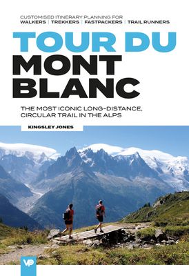
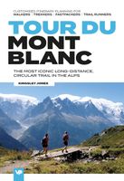
Tour du Mont Blanc is the definitive guidebook for one of the most famous long-distance treks in the world. This trek circles the entire Mont Blanc massif, passing through spectacular scenery in France, Italy and Switzerland. You’ll traverse high mountain passes, see stunning glaciers, pass azure lakes, wander through tranquil green valleys and al...

Verkopers met dit product

Verkoper
Bezorging
Prijs
DeZwerver.nl logo
DeZwerver.nl
2,95
24,95

Anderen bekeken ook

Wandelatlas Tour du Mont Blanc | Cicerone
A booklet of all the mapping needed to complete the Tour du Mont Blanc (TMB), a spectacular circuit around Mont Blanc, Western Europe's highest mountain. Covering 170km (105 miles), the TMB takes around 11 days to walk from its official start at Les Houches (France), passing through Courmayeur (Italy) and Champex (Switzerland) before returning to France via the Chamonix valley. A well-serviced introduction to high-level mountain trekking for walkers with good levels of fitness, it can also be run, fastpacked or hiked in 5–9 days.   The full route line is shown on 1:25,000 IGN maps The map booklet can be used to walk the TMB in either direction Handy facilities planner, route summary tables and accommodation listings help you plan your itinerary Includes urban maps of Les Houches, Les Contamines, Courmayeur, Champex and Chamonix Alternative stages via Col de Tricot (Stage 1A) and Fenêtre d'Arpette (Stage 8A) are also provided An accompanying Cicerone guidebook – Trekking the Tour du Mo…
21,95
Wandelgids Trekking the Tour du Mont Blanc | Cicerone
Uitstekende wandelgids die in etappes de route nauwkeurig beschijft; ook de zijtakken en alternatieve routes koman aan bod. Kaarten zijn schetsmatig en in onze ogen onvoldoende bij slechte weersomstandigheden. Wij raden dan ook om er losse kaarten bij te kopen. A guidebook to hiking the Tour du Mont Blanc (TMB), a spectacular circuit around Mont Blanc, Western Europe's highest mountain. Covering 170km (105 miles), the TMB takes around 11 days to walk from its official start at Les Houches (France), passing through Courmayeur (Italy) and Champex (Switzerland) before returning to France via the Chamonix valley. A well-serviced introduction to high-level mountain trekking for walkers with good levels of fitness, it can also be run, fastpacked or hiked in 5–9 days.   The route is described in both directions in 11 daily stages between 7 and 21km (5–13 miles) in length. Variant routes and alternative stages are also provided, giving the option of visiting cols, refuges and viewpoints no…
25,95
Wandelkaart Tour du Mont Blanc Guidemap | Vertebrate Publishing
The white dome of Mont Blanc looms over France, Italy and Switzerland, and it is no wonder that the 169-kilometre Tour du Mont Blanc (TMB) has captured the public imagination to become one of Europe's most popular long-distance trails. The TMB appeals to people who have different levels of experience and travel at all speeds, and this Vertebrate Publishing Guidemap is unique in that it caters for four categories of user, providing custom itineraries for walkers, trekkers, fastpackers and trail runners. This lightweight, waterproof, durable and easy-to-use folding map features all the essential information for a successful TMB, including 1:40,000-scale mapping for the anticlockwise route starting and finishing in the town of Les Houches, south of Chamonix.   It also includes nine route variations, a detailed elevation profile and route planner, safety advice, terrain information and an accommodation directory, and a link to a GPX file download.
24,50
Wandelgids Tour Du Mont Blanc | Knife Edge Outdoor
Overzichtelijke routegids van deze prachtige wandelroute. Per etappe vind je een hoogteprofiel, goede beschrijvingen van de wandelroute, een topografische kaart op gedetailleerde schaal. Voor en achterin de gids staat aanvullende praktische informatie zoals adressen van campings, andere accommodaties en bijvoorbeeld een paar pagina's over de flora en fauna.    Complete guidebook for planning and trekking the Tour du Mont Blanc, the world's most famous trek   Real maps for each stage: 1:25,000. No need to buy a separate map!   Unique Itinerary Planner: plan a bespoke itinerary to match your ability and vacation schedule. All difficult calculations of time, distance and altitude gain are done for you   Everything the trekker needs to know: route descriptions, costs, budget, difficulty, weather, how to get there, and more   Full accommodation listings: spectacularly situated mountain huts, villages and hamlets   Full section on camping: a complete list of camping locations   10 exciting …
20,95
Wandelgids Trekking the Tour Des Combins | Knife Edge Outdoor
The definitive guidebook for the Tour des Combins: the new bucket list trek in the Swiss/Italian Alps. A superb alternative to the more famous Tour du Mont Blanc. Two-way guide: both clockwise and anti-clockwise routes are described in full. Real Maps: full mapping inside (1:40,000), made specifically for Knife Edge Outdoor Guidebooks. All accommodation/campsites are numbered and marked on the maps. 10 different itineraries: schedules of 6, 7, 8 and 9 days for hikers and runners. Includes both clockwise and anti-clockwise itineraries. Difficult calculations of time, distance and altitude gain/loss are done for you. Also includes: * Detailed information on equipment and travelling light * Full accommodation/campsite listings * Wild camping rules explained * Everything the trekker needs to know: route, costs, difficulty, weather and more * Travel to the trail-head * Essential info for both self-guided and guided trekkers * Information on plants and wildlife * Numbered wayp…
27,50
Wandelgids - Reisinspiratieboek Big Trails: Heart of Europe | Vertebrate Publishing
Mooi inspiratieboek met 25 langeafstandswandelingen in West-Europa. Met foto's, een beschrijving van de route en wat praktische informatie is dit boek perfect om uit te vinden wat het volgende grote wandelavontuur gaat worden.   Big Trails: Heart of Europe is an indispensable guide to the most spectacular and popular long-distance trails in the Western European countries of France, Belgium, Netherlands, Luxembourg, Germany, Switzerland, Austria and Italy.   The twenty-five featured routes cover the best that European trails have to offer, sweeping from the GR21 along the Normandy Coast to the GR1 Tour de Paris and King Ludwig’s Way in Germany. Culminating in trails such as the Tour du Mont Blanc and Chamonix–Zermatt Haute Route, the jewels of the Alps, this delves deep into Western Europe’s most iconic routes.   The book will inspire big adventures. Rather than being carried along the route, this guide provides everything you need to plan and explore further, including a general overv…
24,95
Wandelgids Walking in the Haute Savoie North | Cicerone
Uitstekende wandelgids van dit geweldige gebied. Goed beschreven met veel praktische informatie om de route te kunnen lopen, inclusief redelijke kaarten. A guidebook of half and full-day walks in the lovely Haute Savoie mountains of France. This guide describes 30 circular routes of between 7 and 13km, based around Evian-les-Bains, Morzine, Abondance, Châtel, St-Julien-en-Genevois, Bellevaux, Boège and Habère-Poche. Graded from easy to difficult, there are walks to suit most abilities, but a few have some exposed sections and need a head for heights.   The guide is divided into 6 areas covering the Salève and Vuache, the Vallée Verte, the Vallée du Brevon, Pre-Alpes du Léman and Val d'Abondance. Alongside a detailed route description and map, each walk has a summary of all you need to know before you set out (distance, time to walk, ascent, maximum altitude and instructions for accessing the start). The guidebook includes advice on travel, accommodation and equipment, as well as infor…
20,95
Wandelgids Tour Du Mont Blanc | Trailblazer Guides
Goede wandelgids van deze beroemde route. Veel informatie vooraf en een zeer gedegen duidelijke beschrijving van de te volgen route. Opvallend blijft dat deze uitgever geen gebruik van gewone detailkaarten, maar van getekende schetskaarten waarbij ze de nadruk kunnen leggen op opvallende details langs de route als een markant punt van een boom of rots. At 4810m (15,781ft), Mont Blanc is the highest mountain in western Europe, and one of the most famous mountains in the world. The trail (105 miles, 168km) that circumnavigates the massif, passing through France, Italy and Switzerland, is the most popular long distance walk in Europe.   62 maps – 12 town and village plans and 50 large-scale walking maps – at 1:20,000 – showing route times, gradients, where to stay, interesting features   Itineraries for all walkers – whether walking the 105 mile (168km) route in its entirety, or sampling the highlights on day walks and short breaks   Practical information for all budgets – where to stay …
23,95
Wandelgids Tour du Mont Blanc - Huttentrektocht | Robert Weijdert
De Tour du Mont Blanc is een lange meerdaagse tocht rondom het hoogste massief van de Alpen. De route, die door Frankrijk, Italië en Zwitserland loopt en die gemiddeld twee weken in beslag neemt, is ook in Nederland zeer bekend geworden. De telkens wisselende landschappelijke beelden van hoge bergen, reusachtige gletsjers en lieflijke dalen samen met de sportieve bevrediging als de eindstreep is gehaald, maken op iedere serieuze bergwandelaar een onvergetelijke indruk. Noes Lautier is als een van onze ervarenste bergsporters de juiste persoon om deze tocht te beschrijven. Na twee jaar van omzwervingen, waarbij ze de tocht verschillende keren liep en alle varianten verkende, heeft ze haar ervaringen bijeengebracht in deze praktische gids. Tour du Mont Blanc bevat naast een nauwkeurige beschrijving van de route en zijn varianten de allerlaatste informatie over hutten, berghotels en liften. Met deze gids in de hand zal iedere aankomende Tour du Mont Blanc-ganger zijn weg weten te vinden …
18,95
Wandelkaart Massif et tour du Mont-Blanc | Didier Richard
De hele Tour du Mont Blanc op 1 pocket-sized kaart. Toeristische informatie en outdoor aktiviteiten zijn gemarkeerd op de kaart, GR-paden zijn duidelijk zichtbaar, wegen en sporen worden ook getoond en de kaart is compatible met GPS. Dat is alles in een superhandig klein formaar van 11,5 x 7,5 cm!   The whole of the  Tour du Mont Blanc on one pocket sized light weight map. Tourist information and outdoor activities are marked on the map, GR hiking trails are all highlighted, Road and rail networks are also shown and it is compatible with GPS systems.
12,95

Klanten-reviews van Wandelgids Tour du Mont Blanc | Vertebrate Publishing

Er zijn nog geen beoordelingen voor dit productBen jij de eerste die een review plaatst?

Meer over Wandelgids Tour du Mont Blanc | Vertebrate Publishing

Productomschrijving

Tour du Mont Blanc is the definitive guidebook for one of the most famous long-distance treks in the world. This trek circles the entire Mont Blanc massif, passing through spectacular scenery in France, Italy and Switzerland. You’ll traverse high mountain passes, see stunning glaciers, pass azure lakes, wander through tranquil green valleys and alpine pastures, with snow-capped peaks visible above.   Written by Tour du Mont Blanc expert Kingsley Jones, this guidebook includes unique customised timings to enable accurate itinerary planning for walkers, trekkers, fastpackers and trail runners, allowing you to plan your Tour du Mont Blanc at a pace to suit you.   You’ll find everything that you need to plan and undertake your Tour du Mont Blanc, including travel information, navigation, accommodation options, equipment and safety, food and drink, as well as useful extra information such as wild swimming locations and trekking tips.   Together with amazing photography, the route includes clear and comprehensive directions, refreshments stops, accommodation and local points of interest, and is accompanied by bespoke 1:40,000-scale maps. Route variations are also included.     Inkijkexemplaar


Productinformatie

    Verken gerelateerde categorieën

    Webshop.nl maakt gebruik van cookies. Ga je verder op onze website, ga dan akkoord met het plaatsen van cookies en de verwerking van deze data door ons en vermelde partners.