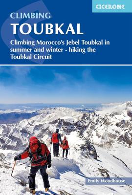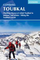
Wandelgids Toubkal climbing | Cicerone

0
A guidebook to hiking Jebel Toubkal in Morocco's Atlas Mountains and the multi-day Toubkal circuit trek. The routes are divided into summer and winter ascents with additional acclimatisation options. They are designed for hikers with some experience in summer and winter trekking at altitude.   Ascents to the Toubkal summit are detailed for both th...

Verkopers met dit product

Verkoper
Bezorging
Prijs
DeZwerver.nl logo
DeZwerver.nl
2,95
23,95

Anderen bekeken ook

Wandelgids Walking and trekking in the Sierra Nevada | Cicerone
Uitstekende wandelgids voor de Sierra Nevada. Goed beschreven met veel praktische informatie om de route te kunnen lopen, inclusief redelijke kaarten. Aanbevolen wandelkaarten Wandelkaart NP Sierra Nevada met Alpujarras | Editorial Penibetica 1:40.000 of Wandelkaart Sierra Nevada en Alpujarras | Editorial Alpina - 1:40.000 Wandelkaart Sierra Nevada - la integral de los 3000 | Editorial Piolet 1:25.000   This guidebook presents 33 graded walks and 5 high mountain scrambles in the striking Sierra Nevada, the highest mountain range in mainland Spain and in western Europe outside the Alps. Easily accessible from Granada and Málaga, it is a world of soaring, snow-clad peaks and deep valleys, far removed from the crowded beaches of the Costa del Sol just two hours away. The routes are spread across the national park, with attractive towns and villages such as Trevélez, Lanjarón, Hoya de la Mora and Cumbres Verdes serving as potential bases for a walking holiday.   The walks have been carefu…
20,95
Wandelgids - Pelgrimsroute Via Francigena part 2 | Cicerone
Guidebook to the Via Francigena pilgrim route from Lausanne to Lucca. Starting at Lake Geneva (Lac Léman), the 725km route crosses the Alps at historic Great Saint Bernard Pass, descends the Po Valley, then climbs to cross the Cisa Pass into Tuscany. Described in 32 stages, with information on facilities and pilgrim hostels.   Seasons Suitable for walking in spring, summer and autumn. The Great Saint Bernard Pass is fully open to hikers only in August and September.   Centres Lausanne, Martigny, Great Saint Bernard Pass, Aosta, Ivrea, Vercelli, Pavia, Piacenza, Pontremoli, Pietrasanta, Lucca.   Difficulty Each stage is graded for difficulty (1-4). A few mountainous stages include steep and slippery slopes. No special gear is required to walk the Via Francigena in season, but off-season crossings of the Great Saint Bernard Pass require winter mountain gear and careful attention to changing mountain conditions.   Must See Dazzling Lake Geneva, the 1500-year-old Abbey of Sai…
24,95
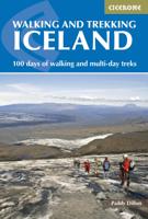
Wandelgids Walking and Trekking in Iceland - IJsland | Cicerone
Wandelgids met beschrijvingen, kaarten en praktische informatie zoals bussen, overnachten, etc. voor meerdaagse wandelroutes en dagwandeltochten op IJsland. A country of extraordinary beauty, Iceland’s incredible variety of volcanic and glacial landscapes makes it a unique destination for walking and trekking holidays. Its three national parks include the mighty Vatnajökull, largest national park in Europe.   The wide range of routes in this book introduce walkers and backpackers to this ‘Land of Ice and Fire’. There are 100 days of walking in this guidebook, stretching over 1722km, split between 49 day walks and 10 multi-stage treks. They climb mountains, cross glaciers, pass lakes and explore coastlines and geothermal areas, and range from easy nature trails to challenging treks. So, there is enough variation to satisfy all kinds of walkers. The routes are spread all around Iceland, grouped into twelve regions. Detailed information is given at the start of each route or trekking sta…
26,95
Wandelgids Kilimanjaro trekking | Cicerone
Goede trekking - wandelgids van de Kilimanjaro. Beklimmingen kunnen van alle kanten in vele vormen en vrijwel alle routes staan goed beschreven  in deze gids. Veel praktische informatie en een duidelijke routebeschrijving, duidelijke enigszins schetsmatige kaarten en een uitgebreide inleiding over wat je wel en niet moet meenemen, regelen en voorbereiden. At 5895m, Kilimanjaro is Africa's highest point and the highest freestanding mountain in the world, yet it is possible to reach its summit, Uhuru Peak, without any technical climbing ability. However, that is not to say that it is an easy undertaking: each year, many people fail in their attempt, often due to poor preparation or insufficient acclimatisation. Those who do make it to 'the Roof of Africa' are richly rewarded, enjoying outstanding views, the unique experience of being 'on top of the world' and, of course, a tremendous sense of achievement.   Guidebook describing all the trekking routes on Kilimanjaro (5895m), one of the …
23,95
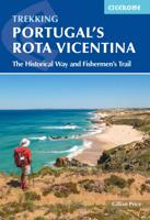
Wandelgids Portugal's Rota Vicentina | Cicerone
This guidebook follows the Rota Vicentina, a 224km walking route along the marvellous Atlantic coastline in the Alentejo and Algarve regions of Portugal. The 12-stage trek combines two well-marked routes, the Caminho Histórico (the Historical Way) and the Trilho dos Pescadores (the Fishermen's Trail), to create a hike starting in Santiago do Cacém and ending at Cabo de São Vicente. The guide also describes an alternative circular route for those who would prefer an 11-stage loop, moving inland from Odeceixe and back up to Santiago de Cacém. Whichever route is chosen, the Rota Vicentina is ideal for a two-week holiday in spring or late summer to autumn, offering walkers a remarkable range of landscapes from coastal fishing villages to wooded river valleys. The guidebook includes advice about accommodation options along the route, information about the surrounding area, and a glossary of Portuguese terms to aid with reading signs and maps. Along the Rota Vicentina are many delights fo…
24,95
Wandelgids Walking on the Gower | Cicerone
Wandelgids met 30 wandelroutes in het zuiden van Wales This guidebook presents 30 circular day walks across the Gower Area of Outstanding Natural Beauty, taking in the rich variety of landscapes across this beautiful area of South Wales. Ranging from 2½ to 14 miles long, there are walks to suit all abilities. The peninsula is famous for its spectacularly steep, rugged coastline and golden sandy beaches but this guide also takes walkers to the inland valleys, hills and ridges little explored by most holidaymakers.   Routes are illustrated with OS mapping extracts and inspiring photography and accompanied by a route summary table to help you choose walks to suit your location and ability. Along the way, the author provides a wealth of information on plants, animals, geology, history and archaeology of a region. There is something for everyone, all within a compact area easily accessible from Swansea and Mumbles.   Coastal areas such as those around Langland, Oxwich and Port Eynon are we…
19,50
Wandelgids Trekking in the Apennines - Apennijnen | Cicerone
Uitstekende wandelgids die in etappes de route nauwkeurig beschijft; ook de zijtakken en alternatieve routes koman aan bod. Kaarten zijn schetsmatig en in onze ogen onvoldoende bij slechte weersomstandigheden. Wij raden dan ook om er losse kaarten bij te kopen, voor zover verkrijgbaar! Guidebook to the Grand Apennines Trek, or Grande Escursione Appenninica (GEA). Through Tuscany and Emilia-Romagna and two National Parks, this 400km, 23 day trail explores the mountains, forests and hills of central Italy. Suitable for a range of walkers, it can be split into shorter sections or day walks if needed. This guidebook describes the Grande Escursione Appenninica (GEA), a nearly 400km long, three week trek crossing the Appenines in 23 stages, from Bocca Trabaria to Passo Due Santi on the edge of Liguria. The route dips in and out of Tuscany and Emilia-Romagna, never dropping below 400 metres. Best walked between spring and autumn, it is suitable for any reasonably fit walker. Highlights inclu…
22,95
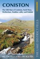
Wandelgids The Lake District Fells Coniston walking guide | Cicerone
Uitstekende uitgebreide wandelgids van een bepaald deel vsn het Lake District, één van de mooiste wandelgebieden van Engeland. De routes zijn goed beschreven, met prima kaartmateriaal. Zolang je niet van de route afwijkt is deze gids voldoende om de wandelroute te lopen.  Part of the Walking the Lake District Fells series, this guidebook covers a wide range of routes to 24 Lakeland summits that can be climbed from Coniston, Torver, the Duddon valley and the Birker Fell road, with highlights including Coniston Old Man, Swirl How, Wetherlam and Black Combe. Suggestions for longer ridge routes are also included. This guide describes ascents of 24 Lake District fells that can be climbed from Coniston and the Duddon and Eskdale valleys, including Coniston Old Man, Swirl How, Wetherlam and Dow Crag. The Coniston Fells - much loved for their classic ridges and wide-reaching views - need little introduction; however, to the west the less-frequented summits of the Birker and Corney Fell massif…
20,95
Wandelgids The Lake District Fells Borrowdale walking guide | Cicerone
Uitstekende uitgebreide wandelgids van een bepaald deel vsn het Lake District, één van de mooiste wandelgebieden van Engeland. De routes zijn goed beschreven, met prima kaartmateriaal. Zolang je niet van de route afwijkt is deze gids voldoende om de wandelroute te lopen.  Part of the Walking the Lake District Fells series, this guidebook covers a wide range of routes to 28 Lakeland summits that can be climbed from the Borrowdale and Thirlmere valleys - both easily accessed from Keswick - with highlights including Catbells, Great Gable and Scafell Pike. Suggestions for longer ridge routes are also included. This guide describes ascents of 28 Lake District fells that can be climbed from Borrowdale and the Newlands and Thirlmere valleys, including Catbells, a perennial favourite, and the mighty Scafell Pike, Great End and Great Gable. Easily accessed from Keswick, Borrowdale is a valley of exquisite natural beauty, with the lower wooded and heather-clad slopes giving way to sweeping moor…
20,95
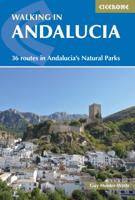
Wandelgids Walking in Andalucia - Andalusië | Cicerone
Mooi en duidelijke wandelgids over bepaalde streken in Andalusië: goed beschreven wandelingen met een redelijke kaart. De tekst is behoorlijk kompleet. Daarnaast ook praktische informatie per route. This guidebook explores six of Andalucía's most beautiful Natural Parks, the Sierra Nevada regions of Aracena, Grazalema, Los Alcornocales and the Gaucín, La Axarquía, the Alpujarras and Cazorla, along the great belt of the Cordillera Bética mountains. The thirty-six half-day and full-day mostly circular walks are evenly split within these six regions, and range in length from 4 to 21km. Walks are graded and some involve steep ascents and descents, all within the capabilities of a reasonably fit walker. The vast mountain range of the Cordillera Bética offers some of the finest year-round walking in Europe. Towering above the Mediterranean, the highest peaks of the Sierra Nevada rise to almost 3500m, mainland Spain's highest mountains. And wrapped within this mighty belt of mountains are s…
22,95

Klanten-reviews van Wandelgids Toubkal climbing | Cicerone

Er zijn nog geen beoordelingen voor dit productBen jij de eerste die een review plaatst?

Meer over Wandelgids Toubkal climbing | Cicerone

Productomschrijving

A guidebook to hiking Jebel Toubkal in Morocco's Atlas Mountains and the multi-day Toubkal circuit trek. The routes are divided into summer and winter ascents with additional acclimatisation options. They are designed for hikers with some experience in summer and winter trekking at altitude.   Ascents to the Toubkal summit are detailed for both the popular Ikhibi Sud route and the less-travelled Ikhibi Nord route. The guide also includes access information from Imlil to Toubkal Basecamp, along with three winter and four summer acclimatisation options. The circular Toubkal Circuit trek explores the Toubkal National Park and is described in 6 stages covering 68km (42 miles).    Oxford Alpine Club mapping included for each route and trek stage  GPX files available to download  Detailed information on planning, facilities and transport All the 4000m peaks included Covers all beginner winter routes in the Toubkal area

Productinformatie

    Verken gerelateerde categorieën

    Webshop.nl maakt gebruik van cookies. Ga je verder op onze website, ga dan akkoord met het plaatsen van cookies en de verwerking van deze data door ons en vermelde partners.