Wandelgids The Welsh Marches | Pocket Mountains

0
Handige compacte wandelgids met 40 dagwandelingen. Deze gids bevat kleine kaartjes en leuke uitgebreide informatie over wat er langs de route te zien is. Goede wandelkaarten zijn echter we noodzakelijk voor deze tochten: de Ordnance Survey explorer maps of Landanger maps zijn zeer geschikt.     The tranquil borderland of the Marches, offers a va...

Verkopers met dit product

Verkoper
Bezorging
Prijs
DeZwerver.nl logo
DeZwerver.nl
2,95
10,95

Anderen bekeken ook

Wandelgids The Welsh Marches | Pocket Mountains
Handige compacte wandelgids met 40 dagwandelingen. Deze gids bevat kleine kaartjes en leuke uitgebreide informatie over wat er langs de route te zien is. Goede wandelkaarten zijn echter we noodzakelijk voor deze tochten: de Ordnance Survey explorer maps of Landanger maps zijn zeer geschikt.     The tranquil borderland of the Marches, offers a varied landscape truncated by rivers meandering to lowland plains. Limestone to the west and north of the old red sandstone of the Hereford Plain has given rise to exceptionally attractive hilly country with delightful, narrow valleys. In these 40 walks Ben Giles explores all the best places to visit in this wonderful area of the country.  
10,95
Wandelgids The Chilterns | Pocket Mountains
Handige compacte wandelgids met 40 dagwandelingen. Deze gids bevat kleine kaartjes en leuke uitgebreide informatie over wat er langs de route te zien is. Goede wandelkaarten zijn echter we noodzakelijk voor deze tochten: de Ordnance Survey explorer maps of Landanger maps zijn zeer geschikt.     With some of the most picturesque countryside in England, yet only a short hop from London, the Chiltern Hills are just waiting to be explored. The glorious views from high ridges, ancient woodlands brimming with wildlife and downs alive with wild flowers and butterflies make the Chilterns and the communities within them English to the core. The vast network of well-established paths provides a wonderful walking country with history and nature keeping you company at every step.   If you are planning to get away from it all in the Chilterns, this collection of 40 moderate walks is your perfect guide.
10,95
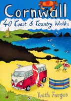
Wandelgids Cornwall | Pocket Mountains
Handige compacte wandelgids met 40 dagwandelingen. Deze gids bevat kleine kaartjes en leuke uitgebreide informatie over wat er langs de route te zien is. Goede wandelkaarten zijn echter we noodzakelijk voor deze tochten: de Ordnance Survey explorer maps of Landanger maps zijn zeer geschikt.   With over 400 miles of mainland coastline and an excellent public path network, Cornwall is all about rugged shorelines, gorgeous sandy beaches, turquoise waters, meandering rivers and wide open countryside. Add to the mix a fantastic diversity of flora and fauna, interesting geology, fascinating history and some of the most striking views in the country and you have one of England's best regions to explore on foot. In these 40 walks, all between two and eight miles in length, Keith Fergus leads you through some of the best rambles Cornwall has to offer. Plaatsen in het boek Bedruthan Steps, Bessie’s Cove, Bude, Cambeak, Camel Estuary, Cape Cornwall, Carbis Bay, Cawsand, Charlestown, Crackington …
10,95
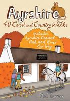
Wandelgids Ayrshire | Pocket Mountains
Handige compacte wandelgids met 40 dagwandelingen. Deze gids bevat kleine kaartjes en leuke uitgebreide informatie over wat er langs de route te zien is. Goede wandelkaarten zijn echter we noodzakelijk voor deze tochten: de Ordnance Survey explorer maps of Landanger maps zijn zeer geschikt.   The county of Ayrshire is located on the Firth of Clyde on the beautiful West Coast of Scotland and is known as one of the most fertile areas of the country, famed for its cattle and crops. Although more industrial to the north, it is in the main a landscape made for walking with an abundance of open countryside and rugged little hills, golden sandy beaches and beautiful sunsets. This guide features 40 mostly moderate walks full of interest which explore all aspects of the region, from craggy cliffs and caves to historic castles, ancient forests to sandy shorelines.
10,95
Wandelgids The Cotswolds | Pocket Mountains
Handige compacte wandelgids met 40 dagwandelingen. Deze gids bevat kleine kaartjes en leuke uitgebreide informatie over wat er langs de route te zien is. Goede wandelkaarten zijn echter we noodzakelijk voor deze tochten: de Ordnance Survey explorer maps of Landanger maps zijn zeer geschikt.   From upland outlooks and secret valleys to rolling pastures and honey stone villages, nature and history weave together in the Cotswolds to create a landscape that is the epitome of rural England. In these 40 walks Dominic North unlocks the secrets of the Cotswolds, from the hills and lanes in the north to the languid riverbanks and ancient woods of the south. Along the way discover sleepy villages, grand country houses and architectural curiosities, and then reach out to explore three of England's most celebrated cities, Bath, Oxford and Stratford-upon-Avon. Plaatsen in het boekje Bath, Bathampton, Batsford, Belas Knap, Bibury, Blenheim Park, Blockley, Bourton-on-the-Hill, Bourton-on-the-Water, …
10,95
Wandelgids The Tweed | Pocket Mountains
Handige compacte wandelgids met 40 dagwandelingen. Deze gids bevat kleine kaartjes en leuke uitgebreide informatie over wat er langs de route te zien is. Goede wandelkaarten zijn echter we noodzakelijk voor deze tochten: de Ordnance Survey explorer maps of Landanger maps zijn zeer geschikt.   One of the world’s great salmon rivers, the Tweed cuts through the heart of the Scottish Borders and, in part, forms the historic boundary between Scotland and England. Rising in the rolling hills near Moffat, it weaves through a cherished landscape on its way to Berwick-upon-Tweed and the North Sea, passing through the proud Border towns of Peebles, Galashiels, Melrose, Kelso and Coldstream on the way.   There is no better way to discover the wildlife, architecture and history of this area of Scotland than to walk. Whatever your ability – walking at high or low level, following tough terrain or level paths – the 25 routes in this guide offer something for everyone.   Plaatsen in het boekje Abbot…
10,95
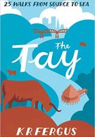
Wandelgids The Tay | Pocket Mountains
Handige compacte wandelgids met 40 dagwandelingen. Deze gids bevat kleine kaartjes en leuke uitgebreide informatie over wat er langs de route te zien is. Goede wandelkaarten zijn echter we noodzakelijk voor deze tochten: de Ordnance Survey explorer maps of Landanger maps zijn zeer geschikt.     As well as being Scotland's longest river, the Tay also carries the largest volume of water of any river in the UK more than the Thames and Severn combined when it reaches the Firth of Tay. From its source high up the slopes of Ben Lui near Tyndrum, the Tay makes its way through Stirlingshire and Perthshire to meet the North Sea near Dundee. As one of the best salmon rivers in Europe, every year it lures anglers from around the world and countless more come to explore the glorious hills and glens it passes.   There is no better way to discover the wildlife, architecture and history of this area of Scotland than to walk. Whatever your ability walking at high or low level, following tough terra…
10,95
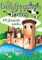
Wandelgids The Dumfriesshire Dales | Pocket Mountains
Handige compacte wandelgids met 40 dagwandelingen. Deze gids bevat kleine kaartjes en leuke uitgebreide informatie over wat er langs de route te zien is. Goede wandelkaarten zijn echter we noodzakelijk voor deze tochten: de Ordnance Survey explorer maps of Landanger maps zijn zeer geschikt.     The three Dumfriesshire dales of Nithsdale, Annandale and Eskdale are a rural playground of heatherclad hills, linns with tumbling waterfalls, babbling rivers and evershifting merse and firth. Despite being bisected by the main road into England, these dales were known more intimately by the discerning Victorians than they are today. Time, then, to rediscover the charms of this peaceful corner of Scotland.   Whether it's a morning exploring the country's highest village, an afternoon paddling the shores of the Solway or an evening gazing at star-filled skies, Darren Flint and Donald Greig;'s hand-picked selection of 40 walks reveals what it is that makes this unassuming part of of the world s…
10,95
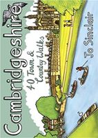
Wandelgids Cambridgeshire | Pocket Mountains
Handige compacte wandelgids met 40 dagwandelingen. Deze gids bevat kleine kaartjes en leuke uitgebreide informatie over wat er langs de route te zien is. Goede wandelkaarten zijn echter we noodzakelijk voor deze tochten: de Ordnance Survey explorer maps of Landanger maps zijn zeer geschikt.   With its hallowed streets, glorious colleges and peaceful riverside walks along the Cam, Cambridge is the jewel in the crown of Cambridgeshire and a richly rewarding city to tour on foot. This is a big county, however, and it is well worth exploring the countryside beyond the glittering city. This guide takes you through the rich heritage of the county's market towns and pretty thatched-roofed villages, along old hilltop tracks and into ancient woodlands, full of interest and beauty. Cambridgeshire is also the lowest and flattest place in England and the straight roads, endless network of dykes and isoloted windmills of the fenlands have a stange minimalist magnetism which is hard to resist.
10,95
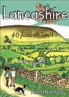
Wandelgids Lancashire | Pocket Mountains
Handige compacte wandelgids met 40 dagwandelingen. Deze gids bevat kleine kaartjes en leuke uitgebreide informatie over wat er langs de route te zien is. Goede wandelkaarten zijn echter we noodzakelijk voor deze tochten: de Ordnance Survey explorer maps of Landanger maps zijn zeer geschikt.   Don´t underestimate Lancashire! Although it is one of the UK¿s most populous counties, it is also largely a rural one, including no less than three Areas of Outstanding Natural Beauty and abutting the Pennines, Dales and Lake District. There is a huge variety of contrasting and inspiring walking country, from the coast to hills and from forests to moors. This collection of 40 favourite walks offers a remarkable range of excellent walking opportunities.
10,95

Klanten-reviews van Wandelgids The Welsh Marches | Pocket Mountains

Er zijn nog geen beoordelingen voor dit productBen jij de eerste die een review plaatst?

Meer over Wandelgids The Welsh Marches | Pocket Mountains

Productomschrijving

Handige compacte wandelgids met 40 dagwandelingen. Deze gids bevat kleine kaartjes en leuke uitgebreide informatie over wat er langs de route te zien is. Goede wandelkaarten zijn echter we noodzakelijk voor deze tochten: de Ordnance Survey explorer maps of Landanger maps zijn zeer geschikt.     The tranquil borderland of the Marches, offers a varied landscape truncated by rivers meandering to lowland plains. Limestone to the west and north of the old red sandstone of the Hereford Plain has given rise to exceptionally attractive hilly country with delightful, narrow valleys. In these 40 walks Ben Giles explores all the best places to visit in this wonderful area of the country.  

Productinformatie

    Verken gerelateerde categorieën

    Webshop.nl maakt gebruik van cookies. Ga je verder op onze website, ga dan akkoord met het plaatsen van cookies en de verwerking van deze data door ons en vermelde partners.