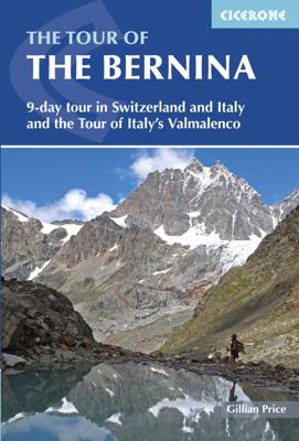
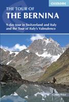
Wandelgids The Tour of the Bernina | Cicerone

0
Uitstekende wandelgids van een meerdaagse tocht in Zwitserland en Italië in het Bernina-gebied. Goede beschrijvingen, veel praktische informatie en redelijke kaarten al zullen deze niet helemaal voldoende zijn.   This guidebook explores two treks in the Bernina region of the Swiss-Italian Alps. The Tour of the Bernina is an 9-stage trek circling t...

Verkopers met dit product

Verkoper
Bezorging
Prijs
DeZwerver.nl logo
DeZwerver.nl
2,95
24,50

Anderen bekeken ook

Wandelgids The Tour of the Bernina | Cicerone
Uitstekende wandelgids van een meerdaagse tocht in Zwitserland en Italië in het Bernina-gebied. Goede beschrijvingen, veel praktische informatie en redelijke kaarten al zullen deze niet helemaal voldoende zijn.   This guidebook explores two treks in the Bernina region of the Swiss-Italian Alps. The Tour of the Bernina is an 9-stage trek circling the Piz Bernina massif, 119km long and suitable for beginner trekkers. Also included in this guide is the 8-stage Alta Via Valmalenco just to the south of the Bernina. Although shorter, at 94km long, this is a more challenging route suitable for trekkers with more experience.   Whether skirting above St. Moritz and below snow-capped giants on the Tour of the Bernina, or climbing over wild, high passes and through isolated mountains in the Italian Valmalenco by Monte Disgrazia, the treks offer incredible experiences. Both feature spectacular peaks towering over snow fields and perfect alpine pastures, with accommodation in comfortable alpine gu…
24,50
Wandelgids Trekking in the Apennines - Apennijnen | Cicerone
Uitstekende wandelgids die in etappes de route nauwkeurig beschijft; ook de zijtakken en alternatieve routes koman aan bod. Kaarten zijn schetsmatig en in onze ogen onvoldoende bij slechte weersomstandigheden. Wij raden dan ook om er losse kaarten bij te kopen, voor zover verkrijgbaar! Guidebook to the Grand Apennines Trek, or Grande Escursione Appenninica (GEA). Through Tuscany and Emilia-Romagna and two National Parks, this 400km, 23 day trail explores the mountains, forests and hills of central Italy. Suitable for a range of walkers, it can be split into shorter sections or day walks if needed. This guidebook describes the Grande Escursione Appenninica (GEA), a nearly 400km long, three week trek crossing the Appenines in 23 stages, from Bocca Trabaria to Passo Due Santi on the edge of Liguria. The route dips in and out of Tuscany and Emilia-Romagna, never dropping below 400 metres. Best walked between spring and autumn, it is suitable for any reasonably fit walker. Highlights inclu…
22,95
Wandelgids Tour of the Lake District | Cicerone
Engelstalige beschrijving van de mooiste wandeltocht in het Lake district. De gids voldoet aan alle verwachtingen die je kunt hebben, het enige dat je mist is een overzichtskaart. Inclusief gidsje met routekaarten van 1:25000 The Lake District National Park is England's most popular mountain region and is designated as a UNESCO World Heritage site. Suitable for most reasonably fit hillwalkers, the 145km (90 mile) Tour of the Lake District takes in the best of this beautiful region in a circular tour. The route is presented in nine stages, plus an optional 'prologue' stage from Windermere station to the start-point in Ambleside, and can be compressed into one week or extended over two weeks, giving time to visit many attractions on the way.   In addition to the main (non-waymarked) route, which links the main towns and valleys of the national park, five interchangeable high-level stages are also offered, enabling you to visit some of the region's most celebrated high peaks - including …
20,95
Wandelgids Tour of the Jungfrau Region - Berner Oberland | Cicerone
Trekkinggids met de gedetailleerde beschrijving van de klassieke Jungfrau-trek, maar ook varianten. Goede etappe-beschrijvingen met veel praktische info. The Tour of the Jungfrau Region is described as a clockwise hut-to-hut circuit, beginning at Schynige Platte and ending at Wilderswil, broken into 10 stages (with a number of alternatives offered). The 111km trek takes you in a horseshoe loop through the Bernese Oberland's most spectacular mountain scenery, in the shadow of such iconic peaks as Wetterhorn, Eiger, Monch and Jungfrau. In a journey of 9 to 10 days the Tour visits pastures, ridges, summits and passes, skirts exquisite mountain lakes and gazes on waterfalls, gorges and glaciers. Accommodation is both plentiful and atmospheric, and the route has lots of bad-weather alternatives.  
20,95
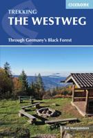
Wandelgids The Westweg | Cicerone
Uitstekende wandelgids van een meerdaagse tocht in het Zwarte Woud in Duitsland. Goede beschrijvingen, veel praktische informatie en redelijke kaarten al zullen deze niet helemaal voldoende zijn. Guidebook to the Westweg (Westway), a 285km walk across Germany's Black Forest from Pforzheim to Basel. This classic route, which includes Feldberg, Black Forest's highest peak, takes 13 to 14 days, each day stage ranging from 15 to 28km. Two variants are described, both well way-marked and suitable for those new to long distance walking. This guidebook is all you need to discover The Westweg, a 285km walk along the length Germany's Black Forest from Pforzheim to Basel. This classic long-distance trail takes around two weeks to walk, in stages of 15-28km. The route is well way-marked and suitable for experienced hikers and those new to long distance walking, though some sections are steep. The Westweg incorporates many of the region's highlights, such the Schwarzwald National Park, the source…
23,95
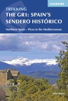
Wandelgids Spain's Sendero Historico: the GR1 | Cicerone
A step by step guide to walking the 1250km long Sendero Historico (the GR1) across northern Spain. Travelling from west to east, the GR1 starts at the Puerto de Tarna, on the border of Asturias and Castilla y Leon, heads east along the southern flank of the Cantabrian Mountains and the foothills of the Pyrenees before finishing on the Mediterranean coast near L'Escala. Arguably one of Spain's best long-distance paths, it follows gently graded paths, making a long but easy walk suitable for a reasonably fit walker. The complete trail requires around 53 days to complete end to end, but the guidebook splits the route into 7 sections, each with a start or endpoint that can be easily reached by train or bus, allowing walkers to explore the route in manageable chunks. The guidebook also describes how to extend the route to Finisterre and the Atlantic using GR routes. As well as extensive notes on the history of modern Spain, from medieval times to more recent events such as the Civil War, t…
26,50
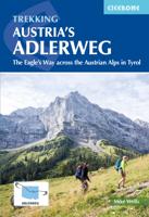
Wandelgids The Adlerweg | Cicerone
A guidebook to Austria's Adlerweg (the Eagle's way) a long-distance trail from St Johann in Tirol in the east, passing through the historic town of Innsbruck at its mid-point before continuing to St Anton am Arlberg in the west. This waymarked 324km trek is presented in 24 stages ranging between 7 and 32km in length, with easier alternate routes provided for the most difficult stages. This guide features 1:50,000 mapping, accommodation details for the start and end points of each stage, which serve hearty meals and refreshments, and details on local transport, planning and local history.   Traversing the North Kakalpen Alps the route passes through the Wilderkaiser, Bradenberger Alpen, Rofangebirge, Karwendelgebirge, Wettersteinebirge and the Lechtaler Alpen ranges, enjoying views as far as Munich and the Swiss Alps. It is the perfect adventure for those looking for an alpine challenge.
26,50
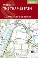
Wandelgids The Thames Path | Cicerone
All the mapping you need to complete the 182 mile (290km) Thames Path National Trail, from the Woolwich Foot Tunnel in London to the river's source in Gloucestershire. This booklet is included with the Cicerone guidebook to the Thames Path, where the route is divided into 20 stages, with each stage ranging from 4 to 16 miles. This gentle riverside walk takes roughly two weeks to complete.   This booklet of Ordnance Survey 1:25,000 Explorer maps has been designed for convenient use on the trail. It shows the full and up-to-date line of the National Trail, along with the relevant extract from the OS Explorer map legend. Conveniently sized for slipping into a jacket pocket or top of a rucksack and provides all the mapping needed to complete the trail.   Passing through London, Windsor and Oxford as well as rural countryside, this National Trail offers walkers a diverse range of landscapes and scenery. With excellent public transport services at each stage, this trail can also be complete…
18,50
Wandelgids the Kerry Way | Cicerone
A guidebook to walking Ireland’s Kerry Way. Covering 190km (117 miles), this circular route from Killarney takes around 10 days to hike and is suitable for walkers of most abilities.   The route is described anti-clockwise in 10 stages of between 13 and 25km (8–16 miles). Also included are a number of side-trips in the area, including an ascent of Carrauntoohil (Ireland’s highest mountain), the Cnoc na dTobar pilgrim’s path and a marine landing on UNESCO-listed Skellig Michael.   1:50,000 maps included for each stage Handy route summary tables and accommodation listings help you plan your itinerary Refreshment and accommodation information given for each trek stage Advice on planning and preparation GPX files available to download
25,95
Wandelgids The Cotswold Way | Cicerone
Uitstekende wandelgids van de Cotswolds Way, waarbij naast alle noodzakelijke informatie ook gebruik gemaakt wordt van de echte topografische kaart. inclusief gidsje met routekaarten van 1:25000 (deze is hier ook los te bestellen) Guidebook to walking the 102 mile (163km) Cotswold Way National Trail between Chipping Campden and Bath, across the Cotswolds AONB. The guidebook - which includes both a guide to the route and a separate OS 1:25,000 map booklet - describes the route in both directions.   The route is described over 13 stages, each following the Cotswold escarpment, with dramatic and far-reaching views across the Severn Vale towards the Welsh hills, plunging down to visit honey-coloured villages, old market towns and the elegant and historic city of Bath. The longest of the 13 stages is 10 miles, the shortest 6 miles: these are dictated by the existence of overnight accommodation. For the determined, the trail can be walked in as little as five days.   The Cotswold Way offers…
23,50

Klanten-reviews van Wandelgids The Tour of the Bernina | Cicerone

Er zijn nog geen beoordelingen voor dit productBen jij de eerste die een review plaatst?

Meer over Wandelgids The Tour of the Bernina | Cicerone

Productomschrijving

Uitstekende wandelgids van een meerdaagse tocht in Zwitserland en Italië in het Bernina-gebied. Goede beschrijvingen, veel praktische informatie en redelijke kaarten al zullen deze niet helemaal voldoende zijn.   This guidebook explores two treks in the Bernina region of the Swiss-Italian Alps. The Tour of the Bernina is an 9-stage trek circling the Piz Bernina massif, 119km long and suitable for beginner trekkers. Also included in this guide is the 8-stage Alta Via Valmalenco just to the south of the Bernina. Although shorter, at 94km long, this is a more challenging route suitable for trekkers with more experience.   Whether skirting above St. Moritz and below snow-capped giants on the Tour of the Bernina, or climbing over wild, high passes and through isolated mountains in the Italian Valmalenco by Monte Disgrazia, the treks offer incredible experiences. Both feature spectacular peaks towering over snow fields and perfect alpine pastures, with accommodation in comfortable alpine guesthouses and high altitude huts.    This guide contains detailed route descriptions in combination with plenty of background and practical information.   Centres In Switzerland: St Moritz, Sils Maria, Pontresina, Maloja, Bernina Pass, Poschiavo In Italy: Sondrio, Chiareggio, Chiesa in Valmalenco   The Tour of the Bernina Stage 1 Pontresina to Fuorcla Surlej Stage 2 Fuorcla Surlej to Maloja Stage 3 Maloja to Rifugio Longoni Stage 3A Maloja to Chiareggio Stage 3B Chiareggio to Rifugio Longoni Stage 4 Rifugio Longoni to Lago Palù Stage 5 Lago Palù to Rifugio Carate Brianza Stage 6 Rifugio Carate Brianza to Rifugio Bignami Stage 7 Rifugio Bignami to Cavaglia Stage 7A Rifugio Bignami to Selva Stage 7B Selva to Cavaglia Stage 8 Cavaglia to Berghaus Diavolezza Stage 8A Cavaglia to Ospizio Bernina Stage 8B Ospizio Bernina to Berghaus Diavolezza Stage 9 Berghaus Diavolezza to Pontresina The Alta Via Valmalenco Stage 1 Torre di Santa Maria to Rifugio Bosio Galli Stage 2 Rifugio Bosio Galli to Rifugio Ventina/Rifugio Gerli-Porro Stage 3 Rifugio Ventina/Rifugio Gerli-Porro to Chiareggio Stage 4 Chiareggio to Lago Palù Stage 5 Lago Palù to Rifugio Marinelli Bombardieri Stage 6 Rifugio Marinelli Bombardieri to Rifugio Bignami Stage 7 Rifugio Bignami to Rifugio Cristina Stage 8 Rifugio Cristina to Caspoggio
 

Productinformatie

    Verken gerelateerde categorieën

    Webshop.nl maakt gebruik van cookies. Ga je verder op onze website, ga dan akkoord met het plaatsen van cookies en de verwerking van deze data door ons en vermelde partners.