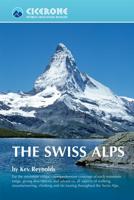
Wandelgids The Swiss Alps | Cicerone

0
  The Swiss Alps are home to the highest and most spectacular mountains in Western Europe. This stunning guidebook describes each mountain area throughout Switzerland – the peaks, passes, valleys and bases – to help you identify the best destinations to plan your trip.   Questions such as ‘Where to walk, climb or ski?’, ‘What multi-day treks are a...

Verkopers met dit product

Verkoper
Bezorging
Prijs
DeZwerver.nl logo
DeZwerver.nl
2,95
34,95

Anderen bekeken ook

Nieuw
Wandelgids Trekking in the Silvretta and Ratikon Alps | Cicerone
Aanbevolen wandelkaarten bij deze gids: Schaal 1:60.000 Wandelkaart 14 Unterengadin | Kümmerly & Frey Wandelkaart 13 Davos - Arosa | Kümmerly & Frey Of schaal 1:25.000 Wandelkaart 26 Alpenvereinskarte Silvrettagruppe This guide describes three treks, between 5 and 8 days, in the Silvretta and Rätikon Alps starting near Klosters, and 12 half-day hut-to-hut routes. These contrasting ranges form a line on the borders of Switzerland, Austria and Liechtenstein. The Tour of the Silvretta, the Prättigauer Höhenweg and the Rätikon Höhenweg. Straddling the borders of Austria, Switzerland and Liechtenstein, the limestone Rätikon Alps reach into the snow-bound and glacier-hung Silvretta Alps to provide a richly diverse series of landscapes. The Tour of the Silvretta, the Prättigauer Höhenweg and the Rätikon Höhenweg, all within easy reach of Klosters, have been devised to help trekkers explore the best of the region. Given sifficient time they can also be combined to create a continuous 2-week t…
25,95
Nieuw
Wandelgids Karawanken - Slovenie - Walking in the Karavanke | Cicerone
Goede wandelgids met veel dagtochten; redelijk kaartmateriaal en goede praktische informatie. This guidebook offers 23 walking routes set across the magnificent 120km-long Karavanke mountain range, which forms a natural border between Austria and Slovenia. Commonly known as 'the way the Alps used to be', as it is yet to experience the extent of commercial development known by the Western Alps, it is one of the longest ranges in Western Europe but it remains genuinely unspoilt and relatively unvisited by English-speaking hillwalkers. The guide's walks begin in pretty towns and villages, and most of them access the peaks from the relatively more gentle Slovenian side of the range, where forest-clad slopes lead to grassy summits where spectacular views can be enjoyed. Arranged by peak from west to east along the range, most of the summits can be reached by waymarked paths and trails. The guide gives all the practical details you need on transport, accessing the routes, accommodation and …
20,95
Nieuw
Wandelgids - Klimgids - Klettersteiggids Via Ferratas of the French Alps | Cicerone
This guidebook covers 66 varied via ferratas in the French Alps. The routes are spread over six areas: Geneva and the Northern Alps, Chambéry, Tarentaise and Maurienne valleys, Grenoble and Briançon, amid the Mont Blanc, Vanoise and Queyras ranges. Difficulty ranges from easy, protected routes through to exposed, technical challenges. With some of the most beautiful scenery in the world, the French Alps have long been a popular destination for a wide range of outdoor activities. In recent years, the region has seen the arrival of a growing number of via ferrata routes.   Via ferrata climbing – using fixed cables, bridges and ladders to explore terrain that is normally only accessible to experienced rock climbers – combines elements of scrambling, mountaineering and rock climbing, yet is a very distinct pursuit. Increasingly popular, recent years have seen a surge in the number of routes being established in these iconic mountains.   The routes in this guidebook range from straightforw…
25,95
Nieuw
Wandelgids 100 Hut Walks In The Alps | Cicerone
This guidebook has route descriptions for 100 day walks to suit alpine walkers of all abilities, with suggestions for some hut-to-hut tours. These routes take you through breathtaking scenery in the Maritime Alps, Julian Alps, Gran Paradiso, the Turnitzer Alps, Bernese Oberland, the Kitzbuheler Alps and the Dolomites of South Tirol. Extending in huge arc of more than 1000km (620 miles) from the Mediterranean coast near Nice to the low, wooded foothills outside Vienna, the Alps display the full gamut of mountain landscape features. All of the routes in this guide have been specially selected to show the amazing diversity of this wonderful mountain chain.   There are walks to suit every taste: gentle and undemanding, long and tough, and everything in between. Most of the routes avoid climbing of a technical nature except the odd scramble aided by a fixed rope. Glacier crossings where crevasses lurk for the unwary have also been avoided in the main, although just a small handful of walks…
22,95
Nieuw
Wandelgids Walking and trekking in the Sierra Nevada | Cicerone
Uitstekende wandelgids voor de Sierra Nevada. Goed beschreven met veel praktische informatie om de route te kunnen lopen, inclusief redelijke kaarten. Aanbevolen wandelkaarten Wandelkaart NP Sierra Nevada met Alpujarras | Editorial Penibetica 1:40.000 of Wandelkaart Sierra Nevada en Alpujarras | Editorial Alpina - 1:40.000 Wandelkaart Sierra Nevada - la integral de los 3000 | Editorial Piolet 1:25.000   This guidebook presents 33 graded walks and 5 high mountain scrambles in the striking Sierra Nevada, the highest mountain range in mainland Spain and in western Europe outside the Alps. Easily accessible from Granada and Málaga, it is a world of soaring, snow-clad peaks and deep valleys, far removed from the crowded beaches of the Costa del Sol just two hours away. The routes are spread across the national park, with attractive towns and villages such as Trevélez, Lanjarón, Hoya de la Mora and Cumbres Verdes serving as potential bases for a walking holiday.   The walks have been carefu…
20,95
Reisinspiratieboek - Reisboek Book of the Alps | Marmota Maps
The Book of the Alps  the great illustrated book about the Alps.290 pages with over 1000 illustrations, graphics, and maps on geography, sports, history, culture, climate, environment and much more. Understand the Alps like never before.Created in cooperation with the Alpine clubs of Germany, Austria, and South Tyrol. CONTENTS The Book of the Alps has 46 chapters in seven subject areas: Geography   Flora and Fauna   Climate and Environment    Alpinism   Mountain Sports   Society and Economy   Arts and Culture   GEOGRAPHY Geological Formation Ice Age Mountains Valleys Mountain Passes Lakes and Rivers Glaciers The Alps are unique. How did they form and evolve? How do glaciers, passes, valleys, lakes, and rivers shape the landscape? Answers to these and many more questions can be found in the geography chapter.   FLORA AND FAUNA Biodiversity Plants Forests Animals National Parks The Alpine environment is fascinating. Alpine flowers such as the edelweiss and Alpine anima…
44,95
Nieuw
Wandelgids Walking in Zermatt and Saas-Fee | Cicerone
Wandelgids met dagtochten: goed beschreven met veel praktische informatie om de route te kunnen lopen, inclusief redelijke kaarten. Enorm veel keus in een groot gebied! Guidebook describing 50 varied walks in the Valais region in the heart of the Swiss Alps. The graded day walks based around the popular resort towns of Zermatt and Saas-Fee explore the Mattertal and Saastal valleys and the surrounding mountains. Ranging from 4 to 18km, the easily accessible routes make use of the area's extensive network of well-made mountain paths and its lift system. There are walks here to suit all tastes, from low-level lake walks or easy strolls up to mountain restaurants, through to serious mountain outings on steep and rocky trails. Distance, walking time and difficulty are shown for each route, and the detailed route description is accompanied by clear mapping.   Dominated by 4000m the giants, the Matterhorn and Monte Rosa, this is a land of contrasts, with snow-capped mountains and glaciers ab…
23,95
Nieuw
Wandelgids Walking and Trekking in the Japan Alps and Mount Fuji | Cicerone
This guidebook presents nine day-walks and thirteen treks of 2-8 days in the magnificent Japanese Alps, plus the four main routes up Japan's highest mountain, Mount Fuji (3776m), and a further route on neighbouring Mount Kurodake. The Japanese Alps stretch across the middle of the main island of Honshu and include several peaks over 3000m. Mount Fuji lies to the south: an active stratovolcano (though with minimal risk of eruption), it has become an iconic symbol of Japan and sees 300,000 visitors to its summit every year. The guide includes all the information you will need to plan a successful walking or trekking holiday, with a wealth of advice on travel, bases, accommodation and facilities. The Japan Alps and Mount Fuji boast a well-developed walking infrastructure, and the routes make use of the many mountain huts and campgrounds, full details of which are given in the guide. Some also include the opportunity to visit a traditional hot spring bath for a refreshing soak after your…
29,95
Nieuw
Wandelgids Julian Alps of Slovenia - Julische Alpen | Cicerone
Engelstalige wandelgids met 57 dagtochten en 4 trekkings door de Julische Alpen. Goede omschrijvingen van de tochten met alle noodzakelijke praktische info alsmede - beperkt - kaartmateriaal. Aanbevolen wandelkaarten bij deze gids Gebied 1 Wandelkaart 064 Julische Alpen - Alpi Giulie | Kompass 1:25.000 Wandelkaart Triglav - Kranjska Gora – Bohinj – Julische Alpen | Sidarta 1:25.000 Gebied 2 Wandelkaart Bohinj Triglav, Krn, Crna prst – Julische Alpen | Sidarta 1:25.000 Gebied 3 Wandelkaart Bovec Trenta - Julische Alpen | Sidarta Gebied 4 Wandelkaart 2 Pocketmap Bled | Kartografija Gebied 5 Wandelkaart - Fietskaart Posocje | Kartografija 1:40.000 Of Voor vrijwel het hele gebied beschreven in de gids. Wandelkaart 141 WK Julische Alpen | Freytag & Berndt  1:50.000   Over 60 walks which bring the best of Slovenia’s Julian Alps to the English-speaking walker. The walks are organized around five bases – Kranjska Gora, Bovec, Kobarid, Bled and Bohinj. The routes range from easy valley walks a…
26,95
Nieuw
Wandelgids - Pelgrimsroute Via Francigena part 2 | Cicerone
Guidebook to the Via Francigena pilgrim route from Lausanne to Lucca. Starting at Lake Geneva (Lac Léman), the 725km route crosses the Alps at historic Great Saint Bernard Pass, descends the Po Valley, then climbs to cross the Cisa Pass into Tuscany. Described in 32 stages, with information on facilities and pilgrim hostels.   Seasons Suitable for walking in spring, summer and autumn. The Great Saint Bernard Pass is fully open to hikers only in August and September.   Centres Lausanne, Martigny, Great Saint Bernard Pass, Aosta, Ivrea, Vercelli, Pavia, Piacenza, Pontremoli, Pietrasanta, Lucca.   Difficulty Each stage is graded for difficulty (1-4). A few mountainous stages include steep and slippery slopes. No special gear is required to walk the Via Francigena in season, but off-season crossings of the Great Saint Bernard Pass require winter mountain gear and careful attention to changing mountain conditions.   Must See Dazzling Lake Geneva, the 1500-year-old Abbey of Sai…
24,95

Klanten-reviews van Wandelgids The Swiss Alps | Cicerone

Er zijn nog geen beoordelingen voor dit productBen jij de eerste die een review plaatst?

Meer over Wandelgids The Swiss Alps | Cicerone

Productomschrijving


The Swiss Alps are home to the highest and most spectacular mountains in Western Europe. This stunning guidebook describes each mountain area throughout Switzerland – the peaks, passes, valleys and bases – to help you identify the best destinations to plan your trip.   Questions such as ‘Where to walk, climb or ski?’, ‘What multi-day treks are available’ and ‘Where do they go?’, ‘Where are the mountain huts, what are their facilities, which peaks do they serve?’ And where are the most suitable valley bases?’ – all these and more are addressed in detail in this essential guidebook.   The Swiss Alps does not give detailed route directions but information is given about all the guides and maps available for every region.   The Swiss Alps by Kev Reynolds is the third book in Cicerone’s World Mountain Ranges series, which include The Pyrenees and Scotland.   descriptions of all the Swiss Alps, area-by-area from the Chablais Alps in the south west to the Silvretta in the north east classic walks and climbs identified, alongside outlines of all the major hut-to-hut trekking routes information on maps, guides and accommodation, pinpointing all the mountain huts in the area  

This book sets out to redress the balance, to introduce those who have not yet found them to some of the unfamiliar and largely unsung mountains and valleys, while still giving due regard to the giants that dominate the landscape at Zermatt, Grindelwald or Pontresina. It’s a handy resource for the active hillwalker, trekker, climber and ski tourer; a guide and gazetteer to the peaks, passes and valleys, providing sufficient background information to help anyone planning a visit to make the most of their time there. Questions such as ‘Where to walk, climb or ski?’, ‘What multi-day treks are available and where do they go?’, ‘Where are the mountain huts, what are their facilities, which peaks do they serve?’, and ‘Where are the most suitable valley bases?’ – all these and more are addressed in detail.

This book does not give detailed route directions but information is given about all the guides and maps available for every region under review. The aim of this volume is not to lead step by step, but to inspire, to entertain and to inform; to show the first-time visitor – and those who have already discovered one or two of its districts – what the Swiss Alps have to offer. The emphasis is on activity; the intention to help the reader gain a quality experience with every visit. In truth the outdoor enthusiast is spoilt for choice, but armed with this guide, it should be possible to make that choice a better informed one.

Dozens of individual valleys are described, together with the mountains that wall them, with recommendations given for their finest walks, treks and climbs. Such recommendations are purely subjective readers may well take issue with some of the suggestions. That is just how it should be.


Verken gerelateerde categorieën

Webshop.nl maakt gebruik van cookies. Ga je verder op onze website, ga dan akkoord met het plaatsen van cookies en de verwerking van deze data door ons en vermelde partners.