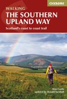
Wandelgids The Southern Upland Way | Cicerone

0
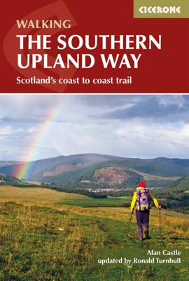
Uitstekende wandelgids van de Southern Upland Way, waarbij naast alle noodzakelijke informatie ook gebruik gemaakt wordt van de echte topografische kaart.   The Southern Upland Way is Scotland's coast-to-coast walk and the longest of the nation's Great Trails. 215 miles long, it links the pretty harbour village of Portpatrick on the west coast wi...

Verkopers met dit product

Verkoper
Bezorging
Prijs
DeZwerver.nl logo
DeZwerver.nl
2,95
20,95

Anderen bekeken ook

Wandelgids The Southern Upland Way | Cicerone
Uitstekende wandelgids van de Southern Upland Way, waarbij naast alle noodzakelijke informatie ook gebruik gemaakt wordt van de echte topografische kaart.   The Southern Upland Way is Scotland's coast-to-coast walk and the longest of the nation's Great Trails. 215 miles long, it links the pretty harbour village of Portpatrick on the west coast with Cockburnspath, a little south of Dunbar, in the east. The walk is at times a strenuous one, crossing the remote high moorland of the Galloway Hills, Carsphairn range, Lowthers, Ettrick Hills and Lammermuirs, calling for competence, fitness and self-reliance.    This guide presents advice on how best to plan and tackle this challenging but highly rewarding journey. The waymarked trail is presented in fourteen stages of 9–19 miles and suggestions for a rest day exploring Moffat and its environs are also included. It is possible either to backpack, taking advantage of five bothies and unlimited wild camping possibilities, or to stay in town…
20,95
Wandelgids Walking in the Southern Uplands | Cicerone
This guidebook describes 44 routes and over 100 summits stretching across the Southern Uplands of Scotland, stretching south-west from Edinburgh to the English border, including the Galloway and Pentland Hills. The walks range between 2 and 29km, suitable for walkers of all abilities.   The Scottish Southern Uplands is a range that is about as big as the English Pennines. It is wild hill country, with over 80 hills of 2000ft or more, and it boasts a real remoteness that is difficult to find elsewhere. All hillwalkers should experience these wonderfully characterful landscapes: green and gentle, but with hidden surprises and remote escapes.   The routes are suitable from spring to autumn, and on winter days with good weather and snow conditions. Each route provides OS mapping, information on distance, ascent, time, maximum altitude and terrain, as well as details of any variants or shortcuts. With notes on points of interest along the way as well as on transport and accommodation, the …
21,95
Wandelkaart Southern Upland Way | Harvey Maps
Southern Upland Way is Britain's first official coast to coast long distance footpath and is one of Scotland's Great Trails. It runs 340km (212 miles) from Portpatrick on the south west coast of Scotland to Cockburnspath on the eastern seaboard. It offers superb and varied walking country, still undiscovered by many enthusiasts. The Way provides a real challenge for the experienced walker, yet some of the shorter stretches are suitable for families and the less ambitious.
28,50
Wandelgids Mountain Walking in Southern Catalunya | Cicerone
First English-language guide to mountain and coastal walking near Tortosa, Southern Catalunya, Spain, in the Parc Natural dels Ports, on the Card and Montsia massifs and along the coast. All easily accessible from Barcelona, Valencia and Reus but unknown outside the region. 30 idyllic winter routes for walkers of all experience and abilities.Seasonsgood walking from October through to May; when strong winds or the occasional dusting of snow arrive on the high ridges the sheltered coastal slopes provide good routesCentresTortosaDifficultyfrom broad tracks to airy scrambles round huge cliffs; walks graded for routefinding, scrambling and exposure; all within capabilities of experienced hill walkers rockclimbing skills and equipment are not neededMust SeeParc Natural dels Ports, herb-covered hillsides, high pine forest, Templar castles, picturesque hill villagesA dramatic coastal mountain region of great natural beauty, Southern Catalunya is mysteriously unknown outside Spain. In the moun…
20,50
Wandelgids Southern Uplands | Pocket Mountains
Mooi uitgevoerde wandelgids in een handzaam formaat: 15 x 10 cm. De wandelingen zijn duidelijk beschreven, soms een beetje summier. This Pocket Mountains guide to the Southern Uplands of Scotland contains 40 hill walks, trademark photography and inventive circular routes. Each route is accompanied by a full colour photograph, contoured map and additional facts about the history, geology and wildlife. Coverage of The Galloway Hills, Lowther and Moffat Hills, Clyde and Tweed, Edinburgh and Lothian, Cheviot and Langholm Hills.  
10,95
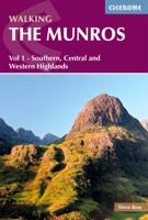
Wandelgids 1 Walking The Munros Vol 1 Southern, Central and Western Highlands - Schotland | Cicerone
Uitstekende wandelgids van het zuiden, midden en westen van de Schotse Hooglanden. Goed beschreven met veel praktische informatie om de route te kunnen lopen, inclusief redelijke kaarten. Guidebook to walking the Munros in southern, central and western Highlands. Describes 69 challenging routes across 139 of the iconic 3000ft+ mountains covering areas such as Glencoe, Bridge of Orchy and Mull. Includes routes up Ben More, Ben Alder, Ben Lomond and Ben Nevis, the highest mountain in the British Isles. Volume 1 of two guidebooks.   Seasons The guide is intended for summer hillwalkers (usually April/May to October in Scotland). In winter conditions the routes become more serious mountaineering expeditions requiring appropriate skills, equipment and experience.   Centres Arrochar, Crianlarich, Killin, Pitlochry, Tyndrum, Glencoe, Fort William, Spean Bridge, Dalwhinnie, Braemar, Glenshee   Difficulty Most of the Munros are straightforward walks but some involve ridge walking, sc…
20,95
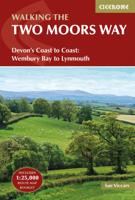
Wandelgids The Two Moors Way | Cicerone
Uitstekende wandelgids van de Two Moors Way, waarbij naast alle noodzakelijke informatie ook gebruik gemaakt wordt van de echte topografische kaart. inclusief gidsje met routekaarten van 1:25000 This guidebook to walking Coast to Coast across Devon, presents a 117 mile route incorporating the Two Moors Way and a section of the Erme-Plym Trail. Beginning at Wembury Bay on the south coast and finishing at Lynmouth, the 11-stage walk passes through the beautiful Devon countryside and across two of southwest England’s magnificent moorlands, Dartmoor and Exmoor. The schedule can be adjusted to give a one-week walk, or a more leisurely pace if preferred, and the book includes low-level bad-weather alternative routes for some moorland stretches.   A full route description is given for walking the route from south to north, with a summary description for walking in the opposite direction. 1:50,000 map extracts show the route and there is lots of practical information on public transport, refr…
23,95
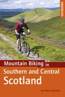
Fietsgids - Mountainbikegids Mountain Biking in Southern and Central Scotland | Cicerone
Degelijke fietsgids met 21 mountainbike routes in zuid en midden Schotland. Goede beschrijvingen en duidelijke kaarten.   This guidebook describes 21 mountain biking routes in central and southern Scotland. It includes the 7stanes trail centre in Dumfries and Galloway, as well as cross-country routes in the Campsie Fells, Pentland Hills and Lammermuirs, the Galloway Forest, Tweed Valley, Cheviots and Lowther Hills. The routes range from 16.5 to 66km and are graded from moderate to very hard. Taking between 2 and 7 hours to complete, they are intended for reasonably fit mountain bikers with at least some experience.   Detailed route descriptions are accompanied by 1:50,000 OS mapping, and the selected routes set out from various points across the area, including Greenock, Glentrool, Peebles and Milngavie, with good access from both Glasgow and Edinburgh. The guidebook also gives an overview of what the region's MTB trail centres have to offer, including the famous 7stanes trail cent…
24,95
Wandelgids The Cambrian Way | Cicerone
Uitstekende wandelgids van de Cambrian Way, waarbij naast alle noodzakelijke informatie ook gebruik gemaakt wordt van de echte topografische kaart.  Dubbed 'the mountain connoisseurs' walk', the Cambrian Way stretches 479km between the mighty castles of Cardiff in the south and Conwy on the north coast. Traversing the heartland of Wales, the challenging route crosses the Brecon Beacons, the Cambrian Mountains and Snowdonia, passing through two national parks and visiting many of the country's iconic summits, including Pen y Fan, Pumlumon, Cadair Idris and Snowdon itself. It can be walked in three weeks (or in shorter sections) and is suitable for experienced hillwalkers with sound navigational skills.   The guide presents the route in 21 stages, offering comprehensive route description illustrated with OS 1:50,000 mapping and elevation profiles. Details of accommodation and facilities are provided, along with a helpful trek planner showing their distribution along the route: although …
20,95
Wandelgids Aconcagua and the Southern Andes - A Trekker's Guidebook | Cicerone
The definitive guidebook to climbing Aconcagua in South America. At 6962m, Aconcagua is the highest peak outside the Himalayas and is accessible to both trekkers and mountaineers. The book covers two popular trekking routes: the Normal (Horcones Valley) route and the Vacas Valley (Polish Glacier) route. It also includes trekking routes up Tupungato, the Maipo Volcano, and other acclimatisation treks, with suggestions for things to see and do around Mendoza and Santiago City.   The guide provides a wealth of practical and indispensable information for those taking on the challenge of Aconcagua. There is information on travel to South America and to the start of the trek, and essential know-how on preparing for high-altitude mountaineering, including advice on equipment, coping with altitude, and strategies for acclimatisation. It gives expert advice on permits, food and water, hiring guides and mules, and staying healthy.   With maps and colour photos and supplemented by background inf…
23,95

Klanten-reviews van Wandelgids The Southern Upland Way | Cicerone

Er zijn nog geen beoordelingen voor dit productBen jij de eerste die een review plaatst?

Meer over Wandelgids The Southern Upland Way | Cicerone

Productomschrijving

Uitstekende wandelgids van de Southern Upland Way, waarbij naast alle noodzakelijke informatie ook gebruik gemaakt wordt van de echte topografische kaart.   The Southern Upland Way is Scotland's coast-to-coast walk and the longest of the nation's Great Trails. 215 miles long, it links the pretty harbour village of Portpatrick on the west coast with Cockburnspath, a little south of Dunbar, in the east. The walk is at times a strenuous one, crossing the remote high moorland of the Galloway Hills, Carsphairn range, Lowthers, Ettrick Hills and Lammermuirs, calling for competence, fitness and self-reliance.    This guide presents advice on how best to plan and tackle this challenging but highly rewarding journey. The waymarked trail is presented in fourteen stages of 9–19 miles and suggestions for a rest day exploring Moffat and its environs are also included. It is possible either to backpack, taking advantage of five bothies and unlimited wild camping possibilities, or to stay in towns and hill villages, B&Bs and inns (facilitated by vehicle pick-up to avoid excessively long walking days).    The guide covers all the practicalities, with tips on planning, transport, accommodation, luggage transfer and vehicle support services. Clear step-by-step route description is provided for each stage, accompanied by 1:50,000 OS mapping and notes on local history and points of interest. A trek planner and useful contacts can be found in the appendices.   The Southern Upland Way showcases the wild beauty of southern Scotland, taking in rugged moorland, rolling hills, wooded river valleys, lochsides and coast, as well as some of the attractive border towns that scatter the region. There are also numerous historical sites, offering an insight into a fascinating past – from ancient cairns to bastles, Covenanters' memorials and literary connections – plus opportunities to visit local attractions, including Castle Kennedy Gardens, Wanlockhead Lead Mining Museum, Traquair House, Melrose Abbey and Thirlestane Castle.   Dorpen en steden Portpatrick, Castle Kennedy, New Luce, Bargrennan, St John's Town of Dalry, Sanquhar, Wanlockhead, Beattock/Moffat, Traquair, Galashiels, Melrose, Lauder, Longformacus, Abbey St Bathans, Cockburnspath  
 

Productinformatie

    Verken gerelateerde categorieën

    Webshop.nl maakt gebruik van cookies. Ga je verder op onze website, ga dan akkoord met het plaatsen van cookies en de verwerking van deze data door ons en vermelde partners.