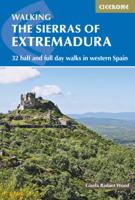
Wandelgids The Sierras of Extremadura | Cicerone

0
Uitstekende wandelgids, goed beschreven met veel praktische informatie om de route te kunnen lopen, inclusief redelijke kaarten This guidebook showcases 32 walks exploring the sierras of Cáceres and Badajoz, one of Spain’s least known regions and a gem for walkers and nature lovers. Walks range in length from 6 to 20km are suitable for any reasona...

Verkopers met dit product

Verkoper
Bezorging
Prijs
DeZwerver.nl logo
DeZwerver.nl
2,95
23,95

Anderen bekeken ook

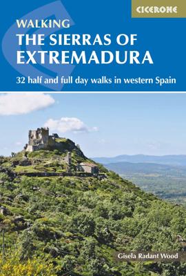
Wandelgids The Sierras of Extremadura | Cicerone
Uitstekende wandelgids, goed beschreven met veel praktische informatie om de route te kunnen lopen, inclusief redelijke kaarten This guidebook showcases 32 walks exploring the sierras of Cáceres and Badajoz, one of Spain’s least known regions and a gem for walkers and nature lovers. Walks range in length from 6 to 20km are suitable for any reasonably fit walker. They can be done from a number of bases in the area including San Martín de Trevejo, Gata, Hervás, Jerte, Jarandilla de la Vera, Montánchez, Guadalupe, Almoharín, Mérida, Alange, Hornachos and Monesterio. Each walk is accompanied by a sketch map and detailed route description, as well as notes on the terrain, refreshments available and access. Background information about the area and the many interesting sites passed along the route combine to give an invaluable guide to an unspoilt and peaceful region.  Extremadura is one of the most untouched regions of Spain, a delightful mix of rugged mountain ranges, gently rolling hills…
23,95
Wandelgids The Mountains of Romania - Roemenië | Cicerone
Guidebook to walks and multi-day treks in the Carpathian mountains of Romania. Includes routes in the Maramures and Bucovina regions, Piatra Craiului ridge, and the Retezat and Fagaras mountains. This guide describes 27 short treks of 2-6 days and 10 day walks in the mountains of Romania. Although there is a slight focus on Transylvania, most of the main massifs are included, with chapters covering the Mountains of Maramures, the Eastern Carpathians, the mountains around Brasov, the Fagara?, the region between the Olt and the Jiu, the Retezat, the mountains of Banat and the Apuseni. Also included is an ascent of Moldoveanu, Romania's highest peak at 2544m.   There is a wealth of advice to help you plan your trip and organise the logistics of your walk or trek. Some routes avail of the network of mountain huts; others offer opportunities to camp in attractive wild locations. Overviews and a route summary table make it easy to choose an appropriate excursion. Each route includes clear d…
26,50
Wandelgids The Westweg | Cicerone
Uitstekende wandelgids van een meerdaagse tocht in het Zwarte Woud in Duitsland. Goede beschrijvingen, veel praktische informatie en redelijke kaarten al zullen deze niet helemaal voldoende zijn. Guidebook to the Westweg (Westway), a 285km walk across Germany's Black Forest from Pforzheim to Basel. This classic route, which includes Feldberg, Black Forest's highest peak, takes 13 to 14 days, each day stage ranging from 15 to 28km. Two variants are described, both well way-marked and suitable for those new to long distance walking. This guidebook is all you need to discover The Westweg, a 285km walk along the length Germany's Black Forest from Pforzheim to Basel. This classic long-distance trail takes around two weeks to walk, in stages of 15-28km. The route is well way-marked and suitable for experienced hikers and those new to long distance walking, though some sections are steep. The Westweg incorporates many of the region's highlights, such the Schwarzwald National Park, the source…
23,95
Wandelgids The Cathar Way | Cicerone
Guidebook to the GR367 Cathar Way (Sentier Cathare) in the Languedoc region of southern France. The 260km waymarked trail from Port la Nouvelle on the Mediterranean to Foix traces the history of the Cathars through the Eastern foothills of the Pyrenees. Split into 13 stages and offering a northern variant, the route takes about 2 weeks to complete. Two of the southernmost départements of France, the Pyrénées-Orientales and Ariège are inextricably linked with the history of the Cathars, a heretical Christian sect who were subjected to a crusade in the thirteenth century. Striking castles built on jagged rocky precipices are a highlight of the region and a reminder of those turbulent times. This guidebook describes the 260km Cathar Way (Sentier Cathare or GR367), a long-distance trail from Port-la-Nouvelle on the Mediterranean coast to Ariége's departmental capital Foix linking several of the impressive Cathar castles. The route follows ancient footpaths, jeep tracks and country lanes a…
22,95
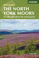
Wandelgids The North York Moors | Cicerone
Uitstekende wandelgids van dit geweldige gebied. Goed beschreven met veel praktische informatie om de routes te kunnen lopen, inclusief redelijke kaarten. Guidebook to 50 walks in the North York Moors National Park. The walks, which range from 4 to 13 miles, are distributed through seven regions within the park, enabling walkers to discover and appreciate the Tabular Hills, Hambleton Hills, Cleveland Hills, Northern Moors, High Moors, Eastern Moors and Cleveland Coast. For those who like a challenge, the course of the classic Lyke Wake Walk, crossing the national park from east to west, is also described.   For each walk (most of which are circular), step-by-step route description is accompanied by extracts of OS mapping. Points of interest are highlighted, and background information provided, detailing the history and industry of the area. The guidebook also includes planning and preparation details such as when to go, where to stay, and how to get around using public transport.   Co…
18,50
Wandelgids Walking and trekking in the Sierra Nevada | Cicerone
Uitstekende wandelgids voor de Sierra Nevada. Goed beschreven met veel praktische informatie om de route te kunnen lopen, inclusief redelijke kaarten. Aanbevolen wandelkaarten Wandelkaart NP Sierra Nevada met Alpujarras | Editorial Penibetica 1:40.000 of Wandelkaart Sierra Nevada en Alpujarras | Editorial Alpina - 1:40.000 Wandelkaart Sierra Nevada - la integral de los 3000 | Editorial Piolet 1:25.000   This guidebook presents 33 graded walks and 5 high mountain scrambles in the striking Sierra Nevada, the highest mountain range in mainland Spain and in western Europe outside the Alps. Easily accessible from Granada and Málaga, it is a world of soaring, snow-clad peaks and deep valleys, far removed from the crowded beaches of the Costa del Sol just two hours away. The routes are spread across the national park, with attractive towns and villages such as Trevélez, Lanjarón, Hoya de la Mora and Cumbres Verdes serving as potential bases for a walking holiday.   The walks have been carefu…
20,95
Wandelgids The high mountains of Crete - Kreta | Cicerone
Guidebook to walking and trekking the high mountains of Crete. The largest of the Greek Islands, Crete's mountains provide breathtaking walking and wilderness to this popular island. The routes in this guidebook are graded for difficulty and range from short, easy strolls to challenging, multi-day treks and summit climbs, so there are options for walkers of all abilities.    All the mountain ranges of Crete feature high plains, gorges and ravines, but in the heart of the Lefka Ori there is something else. High above the treeline snow thaws by July to reveal a great circle of massive barren peaks, interspersed with ‘moonscape’ outcrops, or depressions, of sinkholes in black, grey or red rock. This high desert wilderness is seldom visited but covers some 960sqkm.   In central Crete, where the island is at its widest, the huge mass of Psiloritis (Mount Ida) dominates the whole region. Covering about 560sqkm this massif is different in that a single huge, partly scree-surfaced summit ridg…
26,50
Wandelgids The Swiss Alps | Cicerone
  The Swiss Alps are home to the highest and most spectacular mountains in Western Europe. This stunning guidebook describes each mountain area throughout Switzerland – the peaks, passes, valleys and bases – to help you identify the best destinations to plan your trip.   Questions such as ‘Where to walk, climb or ski?’, ‘What multi-day treks are available’ and ‘Where do they go?’, ‘Where are the mountain huts, what are their facilities, which peaks do they serve?’ And where are the most suitable valley bases?’ – all these and more are addressed in detail in this essential guidebook.   The Swiss Alps does not give detailed route directions but information is given about all the guides and maps available for every region.   The Swiss Alps by Kev Reynolds is the third book in Cicerone’s World Mountain Ranges series, which include The Pyrenees and Scotland.   descriptions of all the Swiss Alps, area-by-area from the Chablais Alps in the south west to the Silvretta in the north east classi…
34,95
Wandelgids The Isle of Man | Cicerone
Wandelgids met 40 wandelingen op het eiland Man dat tussen Engeland en Ierland in ligt. De wandelingen variëren van zo'n 2 tot 22 km. Kaartmateriaal voldoende. Engelstalig. A guidebook to 40 walking routes on the Isle of Man. The varied selection of day walks, which range from 1 to 14 miles long (2 and 22km) take in the best scenic routes right across this delightful island. Many routes can be combined to create longer more ambitious walks.   The Isle of Man offers the walker a wonderfully diverse range of landscapes within a relatively compact island setting, and the routes reflect this diversity - scale the highest point Snaefell (620m), cross wide-open moorlands, drift over beaches and climb coastal clifftops. The assortment provides walkers with fantastic trails, along with detail on the wildlife, wild flowers, unique history and points of interest encountered. Alongside detailed route descriptions and OS 1:50,000 maps (blown up to 1:40,000 for greater clarity), there is plenty…
20,95
Wandelgids The Ridgeway | Cicerone
Uitstekende wandelgids van de Ridgeway, waarbij naast alle noodzakelijke informatie ook gebruik gemaakt wordt van de echte topografische kaart. Inclusief gidsje met routekaarten van 1:25000   This guidebook - which includes both a guide to the route and a separate OS map booklet - describes the Ridgeway National Trail, an 87 mile (139km) route through southern England from Avebury in Wiltshire to Ivinghoe Beacon in Buckinghamshire. Typically walked in 6 or 8 days, this is a low-level waymarked route suitable for all abilities and for year round walking.   The guidebook details the trail in both directions, west to east and east to west. Step-by-step route descriptions are accompanied by 1:100,000 OS mapping and a separate OS 1:25,000 map booklet showing the entire route is included. Packed with details on points of interest and a trek planner giving at-a-glance information about facilities, public transport and accommodation available along the way, this book is an indispensable guide…
23,95

Klanten-reviews van Wandelgids The Sierras of Extremadura | Cicerone

Er zijn nog geen beoordelingen voor dit productBen jij de eerste die een review plaatst?

Meer over Wandelgids The Sierras of Extremadura | Cicerone

Productomschrijving

Uitstekende wandelgids, goed beschreven met veel praktische informatie om de route te kunnen lopen, inclusief redelijke kaarten

This guidebook showcases 32 walks exploring the sierras of Cáceres and Badajoz, one of Spain’s least known regions and a gem for walkers and nature lovers. Walks range in length from 6 to 20km are suitable for any reasonably fit walker. They can be done from a number of bases in the area including San Martín de Trevejo, Gata, Hervás, Jerte, Jarandilla de la Vera, Montánchez, Guadalupe, Almoharín, Mérida, Alange, Hornachos and Monesterio. Each walk is accompanied by a sketch map and detailed route description, as well as notes on the terrain, refreshments available and access. Background information about the area and the many interesting sites passed along the route combine to give an invaluable guide to an unspoilt and peaceful region.  Extremadura is one of the most untouched regions of Spain, a delightful mix of rugged mountain ranges, gently rolling hills, deciduous forests, deep river valleys, olive groves and shady pastures, all criss-crossed by thousands of paths. Superb birdlife and a variety of heritage sites, from cave paintings to monasteries, add to this region’s charms.   Steden en Dorpen San Martín de Trevejo, Gata, La Garganta (Hervás), Jerte, Jarandilla de la Vera, Montánchez, Almoharín, Guadalupe, Mérida, Alange, Hornachos, Monesterio.

Productinformatie

    Verken gerelateerde categorieën

    Webshop.nl maakt gebruik van cookies. Ga je verder op onze website, ga dan akkoord met het plaatsen van cookies en de verwerking van deze data door ons en vermelde partners.