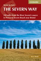
Wandelgids The Severn Way | Cicerone

0
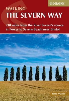
Uitstekende wandelgids van de Severn Way, waarbij naast alle noodzakelijke informatie ook gebruik gemaakt wordt van de echte topografische kaart.    Guidebook to walking the Severn Way, a 210 mile (338km) walk through the Welsh borders. Beginning near the source of the River Severn in Powys, mid-Wales, and finishing in Bristol, the history-rich ro...

Verkopers met dit product

Verkoper
Bezorging
Prijs
DeZwerver.nl logo
DeZwerver.nl
2,95
18,50

Anderen bekeken ook

Nieuw
Wandelgids The North Downs Way | Cicerone
Uitstekende wandelgids van de North Downs Way, waarbij naast alle noodzakelijke informatie ook gebruik gemaakt wordt van de echte topografische kaart. inclusief gidsje met routekaarten van 1:25000 A guidebook to walking the North Downs Way National Trail, a 130 mile (208km) walk between the high downland of Farnham and the historic city of Dover on the Kent coast, with an optional visit to Canterbury. The route is described in 11 stages, and is fully illustrated with colour photographs and OS map extracts. The North Downs Way is one of the easier national trails with a modest number of steep (but short) ascents and descents and long sections with no noticeable height gain or loss. Several historic sites including Neolithic burial chambers, Roman roads and Norman churches are passed and much of the route follows The Pilgrims' Way. The area also boasts many literary connections with some of the most celebrated voices in English literature. A separate pocket-sized map booklet is included…
23,95
Wandelgids Walking in Provence - West | Cicerone
This guide offers 30 circular day walks in the western half of Provence, the large sun-kissed coastal region of south-east France. Spanning from the Baronnies in the north to the Ste-Baume ridge in the south, the walks are set in the areas of the Drôme Provençale, Vaucluse and the Var. Provence’s sunshine and Mediterranean charm attract many visitors to its coast, yet the area also has much more to offer the walker. The countryside inland boasts a range of scenery from remote mountaintops to spectacular gorges. History is everywhere, in medieval villages, arcaded streets, abbeys, churches and castles.    This guide covers the western regions, with its companion volume, Walking in Provence: East, covering the rest of this fascinating and historic landscape. The walking is incredibly diverse; from the green waves of the Barronies hills in Drôme Provençale, to the unforgettable silhouette of Mont Ventoux giving way to limestone plateaux cut with ravines in the Vauclause. Further south li…
21,95
Nieuw
Wandelgids Trekking in Ladakh | Cicerone
Cicerone wandelgids van Ladakh met acht uitdagende trekkingen.    This trekking guidebook gives detailed descriptions of eight different treks across the Ladakh, Zanskar and Markha Valley in northern India. Ranging from moderate difficulty to very demanding, each trek is broken down into multiple stages, and has information on difficulty, available accommodation and access, as well as the many combinations and alternative routes open to exploration.    Known as Little Tibet; for both its landscape and culture, Ladakh lies at the northern tip of India. The region is bisected by the great River Indus and neighbours Tibet and Kashmir. This quiet corner of the Himalaya has developed a strong trekking culture over recent years for adventurous trekkers. Trekking in this remote, high-altitude region is extremely challenging, as paths are not signed and there are only a limited number of villages. However, its magnificent landscape (a huge area full of limitless trekking possibilities), ho…
33,95
Wandelgids Walking in Provence - East | Cicerone
This guide offers 30 circular day walks in the eastern half of Provence, the large sun-kissed coastal region of south-east France. Spanning from the red rocks in the Ésterel on the Mediterranean to high mountains inland, the walks are set in the areas of the Alpes Maritimes, the Alpes de Haute-Provence and the Mercantour. Provence’s sunshine and Mediterranean charm attract many visitors to its coast, yet the area also has much more to offer the walker. The countryside inland boasts a range of scenery from remote mountaintops to spectacular gorges. History is everywhere, in medieval villages, arcaded streets, abbeys, churches and castles.    This guide covers the eastern regions, with its companion volume, Walking in Provence: West, covering the rest of this fascinating and historic landscape. The walking is incredibly diverse, and explores the country that hugs the Côte d'Azur and Italian border. The Alpes Maritimes rise craggy and wild above towns as unique as Grasse, Cannes and Mona…
21,95
Nieuw
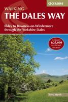
Wandelgids The Dales Way | Rucksack Readers
This charming walk runs for 79 miles (127 km) from Ilkley in the Yorkshire Dales to Bowness in the Lake District. The route heads north through Wharfedale, crisscrossing the river, and rises over high moorland to pick up River Dee through Dentdale. It joins River Lune briefly before heading west to Bowness on Lake Windermere. The LDWA has documented Link Routes for walkers beginning in Leeds, Harrogate and Bradford.   Along the Way, you’ll see impressive railway viaducts and fine stone bridges; Bolton Priory and many small churches; limestone scenery with stone walls, hay meadows and lime kilns; and heritage centres you can visit. Above all, the route is blessed with many small villages with B&Bs and welcoming pubs at strategic intervals. Gradients are modest and most people will complete it comfortably in 6 or 7 days.   This guidebook has all you need to plan and enjoy the Dales Way:   detailed directions for the main Way walked south to north detailed directions for the Bradfor…
17,50
Nieuw
Wandelgids 15 Short Walks Yorkshire Dales | Cicerone
Discover 15 of the best short walks around Sedbergh, Kirkby Lonsdale and Ingleton. Each walk comes with easy-to-read Ordnance Survey maps, clear route description and lots of images, plus information on beauty spots and refreshment stops. No challenging terrain or complicated navigation means everyone can enjoy walks.   Seasons These routes are suitable for walking at all times of the year, although in winter and extremely wet weather, extra care will be needed on steep slopes and near rivers and waterfalls. Centres Sedbergh and Kirkby Lonsdale are the main centres. The villages of Dent and Barbon also provide a range of more limited facilities. Difficulty The Yorkshire Dales comprise dales (valleys) but also steep hillsides from where extensive views can be enjoyed. Stoney tracks and paths tend to be the norm, rivers and streams are crossed on footbridges, and narrow ‘squeeze’ stiles pass through drystone walls. Must See Sedbergh, Kirkby Lonsdale, Dent, Barbon, Barbondale, Dentdale, …
18,95
Nieuw
Wandelgids Walking in the Thames Valley | Cicerone
Walking in the Thames Valley offers 25 challenging circular walks around the River Thames and River Kennet in the south of England, taking in the Southern Chilterns, the Berkshire and North Hampshire Downs, Southern Oxfordshire and the eastern edge of Wiltshire. All routes are within easy reach of Reading, Newbury, Abingdon and London. While some walks visit Iron Age hill forts, others pass more modern features such as Wilton Windmill and the Kennet and Avon Canal. Some follow sections of the Ridgeway, while others meander along the banks of the Thames. What they all have in common is that they take the keen rambler to some of the best parts of the Thames Valley – a patchwork of open chalk grassland, broadleaved woodland and farmland and home to two Areas of Outstanding Natural Beauty. • walks from 10 to 18 miles, including one 2-day route • shorter, less strenuous alternatives for many of the walks • detailed route descriptions with information on local points of interest, OS mapping…
18,50
Nieuw
Wandelgids The Cotswold Way | Cicerone
Uitstekende wandelgids van de Cotswolds Way, waarbij naast alle noodzakelijke informatie ook gebruik gemaakt wordt van de echte topografische kaart. inclusief gidsje met routekaarten van 1:25000 (deze is hier ook los te bestellen) Guidebook to walking the 102 mile (163km) Cotswold Way National Trail between Chipping Campden and Bath, across the Cotswolds AONB. The guidebook - which includes both a guide to the route and a separate OS 1:25,000 map booklet - describes the route in both directions.   The route is described over 13 stages, each following the Cotswold escarpment, with dramatic and far-reaching views across the Severn Vale towards the Welsh hills, plunging down to visit honey-coloured villages, old market towns and the elegant and historic city of Bath. The longest of the 13 stages is 10 miles, the shortest 6 miles: these are dictated by the existence of overnight accommodation. For the determined, the trail can be walked in as little as five days.   The Cotswold Way offers…
23,50
Nieuw
Wandelgids The Andalucian Coast to Coast Walk - Andalusie | Cicerone
Wandelgids met goed beschreven etappes met veel praktische informatie om de route te kunnen lopen, inclusief redelijke kaarten. Kaartmateriaal is vrij beperkt, maar het is moeilijk om deze route geheel met kaarten te dekken, dan heb je er wel erg veel nodig. De beschrijvinen zijn echter best goed, met wat gepuzzel ter plekke is het prima te doen.  Guidebook to the Andalucian Coast to Coast Walk, a 440km, 21-day route from Maro on the Mediterranean coast to Bolonia, on the Atlantic. The route, which passes through 7 Natural Parks, links some of Andalucía's most beautiful villages and passes historical sites of both Roman and Moorish origins, including Ronda and Tarifa.   Seasons Seasons Andalucía's mild winter climate means that this is a region that is suited to year-round walking, apart from July and August when temperatures are generally too hot for comfortable hiking.   Centres Centres Frigiliana, Cómpeta, Alcaucín, Riogordo, Villanueva de la Concepción, El Chorro, Carratraca, El B…
20,95
Nieuw
Wandelgids Karawanken - Slovenie - Walking in the Karavanke | Cicerone
Goede wandelgids met veel dagtochten; redelijk kaartmateriaal en goede praktische informatie. This guidebook offers 23 walking routes set across the magnificent 120km-long Karavanke mountain range, which forms a natural border between Austria and Slovenia. Commonly known as 'the way the Alps used to be', as it is yet to experience the extent of commercial development known by the Western Alps, it is one of the longest ranges in Western Europe but it remains genuinely unspoilt and relatively unvisited by English-speaking hillwalkers. The guide's walks begin in pretty towns and villages, and most of them access the peaks from the relatively more gentle Slovenian side of the range, where forest-clad slopes lead to grassy summits where spectacular views can be enjoyed. Arranged by peak from west to east along the range, most of the summits can be reached by waymarked paths and trails. The guide gives all the practical details you need on transport, accessing the routes, accommodation and …
20,95

Klanten-reviews van Wandelgids The Severn Way | Cicerone

Er zijn nog geen beoordelingen voor dit productBen jij de eerste die een review plaatst?

Meer over Wandelgids The Severn Way | Cicerone

Productomschrijving

Uitstekende wandelgids van de Severn Way, waarbij naast alle noodzakelijke informatie ook gebruik gemaakt wordt van de echte topografische kaart.    Guidebook to walking the Severn Way, a 210 mile (338km) walk through the Welsh borders. Beginning near the source of the River Severn in Powys, mid-Wales, and finishing in Bristol, the history-rich route is described over 22 stages (ranging from 3 to 14 miles), passing through the counties of Powys, Shropshire, Worcestershire and Gloucestershire.   Seasons May to September should avoid the usual periods of flooding and the muddy aftermath they bring.   Centres main centres are Worcester and Gloucester. Other centres are Newtown, Welshpool, Shrewsbury, Bridgnorth, Stourport and Tewkesbury, plus numerous small villages and hamlets.   Difficulty a regular walker should find no difficulty following the Severn Way. Once descended from the Hafren Forest and the upper Severn, easy river walking ensues all the way to Severn Beach. Equipment and clothing for day walking is adequate.   Must See flowing through the most superb landscapes and past appealing towns and villages, the River Severn pulls together threads of history, trade, commerce, civil war and the lives of ordinary folk. It is the longest river in the UK.

Verken gerelateerde categorieën

Webshop.nl maakt gebruik van cookies. Ga je verder op onze website, ga dan akkoord met het plaatsen van cookies en de verwerking van deze data door ons en vermelde partners.