Wandelgids The Ridgeway | Sparky Books

0
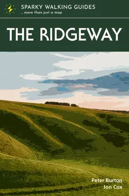
The Ridgeway - possibly the country’s oldest path - follows the central section of the mighty swathe of chalk that cuts across England from the Dorset to the Norfolk coasts. Between Avebury in Wiltshire and Ivinghoe Beacon in Buckinghamshire, it winds, undemandingly, for 87 miles along a trail of two halves, with the Thames providing its midpoint....

Verkopers met dit product

Verkoper
Bezorging
Prijs
DeZwerver.nl logo
DeZwerver.nl
2,95
20,95

Anderen bekeken ook

Wandelgids The Ridgeway | Sparky Books
The Ridgeway - possibly the country’s oldest path - follows the central section of the mighty swathe of chalk that cuts across England from the Dorset to the Norfolk coasts. Between Avebury in Wiltshire and Ivinghoe Beacon in Buckinghamshire, it winds, undemandingly, for 87 miles along a trail of two halves, with the Thames providing its midpoint. The wide-open spaces of the bare North Wessex Downs are rich in prehistoric treasures and soul-cleansing views, while the Chilterns to the east are cosier, more populated, more heavily wooded. Step out and back in time on this classic ancient route.  * the latest 1:25,000 OS mapping, with the trail highlighted so you can see it at a glance * information nuggets throughout bring the countryside alive – past and present, seen and unseen * a handy slip-into-your-pocket design, with cover flaps to mark your page * planning info – practical help to plan your hike, including an overview map of the whole trail * stage descriptors, giving you an ove…
20,95
Wandelgids Cotswold Way | Sparky Books
The beauty of the Cotswolds is in no way lessened by its popularity, and the Cotswold Way leads you through the best of this most comforting of regions. The trail follows a snaking path along the western edge of the hills for 102 miles, from the pristine market town of Chipping Campden to the stately city of Bath – through deep-cut valleys and over beech-clad hills, across open pasture and past ancient barrows. You are never far from a view of the Severn Vale and the Welsh hills, or from a welcoming pub in a village of amber-hued stone.  * the latest 1:25,000 OS mapping, with the trail highlighted so you can see it at a glance * information nuggets throughout bring the countryside alive – past and present, seen and unseen * a handy slip-into-your-pocket design, with cover flaps to mark your page * planning info – practical help to plan your hike, including an overview map of the whole trail * stage descriptors, giving you an overview of what to expect on each leg * accommodation ideas…
20,95
Wandelgids South Downs Way | Sparky Books
The magnificent South Downs Way traverses the chalk hills of Hampshire and Sussex for 100 miles between Winchester and Eastbourne, building in drama from west to east. Cosy rolling countryside, wooded escarpment slopes and rolling grassland downs - this national trail has it all, including the dazzling spectacle of the world-famous Seven Sisters and Beachy Head. Walk with the ghosts of our prehistoric ancestors across an arrestingly empty landscape, with breath-catching views at almost every step.  * the latest 1:25,000 OS mapping, with the trail highlighted so you can see it at a glance * information nuggets throughout bring the countryside alive – past and present, seen and unseen * a handy slip-into-your-pocket design, with cover flaps to mark your page * planning info – practical help to plan your hike, including an overview map of the whole trail * stage descriptors, giving you an overview of what to expect on each leg * accommodation ideas – B&Bs, hotels, pubs and campsites clos…
20,95
Wandelgids Capital Ring | Sparky Books
The Capital Ring traces a 78-mile loop between outer and inner London. Linking the city’s diverse communities and districts via green corridors, it provides a fascinating window into the ever-changing capital and the stories of those who have made it home. The variety is dizzying. Flitting between the urban and bucolic, you walk streets humble and high-class, across parks and woodlands, past palaces and factories, beside canals and rivers, taking in world-renowned sights and intriguing backwaters, and with frequent stunning views. No matter how well you think you know the metropolis, the Capital Ring will help you see London with fresh eyes. Guaranteed.   * super-clear OS town mapping, with the trail highlighted so you can see it at a glance * information nuggets throughout bring the city alive – past and present, seen and unseen * a handy slip-into-your-pocket design, with cover flaps to mark your page * planning info – practical help to plan your hike, including an overview map of t…
24,95
Wandelgids The Ridgeway | Cicerone
Uitstekende wandelgids van de Ridgeway, waarbij naast alle noodzakelijke informatie ook gebruik gemaakt wordt van de echte topografische kaart. Inclusief gidsje met routekaarten van 1:25000   This guidebook - which includes both a guide to the route and a separate OS map booklet - describes the Ridgeway National Trail, an 87 mile (139km) route through southern England from Avebury in Wiltshire to Ivinghoe Beacon in Buckinghamshire. Typically walked in 6 or 8 days, this is a low-level waymarked route suitable for all abilities and for year round walking.   The guidebook details the trail in both directions, west to east and east to west. Step-by-step route descriptions are accompanied by 1:100,000 OS mapping and a separate OS 1:25,000 map booklet showing the entire route is included. Packed with details on points of interest and a trek planner giving at-a-glance information about facilities, public transport and accommodation available along the way, this book is an indispensable guide…
23,95
Wandelgids The Ridgeway | Trailblazer Guides
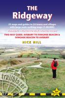
Goede wandelgids waarin met veel details alle etappes zijn beschreven. Tevens informatie over overnachtingen en openbaar vervoer. The go-to, all-in-one guide to walking The Ridgeway path. Running from Wiltshire to Buckinghamshire, in southern England, this ancient trackway is Britain's oldest road. In this fully revised and updated, two-way edition all routes have been completely rewalked in both directions from Avebury to Ivinghoe Beacon near Aylesbury and Ivinghoe Beacon to Avebury.   Coverage includes: Marlborough, Avebury, West Overton, Avebury Stone Circle, Kennett and East Kennett, Foxhill, Liddington, Wantage, Bishopstone, Ashbury, Woolstone, Uffington, Goring, Streatley, Wallingford, Crowmarsh Gifford, Watlington, Princes Risborough, Tring, Ivinghoe Beacon   In this guide you will find: - 53 detailed walking maps - the largest scale maps available - at just under 1:20,000 (8cm or 31/8 inches to one mile) these are bigger than even the most detailed walking maps currently avail…
21,95
Wandelgids The Ridgeway - National Trail Guides | Aurum Press
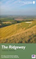
Uitstekend routeboek met goede kaarten van Ordnance Survey. Praktische info voor overnachten enigzins beperkt achterin. The Ridgeway follows one of the oldest ‘green roads’ in Europe. It runs for 87 miles (140 km) from Overton Hill in the west, across the Marlborough Downs and the Vale of the White Horse, to Ivinghoe Beacon on the northern edge of the Chilterns. This is the complete, official guide for the long-distance walker or the weekend stroller. All you need is this one book.   Anthony Burton's official guide has been fully revised and updated for 2016, and this new edition has been completely redesigned with more and bigger photographs and much new background history and information.     National Trail Guides are the official guidebooks to the fifteen National Trails in England and Wales and are published in association with Natural England, the official body charged with developing and maintaining the Trails.  
20,95
Wandelgids The Jurassic Coast | Northern Eye Books
One of five books in the upcoming South West Coast Path: Top 10 Walks series. Handy, pocket-sized, full colour walking guides written by experts. The perfect impulse buy. Free display stands and spinners. Other titles in the new series will be: North Devon Coast, North Cornwall Coast, South Cornwall Coast, and South Devon Coast. These attractive and cleverly structured guides will give walkers ten of the best short circular walks along every section of the 630-mile long South West Coast Path in a popular pocket-size format. With clear information, an overview and introduction for each walk, expertly written numbered directions, large scale Ordnance Survey maps, superb eye-grabbing panoramic photographs, and interpretation of points of interest along the way, these guides set a new standard in clarity and ease-of-use. Featured walks in the Jurassic Coast include: Golden Cap , Chesil Beach & Abbotsbury, Portland Bill, Ringstead Bay, Durdle Door & Lulworth Cove, Kimmeridge Ledges, St Ald…
10,95
Wandelgids The South West Coast Path | Cicerone
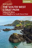
Goede wandelgids van het langste gemarkeerde wandelpad van Groot Brittanië; 1015 km! Uit de bekende Cicerone serie, dus met mooie foto's en duidelijke routebeschrijvingen en kaartjes. The South West Coast Path is Britain's longest way-marked trail, measuring a staggering 1015km (630 miles). Written by the well-known outdoor writer, Paddy Dillon, the guide provides a wealth of detailed knowledge to help tackle this immense route with confidence. It describes the way-marked trail from Minehead to Poole along the north Devon, Cornish and south Devon coastline to finish at Poole Harbour. A full introduction provides the route's historical background, advice on accommodation along the route and details on travelling to and around the South West.There is detailed information on how to use this guide to make the most of your walk, whether you choose to walk the whole route in one go or decide to achieve sections at intervals.Day-by-day route summaries accompany the 45-day stages and the fina…
24,95
Wandelgids Wales Coast Path: Snowdonia and Ceredigion | Northern Eye Books
Official Guide: Wales Coast Path: Snowdonia & Ceredigion Coast One of seven Official Guides to the Wales Coast Path This Official Guide to the Snowdonia & Ceredigion Coast section of the Wales Coast Path contains everything local and long-distance walkers need to enjoy the path.   Cardigan Bay probably offers a more diverse walking experience than any other section of the Wales Coast Path. The stretch covered in this book – from Porthmadog in the north to Cardigan in the south – largely covers two contrasting Welsh counties.   The first 97 kilometres pass through Gwynedd, along the western edge of the Snowdonia National Park. Here, just before the rivers that rise in the highest of the Welsh mountains reach the sea, they fan out to form broad estuaries that provide rich pickings for waders and other birdlife. The estuaries of the Dwyryd, the Mawddach and the Dyfi are the largest of these. Between them are some very large dune systems, including Morfa Harlech and Morfa Dyffryn – home t…
23,95

Klanten-reviews van Wandelgids The Ridgeway | Sparky Books

Er zijn nog geen beoordelingen voor dit productBen jij de eerste die een review plaatst?

Meer over Wandelgids The Ridgeway | Sparky Books

Productomschrijving

The Ridgeway - possibly the country’s oldest path - follows the central section of the mighty swathe of chalk that cuts across England from the Dorset to the Norfolk coasts. Between Avebury in Wiltshire and Ivinghoe Beacon in Buckinghamshire, it winds, undemandingly, for 87 miles along a trail of two halves, with the Thames providing its midpoint. The wide-open spaces of the bare North Wessex Downs are rich in prehistoric treasures and soul-cleansing views, while the Chilterns to the east are cosier, more populated, more heavily wooded. Step out and back in time on this classic ancient route.  * the latest 1:25,000 OS mapping, with the trail highlighted so you can see it at a glance * information nuggets throughout bring the countryside alive – past and present, seen and unseen * a handy slip-into-your-pocket design, with cover flaps to mark your page * planning info – practical help to plan your hike, including an overview map of the whole trail * stage descriptors, giving you an overview of what to expect on each leg * accommodation ideas – B&Bs, hotels, pubs and campsites close to the path * links to inspirational resources – websites and books to help you dive deeper * flora & fauna – pictorial guides to nature’s riches along the trail  

Productinformatie

    Verken gerelateerde categorieën

    Webshop.nl maakt gebruik van cookies. Ga je verder op onze website, ga dan akkoord met het plaatsen van cookies en de verwerking van deze data door ons en vermelde partners.