webshop.nl

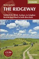
Wandelgids The Ridgeway - National Trail Guides | Aurum Press

0
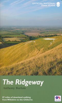
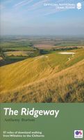
Uitstekend routeboek met goede kaarten van Ordnance Survey. Praktische info voor overnachten enigzins beperkt achterin. The Ridgeway follows one of the oldest ‘green roads’ in Europe. It runs for 87 miles (140 km) from Overton Hill in the west, across the Marlborough Downs and the Vale of the White Horse, to Ivinghoe Beacon on the northern edge o...

Webshops met dit product

Webshop
Bezorging
Prijs
DeZwerver.nl logo
DeZwerver.nl
niet bekend
20,95

Anderen bekeken ook

Wandelgids 10 The South West Coast Path National Trail Guide | Aurum Press
Goede beschrijving van een deel van het beroemde South West Coast path in Cornwall. Men heeft gebruik gemaakt van zeer gedetailleerde kaarten van Ordnance Survey. The South West Coast Path follows Britain's stunning coastline for 630 miles around the southern tip of Britain. This volume covers the 172 miles of the National Trail along the south Cornwall and Devon coast from Falmouth to the mouth of the Exe. It takes in some of Britain's most popular beaches and resorts, as well as arresting clifftop scenery, romantic coves and the spectacular 'drowned' estuaries of the Fal, the Yealm and the Dart. Whether you want golden sands, the steep streets of picturesque fishing villages, or a sight of the rare cirl bunting, this book is all you need as your guide to this wonderful walk. This new edition has been fully revised and updated for 2015 and completely resdesigned to feature many more colour photographs and much added information on the history, wildlife and cultural asociations of the…
20,95
Wandelgids 9 The South West Coast Path National Trail Guide | Aurum Press
Goede beschrijving van een deel van het beroemde South West Coast path in Cornwall. Men heeft gebruik gemaakt van zeer gedetailleerde kaarten van Ordnance Survey. Part two of the official four-part series covering Britain's longest National Trail in detail. Contains easy to follow Ordnance Survey mapping for individual sections, detailed route descriptions for the National Trail and shorter, circular walks off it. Full colour throughout. The South West Coast Path is the spectacular 630-mile (1008 km) National Trail around the tip of Britain. This volume features the section of the Path from Padstow to Falmouth, a distance of 169 miles (271 km). Following Natural England's acorn waymarks, the route hugs the coast right around Land's End and the Lizard, via the ports of St Ives and Penzance, This is the complete, official guide for the long-distance walker or the weekend stroller. National Trail Guides are the official guidebooks to the fifteen National Trails in England and Wales and a…
20,95
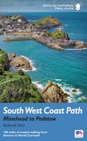
Wandelgids 8 The South West Coast Path | Aurum Press
Goede beschrijving van een deel van het beroemde South West Coast path in Cornwall. Men heeft gebruik gemaakt van zeer gedetailleerde kaarten van Ordnance Survey. Part one of the official four-part series covering Britain's longest National Trail in detail. Contains easy to follow Ordnance Survey mapping for individual sections, detailed route descriptions for the National Trail and shorter, circular walks off it. Full colour throughout. The South West Coast Path is the spectacular 630-mile (1008-km) National Trail around the tip of Britain. This volume features the section of the Path from Minehead to Padstow, a distance of 163 miles (262 km). The Trail traces the beautiful coastline, through Exmoor National Park, Clovelly and Tintagel, following Natural England's acorn waymarks. This is the complete, official guide for the long distance walker or the weekend stroller. All you need is this one book. National Trail Guides are the official guidebooks to the fifteen National Trails in E…
20,95
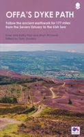
Wandelgids Offa's Dyke Path (Prestatyn - Chepstow) | Aurum Press
Goede beschrijving van de aantrekkelijke route. Kaartmateriaal van Ordnance Survey - de Engelse topografische dienst op een schaal van 1:25.000. Praktische info voor overnachten ed. niet altijd uitgebreid, maar die is op de site van de Ramblers (de engelse wandelorganisatie) te vinden. Offa's Dyke Path is the 177-mile (283-km) National Trail following the course of the man-made dyke that gives it its name. This volume, now fully updated, features the complete section of the Path, following Natural England's acorn waymarks from Chepstow to Prestatyn.  This is the complete, official guide for the long distance walker or the weekend stroller. All you need is this one book. National Trail Guides are the official guidebooks to the fifteen National Trails in England and Wales and are published in association with Natural England, the official body charged with developing and maintaining the Trails. 
20,95
Wandelgids North Downs Way national trail | Aurum Press
Goede engelstalige wandelgids van deze LAW in zuid oost Engeland, net onder Londen. Goede beschrijving en prima kaarten van Ordnance Survey, enigzins beperkte praktische tips, maar die zijn op de website van de route eenvoudig te vinden. This is the complete official guide to walking the well-loved and popular North Downs. Whether you're an experienced long distance walker or a weekend stroller, this is the only companion you need to this beautiful and scenic route. The North Downs Way is the National Trail that follows the official acorn waymarks from Farnham to the coast at Dover.   This picturesque trail takes in chalk ridges, river valleys and sections of the Pilgrims' Way. At the eastern end you can either walk via Canterbury (a total distance of 130 miles, 208 km) or follow the southern route (123 miles, 197 km). With Ordnance Survey mapping for the entire route, this is a superb guide to the North Downs Way National Trail which can be enjoyed by all.    
22,50
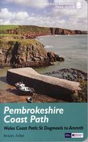
Wandelgids Pembrokeshire Coast Path Wales, St. Dogmaels to Amroth | Aurum Press
Beschrijving van de route langs de kust van Zuidwest Wales. Historische en culturele aspecten komen vrij uitgebreid aan bod, praktische informatie is wel summier. Kaartmateriaal zonder meer uitstekend! The Pembrokeshire Coast Path is one of the most popular of the fifteen National Trails in England and Wales. Running for 299km it follows the spectacular coast of the Pembrokehire National Park from St Dogmaels on the peninsula's northern coast, via the lovely town of St David's and Tenby, and the dramatic natural harbour of Milford Haven, to Amroth on the south coast. National Trail Guides are the official guidebooks to the fifteen National Trails in England and Wales and are published in association with Natural England, the official body charged with developing and maintaining the Trails.
20,95
Wandelgids Israel National Trail | Eshkol
The Israel national trail is one of the most exciting hikes in the world, expanding over 1000 kilometers from the north to the south of Israel. You can hike its' entire length, or just selected sections of your choice. It is the ultimate Israeli hiking experience, and you can do it easily with the guide that simply has all you need. This full and comprehensive guide includes 55 topographical maps (1:50,000) and 7 road maps (1:250,000). This is the only guide with all the maps in English. The guide offers a full description of the hike on the Israel national trail in both northbound and southbound directions and the hiking profile - distance and height above or below sea level. The maps along with a day-by-day trail descriptions and tips make this guide your one-stop shop and all you need to hike the Israel National Trail. The guide is suitable for experienced hikers as well as families and individuals looking to explore Israel in a whole new and exciting way. We have provided in the g…
69,95
Reisgids New England - Mid-Atlantic States National Parks | Lonely Planet
Lonely Planet's New England and the Mid-Atlantic States' National Parks is your passport to the most up-to-date advice on what to see and skip. Cycle carriage roads, hike ladder trails and zip down Skyline Drive; all with your trusted travel companion. Get to the heart of New England and the Mid-Atlantic's National Parks and begin your journey now! Inside Lonely Planet'sNew England and the Mid-Atlantic States' National Parks Travel Guide: Up-to-date information - all businesses were rechecked before publication to ensure they are still open after 2020's COVID-19 outbreak User-friendly highlightsand itinerarieshelp you tailor your trip to your personal needs and interests Insider tipsto save time and money and get around like a local, avoiding crowds and trouble spots Essential infoat your fingertips- hours of operation, phone numbers, websites, transit tips, prices, emergency information, park seasonality, hiking trail junctions, viewpoints, landscapes, elevations, distances, difficu…
18,50
Reisgids Fodor's the Complete Guide to the National Parks of the USA | Fodor's Travel
Whether you want to hike through the jaw-dropping scenery of Acadia, see rare wildlife and natural wonders in Yellowstone, or go river-rafting in the Grand Canyon, the local Fodor's travel experts in all the National Parks are here to help! Fodor's Complete Guide to the National Parks of the USA is packed with maps, carefully curated recommendations, and everything else you need to simplify your trip-planning process and make the most of your time. This brand new title has been designed with an easy-to-read layout, fresh information, and beautiful color photos. Fodor's Complete Guide to the National Parks of the USA travel guide includes: AN ILLUSTRATED ULTIMATE EXPERIENCES GUIDE to the top things to see and do MULTIPLE ITINERARIES to effectively organize your days and maximize your time MORE THAN 70 DETAILED MAPS to help you navigate confidently COLOR PHOTOS throughout to spark your wanderlust! HONEST RECOMMENDATIONS FROM LOCALS on the best sights, restaurants, hotels, activiti…
26,95
Reisgids Green Britain & Northern Ireland | Rough Guides
Een kleinere versie van de grotere versies van de Rough Guides. Als altijd weer vol met goede informatie over cultuur en praktische zaken. Achterin kleine plattegronden.   Practical travel guide to Green Britain & Northern Ireland with a free eBook featuring points-of-interest structured lists of all sights and off-the-beaten-track treasures, with detailed colour-coded maps, practical details about what to see and to do in Green Britain & Northern Ireland. The Rough Guide to Green Britain & Northern Ireland also includes details on how to get there and around, pre-departure information, as well as top time-saving tips, like a visual list of things not to miss in Green Britain & Northern Ireland, expert author picks and itineraries to help you plan your trip. This guide book has been fully updated post-COVID-19.     The Rough Guide to Green Britain & Northern Ireland covers: London & the Southeast, the Southwest, Central England, Northern England, Wales, Scotland and Northern Irela…
13,95

Klanten-reviews van Wandelgids The Ridgeway - National Trail Guides | Aurum Press

Er zijn nog geen beoordelingen voor dit productBen jij de eerste die een review plaatst?

Meer over Wandelgids The Ridgeway - National Trail Guides | Aurum Press

Productomschrijving

Uitstekend routeboek met goede kaarten van Ordnance Survey. Praktische info voor overnachten enigzins beperkt achterin.

The Ridgeway follows one of the oldest ‘green roads’ in Europe. It runs for 87 miles (140 km) from Overton Hill in the west, across the Marlborough Downs and the Vale of the White Horse, to Ivinghoe Beacon on the northern edge of the Chilterns. This is the complete, official guide for the long-distance walker or the weekend stroller. All you need is this one book.   Anthony Burton's official guide has been fully revised and updated for 2016, and this new edition has been completely redesigned with more and bigger photographs and much new background history and information.     National Trail Guides are the official guidebooks to the fifteen National Trails in England and Wales and are published in association with Natural England, the official body charged with developing and maintaining the Trails.


Verken gerelateerde categorieën

Webshop.nl maakt gebruik van cookies. Ga je verder op onze website, ga dan akkoord met het plaatsen van cookies en de verwerking van deze data door ons en vermelde partners.