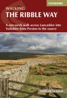
Wandelgids The Ribble Way | Cicerone

0
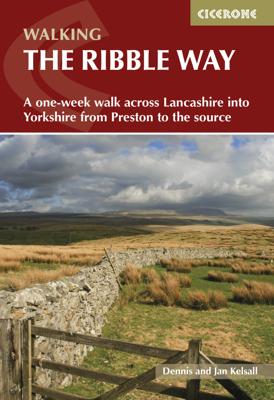
The 72 mile (116km) Ribble Way is described in seven stages, ranging from 8.25 to 17 miles (13.3 to 27.4km). The route follows the Ribble valley, from the estuary mouth near Preston to the river's source on Cam Fell in the Yorkshire Dales. The route might not be the most challenging of Long Distance routes, but the contrast through a succession o...

Verkopers met dit product

Verkoper
Bezorging
Prijs
DeZwerver.nl logo
DeZwerver.nl
2,95
23,95

Anderen bekeken ook

Wandelkaart The Dales Way | Footprint maps
Handzame wandelkaart voor de Dales Way in Noord Engeland.  The Dales Way is a 79 mile (127km) long distance trail in the north of England, running between Ilkley, in North Yorkshire and Bowness-on-Windermere, in Cumbria. Much of the route passes through the Yorkshire Dales and Lake District National Parks. Starting out in Ilkley, the route runs along Wharfedale, passing the impressive ruins of Bolton Priory and the attractive market town of Grassington. It continues along the River Wharfe through dramatic limestone scenery before it crosses The Pennines to reach Dentdale and Sedbergh. It then skirts the Howgill Fells and crosses the M6 motorway to finish overlooking Lake Windermere.   This map-guide is laid out for walkers travelling from Ilkley to Bowness, although walkers travelling in the opposite direction should find it equally useful. Each panel includes a detailed route map, route profile and helpful notes on navigation.   There are link routes from Bradford, Leeds and Harrogat…
12,95
Wandelgids The Dales Way | Rucksack Readers
This charming walk runs for 79 miles (127 km) from Ilkley in the Yorkshire Dales to Bowness in the Lake District. The route heads north through Wharfedale, crisscrossing the river, and rises over high moorland to pick up River Dee through Dentdale. It joins River Lune briefly before heading west to Bowness on Lake Windermere. The LDWA has documented Link Routes for walkers beginning in Leeds, Harrogate and Bradford.   Along the Way, you’ll see impressive railway viaducts and fine stone bridges; Bolton Priory and many small churches; limestone scenery with stone walls, hay meadows and lime kilns; and heritage centres you can visit. Above all, the route is blessed with many small villages with B&Bs and welcoming pubs at strategic intervals. Gradients are modest and most people will complete it comfortably in 6 or 7 days.   This guidebook has all you need to plan and enjoy the Dales Way:   detailed directions for the main Way walked south to north detailed directions for the Bradfor…
17,50
Wandelgids The Yorkshire Dales - Walking in the North and East | Cicerone
This guidebook contains 43 circular day walks in the north and east Yorkshire Dales. It explores the dales, hills and moors between Kirkby Stephen and Pateley Bridge. Walking ranges from gentle three-mile strolls to more strenuous day-long rambles across the Howgills, Wensleydale, Swaledale, Nidderdale, Mallerstang and Coverdale   In this guidebook, 43 circular walks, ranging from 3-mile strolls to full-day adventures are explored in the northern and eastern Dales. Few areas in England are as appealing as the Yorkshire Dales and this volume of a two-part guide provides walkers with a comprehensive walking guide to the whole of the region.     Each valley has a character and history of its own and this guide covers the varied fell and dale landscapes of the Howgills, Mallerstang, Swaledale, Wensleydale, Coverdale and Nidderdale. Spectacular waterfalls, dramatic gorges, expansive heather moors, rich woodlands and colourful flower meadows are just some of the natural delights encountered…
19,95
Wandelgids The Dales Way | Cicerone
A fully waymarked trail from Ilkley to Bowness-on-Windermere, the Dales Way links two of England's most celebrated national parks, the Yorkshire Dales and the Lake District. Well served for accommodation and facilities, and with easy walking on riverside paths, it is one of the gentlest multi-day walks in Britain and therefore an ideal introduction to long-distance walking. It can be comfortably completed in 6-8 days.   The guide offers comprehensive notes on local points of interest, as well as an overview of Dales geology, history, plants and wildlife to enhance the walking experience. The practical information is all there too, including when to go, how to get there and what to take, making for an ideal companion to enjoying this delightful route.   Presented in six daily stages of 7-19 miles (with suggestions for alternative schedules), this guide describes the Way in both directions, with the main route description running from south to north. Step-by-step route description is ac…
20,95
Wandelgids The Cleveland way and the Yorkshire Wolds way | Cicerone
Uitstekende wandelgids van de Cotswolds Way, waarbij naast alle noodzakelijke informatie ook gebruik gemaakt wordt van de echte topografische kaart. Inclusief gidsje met routekaarten van 1:25000 Guidebook to the Cleveland Way and Yorkshire Wolds Way National Trails, plus the Tabular Hills Walk link route. The guidebook also contains a 1:25,000 scale OS route map booklet of the Cleveland Way.   The Cleveland Way National Trail, described in seven day stages, is a fine 177km (110 miles) walk around the North York Moors National Park from Helmsley to Filey. The Yorkshire Wolds Way is one of the quietest of Britain's National Trails and wanders for 130km (80 miles) through gentle, cultivated and sparsely populated countryside. Described here in nine day stages, from Hessle near Redcar to Filey, it links end-to-end with the Cleveland Way on the coast. Also described is the three-day, 80km (50 mile) Tabular Hills Walk, a Regional Trail that allows walkers to close the loop of the Cleveland …
25,95
Wandelgids Walking in the Yorkshire Dales: South and West | Cicerone
Veelzijdige wandelgids van een deel van de Yorkshire Dales, goede kaarten en beschrijvingen en veel keuze uit een behoorlijk aantal wandelingen. Part of a two-book set, this guidebook describes 44 walks in the southern and western Yorkshire Dales, including the famous 23 mile Three Peaks circuit over Pen-y-Ghent, Whernside and Ingleborough. The other, mostly circular routes of 3½ to 13 miles cover the scenic region between Sedbergh, Kirkby Lonsdale, Settle, Skipton and Grassington. The Yorkshire Dales need little introduction: their picturesque scenery and hundreds of miles of footpaths, tracks and bridleways have been attracting walkers for decades. Part of a two-volume set, this guidebook presents over 40 routes in the south and west of the National Park, with bases including Sedburgh, Malham, Grassington, Skipton, Settle and Kirkby Lonsdale. The walks cover the valleys of Wharfedale, Littondale, Malhamdale, Ribblesdale and Dentdale – each with its own distinctive landscape and char…
19,95
Wandelgids Walking in the Forest of Bowland and Pendle | Cicerone
This handy guidebook contains 40 diverse circular day walks suitable for walkers with navigational skills. There is a variety of terrain covered in the Forest of Bowland and Pendle which makes it perfect for those who wish to explore an AONB. Some of the routes covered include: Ward's Stone, Pendle Hill, Longridge Fell and Fair Snape Fell. The Forest of Bowland and Pendle provide vastly differing terrain – from the lush farmlands of the Ribble valley to the more rugged rough pastures of the Forest of Bowland uplands and the huge boggy uplifts of the main Bowland massif itself.   The walks in this guidebook are suitable for those who already have good navigational skills and range from 3 miles to 12.5. For walkers who like to ‘collect’ summits, there are six Marilyns within the area of the Forest of Bowland and Pendle, only two of which (White Hill and Easington Fell) are not included in any of the walks. However, this guidebook does offer information on how to access both for those wh…
7,50
Wandelkaart Pennine Bridleway | Harvey Maps
Mooie, duidelijke kaart van de Pennine Bridle Way in Noord-Engeland. Geplastificeerd met veel extra informatie en uitsnedes van de route.    Pennine Bridleway South map - Derbyshire to South Pennines   Entire route on one map - 330km (205 miles)   The Pennine Bridleway is the only National Trail purpose built for horse riders, mountain bikers and walkers. This map covers the entire route from Derbyshire to Cumbria - Middleton Top to Ravenstonedale.   The Trail for mountain bikers starts at Middleton Top near Matlock whereas horse riders can join at Hartington Station. The Trail intersects the limestone plateau of the White Peak, winding through scenic dales before climbing to the more challenging terrain of the Dark Peak. Moving north, from the top of the Mary Towneley Loop, the Trail heads across the hills into the Ribble Valley before reaching the stunning limestone landscape of the Yorkshire Dales and the Settle Loop.   The route continues through the Mallerstang valley befo…
28,50
Wandelgids The Cumbria Way | Cicerone
A guidebook to the Cumbria Way, a 73-mile long distance path through the heart of the English Lake District from Ulverston to Carlisle. The route is largely low-level, and accessible to new trekkers, but this guide offers alternative mountain days to climb some of the famous fells en route.   The guide divides the route into 5 stages of between 12 and 16 miles, but there is plenty of opportunity to plan your itinerary for a more easy-going 7 to 8 days. The Lake District is a walkers paradise, and there is no better way to experience the fells, lakes and woodlands of the Lake District than by trekking through their midst.    This guidebook also provides useful information for every stage, from accommodation to available facilities en route, as well as an annotated OS map and details on points of interest. The result is a guidebook that enhances a walk on the Cumbria Way, as well as providing the walker with the tools to complete the trek.   Steden en Dorpen Ulverston, Torver, Coniston,…
20,95
Wandelgids Coast to Coast Walk, From St Bees to Robin Hood's Bay | Cicerone
De beschrijving van de klassieke kust naar kust wandeling in het noorden van Engeland. Een van de mooiste en meest afwisselende wandeltochten van heel Engeland. Inclusief gidsje met routekaarten van 1:25000 First devised by Alfred Wainwright, the Coast to Coast Walk has emerged as a favourite among long-distance walkers. The route stretches some 185 miles (296km) from St Bees, an historic seaside village on Cumbria's west coast to Robin Hood's Bay in North Yorkshire. It is suitable for most fit walkers and can be comfortably walked in around a fortnight.   This guidebook presents the full route from west to east in 13 stages of 10½-20¾ miles (16.8-33.2km), with summaries covering the opposite direction. Alongside step-by-step route description, 1:100,000 mapping and fascinating notes about points of interest along the way, a comprehensive trek planner offers a helpful overview of facilities on route, and full accommodation listings and useful contacts can be found in the appendices. T…
23,95

Klanten-reviews van Wandelgids The Ribble Way | Cicerone

Er zijn nog geen beoordelingen voor dit productBen jij de eerste die een review plaatst?

Meer over Wandelgids The Ribble Way | Cicerone

Productomschrijving

The 72 mile (116km) Ribble Way is described in seven stages, ranging from 8.25 to 17 miles (13.3 to 27.4km). The route follows the Ribble valley, from the estuary mouth near Preston to the river's source on Cam Fell in the Yorkshire Dales. The route might not be the most challenging of Long Distance routes, but the contrast through a succession of different landscapes can be immensely satisfying for novice and experienced walkers alike.   The guide provides detailed route descriptions, OS mapping and a route summary table, with variants included for day walkers. Information is included on points of interest along the route, plus there's also background information on the landscape, wildlife, and history, and planning details on when to go, where to stay and what to take. The River Ribble springs from the limestone of the Yorkshire Dales, high on Cam Fell in the heart of Three Peak country.   Initially forcing a passage between high, rugged moorland hills, it then breaks free to wind through gentler countryside south of Settle, meandering lazily through alternating pasture and ancient woodland, where old manor houses and early 18th-century village cottages still hold sway against the pervasive tide of modernity. Beyond Preston, the river dramatically changes yet again, trained to run straight to the Irish Sea, but further to the west, a vast expanse of the salt marsh still remains and attracts huge populations of birds, particularly in winter.


Verken gerelateerde categorieën

Webshop.nl maakt gebruik van cookies. Ga je verder op onze website, ga dan akkoord met het plaatsen van cookies en de verwerking van deze data door ons en vermelde partners.