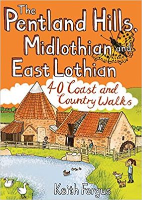
Wandelgids The Pentland Hills, Midlothian and East Lothian | Pocket Mountains

0
Handige compacte wandelgids met 40 dagwandelingen. Deze gids bevat kleine kaartjes en leuke uitgebreide informatie over wat er langs de route te zien is. Goede wandelkaarten zijn echter we noodzakelijk voor deze tochten: de Ordnance Survey explorer maps of Landanger maps zijn zeer geschikt.     Think of East Lothian and Midlothian and a low-lyin...

Verkopers met dit product

Verkoper
Bezorging
Prijs
DeZwerver.nl logo
DeZwerver.nl
niet bekend
10,95

Anderen bekeken ook

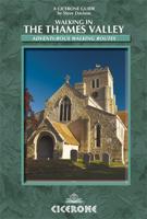
Wandelgids Walking in the Thames Valley | Cicerone
Walking in the Thames Valley offers 25 challenging circular walks around the River Thames and River Kennet in the south of England, taking in the Southern Chilterns, the Berkshire and North Hampshire Downs, Southern Oxfordshire and the eastern edge of Wiltshire. All routes are within easy reach of Reading, Newbury, Abingdon and London. While some walks visit Iron Age hill forts, others pass more modern features such as Wilton Windmill and the Kennet and Avon Canal. Some follow sections of the Ridgeway, while others meander along the banks of the Thames. What they all have in common is that they take the keen rambler to some of the best parts of the Thames Valley – a patchwork of open chalk grassland, broadleaved woodland and farmland and home to two Areas of Outstanding Natural Beauty. • walks from 10 to 18 miles, including one 2-day route • shorter, less strenuous alternatives for many of the walks • detailed route descriptions with information on local points of interest, OS mapping…
18,50
Wandelgids East Lothian | Hallewell Publications
Rewalked and updated in 2017, Walks East Lothian including Haddington, North Berwick & Dunbar covers the county of East Lothian, which lies to the east of Edinburgh. Walks include a number of coastal paths along the Firth of Forth and the North Sea, some paths through the county's fertile farmland plus some hill walks on the edge of the Lammermuir Hills. The 21 walks featured range from 0.5 miles to 11 miles (1-18km). Routes include: Dunbar Clifftop Trail, Traprain Law, Haddington Riverside and Gullane to North Berwick. Part of a regularly updated popular series of A6 pocket walking guides which describe routes which are suitable for walkers of all abilities and to suit all tastes. Route descriptions are accompanied by 2-colour sketch maps. The guides are illustrated with line illustrations, and will provide walkers with a good introduction to what each area covered has to offer.  
5,95
Wandelgids North Portugal - Noord Portugal | Sunflower books
Wandelgids: vele dagtochten worden degelijk beschreven met openbaar vervoer informatie, goede routebeschrijvingen en kaartmateriaal. Tevens enkele autotochten. (Engelstalig) 3 car tours, 30 long and short walks If you explore with us, we can set your feet wandering over the hills into breathtaking scenic beauty. History still lives here, too, written millennia ago in the permanence of granite. Our walks follow some of the delightful old trails, built from huge granite slabs, which lead high into the mountains. You can only marvel at the effort and energy invested in their building, and wonder about the people who once lived in these mountains. Many people in the Minho still live in isolated villages only recently connected to the modern road system, and some are still only accessible by foot; these villages are a delight to visit. It is like going back in time. The villagers vigorously pursue farming techniques developed four centuries ago and still largely unchanged. Long-horned oxen…
20,95
Wandelgids The Swiss Alps | Cicerone
  The Swiss Alps are home to the highest and most spectacular mountains in Western Europe. This stunning guidebook describes each mountain area throughout Switzerland – the peaks, passes, valleys and bases – to help you identify the best destinations to plan your trip.   Questions such as ‘Where to walk, climb or ski?’, ‘What multi-day treks are available’ and ‘Where do they go?’, ‘Where are the mountain huts, what are their facilities, which peaks do they serve?’ And where are the most suitable valley bases?’ – all these and more are addressed in detail in this essential guidebook.   The Swiss Alps does not give detailed route directions but information is given about all the guides and maps available for every region.   The Swiss Alps by Kev Reynolds is the third book in Cicerone’s World Mountain Ranges series, which include The Pyrenees and Scotland.   descriptions of all the Swiss Alps, area-by-area from the Chablais Alps in the south west to the Silvretta in the north east classi…
34,95
Wandelgids The Scottish Borders | Pocket Mountains
Handige compacte wandelgids met 40 dagwandelingen. Deze gids bevat kleine kaartjes en leuke uitgebreide informatie over wat er langs de route te zien is. Goede wandelkaarten zijn echter we noodzakelijk voor deze tochten: de Ordnance Survey explorer maps of Landanger maps zijn zeer geschikt.   The Scottish Borders cover a vast area, stretching from the east coast to rural Dumfriesshire and from the more populous Lothians to the border with England. Although there are no very high mountains, the Borders have always attracted walkers keen to explore the quiet moorlands, rolling hills, ancient woodland and rugged coast, as well as the romantic ruins of abbeys and castles, grand estates and rich literary heritage of the area.Ancient native tribes and Roman legions left their mark on this landscape, as did years of fierce warfare with our southern neighbours and raiding by ruthless Border Reivers. These 40 walks will introduce you to some of the fascinating history which shaped this most in…
10,95
Fietskaart 10 Cycling guides North York Moors | Goldeneye
Scheur- en watervast foetskaart van de North York Moors  met ingetekende fietsroutes.   Our maps are double-sided, printed on an A2 sheet with a concertina fold. This allows for easy folding and folding, and an ease of access to the mapping. The material is rain and tear-resistant. Our early maps were designed at the scale of 2 miles to 1 inch/1:126,720. The later designs along with digitalisation are 1: 100,000. We were encouraged by the Cycle Touring Club to convert our cartography toward the cycle market (to replace the out-of-print Bartholomew series). As time and the series progressed we have added more data: The National Cycle Network routes, Regional Routes, and Traffic-Free Family Routes, as and when they are developed. These routes are in addition to the Circular Routes Goldeneye Commissioned at the outset of our publishing schedule. We are also adding to new editions; bike shops, cycle hire, and tea rooms, along with the tourist attractions already featured. Our plan is to m…
14,95
Wandelgids The Tweed | Pocket Mountains
Handige compacte wandelgids met 40 dagwandelingen. Deze gids bevat kleine kaartjes en leuke uitgebreide informatie over wat er langs de route te zien is. Goede wandelkaarten zijn echter we noodzakelijk voor deze tochten: de Ordnance Survey explorer maps of Landanger maps zijn zeer geschikt.   One of the world’s great salmon rivers, the Tweed cuts through the heart of the Scottish Borders and, in part, forms the historic boundary between Scotland and England. Rising in the rolling hills near Moffat, it weaves through a cherished landscape on its way to Berwick-upon-Tweed and the North Sea, passing through the proud Border towns of Peebles, Galashiels, Melrose, Kelso and Coldstream on the way.   There is no better way to discover the wildlife, architecture and history of this area of Scotland than to walk. Whatever your ability – walking at high or low level, following tough terrain or level paths – the 25 routes in this guide offer something for everyone.   Plaatsen in het boekje Abbot…
10,95
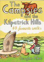
Wandelgids The Campsies and the Kilpatrick Hills | Pocket Mountains
Handige compacte wandelgids met 40 dagwandelingen. Deze gids bevat kleine kaartjes en leuke uitgebreide informatie over wat er langs de route te zien is. Goede wandelkaarten zijn echter we noodzakelijk voor deze tochten: de Ordnance Survey explorer maps of Landanger maps zijn zeer geschikt.   The Campsie Fells, along with the Kilpatrick, Kilsyth, Fintry and Gargunnock Hills, form a sprawling upland range which stretches eastwards from Dumbarton, passing to the north of the city of Glasgow and across the narrow waist of Scotland towards Stirling. It is often said that Glasgow is one of the easiest cities to get away from and the Campsies and theKilpatrick Hills, a few short miles north of the city, are the first port of call. This guide covers all of the major hills within both ranges, as well as low-level walks around and between the villages which lie on their perimeters.   Many of these 40 walks make use of both the West Highland Way and the John MuirWay which cut through the heart …
10,95
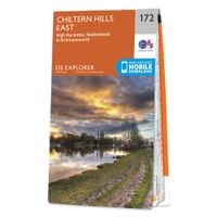
Wandelkaart - Topografische kaart 172 OS Explorer Map Chiltern Hills East | Ordnance Survey
Discover the east Chiltern Hills where they meet the Thames Valley, replete with lovely countryside, beautiful views and rich history. Delight in the unrivalled sailing reaches of Maidenhead; the Georgian architecture of High Wycome, the onetime furniture capital of England and the market town of Rickmansworth, set in beautiful country but a stone’s throw from London.    Bathe in natural beauty, from carpets of bluebells in the beech woods to red kites on the chalk grasslands and wildflower meadows where rare butterflies like the Adonis Blue flutter  Discover stately homes and historic houses including the gorgeous Italianate mansion of Clevedon, the charming Tudor manor Chenies and Milton’s Cottage where Paradise Lost was finished  Walk, cycle or hike a wide range of recreational paths including the Chiltern Way, South Bucks Way, Shakespeare’s Way and the Thames Path  Met zijn 4cm voor 1 km (2 ½ cm voor 1 mijl) schaal, is de OS Explorer kaartenserie de ideale en meest gedetailleer…
19,50
Wandelgids Thames Path | Trailblazer Guides
This book follows the Thames Path National Trail from the river's source in Gloucestershire to the Thames Barrier in London. Officially 184 miles (294km) in length (although the actual distance you walk will depend on a number of decisions you make en route), the path meanders, accompanied by its watery muse, through pristine and tranquil countryside, past historic sites and buildings, via pub, lock, weir, and the occasional scattering of waterfowl, to a city, once the fulcrum of an empire, and now the heart of modern day England. The river, responsible for the metropolis' very being, tells tales, inspires artists, accommodates swans, geese, and water voles, reflects the silhouettes of red kites and kingfishers, provides employment, entices adventure, and allows time for carefree pilgrims to procrastinate and think. Following its banks is a grand way to go for a ramble. The path begins, as the river does, in a meadow in the Cotswolds; its upper reaches lonely and wild, the meadows and…
19,95

Klanten-reviews van Wandelgids The Pentland Hills, Midlothian and East Lothian | Pocket Mountains

Er zijn nog geen beoordelingen voor dit productBen jij de eerste die een review plaatst?

Meer over Wandelgids The Pentland Hills, Midlothian and East Lothian | Pocket Mountains

Productomschrijving

Handige compacte wandelgids met 40 dagwandelingen. Deze gids bevat kleine kaartjes en leuke uitgebreide informatie over wat er langs de route te zien is. Goede wandelkaarten zijn echter we noodzakelijk voor deze tochten: de Ordnance Survey explorer maps of Landanger maps zijn zeer geschikt.     Think of East Lothian and Midlothian and a low-lying, predominantly rural landscape may well spring to mind, yet the Pentland Hills, just south of Edinburgh, rise to nearly 600m in height and provide some of the finest hillwalking in Scotland with wonderful views from the summits. To the east, the Lammermuir Hills may not have quite the same appeal as their near neighbours but they still offer superb hillwalking options, while North Berwick Law, Traprain Law and the Garleton Hills make up for what they lack in height with a succession of incredible panoramas. Away from the high ground there a lovely pockets of woodland, wildlife-rich country parks, fascinating historic sites and forty miles of coastline between Musselburgh and Dunbar with some of the best dune-backed beaches in the country to enjoy.  

Verken gerelateerde categorieën

Webshop.nl maakt gebruik van cookies. Ga je verder op onze website, ga dan akkoord met het plaatsen van cookies en de verwerking van deze data door ons en vermelde partners.