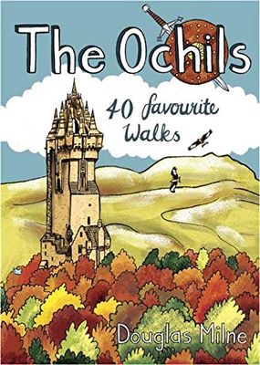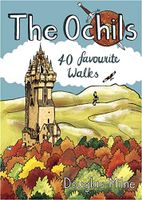
Wandelgids The Ochils | Pocket Mountains

0
Handige compacte wandelgids met 40 dagwandelingen. Deze gids bevat kleine kaartjes en leuke uitgebreide informatie over wat er langs de route te zien is. Goede wandelkaarten zijn echter we noodzakelijk voor deze tochten: de Ordnance Survey explorer maps of Landanger maps zijn zeer geschikt.   40 easy short walks with a very cute cartoonish style K...

Verkopers met dit product

Webshop
Bezorging
Prijs
DeZwerver.nl logo
DeZwerver.nl
niet bekend
10,95

Anderen bekeken ook

Wandelgids The Campsies and the Kilpatrick Hills | Pocket Mountains
Handige compacte wandelgids met 40 dagwandelingen. Deze gids bevat kleine kaartjes en leuke uitgebreide informatie over wat er langs de route te zien is. Goede wandelkaarten zijn echter we noodzakelijk voor deze tochten: de Ordnance Survey explorer maps of Landanger maps zijn zeer geschikt.   The Campsie Fells, along with the Kilpatrick, Kilsyth, Fintry and Gargunnock Hills, form a sprawling upland range which stretches eastwards from Dumbarton, passing to the north of the city of Glasgow and across the narrow waist of Scotland towards Stirling. It is often said that Glasgow is one of the easiest cities to get away from and the Campsies and theKilpatrick Hills, a few short miles north of the city, are the first port of call. This guide covers all of the major hills within both ranges, as well as low-level walks around and between the villages which lie on their perimeters.   Many of these 40 walks make use of both the West Highland Way and the John MuirWay which cut through the heart …
10,95
Wandelgids Shetland | Pocket Mountains
Handige compacte wandelgids met 40 dagwandelingen. Deze gids bevat kleine kaartjes en leuke uitgebreide informatie over wat er langs de route te zien is. Goede wandelkaarten zijn echter we noodzakelijk voor deze tochten: de Ordnance Survey explorer maps of Landanger maps zijn zeer geschikt. The most northerly of Britain's island groups, Shetland is so far removed from the rest of the UK that it usually appears as an inset on maps. Although relatively little known to those from outside the islands, Shetland is a magnificent terrain for walkers, especially those who love to really explore and get away from the beaten track. The coastal walking here includes some of the finest in the country, with superb cliffs, towering sea stacks, caves and natural arches seemingly around every corner. Added to this is Shetland's better known claim to fame for its spectacular seabird colonies, huge gannetries, moorland packed with arctic and great skuas, arctic terns in the more sheltered spots, and ev…
10,95
Wandelgids Oban and North Argyll | Pocket Mountains
This guidebook covers a large swathe of Mid and North Argyll, sweeping inland from the fractured western seaboard between Crinan and Appin to Arrochar and Bridge of Orchy on the region’s eastern periphery. Between these four points lies a landscape awash with sea lochs, with Inveraray roughly at the geographical centre. There are no large urban areas here and Oban is the largest settlement. Although the road network and public transport infrastructure are good, many routes feel off the beaten track. This is not only down to the low scattered population but also to the indented coast and its many islands, the sea lochs encroaching deep inland, the elongated freshwater lochs and the mountainous interior – making road travel much more convoluted than direct ‘as-the-crow-flies’ distances would suggest. As well as many great sea lochs, tumbling rivers and iconic mountains, Oban and North Argyll also boasts ancient, wildlife-rich woodlands and several fine gardens. Add to this the Crinan Ca…
10,95
Wandelgids Wester Ross and Lochalsh | Pocket Mountains
Handige compacte wandelgids met 40 dagwandelingen. Deze gids bevat kleine kaartjes en leuke uitgebreide informatie over wat er langs de route te zien is. Goede wandelkaarten zijn echter we noodzakelijk voor deze tochten: de Ordnance Survey explorer maps of Landanger maps zijn zeer geschikt.     Wester Ross and Lochalsh are amongst the most popular areas for walks in the Scottish Highlands. The Lochalsh peninsula between the shores of Loch Duich and Loch Carron offers varied walking from villages such as Plockton as well as the region's main town at Kyle of Lochalsh. Across the dramatic Mam Ratagan pass is the remote and secluded Glenelg peninsula, a tranquil and peaceful haven far from busy routes.   Further north are Applecross and Lochcarron, with mountains that yield nothing in ruggedness to their more famous counterparts in Torridon, as well as attractive fishing villages and forest walks. Finally around Gairloch is an area that has long been famous for its fine sandy beaches, m…
10,95
Wandelgids Outer Hebrides | Pocket Mountains
Handige compacte wandelgids met 40 dagwandelingen. Deze gids bevat kleine kaartjes en leuke uitgebreide informatie over wat er langs de route te zien is. Goede wandelkaarten zijn echter we noodzakelijk voor deze tochten: de Ordnance Survey explorer maps of Landanger maps zijn zeer geschikt. The Outer Hebrides are a place apart, an island chain stretching almost 200km from the Butt of Lewis to Barra Head with some of Britain's most mesmerising beaches, dramatic mountain ranges, wonderful wildlife, a long and fascinating history and a rich and vibrant Gaelic culture. This book features 40 mostly moderate walks, with many ideal for families, which take in magnificent sweeps of sand, soaring sea cliffs and memorable hill ascents, as well as celebrated cultural sights such as the haunting Standing Stones at Callanish and the blackhouse village of Na Gearrannan.
10,95
Wandelgids The Scottish Borders | Pocket Mountains
Handige compacte wandelgids met 40 dagwandelingen. Deze gids bevat kleine kaartjes en leuke uitgebreide informatie over wat er langs de route te zien is. Goede wandelkaarten zijn echter we noodzakelijk voor deze tochten: de Ordnance Survey explorer maps of Landanger maps zijn zeer geschikt.   The Scottish Borders cover a vast area, stretching from the east coast to rural Dumfriesshire and from the more populous Lothians to the border with England. Although there are no very high mountains, the Borders have always attracted walkers keen to explore the quiet moorlands, rolling hills, ancient woodland and rugged coast, as well as the romantic ruins of abbeys and castles, grand estates and rich literary heritage of the area.Ancient native tribes and Roman legions left their mark on this landscape, as did years of fierce warfare with our southern neighbours and raiding by ruthless Border Reivers. These 40 walks will introduce you to some of the fascinating history which shaped this most in…
10,95
Wandelgids The Pentland Hills, Midlothian and East Lothian | Pocket Mountains
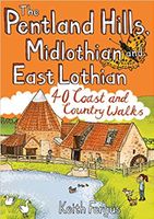
Handige compacte wandelgids met 40 dagwandelingen. Deze gids bevat kleine kaartjes en leuke uitgebreide informatie over wat er langs de route te zien is. Goede wandelkaarten zijn echter we noodzakelijk voor deze tochten: de Ordnance Survey explorer maps of Landanger maps zijn zeer geschikt.     Think of East Lothian and Midlothian and a low-lying, predominantly rural landscape may well spring to mind, yet the Pentland Hills, just south of Edinburgh, rise to nearly 600m in height and provide some of the finest hillwalking in Scotland with wonderful views from the summits. To the east, the Lammermuir Hills may not have quite the same appeal as their near neighbours but they still offer superb hillwalking options, while North Berwick Law, Traprain Law and the Garleton Hills make up for what they lack in height with a succession of incredible panoramas. Away from the high ground there a lovely pockets of woodland, wildlife-rich country parks, fascinating historic sites and forty miles o…
10,95
Wandelgids Cornwall | Pocket Mountains
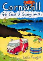
Handige compacte wandelgids met 40 dagwandelingen. Deze gids bevat kleine kaartjes en leuke uitgebreide informatie over wat er langs de route te zien is. Goede wandelkaarten zijn echter we noodzakelijk voor deze tochten: de Ordnance Survey explorer maps of Landanger maps zijn zeer geschikt.   With over 400 miles of mainland coastline and an excellent public path network, Cornwall is all about rugged shorelines, gorgeous sandy beaches, turquoise waters, meandering rivers and wide open countryside. Add to the mix a fantastic diversity of flora and fauna, interesting geology, fascinating history and some of the most striking views in the country and you have one of England's best regions to explore on foot. In these 40 walks, all between two and eight miles in length, Keith Fergus leads you through some of the best rambles Cornwall has to offer. Plaatsen in het boek Bedruthan Steps, Bessie’s Cove, Bude, Cambeak, Camel Estuary, Cape Cornwall, Carbis Bay, Cawsand, Charlestown, Crackington …
10,95
Wandelgids Walk! Costa del Sol: Axarquia | Discovery Walking Guides
Goede wandelgids van een uitermate geschikt wandelgebied aan de Costa del Sol: het binnenland boven Nerja rond Competa en andere bergdorpen. De beschrijvingen zijn prima, zo ook de praktische informatie en de kaarten. We celebrate a Costa del Sol that does not correspond to the cliches, a Costa del Sol that is all right rather than all wrong, a playground of green valleys and gilded mountain tops, a hidden idyll unknown to most visitors, a haven for dedicated walkers and adventurous tourists alike, a place in which every nook is graced with some gratifying discovery and every outing is a great adventure. The majority of walks are aimed at the adventurous leisure walker, people who will on the whole have some experience of hiking in mountains, are happy to invest a certain amount of effort for a corresponding reward. Covering the best preserved stretch of coastline, the prettiest villages, and most spectacular mountains, Walk! Costa del Sol explores the Axarquia region east of Malaga, …
18,50
Wandelgids Caithness and Sutherland | Pocket Mountains
Handige compacte wandelgids met 40 dagwandelingen. Deze gids bevat kleine kaartjes en leuke uitgebreide informatie over wat er langs de route te zien is. Goede wandelkaarten zijn echter we noodzakelijk voor deze tochten: de Ordnance Survey explorer maps of Landanger maps zijn zeer geschikt. The county of Ayrshire is located on the Firth of Clyde on the beautiful West Coast of Scotland and is known as one of the most fertile areas of the country, famed for its cattle and crops. Although more industrial to the north, it is in the main a landscape made for walking with an abundance of open countryside and rugged little hills, golden sandy beaches and beautiful sunsets. This guide features 40 mostly moderate walks full of interest which explore all aspects of the region, from craggy cliffs and caves to historic castles, ancient forests to sandy shorelines. Sutherland and Caithness are the most northerly parts of mainland Britain. Northwest Sutherland is a landscape of sandy beaches and …
10,95

Klanten-reviews van Wandelgids The Ochils | Pocket Mountains

Er zijn nog geen beoordelingen voor dit productBen jij de eerste die een review plaatst?

Meer over Wandelgids The Ochils | Pocket Mountains

Productomschrijving

Handige compacte wandelgids met 40 dagwandelingen. Deze gids bevat kleine kaartjes en leuke uitgebreide informatie over wat er langs de route te zien is. Goede wandelkaarten zijn echter we noodzakelijk voor deze tochten: de Ordnance Survey explorer maps of Landanger maps zijn zeer geschikt.  

40 easy short walks with a very cute cartoonish style

Known to the ancient people of Central Scotland as uchel – ‘the high place’ – the long upland massif of the Ochils rises between the River Forth and the Southern Highlands, with a dramatic escarpment running between the cities of Stirling and Perth. The high rounded hills are cleaved by steep-sided ravines and dotted with castles, standing stones, burial mounds, hillforts and battlesites, making the Ochils a walker’s paradise. This collection of 40 routes covers all the main summits, as well as the magnificent glens and the two rivers, the Allan and the Devon, which transect them.


Verken gerelateerde categorieën

Webshop.nl maakt gebruik van cookies. Ga je verder op onze website, ga dan akkoord met het plaatsen van cookies en de verwerking van deze data door ons en vermelde partners.