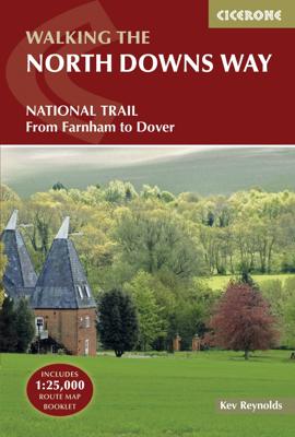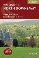
Wandelgids The North Downs Way | Cicerone

0
Uitstekende wandelgids van de North Downs Way, waarbij naast alle noodzakelijke informatie ook gebruik gemaakt wordt van de echte topografische kaart. inclusief gidsje met routekaarten van 1:25000 A guidebook to walking the North Downs Way National Trail, a 130 mile (208km) walk between the high downland of Farnham and the historic city of Dover o...

Verkopers met dit product

Verkoper
Bezorging
Prijs
DeZwerver.nl logo
DeZwerver.nl
2,95
23,95

Anderen bekeken ook

Nieuw
Wandelgids Walking the North Downs Way Map Booklet | Cicerone
All the mapping you need to walk the 130 mile (208km) North Downs Way National Trail between Farnham and Dover. One of the easier National Trails, it can be comfortably walked in 11-12 days and includes an optional detour via Canterbury.   This map booklet contains all the OS 1:25,000 Explorer mapping you need to walk the route, saving the space, weight and expense of multiple map sheets. Conveniently sized to slip in a jacket pocket or rucksack top, it comes in a clear PVC sleeve.   NOTE An accompanying Cicerone guidebook - The North Downs Way - describes the full route from West to East with lots of other practical and historical information. The accompanying guidebook INCLUDES a copy of this map booklet.
13,95
Wandelgids North Downs Way national trail | Aurum Press
Goede engelstalige wandelgids van deze LAW in zuid oost Engeland, net onder Londen. Goede beschrijving en prima kaarten van Ordnance Survey, enigzins beperkte praktische tips, maar die zijn op de website van de route eenvoudig te vinden. This is the complete official guide to walking the well-loved and popular North Downs. Whether you're an experienced long distance walker or a weekend stroller, this is the only companion you need to this beautiful and scenic route. The North Downs Way is the National Trail that follows the official acorn waymarks from Farnham to the coast at Dover.   This picturesque trail takes in chalk ridges, river valleys and sections of the Pilgrims' Way. At the eastern end you can either walk via Canterbury (a total distance of 130 miles, 208 km) or follow the southern route (123 miles, 197 km). With Ordnance Survey mapping for the entire route, this is a superb guide to the North Downs Way National Trail which can be enjoyed by all.    
22,50
Wandelkaart North Downs Way | Harvey Maps
Mooie, duidelijke kaart van de North Downs Way in Engeland. Geplastificeerd met veel extra informatie en uitsnedes van de route.    XT40 - Leap forward in technical excellence. Tough, light and 100% waterproof   Compact and light - the map itself weighs just 60gms - a third of the weight of a laminated map, and much less bulky. And you can fold or refold it time and again, or stuff it in your back pocket and it won't fall to pieces.   Revised edition and format Shows the entire route on one XT40 map sheet.   The Way is 246km (156 miles). This map covers the whole route from Farnham in the west to Dover on the south east coast.   Information on finding accommodation, camping, food. Directions to the start and end points. Shows facilities available and includes tips on weather and clothing.     Detailed mapping, full legend. National Grid - can be used with GPS. 1:40,000 scale. Waterproof. Supplied in clear plastic pocket.
25,50
Nieuw
Wandelgids South Downs Way | Cicerone
Uitstekende wandelgids van dit geweldige gebied. goed beschreven met veel praktische informatie om de route te kunnen lopen, inclusief een apart boekje met zeer gedetaileerde kaarten. The South Downs Way National Trail is a 100 mile (160km) walk between Eastbourne and Winchester, staying within the glorious South Downs National Park for its entire length. Presented here in 12 stages of up to 12 miles (19km), the route is described in both east-west and west-east. A waymarked trail with very few stiles, it can be walked at any time of year and makes a good introduction to long-distance walking. Step-by-step route descriptions are illustrated with extracts from OS 1:50,000 mapping for every stage, and a separate, conveniently sized booklet with 1:25,000 maps for the entire route is included. The guide provides detailed practical information on getting to the trail, and facilities and accommodation en route. The South Downs Way offers easy walking on ancient and historical tracks, and sh…
24,95
Nieuw
Wandelgids - Pelgrimsroute The Pilgrims' Way | Cicerone
Uitstekende wandelgids van de Pilgrims' Way, waarbij naast alle noodzakelijke informatie ook gebruik gemaakt wordt van de echte topografische kaart.  This guidebook details the Pilgrims' Way, an historic pilgrimage route to Canterbury Cathedral in Kent, home of the shrine of the martyred archbishop, St Thomas Becket. The route is described both from Winchester in Hampshire (136½ miles) and London's Southwark Cathedral (90¼ miles), with an optional spur to Rochester Cathedral.   With relatively easy walking on ancient byways, the route from Winchester is presented in 15 stages of 4¾-13½ miles: it can be comfortably completed in under a fortnight. It follows a major chalk ridge through scenic countryside, taking in characterful towns and villages and historic churches. The route from Southwark is described in 10 stages and includes a visit to the ruined Lesnes Abbey.   Detailed route description is accompanied by 1:50,000 OS mapping, advice on making the most of a trip and information o…
18,50
Nieuw
Wandelgids The Ridgeway | Cicerone
Uitstekende wandelgids van de Ridgeway, waarbij naast alle noodzakelijke informatie ook gebruik gemaakt wordt van de echte topografische kaart. Inclusief gidsje met routekaarten van 1:25000   This guidebook - which includes both a guide to the route and a separate OS map booklet - describes the Ridgeway National Trail, an 87 mile (139km) route through southern England from Avebury in Wiltshire to Ivinghoe Beacon in Buckinghamshire. Typically walked in 6 or 8 days, this is a low-level waymarked route suitable for all abilities and for year round walking.   The guidebook details the trail in both directions, west to east and east to west. Step-by-step route descriptions are accompanied by 1:100,000 OS mapping and a separate OS 1:25,000 map booklet showing the entire route is included. Packed with details on points of interest and a trek planner giving at-a-glance information about facilities, public transport and accommodation available along the way, this book is an indispensable guide…
23,95
Nieuw
Wandelgids Walking on the North Wessex Downs | Cicerone
Guidebook to 30 circular walks in the North Wessex Downs Area of Outstanding Natural Beauty (AONB). The routes, which range from 7 to 21km (4 to 13 miles), take in parts of four counties - Berkshire, Hampshire, Wiltshire and Oxfordshire.   The North Wessex Downs are accessible hills rising above the towns and rural plains of southern England and rolling gently west from Reading and Basingstoke to Swindon and down past Marlborough to Andover. The walks allow you to explore parts of the Ridgeway National Trail, the Kennet and Avon Canal and stunning historic sites such as Avebury, the 3000-year-old Uffington White Horse, impressive Neolithic long barrows and Iron Age hill forts.   Alongside clear route descriptions and OS maps are plenty of details about points of interest, as well as practical information on the area, from public transport links to ideal refreshment stops on each walk. The result is an ideal companion to exploring both the popular and untouched corners of the North Wes…
19,95
Nieuw
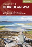
Wandelgids The Hebridean Way | Cicerone
Uitstekende wandelgids van de Hebridean Way, waarbij naast alle noodzakelijke informatie ook gebruik gemaakt wordt van de echte topografische kaart. Officially launched in 2017, the Hebridean Way offers walkers the opportunity to experience the magic of Scotland's Outer Hebrides in one inspirational journey. The waymarked route stretches 247km (155 miles) from Vatersay to Stornaway, linking ten major islands of the archipelago by means of causeways and two ferry crossings: Vatersay, Barra, Eriskay, South Uist, Benbecula, Grimsay, North Uist, Berneray, Harris and Lewis. Suitable for most walkers with a moderate level of fitness, it can be completed in 8-14 days and is rich in natural, historical and cultural interest.   This guidebook presents the Hebridean Way in 10 stages of 16-35km (10-22 miles), plus two additional stages to extend the route to the Butt of Lewis in line with future plans. Detailed route description is accompanied by 1:50,000 OS mapping, stunning photography to w…
20,95
Nieuw
Wandelgids Walking in the Thames Valley | Cicerone
Walking in the Thames Valley offers 25 challenging circular walks around the River Thames and River Kennet in the south of England, taking in the Southern Chilterns, the Berkshire and North Hampshire Downs, Southern Oxfordshire and the eastern edge of Wiltshire. All routes are within easy reach of Reading, Newbury, Abingdon and London. While some walks visit Iron Age hill forts, others pass more modern features such as Wilton Windmill and the Kennet and Avon Canal. Some follow sections of the Ridgeway, while others meander along the banks of the Thames. What they all have in common is that they take the keen rambler to some of the best parts of the Thames Valley – a patchwork of open chalk grassland, broadleaved woodland and farmland and home to two Areas of Outstanding Natural Beauty. • walks from 10 to 18 miles, including one 2-day route • shorter, less strenuous alternatives for many of the walks • detailed route descriptions with information on local points of interest, OS mapping…
18,50
Nieuw
Wandelgids The Cleveland way and the Yorkshire Wolds way | Cicerone
Uitstekende wandelgids van de Cotswolds Way, waarbij naast alle noodzakelijke informatie ook gebruik gemaakt wordt van de echte topografische kaart. Inclusief gidsje met routekaarten van 1:25000 Guidebook to the Cleveland Way and Yorkshire Wolds Way National Trails, plus the Tabular Hills Walk link route. The guidebook also contains a 1:25,000 scale OS route map booklet of the Cleveland Way.   The Cleveland Way National Trail, described in seven day stages, is a fine 177km (110 miles) walk around the North York Moors National Park from Helmsley to Filey. The Yorkshire Wolds Way is one of the quietest of Britain's National Trails and wanders for 130km (80 miles) through gentle, cultivated and sparsely populated countryside. Described here in nine day stages, from Hessle near Redcar to Filey, it links end-to-end with the Cleveland Way on the coast. Also described is the three-day, 80km (50 mile) Tabular Hills Walk, a Regional Trail that allows walkers to close the loop of the Cleveland …
25,95

Klanten-reviews van Wandelgids The North Downs Way | Cicerone

Er zijn nog geen beoordelingen voor dit productBen jij de eerste die een review plaatst?

Meer over Wandelgids The North Downs Way | Cicerone

Productomschrijving

Uitstekende wandelgids van de North Downs Way, waarbij naast alle noodzakelijke informatie ook gebruik gemaakt wordt van de echte topografische kaart. inclusief gidsje met routekaarten van 1:25000

A guidebook to walking the North Downs Way National Trail, a 130 mile (208km) walk between the high downland of Farnham and the historic city of Dover on the Kent coast, with an optional visit to Canterbury. The route is described in 11 stages, and is fully illustrated with colour photographs and OS map extracts. The North Downs Way is one of the easier national trails with a modest number of steep (but short) ascents and descents and long sections with no noticeable height gain or loss. Several historic sites including Neolithic burial chambers, Roman roads and Norman churches are passed and much of the route follows The Pilgrims' Way. The area also boasts many literary connections with some of the most celebrated voices in English literature. A separate pocket-sized map booklet is included and shows the full route on 1:25,000 scale OS maps.   Activities Walking, long distance hiking Seasons The North Downs Way can be walked at any time of the year, but is seen at its best between April and October Centres Beginning in Farnham, the North Downs Way passes close-to or through Guildford, Otford, Wrotham, Detling, Charing, Wye, Chilham, Canterbury, Patrixbourne and ends in Dover Difficulty Despite some reasonably short steep ascents and descents, the North Downs Way is one of the more gentle of National Trails and is suitable for first-time long distance walkers. Must See Passing through the Surrey and Kent Downs Areas of Outstanding Natural Beauty, the North Downs Way crosses Box Hill, visits Neolithic sites like the Coldrum Stones and Kits Coty House; passes below the remains of Thurnham Castle, visits Canterbury Cathedral, Dover Castle, and across Shakespeare Cliff, one of the White Cliffs of Dover.

Verken gerelateerde categorieën

Webshop.nl maakt gebruik van cookies. Ga je verder op onze website, ga dan akkoord met het plaatsen van cookies en de verwerking van deze data door ons en vermelde partners.