webshop.nl
Categorieën
  Sluiten

Meer Cicerone

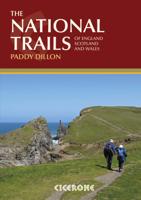
Wandelgids the National Trails - Great British Walks - Engeland, Wales

0
Guidebook to Britain's National Trails - 19 long-distance walking routes through England, Wales and Scotland, describing what makes each of them so special and providing the practical information to help you plan your route. A definitive reference to the best of British walking. England South West Coast Path South Downs Way North Downs Way The Ridg...

Webshops met dit product

Webshop
Bezorging
Prijs

Anderen bekeken ook

Wandelgids the National Trails - Great British Walks - Engeland, Wales
Guidebook to Britain's National Trails - 19 long-distance walking routes through England, Wales and Scotland, describing what makes each of them so special and providing the practical information to help you plan your route. A definitive reference to the best of British walking. England South West Coast Path South Downs Way North Downs Way The Ridgeway Thames Path Cotswold Way Peddars Way & Norfolk Coast Path Cleveland Way Pennine Bridleway Hadrian's Wall Path Wales Pembrokeshire Coast Path Offa's Dyke Path Glyndwyrs Way Scotland Southern Upland Way Speyside Way West Highland Way Great Glen Way In 1965 as the first National Trail in the country was opened – ‘a Pennine Way from the Peak to the Cheviots’. Together, the National Trails cover well over 5000 kilometres (3100 miles), exploring the rich, scenic, historic countryside of Britain. Some trails are short and easy, while others are long and challenging. Some have a strong theme, following rugged coastlines or meandering rivers. Oth…
29,50
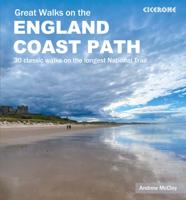
Wandelgids Great Walks on the England Coast Path | Cicerone
Guidebook to 30 routes celebrating the best day and weekend walks on the England Coast Path, a new National Trail. Includes a varied selection of walks along the country's diverse shoreline, on cliff paths, estuaries, beaches and saltmarsh. Routes from 9 to 45km to suit all ages and abilities, many of which can be enjoyed all year round. At around 4500km (2800 miles), the England Coast Path is the longest coastal trail in the world. This inspirational large-format guide presents a handpicked selection of 30 highlight sections, offering a taste of England's stunning and diverse shoreline. Routes range from 9 to 45km, spanning between 3 hours and 2 days, offering options to suit all abilities. They can be accessed by public transport and are walkable year round (weather permitting!). Route descriptions are accompanied by 1:50,000 OS map extracts. Included in each walk are comprehensive listings of public transport, toilets and places to eat and drink, which highlight the excellent walkin…
27,95
Fietskaart Cycling guides Dartmoor - South Devon | Goldeneye
Dartmoor. One of England’s greater National Parks; the Forest of Dartmoor covers 365 square miles and contains the highest ground in England south of the Peak District. On its desolate moorland tracks the wanderer can believe they are further from a public road than anywhere in the country, but on the fringes lush valleys lead down on every side to thick woodland, green vegetation and picturesque villages. Dartmoor is well known for its wildlife - attractive herds of ponies, seemingly wild but in fact individually owned, foxes, badgers and otters - also the occasional adder. Fallow, roe and Sitka deer can often be seen, but the red deer of Exmoor have never penetrated the area. Buzzards, kestrels and various Birds of Prey are frequently seen, as well as the wheatear, while crows, ravens and the skylark are fairly commonplace. The Moor abounds in prehistoric remains. There are also many deserted medieval villages with remains of the traditional ‘longhouse’ buildings. For centuries tin m…
12,95
Wandelgids Big Trails Great Britain & Ireland Volume 2 | Vertebrate Pu
Big Trails: Great Britain and Ireland Volume 2 is the second volume of this inspirational guide to the most iconic long-distance trails in England, Scotland, Wales, Ireland and the Channel Islands.   The twenty-five routes featured in this book comprise more of the best trails in Great Britain and Ireland. From some of Wales’ best views on the Pembrokeshire Coast Path and the magnificent moorlands of the Two Moors Way (Devon Coast to Coast) in South-West England, to Scotland’s wild moors on the Southern Upland Way and over high cliffs on Ireland’s Burren Way. In the shadows of Lakeland peaks on the Cumbria Way and around five islands on the Channel Island Way, the book incorporates the highlights of Great Britain and Ireland, from its centre to its outermost edges.   Big Trails books are designed to inspire big adventures. Rather than being carried along the route, this guide provides everything you need to plan and explore further, including a general overview of the trails, specific …
16,50
Wandelkaart Adventure Atlas Hadrian's Wall Path | A-Z Map Company
AZ heeft de meest gedetailleerde wandelkaarten van het Hadrian's Wall Path gebundeld in een atlasje. Daardoor is het heel handig qua formaat. De kaarten zelf zijn perfect voor het wandelen. Schaal 1:25.000 The A-Z Adventure Series of maps combines the best of OS and A-Z, creating the perfect companion for walkers, off-road cyclists, horse riders and anyone wishing to explore the great outdoors. Hadrian's Wall Path is a National Trail which follows the line of Hadrian's Wall from coast-to-coast. The 84 mile (135km) path weaves through beautiful countryside, encountering historic remains of Roman forts and milecastles, splendid bridges, views from the Whin Sill escarpment and Solway salt marshes. Starting in Wallsend in Newcastle and ending in Bowness-on-Solway, the route on the map is clearly highlighted in yellow with mileage markers added to guage distances when planning sections of the walk to enjoy. This official National Trail Map of Hadrian's Wall Path features 38 pages of continu…
12,95
Wandelgids 100 outstanding British Walks | Ordnance Survey
Beschrijving van de 100 mooiste Pathfinder wandelingen in Engeland, Wales en Schotland. Uitstekende beschrijving van de route met een zeer duidelijke topografische kaart waarop de route is ingetekend.  This magnificent compendium of outstanding British walks brings together the finest selection of Pathfinder Walks in Britain s officially designated places of scenic beauty and historic interest: National Parks, Areas of Outstanding Natural Beauty, National Scenic Areas, Heritage Coast, National Trails and UNESCO World Heritage Sites. There are 100 walking gems in this collection, recommended by a group of experienced authors and guides. The walks span a range of distances and degrees of challenge and are organised by region with coverage across England, Wales and Scotland. 100 Outstanding British Walks is lavishly illustrated with stunning landscape photography and informative introductions to each of the walks. It is designed to be enjoyed at home, while the OS Maps app provides the pr…
27,95
Fietskaart Cycling guides Exmoor - North Devon | Goldeneye
Scheur- en watervast foetskaart van Exmoor en Noord Devon met ingetekende fietsroutes.   Our maps are double-sided, printed on an A2 sheet with a concertina fold. This allows for easy folding and folding, and an ease of access to the mapping. The material is rain and tear-resistant. Our early maps were designed at the scale of 2 miles to 1 inch/1:126,720. The later designs along with digitalisation are 1: 100,000. We were encouraged by the Cycle Touring Club to convert our cartography toward the cycle market (to replace the out-of-print Bartholomew series). As time and the series progressed we have added more data: The National Cycle Network routes, Regional Routes, and Traffic-Free Family Routes, as and when they are developed. These routes are in addition to the Circular Routes Goldeneye Commissioned at the outset of our publishing schedule. We are also adding to new editions; bike shops, cycle hire, and tea rooms, along with the tourist attractions already featured. Our plan is to m…
12,95

Klanten-reviews van Wandelgids the National Trails - Great British Walks - Engeland, Wales

Er zijn nog geen beoordelingen voor dit productBen jij de eerste die een review plaatst?

Meer over Wandelgids the National Trails - Great British Walks - Engeland, Wales

Productomschrijving

Guidebook to Britain's National Trails - 19 long-distance walking routes through England, Wales and Scotland, describing what makes each of them so special and providing the practical information to help you plan your route. A definitive reference to the best of British walking. England South West Coast Path South Downs Way North Downs Way The Ridgeway Thames Path Cotswold Way Peddars Way & Norfolk Coast Path Cleveland Way Pennine Bridleway Hadrian's Wall Path Wales Pembrokeshire Coast Path Offa's Dyke Path Glyndwyrs Way Scotland Southern Upland Way Speyside Way West Highland Way Great Glen Way In 1965 as the first National Trail in the country was opened – ‘a Pennine Way from the Peak to the Cheviots’. Together, the National Trails cover well over 5000 kilometres (3100 miles), exploring the rich, scenic, historic countryside of Britain. Some trails are short and easy, while others are long and challenging. Some have a strong theme, following rugged coastlines or meandering rivers. Others use ancient cross-country routes or follow the courses of ancient boundaries. Packed with information, this guide will help you get out and walk the finest long-distance routes in the country. Outline schedules for each Trail allow you compare the routes and organise your own walking itinerary. Basic day-by-day route descriptions for each Trail are illustrated with maps and profiles. For each Trail information is provided on access to and from the route, maps, public transport, guidebooks, TICs, accommodation and useful websites.

Productspecificaties

Artikelnummer(s)
Brand
Cicerone
Webshop.nl maakt gebruik van cookies. Ga je verder op onze website, ga dan akkoord met het plaatsen van cookies en de verwerking van deze data door ons en vermelde partners.