Wandelgids the National Trails - Great British Walks - Engeland, Wales en Schotland | Cicerone

0
Guidebook to Britain's National Trails - 19 long-distance walking routes through England, Wales and Scotland, describing what makes each of them so special and providing the practical information to help you plan your route. A definitive reference to the best of British walking. England South West Coast Path South Downs Way North Downs Way The Rid...

Verkopers met dit product

Verkoper
Bezorging
Prijs
DeZwerver.nl logo
DeZwerver.nl
2,95
29,50

Anderen bekeken ook

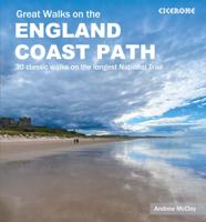
Wandelgids Great Walks on the England Coast Path | Cicerone
Guidebook to 30 routes celebrating the best day and weekend walks on the England Coast Path, a new National Trail. Includes a varied selection of walks along the country's diverse shoreline, on cliff paths, estuaries, beaches and saltmarsh. Routes from 9 to 45km to suit all ages and abilities, many of which can be enjoyed all year round. At around 4500km (2800 miles), the England Coast Path is the longest coastal trail in the world. This inspirational large-format guide presents a handpicked selection of 30 highlight sections, offering a taste of England's stunning and diverse shoreline. Routes range from 9 to 45km, spanning between 3 hours and 2 days, offering options to suit all abilities. They can be accessed by public transport and are walkable year round (weather permitting!). Route descriptions are accompanied by 1:50,000 OS map extracts. Included in each walk are comprehensive listings of public transport, toilets and places to eat and drink, which highlight the excellent walki…
27,95
Wandelgids The National Trails | Conway
Exploring each of our 17 unique and varied National Trails, this beautiful and inspiring guidebook highlights over 1,000 adventures to enjoy along the way. Our National Trails encapsulate and embody the character of England and Wales, ensuring that people from all different backgrounds can enjoy our nation's most precious asset: 24/7 access to the wild outdoors. Following on from Stephen Neale's successful guides to the England Coast Path and the South West Coast Path, the publication of this book coincides with the opening of the Coast to Coast Path National Trail in 2025 (a 197-mile route from St Bees in Cumbria to Robin Hoods Bay in the North York Moors). This guide is the first to feature all 17 of the National Trails, from the Cleveland Way to Hadrian's Wall Path and the Thames Path, from the South West Coast Path to the Pennine Way and the Cotswold Way, and promotes a more accessible and modern take on the traditional 'turn left at the stile' walking guide. Read on for the st…
27,95
Wandelgids The South West Coast Path | Cicerone
Goede wandelgids van het langste gemarkeerde wandelpad van Groot Brittanië; 1015 km! Uit de bekende Cicerone serie, dus met mooie foto's en duidelijke routebeschrijvingen en kaartjes. The South West Coast Path is Britain's longest way-marked trail, measuring a staggering 1015km (630 miles). Written by the well-known outdoor writer, Paddy Dillon, the guide provides a wealth of detailed knowledge to help tackle this immense route with confidence. It describes the way-marked trail from Minehead to Poole along the north Devon, Cornish and south Devon coastline to finish at Poole Harbour. A full introduction provides the route's historical background, advice on accommodation along the route and details on travelling to and around the South West.There is detailed information on how to use this guide to make the most of your walk, whether you choose to walk the whole route in one go or decide to achieve sections at intervals.Day-by-day route summaries accompany the 45-day stages and the fina…
24,95
Wandelgids Wales: The Ceredigion and Snowdonia Coast Paths | Cicerone
As part of the Wales Coast Path, the Ceredigion Coast Path and Snowdonia Coast Path trace a curve of 233km (145 miles) of coastal and inland walking down Cardigan Bay. This guidebook describes a 16-stage guide to the walk from Porthmadog to St Dogmaels covering the trail between the Llyn Peninsula and the Pembrokeshire Coast Path. .In 16 day stages from Porthmadog to St Dogmaels, this guidebook offers all the information walkers need to complete the 233km (145 miles) section of the Wales Coast Path that curve down Cardigan Bay, passing through a range of contrasting landscapes.   Six days are spent on the Snowdonia Coast Path, two around the Dyfi Estuary, seven on the Ceredigion Coast Path and one from Cardigan to St Dogmaels.   Linking the Llyn Peninsula Coast Path with that of the Pembrokeshire Coastal Path, this section takes in Snowdonia National Park’s splendid coastal plains, leads inland through beautiful hill country around the Dyfi Estuary and follows some of the finest coast…
18,50
Wandelgids The Peddars Way and Norfolk Coast Path | Cicerone
Uitstekende wandelgids van de Peddars Way en de Norfolk Coast Path, waarbij naast alle noodzakelijke informatie ook gebruik gemaakt wordt van de echte topografische kaart. The Peddars Way and Norfolk Coast Path National Trail is an easy-to-follow 130-mile trail that combines the best of inland and coastal walking in Norfolk, and one that, being well waymarked, largely flat and within easy reach of public transport for most of its length, is ideal for people new to long-distance walks.   Described here in 11 stages, the route can be walked in just over a week but also easily split into day walks or over a series of weekends, with full information about access to start and finish points for each stage by public transport. This handy guidebook is illustrated throughout with extracts of OS 1:50,000 mapping and stunning photographs depicting the Trail in all seasons and describes points of interest along the way, including the Nofolk Songlines sculptures, and also facilities available in t…
18,50
Wandelgids Glyndwr's Way - Wales | Cicerone
Een beschrijving van de Glyndwr's way, goede beschrijving met gedetailleerd kaartmateriaal..Ook praktische informatie en hoogteprofielen per etappe. Guidebook to walking Glyndwr's Way, a long-distance National Trail through mid-Wales. The 135 mile route from Knighton via Machynlleth to Welshpool takes 9 days to walk, and 2 days (29 miles) to complete the loop down the Offa's Dyke Path to create a circular trail. A lovely trail through quiet hills, forests and rolling countryside.   A complete guide to walking Glyndŵr's Way National Trail. This guidebook divides the 135 mile trail into nine day stages, starting at Knighton and ending at Welshpool. Days 10 and 11 follow the Offa's Dyke Path National Trail for those who prefer a circular route. The step-by-step route descriptions are accompanied by OS map extracts, photographs and lots of information on facilities available and historical points of interest along the way. Glyndŵr's Way is clearly waymarked throughout and there is accommo…
23,95
Wandelgids North Wales Coast walks | Northern Eye Books
Zeer handzaam boekje van een tiental rondwandelingen, met goede kaarten en beschrijving. Leuke toevoeging op de route of als je alleen maar naar die streek gaat en op zoek bent naar mooie dagtochten.   One of a series of nine books in the new Top 10 Walks: Wales Coast Path series. Handy, pocket-sized, full colour walking guides written by experts. The perfect impulse buy. Each volume outlines the most popular circular walks along key sections of the Wales Coast Path. Other titles in the series include: Isle of Anglesey, Llyn Peninsula, Cardigan Bay North, Ceredigion Coast Path, Pembrokeshire North, Pembrokeshire South, Carmarthen Bay & Gower and South Wales Coast. These attractive and cleverly structured guidebooks give walkers the ten finest circular routes on a section of the Wales Coast Path in a popular pocketable format. With clear information, an overview and introduction for each walk, expertly written numbered directions, enhanced Ordnance Survey maps, eye-grabbing panoramic p…
10,95
Wandelgids - Fietsgids Hiking and Cycling the California Missions Trail - Californie | Cicerone
Guidebook to hiking or cycling the 800 mile (1289km) California Missions Trail between San Francisco Bay and San Diego. The pilgrimage trail takes in 21 historic Spanish missions and can be completed in 50-60 walking days or 2-3 weeks cycling. With 1:100,000 mapping, route description, and details of accommodation and facilities for each stage. Ancient footpaths became connecting routes between the Spanish missions, pueblos, and presidios in the period 1769 to 1823. Over time these routes became automobile roadways and were marked with bells starting in 1906 to promote and preserve the El Camino Real. Today, the California Missions Trail follows a pedestrian route through urban cities and historic towns, through forest paths and country lanes, to each of the twenty-one historic Spanish missions. The 800-mile California Missions Trail leads walkers and cyclists through some of the most scenic and historic sites of one of America's most beautiful states. The 21 missions, founded 200-250…
26,50
Wandelgids Trekking the Coast to Coast Path | Knife Edge Outdoor
The definitive two-way guide to the Coast to Coast Path: both eastbound and westbound routes are described in full. Real Maps: Full Ordnance Survey mapping inside (1:25,000). All accommodation is numbered and marked on the maps. 19 different itineraries: schedules of 11, 12, 13, 14, 15, 16, 17, 18 and 19 days for hikers and runners. Includes both eastbound and westbound itineraries. Difficult calculations of time, distance and altitude gain/loss are done for you. Also includes: - Detailed information on equipment and traveling light - Full accommodation listings: the best pubs, B&B's and hotels - Detailed section on camping, including wild camping - Everything the trekker needs to know: route, costs, difficulty, weather, travel, and more - Essential info for both self-guided and guided trekkers - Information on plants and wildlife - Numbered way points linking the Real Maps to our clear descriptions The Coast to Coast Path is the most popular and aspirational long-distance walking …
21,95
Wandelgids Walking the Pembrokeshire Coast Path map booklet | Cicerone
A booklet of all the mapping needed to walk the Pembrokeshire Coast Path National Trail between Amroth near Tenby and St Dogmaels by Cardigan. Covering 290km (180 miles) and over 10,500m of ascent, this trail takes around 2 weeks to complete. The full route is shown on 1:25,000 OS maps The map booklet can be used to walk the trail in either direction Sized to easily fit in a jacket pocket or rucksack The relevant extract from the OS Explorer map legend is includedHigh tide and military range closure alternate routes are providedAn accompanying Cicerone guidebook – Walking the Pembrokeshire Coast Path is also available, which includes a copy of this map booklet   Both native Lancastrians, Dennis and Jan Kelsall have long held a passion for countryside and hill walking. Since their first Cicerone title was published in 1995, they have written and illustrated around 35 guides covering some of Britain’s most popular walking areas and have become regular contributors to various outdoor ma…
15,95

Klanten-reviews van Wandelgids the National Trails - Great British Walks - Engeland, Wales en Schotland | Cicerone

Er zijn nog geen beoordelingen voor dit productBen jij de eerste die een review plaatst?

Meer over Wandelgids the National Trails - Great British Walks - Engeland, Wales en Schotland | Cicerone

Productomschrijving

Guidebook to Britain's National Trails - 19 long-distance walking routes through England, Wales and Scotland, describing what makes each of them so special and providing the practical information to help you plan your route. A definitive reference to the best of British walking.

England
South West Coast Path
South Downs Way
North Downs Way
The Ridgeway
Thames Path
Cotswold Way
Peddars Way & Norfolk Coast Path
Cleveland Way
Pennine Bridleway
Hadrian's Wall Path

Wales
Pembrokeshire Coast Path
Offa's Dyke Path
Glyndwyrs Way

Scotland
Southern Upland Way
Speyside Way
West Highland Way
Great Glen Way

In 1965 as the first National Trail in the country was opened – ‘a Pennine Way from the Peak to the Cheviots’. Together, the National Trails cover well over 5000 kilometres (3100 miles), exploring the rich, scenic, historic countryside of Britain. Some trails are short and easy, while others are long and challenging. Some have a strong theme, following rugged coastlines or meandering rivers. Others use ancient cross-country routes or follow the courses of ancient boundaries.

Packed with information, this guide will help you get out and walk the finest long-distance routes in the country.

Outline schedules for each Trail allow you compare the routes and organise your own walking itinerary.
Basic day-by-day route descriptions for each Trail are illustrated with maps and profiles.
For each Trail information is provided on access to and from the route, maps, public transport, guidebooks, TICs, accommodation and useful websites.

Productinformatie

    Verken gerelateerde categorieën

    Webshop.nl maakt gebruik van cookies. Ga je verder op onze website, ga dan akkoord met het plaatsen van cookies en de verwerking van deze data door ons en vermelde partners.