webshop.nl
Categorieën
  Sluiten

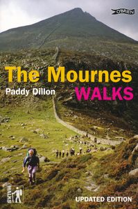
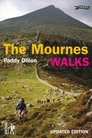
Wandelgids The Mournes Walks | O'Brien Press

Wandelgids met beschrijvingen van 32 wandelroutes in de Mournes, met achtergrond en natuurinformatie en handgetekende kaarten. Thirty-two walks explore the Mournes, taking in rugged coast, high mountains, forest parks and low-level farmlands. The routes lie within the Mourne Area of Outstanding Natural Beauty, and include Slieve Croob and the north...
11,50

Webshops met dit product

Webshop
Bezorging
Prijs

Anderen bekeken ook

Wandelgids The Mournes Walks | O'Brien Press
Wandelgids met beschrijvingen van 32 wandelroutes in de Mournes, met achtergrond en natuurinformatie en handgetekende kaarten. Thirty-two walks explore the Mournes, taking in rugged coast, high mountains, forest parks and low-level farmlands. The routes lie within the Mourne Area of Outstanding Natural Beauty, and include Slieve Croob and the north-east coastline. They sweep down to the sea, they rise in huge heathery humps, surrounded by farmlands divided into tiny, stone-walled fields. Explore the Mournes in the company of walking expert Paddy Dillon, taking in rugged coast, high mountains and forest parks. Follow the mighty Mourne Wall on its meanderings and visit the quiet corners where the history, heritage, wildlife and stillness of the area can be enjoyed.   The Walks: Covers all parts of the Mournes - the High and Low Mournes as well as the Kingdom of Mourne; the Silent Valley circuit; the Mourne Coastal Path; the old smuggling route of the Brandy Pad; Warrenpoint and Rostrevor…
11,50
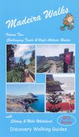
Wandelgids 2 Madeira Walks | Discovery Walking Guides
Engelstalige wandelgids Madeira, met uitgebreide beschrijvingen van wandelroutes, routekaartjes en praktische informatie zoals bussen en accommodatie. In dit tweede deel staan de wat uitdagendere routes. As a walker's paradise, Madeira has it all - majestic mountains, rugged coastline, ancient forests, a unique levada network and verdant flora; easy to see why so many walkers return year after year. In 2015 Madeira was voted the "World's Best Island Destination" by the World Travel Awards the final accolade from the previous two years when it was voted "Europe's Leading Island Destination". Quite an achievement, brought about largely by the substantial EU investment over the past decade in the improvement and development of the island's infrastructure and facilities.   One of the initiatives focused on improving and creating new walking trails which has resulted in Madeira now being regarded as one of Europe's top hiking destinations.To date, around thirty routes on Madeira have been d…
19,95
Wandelkaart The Mournes | Ordnance Survey Ireland
From the rugged granite peaks of the mountains to the picturesque coastline below, the Mournes region is an Area of Outstanding Natural Beauty. This guide map has information about climbing, rambling or relaxing in the area.   The 1:25,000 scale paper map is for outdoor enthusiasts and provides a detailed guide for many outdoor activities and highlights local amenities and services such as filling stations and bus stops. The map includes Slieve Croob, the Murlough Nature Reserve and Castlewellan Forest Park.   A map for everyone, from the experienced hill walker or rock climber to the casual rambler, from the bird watcher or fisherman to the family out for a picnic.   The Mournes in detail - tracks, cliffs, climbs, the Wall, etc. Contouring at 10 -metre intervals showing clearly the impressive relief of the uplands...sweeping down to the sea via the scenic drives and forests to boating and fishing.   OSNI activity maps are double sided and printed on water resistant paper.   Features: …
14,95
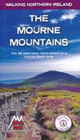
Wandelgids The Mourne Mountains | Knife Edge Outdoor
The only guidebook for the Mourne Mountains written by a County Down local hiker: 30 handpicked routes. The only guidebook for the Mourne Mountains with Real 1:25,000 Maps: this makes navigation easy and saves you money: no need to carry additional maps. Also includes: -Game of Thrones film locations -Numbered waypoints linking maps to text -Quick Reference Route List: enabling you to plan an itinerary to match your ability and schedule. All difficult calculations of time, distance and altitude gain are done for you -Everything the hiker needs to know to plan routes: route descriptions, difficulty, weather, how to get there, and more -Accommodation section -Information on Wildlife, Plants & Geology -History of the Mourne Wall -List of Irish Place Names -Edge to edge colour: the most modern and beautiful Mournes guidebook The Mourne range comprises the highest mountains in Northern Ireland. It is a stunning wilderness which is popular with local walkers but is relatively unknown to thos…
19,50
Wandelgids Walking in the Thames Valley | Cicerone
Walking in the Thames Valley offers 25 challenging circular walks around the River Thames and River Kennet in the south of England, taking in the Southern Chilterns, the Berkshire and North Hampshire Downs, Southern Oxfordshire and the eastern edge of Wiltshire. All routes are within easy reach of Reading, Newbury, Abingdon and London. While some walks visit Iron Age hill forts, others pass more modern features such as Wilton Windmill and the Kennet and Avon Canal. Some follow sections of the Ridgeway, while others meander along the banks of the Thames. What they all have in common is that they take the keen rambler to some of the best parts of the Thames Valley – a patchwork of open chalk grassland, broadleaved woodland and farmland and home to two Areas of Outstanding Natural Beauty. • walks from 10 to 18 miles, including one 2-day route • shorter, less strenuous alternatives for many of the walks • detailed route descriptions with information on local points of interest, OS mapping …
18,50
Wandelgids 100 outstanding British Walks | Ordnance Survey
Beschrijving van de 100 mooiste Pathfinder wandelingen in Engeland, Wales en Schotland. Uitstekende beschrijving van de route met een zeer duidelijke topografische kaart waarop de route is ingetekend.  This magnificent compendium of outstanding British walks brings together the finest selection of Pathfinder Walks in Britain s officially designated places of scenic beauty and historic interest: National Parks, Areas of Outstanding Natural Beauty, National Scenic Areas, Heritage Coast, National Trails and UNESCO World Heritage Sites. There are 100 walking gems in this collection, recommended by a group of experienced authors and guides. The walks span a range of distances and degrees of challenge and are organised by region with coverage across England, Wales and Scotland. 100 Outstanding British Walks is lavishly illustrated with stunning landscape photography and informative introductions to each of the walks. It is designed to be enjoyed at home, while the OS Maps app provides the pr…
27,95
Wandelgids Walking and trekking in the Sierra Nevada | Cicerone
Uitstekende wandelgids voor de Sierra Nevada. Goed beschreven met veel praktische informatie om de route te kunnen lopen, inclusief redelijke kaarten. Aanbevolen wandelkaarten Wandelkaart NP Sierra Nevada met Alpujarras | Editorial Penibetica 1:40.000 of Wandelkaart Sierra Nevada en Alpujarras | Editorial Alpina - 1:40.000 Wandelkaart Sierra Nevada - la integral de los 3000 | Editorial Piolet 1:25.000   This guidebook presents 33 graded walks and 5 high mountain scrambles in the striking Sierra Nevada, the highest mountain range in mainland Spain and in western Europe outside the Alps. Easily accessible from Granada and Málaga, it is a world of soaring, snow-clad peaks and deep valleys, far removed from the crowded beaches of the Costa del Sol just two hours away. The routes are spread across the national park, with attractive towns and villages such as Trevélez, Lanjarón, Hoya de la Mora and Cumbres Verdes serving as potential bases for a walking holiday.   The walks have been careful…
20,95
Wandelgids Walking in London | Cicerone
A guidebook to 25 walks in London's green spaces and nature reserves, covering both the city centre and Greater London area. Taking in woods and forests, parks and heaths, canals and rivers, the guide includes a wealth of information about some of the species you might encounter, as well as the history and conservation of these areas. This guidebook presents 25 varied walks exploring London's green and open spaces. Covering both the city centre and the Greater London area, it takes in royal parks, heaths, forests, canals and rivers, including Epping Forest, Hampstead Heath, the World Heritage site of Kew Gardens and Wimbledon Common. Walks range from 4 to 14 miles and most can be accessed by public transport.Alongside detailed route descriptions and OS mapping, the book features practical information on parking, public transport and refreshments. Each walk showcases a particular species of wildlife that you might encounter, and there is fascinating background information the history an…
20,95

Klanten-reviews van Wandelgids The Mournes Walks | O'Brien Press

Er zijn nog geen beoordelingen voor dit productBen jij de eerste die een review plaatst?

Meer over Wandelgids The Mournes Walks | O'Brien Press

Productomschrijving

Wandelgids met beschrijvingen van 32 wandelroutes in de Mournes, met achtergrond en natuurinformatie en handgetekende kaarten. Thirty-two walks explore the Mournes, taking in rugged coast, high mountains, forest parks and low-level farmlands. The routes lie within the Mourne Area of Outstanding Natural Beauty, and include Slieve Croob and the north-east coastline. They sweep down to the sea, they rise in huge heathery humps, surrounded by farmlands divided into tiny, stone-walled fields. Explore the Mournes in the company of walking expert Paddy Dillon, taking in rugged coast, high mountains and forest parks. Follow the mighty Mourne Wall on its meanderings and visit the quiet corners where the history, heritage, wildlife and stillness of the area can be enjoyed.   The Walks: Covers all parts of the Mournes - the High and Low Mournes as well as the Kingdom of Mourne; the Silent Valley circuit; the Mourne Coastal Path; the old smuggling route of the Brandy Pad; Warrenpoint and Rostrevor; the complete Mounre Wall circuit; the Mourne Trail section of the Ulster Way in four parts from Newry to Clough; Tollymore and Castlewellan Forest Parks; as well as lesser-known outlying trails such as the Castlwellan Loanans.
Webshop.nl maakt gebruik van cookies. Ga je verder op onze website, ga dan akkoord met het plaatsen van cookies en de verwerking van deze data door ons en vermelde partners.