webshop.nl
Categorieën
  Sluiten

Meer The Collins Press

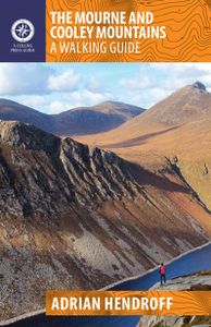
Wandelgids The Mourne and Cooley Mountains | The Collins Press

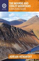
The Mourne and Cooley Mountains are quite simply a hiker’s paradise.   These exhilarating walks will take you to the highest point in Northern Ireland, to scenic Slieve Foye and the ancient summit of Slieve Gullion.    On routes steeped in the legend of the Táin Bó Cúailgne, trek through picturesque woodlands. Discover the highest passage tomb in I...
22,50

Webshops met dit product

Webshop
Bezorging
Prijs

Anderen bekeken ook

Wandelgids The Mourne and Cooley Mountains | The Collins Press
The Mourne and Cooley Mountains are quite simply a hiker’s paradise.   These exhilarating walks will take you to the highest point in Northern Ireland, to scenic Slieve Foye and the ancient summit of Slieve Gullion.    On routes steeped in the legend of the Táin Bó Cúailgne, trek through picturesque woodlands. Discover the highest passage tomb in Ireland, use an old smugglers’ route and walk alongside tranquil reservoirs. The more ambitious will relish the Mourne Wall and Mourne Seven Sevens challenges, and some summits include optional scrambles to the top of dramatic granite tors or rocky outcrops.  Each graded route is illustrated with photographs and specially drawn maps. Snippets on the rich flora, fauna, geology, history, heritage and folklore of each area are included throughout.  So, get your walking boots on and discover the impressive landscape that inspired C.S. Lewis’ magical world of Narnia and served as the backdrop for Game of Thrones.
22,50
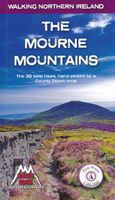
Wandelgids The Mourne Mountains | Knife Edge Outdoor
The only guidebook for the Mourne Mountains written by a County Down local hiker: 30 handpicked routes. The only guidebook for the Mourne Mountains with Real 1:25,000 Maps: this makes navigation easy and saves you money: no need to carry additional maps. Also includes: -Game of Thrones film locations -Numbered waypoints linking maps to text -Quick Reference Route List: enabling you to plan an itinerary to match your ability and schedule. All difficult calculations of time, distance and altitude gain are done for you -Everything the hiker needs to know to plan routes: route descriptions, difficulty, weather, how to get there, and more -Accommodation section -Information on Wildlife, Plants & Geology -History of the Mourne Wall -List of Irish Place Names -Edge to edge colour: the most modern and beautiful Mournes guidebook The Mourne range comprises the highest mountains in Northern Ireland. It is a stunning wilderness which is popular with local walkers but is relatively unknown to thos…
19,50
Wandelkaart Mourne Mountains | Harvey Maps
The Mournes, a granite mountain range in County Down, includes the highest mountains in Northern Ireland. The highest is Slieve Donard at 850 metres.   Detailed map for hillwalkers of the Mountains of Mourne at 1:25,000 scale.   The Mournes is an Area of Outstanding Natural Beauty and has been proposed as the first national park in Northern Ireland. The area is partly owned by the National Trust and sees a large number of visitors every year.   The Mourne Wall is among the more famous features in the Mournes. It is a 35km (22mls) drystone wall that crosses fifteen summits, constructed in 1904 and completed in 1922 to define the boundaries of land purchased by the Belfast Water Commissioners in the late 1800s.   Includes The Mourne Way Long Distance Footpath.   Scale: 1:25,000 Ratio: 4cm = 1km Flat size: 696 x 486mm Folded size: 116 x 243mm Weight: 33gms Area of mapping: 353sqkm Double sided
24,95
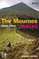
Wandelgids The Mournes Walks | O'Brien Press
Wandelgids met beschrijvingen van 32 wandelroutes in de Mournes, met achtergrond en natuurinformatie en handgetekende kaarten. Thirty-two walks explore the Mournes, taking in rugged coast, high mountains, forest parks and low-level farmlands. The routes lie within the Mourne Area of Outstanding Natural Beauty, and include Slieve Croob and the north-east coastline. They sweep down to the sea, they rise in huge heathery humps, surrounded by farmlands divided into tiny, stone-walled fields. Explore the Mournes in the company of walking expert Paddy Dillon, taking in rugged coast, high mountains and forest parks. Follow the mighty Mourne Wall on its meanderings and visit the quiet corners where the history, heritage, wildlife and stillness of the area can be enjoyed.   The Walks: Covers all parts of the Mournes - the High and Low Mournes as well as the Kingdom of Mourne; the Silent Valley circuit; the Mourne Coastal Path; the old smuggling route of the Brandy Pad; Warrenpoint and Rostrevor…
11,50
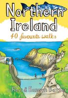
Wandelgids Northern Ireland | Pocket Mountains
Handige compacte wandelgids met 40 dagwandelingen. Deze gids bevat kleine kaartjes en leuke uitgebreide informatie over wat er langs de route te zien is. From the famous interlocking basalt columns of the Giant’s Causeway, part of a 200km-long wild Atlantic coastline littered with castles, lighthouses, wildflowers and birdlife, to the rugged granite summits of the mighty Mourne Mountains which dominate the County Down skyline, Northern Ireland is packed with a magnificent variety of unforgettable walking opportunities. In this guide you will find routes along windblown clifftop paths, through oakwood forests, over old smuggling routes and across high mountain ridges. On the way you’ll discover a land steeped in hundreds of years of history and ancient legend with a remarkable range of wildlife habitats and interesting geology.
10,95
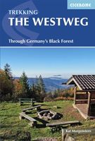
Wandelgids The Westweg | Cicerone
Uitstekende wandelgids van een meerdaagse tocht in het Zwarte Woud in Duitsland. Goede beschrijvingen, veel praktische informatie en redelijke kaarten al zullen deze niet helemaal voldoende zijn. Guidebook to the Westweg (Westway), a 285km walk across Germany's Black Forest from Pforzheim to Basel. This classic route, which includes Feldberg, Black Forest's highest peak, takes 13 to 14 days, each day stage ranging from 15 to 28km. Two variants are described, both well way-marked and suitable for those new to long distance walking. This guidebook is all you need to discover The Westweg, a 285km walk along the length Germany's Black Forest from Pforzheim to Basel. This classic long-distance trail takes around two weeks to walk, in stages of 15-28km. The route is well way-marked and suitable for experienced hikers and those new to long distance walking, though some sections are steep. The Westweg incorporates many of the region's highlights, such the Schwarzwald National Park, the source …
23,95

Klanten-reviews van Wandelgids The Mourne and Cooley Mountains | The Collins Press

Er zijn nog geen beoordelingen voor dit productBen jij de eerste die een review plaatst?

Meer over Wandelgids The Mourne and Cooley Mountains | The Collins Press

Productomschrijving

The Mourne and Cooley Mountains are quite simply a hiker’s paradise.   These exhilarating walks will take you to the highest point in Northern Ireland, to scenic Slieve Foye and the ancient summit of Slieve Gullion.    On routes steeped in the legend of the Táin Bó Cúailgne, trek through picturesque woodlands. Discover the highest passage tomb in Ireland, use an old smugglers’ route and walk alongside tranquil reservoirs. The more ambitious will relish the Mourne Wall and Mourne Seven Sevens challenges, and some summits include optional scrambles to the top of dramatic granite tors or rocky outcrops.  Each graded route is illustrated with photographs and specially drawn maps. Snippets on the rich flora, fauna, geology, history, heritage and folklore of each area are included throughout.  So, get your walking boots on and discover the impressive landscape that inspired C.S. Lewis’ magical world of Narnia and served as the backdrop for Game of Thrones.

Productspecificaties

Artikelnummer(s)
Brand
The Collins Press
Webshop.nl maakt gebruik van cookies. Ga je verder op onze website, ga dan akkoord met het plaatsen van cookies en de verwerking van deze data door ons en vermelde partners.