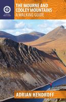
Wandelgids The Mourne and Cooley Mountains | The Collins Press

0
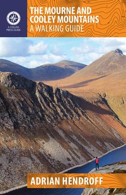
The Mourne and Cooley Mountains are quite simply a hiker’s paradise.   These exhilarating walks will take you to the highest point in Northern Ireland, to scenic Slieve Foye and the ancient summit of Slieve Gullion.    On routes steeped in the legend of the Táin Bó Cúailgne, trek through picturesque woodlands. Discover the highest passage tomb in ...

Verkopers met dit product

Verkoper
Bezorging
Prijs
DeZwerver.nl logo
DeZwerver.nl
2,95
22,50

Anderen bekeken ook

Wandelgids The Mourne Mountains | Knife Edge Outdoor
The only guidebook for the Mourne Mountains written by a County Down local hiker: 30 handpicked routes. The only guidebook for the Mourne Mountains with Real 1:25,000 Maps: this makes navigation easy and saves you money: no need to carry additional maps. Also includes: -Game of Thrones film locations -Numbered waypoints linking maps to text -Quick Reference Route List: enabling you to plan an itinerary to match your ability and schedule. All difficult calculations of time, distance and altitude gain are done for you -Everything the hiker needs to know to plan routes: route descriptions, difficulty, weather, how to get there, and more -Accommodation section -Information on Wildlife, Plants & Geology -History of the Mourne Wall -List of Irish Place Names -Edge to edge colour: the most modern and beautiful Mournes guidebook The Mourne range comprises the highest mountains in Northern Ireland. It is a stunning wilderness which is popular with local walkers but is relatively unknown to tho…
19,50
Wandelgids The Comeragh, Galtee, Knockmealdown & Slieve Bloom Mountains | The Collins Press
The Comeragh, Galtee, Knockmealdown & Slieve Bloom Mountains : A Walking Guide John G. O’Dwyer’s comprehensive guide to the best walks in Tipperary and Waterford has now been updated and expanded to include Laois and Offaly. From the rugged Comeragh coums to the stately peaks of the Galtees, and from myth-laden Slievenamon to the sequestered glens of the popular Slieve Bloom Mountains, there are walks to suit all tastes in these uplands. The most captivating outings the region has to offer are shared here, along with all the necessary practical information such as maps, directions, the degree of difficulty and estimated duration.    But this is more than just a walking guide. Each route gets beneath the skin of this ancient landscape littered with historic artifacts. A booley on a hillside tells how the uplands contributed to human survival; a working farmstead demonstrates the continuation of this tradition; a ruined cottage confirms a battle lost. This guidebook will appeal to commi…
22,50
Wandelgids The Mournes Walks | O'Brien Press
Wandelgids met beschrijvingen van 32 wandelroutes in de Mournes, met achtergrond en natuurinformatie en handgetekende kaarten. Thirty-two walks explore the Mournes, taking in rugged coast, high mountains, forest parks and low-level farmlands. The routes lie within the Mourne Area of Outstanding Natural Beauty, and include Slieve Croob and the north-east coastline. They sweep down to the sea, they rise in huge heathery humps, surrounded by farmlands divided into tiny, stone-walled fields. Explore the Mournes in the company of walking expert Paddy Dillon, taking in rugged coast, high mountains and forest parks. Follow the mighty Mourne Wall on its meanderings and visit the quiet corners where the history, heritage, wildlife and stillness of the area can be enjoyed.   The Walks: Covers all parts of the Mournes - the High and Low Mournes as well as the Kingdom of Mourne; the Silent Valley circuit; the Mourne Coastal Path; the old smuggling route of the Brandy Pad; Warrenpoint and Rostrevo…
11,50
Wandelgids Northern Ireland | Pocket Mountains
Handige compacte wandelgids met 40 dagwandelingen. Deze gids bevat kleine kaartjes en leuke uitgebreide informatie over wat er langs de route te zien is. From the famous interlocking basalt columns of the Giant’s Causeway, part of a 200km-long wild Atlantic coastline littered with castles, lighthouses, wildflowers and birdlife, to the rugged granite summits of the mighty Mourne Mountains which dominate the County Down skyline, Northern Ireland is packed with a magnificent variety of unforgettable walking opportunities. In this guide you will find routes along windblown clifftop paths, through oakwood forests, over old smuggling routes and across high mountain ridges. On the way you’ll discover a land steeped in hundreds of years of history and ancient legend with a remarkable range of wildlife habitats and interesting geology.
10,95
Wandelgids Ireland's Best Walks | The Collins Press
Duidelijke wandelgids van Ierland:  Goede praktische informatie en zeker voor de GPS wandelaar handig met vermelde waypoints. Kaarten zijn schetsmatig, maar er wordt verwezen naar de benodigde topografische kaarten van Ierland.  In a country richly endowed with wild mountain ranges, secluded valleys and untamed coastlines, the best natural landscapes can only be explored on foot. Here are over sixty of the greatest one-day walking routes in Ireland, varying from short strolls to full-day treks. Every part of the Republic and Northern Ireland is featured. From rugged peaks and chiselled ridge lines to towering sea cliffs and sheltered loughs, these routes take you past all the country’s finest scenery. Many of the routes are hill-walks, with clear descriptions of the country’s classic mountain ascents. Even seasoned hillwalkers will find challenging outings.   Each walk is illustrated with sketch maps and colour photos and is prefaced with a quick-reference summary and access notes. Ro…
22,50
Wandelkaart The Mournes | Ordnance Survey Ireland
From the rugged granite peaks of the mountains to the picturesque coastline below, the Mournes region is an Area of Outstanding Natural Beauty. This guide map has information about climbing, rambling or relaxing in the area.   The 1:25,000 scale paper map is for outdoor enthusiasts and provides a detailed guide for many outdoor activities and highlights local amenities and services such as filling stations and bus stops. The map includes Slieve Croob, the Murlough Nature Reserve and Castlewellan Forest Park.   A map for everyone, from the experienced hill walker or rock climber to the casual rambler, from the bird watcher or fisherman to the family out for a picnic.   The Mournes in detail - tracks, cliffs, climbs, the Wall, etc. Contouring at 10 -metre intervals showing clearly the impressive relief of the uplands...sweeping down to the sea via the scenic drives and forests to boating and fishing.   OSNI activity maps are double sided and printed on water resistant paper.   Features:…
14,95
Fietsgids Cycling Kerry | The Collins Press
Een beschrijving van een deel van The Wild Atlantic Way in 3 etappes en ook nog eens 28 dagtochten , wel alleen in Kerry. Goede beschrijvingen, veel praktische informatie maar wel slechts schetsmatige kaarten  A guidebook to the scenic bicycling routes of County Kerry, Ireland, for all cycling abilities. It includes popular routes as well as hidden gems. Each route description is illustrated with color maps, photos, a gradient graph and key facts and statistics. Information is provided on the natural landmarks and historical sites you'll see along the way. With some of Ireland's most beautiful and untamed scenery, 400km of rugged coastline and enticingly peaceful roads, what better way to explore County Kerry than by bike? These scenic cycles will guide you along popular routes and bring you to hidden gems. In a county famous for its climbs, some of the country's most spectacular ascents, summit views and descents feature, including the Conor Pass and Ballaghbeama.Each route descripti…
22,50
Wandelgids Donegal, Sligo & Leitrim | The Collins Press
The northwest of Ireland provides a diversity of walks, from the wild, untamed landscape of Donegal to the gentler hills and green valleys of Sligo and Leitrim. This guidebook describes 30 walks of various difficulties, accompanied by quality photographs The northwest of Ireland provides a diversity of walks, from the wild, untamed landscape of Donegal, with its mountains, sea-cliffs and glens, to the gentler hills, green valleys and picturesque escarpments of Sligo and Leitrim. This guidebook describes 30 walks of various grades in this fascinating part of Ireland that has inspired poets, and is rich in folklore and history. Quality photographs and specially-drawn maps will inspire one to get the walking boots on and start exploring this majestic landscape. Since most routes are not signposted or way-marked, an up-to-date guidebook is essential. Walk descriptions also include material on the natural history, folklore, geology and place-names of the area.
22,50
Wandelgids Dublin & Wicklow | The Collins Press
Duidelijke wandelgids van dit specifieke deel van Ierland. Goede praktische informatie en zeker voor de GPS wandelaar handig met vermelde waypoints. Kaarten zijn schetsmatig, maar er wordt verwezen naar de benodigde topografische kaarten van Ierland.  This guidebook describes the best walking routes in Dublin and Wicklow. From mountain landscape to scenic coastal paths, from woodland trails to challenging hill-walks, there are routes here for everyone. Trips vary from two-hour strolls to eight-hour treks, and are illustrated with sketch maps and colour photographs. This is an area of great scenic variety with countless hidden gems to discover - sheer cliffs, dramatic corries, secluded lakes and charming forests. As well as inspiring you to visit the region's natural attractions, the guide provides a host of practical and background information. Each route is prefaced with a quick-reference summary, and descriptions include detailed access notes and navigational guidance. Points of int…
22,50
Fietsgids Cycling Munster | The Collins Press
With routes spanning the province, here is everything you need to explore the highways and byways of Munster – on two wheels.   This popular guide has now been updated to include the Waterford Greenway, which officially opened in spring 2017. The route, set against the glorious backdrop of the Comeragh Mountains, runs for 46km along an old railway line between Waterford and Dungarvan, crossing three stunning viaducts and taking in charming villages along the way. Graded cycles along the greenway are outlined, from shorter jaunts to suit families, through challenges for intermediate cyclists, up to a 92km loop of the whole route for the experienced.   Each of the routes in the guide is graded by difficulty, from the gentlest, shortest circuits in Cork, through Tipperary, Limerick and Clare, to the thigh-burning Ring of Kerry, and Waterford's Copper Coast and Grand Vee. Each cycle is prefaced with summary information and illustrated with photos, a custom-drawn map and a gradient graph. …
22,50

Klanten-reviews van Wandelgids The Mourne and Cooley Mountains | The Collins Press

Er zijn nog geen beoordelingen voor dit productBen jij de eerste die een review plaatst?

Meer over Wandelgids The Mourne and Cooley Mountains | The Collins Press

Productomschrijving

The Mourne and Cooley Mountains are quite simply a hiker’s paradise.   These exhilarating walks will take you to the highest point in Northern Ireland, to scenic Slieve Foye and the ancient summit of Slieve Gullion.    On routes steeped in the legend of the Táin Bó Cúailgne, trek through picturesque woodlands. Discover the highest passage tomb in Ireland, use an old smugglers’ route and walk alongside tranquil reservoirs. The more ambitious will relish the Mourne Wall and Mourne Seven Sevens challenges, and some summits include optional scrambles to the top of dramatic granite tors or rocky outcrops.  Each graded route is illustrated with photographs and specially drawn maps. Snippets on the rich flora, fauna, geology, history, heritage and folklore of each area are included throughout.  So, get your walking boots on and discover the impressive landscape that inspired C.S. Lewis’ magical world of Narnia and served as the backdrop for Game of Thrones.

Productinformatie

    Verken gerelateerde categorieën

    Webshop.nl maakt gebruik van cookies. Ga je verder op onze website, ga dan akkoord met het plaatsen van cookies en de verwerking van deze data door ons en vermelde partners.