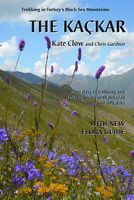
Wandelgids The Kackar - Trekking in Turkey's Black Sea Mountains | Kate Clow

0
Engelstalige wandelgids met kaart met beschrijvingen van wandelroutes in het Zwarte Zeegebied van Turkije. In deze engelstalige gids worden 32 wandelroutes beschreven van dagdeel wandeltochten tot meerdaagse routes. The Kaçkar Mountains are part of the Pontic Alps, a glaciated, granite mountain range which hugs the south coast of the Black Sea, ex...

Verkopers met dit product

Verkoper
Bezorging
Prijs
DeZwerver.nl logo
DeZwerver.nl
2,95
22,95

Anderen bekeken ook

Wandelgids Trekking in the Silvretta and Ratikon Alps | Cicerone
Aanbevolen wandelkaarten bij deze gids: Schaal 1:60.000 Wandelkaart 14 Unterengadin | Kümmerly & Frey Wandelkaart 13 Davos - Arosa | Kümmerly & Frey Of schaal 1:25.000 Wandelkaart 26 Alpenvereinskarte Silvrettagruppe This guide describes three treks, between 5 and 8 days, in the Silvretta and Rätikon Alps starting near Klosters, and 12 half-day hut-to-hut routes. These contrasting ranges form a line on the borders of Switzerland, Austria and Liechtenstein. The Tour of the Silvretta, the Prättigauer Höhenweg and the Rätikon Höhenweg. Straddling the borders of Austria, Switzerland and Liechtenstein, the limestone Rätikon Alps reach into the snow-bound and glacier-hung Silvretta Alps to provide a richly diverse series of landscapes. The Tour of the Silvretta, the Prättigauer Höhenweg and the Rätikon Höhenweg, all within easy reach of Klosters, have been devised to help trekkers explore the best of the region. Given sifficient time they can also be combined to create a continuous 2-week t…
25,95
Wandelgids The Slovene Mountain Trail | Cicerone
Uitstekende wandelgids van de Slovenska Planinska Pot. Goed beschreven met veel praktische informatie om de route te kunnen lopen, inclusief redelijke kaarten. A guidebook to trekking the Slovene Mountain Trail, crossing Slovenia from Austria to the Adriatic. The 550km route is presented in a series of 12 3 to 6-day treks of all levels of difficulty, all featuring start and finish points that can be accessed by public transport. They can be completed as single sections or linked to create a longer trip. Each day is graded: low-grade walking is mostly on tracks or lanes with no steep ascents, whereas the most difficult stages may involve steep and technical terrain including fixed protection or sections of via ferrata, for which a helmet, self-belaying equipment and the appropriate experience are required.   In addition to clear route description and mapping, the guide provides all the practical information you will need to plan your trip, covering transport, accommodation and safet…
23,95
Wandelgids Trekking in Ladakh | Cicerone
Cicerone wandelgids van Ladakh met acht uitdagende trekkingen.    This trekking guidebook gives detailed descriptions of eight different treks across the Ladakh, Zanskar and Markha Valley in northern India. Ranging from moderate difficulty to very demanding, each trek is broken down into multiple stages, and has information on difficulty, available accommodation and access, as well as the many combinations and alternative routes open to exploration.    Known as Little Tibet; for both its landscape and culture, Ladakh lies at the northern tip of India. The region is bisected by the great River Indus and neighbours Tibet and Kashmir. This quiet corner of the Himalaya has developed a strong trekking culture over recent years for adventurous trekkers. Trekking in this remote, high-altitude region is extremely challenging, as paths are not signed and there are only a limited number of villages. However, its magnificent landscape (a huge area full of limitless trekking possibilities), ho…
33,95
Wandelgids St. Paul Trail | Kate Clow
De St Paul Trail is een nieuw bewegwijzerd pad in Turkije. Zoals het eerste GR-pad in Turkije, de Lycian Way, is ook dit pad vooral de creatie van de onvermoeibare Kate Clow, een engelse vrouw die al meer dan 15 jaar in Turkije woont. De afstand bedraagt ruwweg 600 km en het pad is volledig gemarkeerd vanaf 2003 en beschreven. Bovendien wordt alles “op de voet” gevolgd en begeleid met een uitstekende website. Erg uitgebreid gaat het boek in op de geschiedenis en exploratie van een aantal archeologische plaatsen die je op de tocht passeert. Hierdoor is het boek ook bruikbaar voor zij die niet zo geïnteresseerd zijn in wandelen maar wel in afgelegen en eerder onbekende vergane steden uit de klassieke periode. Het boek staat bol van praktische info en tips verzameld door jaren te wandelen in dit gebied. The landscape of Turkey's Toros mountains and lake district contrasts and combines inA brand new edition of the St Paul Trail guidebook, following the saint's journey from Perge, near Ant…
25,95
Wandelgids Trekking and Canyoning in the Jordanian Dead Sea Rift | Desert Breeze
Erg volledige gids en enig in zijn soort, over dit prachtige gebied op de westgrens van Jordanië, vol canyons, kloven, bergen, woestijn, waterbronnen en watervallen. De eerste gids waarin deze hoeveelheid tochten staat in dit gebied. De tochten zijn zeer divers en zowel voor de beginnende als geoefende wandelaar / klimmer, zowel dagtochten als meerdaagse tochten. Soms is het aanbevolen een bedoein gids of een touw mee te nemen. The Jordanian Dead Sea Rift includes some of the world's most rugged and colorful desert landscapes. Its dramatic canyons are only now beginning to be revealed, offering the trekker untamed desert wilderness. Year-round streams, waterfalls and lush vegetation are all here to be found, dotting the desert with numerous oases. Rising above the canyons are mazes of sandstone domes and isolated cliffs with spectacular vistas. Bedouin nomads roam through the region, herding their goats and often still living in goat-hair tents, not far from world-famous archeological…
20,95
Wandelgids Trekking in the Vanoise | Cicerone
Uitstekende wandelgids van dit geweldige gebied. goed beschreven met veel praktische informatie om de route te kunnen lopen, inclusief redelijke kaarten. This guide describes the eleven-day 163km Tour of the Vanoise and the five-day 72km Tour des Glaciers de la Vanoise, two fantastic hut-to-hut treks through the pristine Alpine landscapes of France's Vanoise National Park. Three other short treks - the Tour of the Eastern Vanoise, the Tour of the Western Vanoise and a Traverse of the Vanoise via the GR5 and GR55 - are also summarised. The routes tackle several passes in excess of 2500m but there are no glacier crossings, no significant scrambling and no lengthy paths exposed to either stonefall or vertigo-inspiring exposure (though optional variants may involve some slightly more challenging sections), and waymarking is usually clear - making this an ideal route for those new to Alpine trekking.   The guide contains everything you need to plan and walk the routes, with advice on trave…
23,95
Wandelgids Walking and Trekking in Iceland - IJsland | Cicerone
Wandelgids met beschrijvingen, kaarten en praktische informatie zoals bussen, overnachten, etc. voor meerdaagse wandelroutes en dagwandeltochten op IJsland. A country of extraordinary beauty, Iceland’s incredible variety of volcanic and glacial landscapes makes it a unique destination for walking and trekking holidays. Its three national parks include the mighty Vatnajökull, largest national park in Europe.   The wide range of routes in this book introduce walkers and backpackers to this ‘Land of Ice and Fire’. There are 100 days of walking in this guidebook, stretching over 1722km, split between 49 day walks and 10 multi-stage treks. They climb mountains, cross glaciers, pass lakes and explore coastlines and geothermal areas, and range from easy nature trails to challenging treks. So, there is enough variation to satisfy all kinds of walkers. The routes are spread all around Iceland, grouped into twelve regions. Detailed information is given at the start of each route or trekking sta…
26,95
Wandelgids Walking and Trekking in the Japan Alps and Mount Fuji | Cicerone
This guidebook presents nine day-walks and thirteen treks of 2-8 days in the magnificent Japanese Alps, plus the four main routes up Japan's highest mountain, Mount Fuji (3776m), and a further route on neighbouring Mount Kurodake. The Japanese Alps stretch across the middle of the main island of Honshu and include several peaks over 3000m. Mount Fuji lies to the south: an active stratovolcano (though with minimal risk of eruption), it has become an iconic symbol of Japan and sees 300,000 visitors to its summit every year. The guide includes all the information you will need to plan a successful walking or trekking holiday, with a wealth of advice on travel, bases, accommodation and facilities. The Japan Alps and Mount Fuji boast a well-developed walking infrastructure, and the routes make use of the many mountain huts and campgrounds, full details of which are given in the guide. Some also include the opportunity to visit a traditional hot spring bath for a refreshing soak after your…
29,95
Wandelgids Kilimanjaro trekking | Cicerone
Goede trekking - wandelgids van de Kilimanjaro. Beklimmingen kunnen van alle kanten in vele vormen en vrijwel alle routes staan goed beschreven  in deze gids. Veel praktische informatie en een duidelijke routebeschrijving, duidelijke enigszins schetsmatige kaarten en een uitgebreide inleiding over wat je wel en niet moet meenemen, regelen en voorbereiden. At 5895m, Kilimanjaro is Africa's highest point and the highest freestanding mountain in the world, yet it is possible to reach its summit, Uhuru Peak, without any technical climbing ability. However, that is not to say that it is an easy undertaking: each year, many people fail in their attempt, often due to poor preparation or insufficient acclimatisation. Those who do make it to 'the Roof of Africa' are richly rewarded, enjoying outstanding views, the unique experience of being 'on top of the world' and, of course, a tremendous sense of achievement.   Guidebook describing all the trekking routes on Kilimanjaro (5895m), one of the …
23,95
Wandelgids Trekking in the Apennines - Apennijnen | Cicerone
Uitstekende wandelgids die in etappes de route nauwkeurig beschijft; ook de zijtakken en alternatieve routes koman aan bod. Kaarten zijn schetsmatig en in onze ogen onvoldoende bij slechte weersomstandigheden. Wij raden dan ook om er losse kaarten bij te kopen, voor zover verkrijgbaar! Guidebook to the Grand Apennines Trek, or Grande Escursione Appenninica (GEA). Through Tuscany and Emilia-Romagna and two National Parks, this 400km, 23 day trail explores the mountains, forests and hills of central Italy. Suitable for a range of walkers, it can be split into shorter sections or day walks if needed. This guidebook describes the Grande Escursione Appenninica (GEA), a nearly 400km long, three week trek crossing the Appenines in 23 stages, from Bocca Trabaria to Passo Due Santi on the edge of Liguria. The route dips in and out of Tuscany and Emilia-Romagna, never dropping below 400 metres. Best walked between spring and autumn, it is suitable for any reasonably fit walker. Highlights inclu…
22,95

Klanten-reviews van Wandelgids The Kackar - Trekking in Turkey's Black Sea Mountains | Kate Clow

Er zijn nog geen beoordelingen voor dit productBen jij de eerste die een review plaatst?

Meer over Wandelgids The Kackar - Trekking in Turkey's Black Sea Mountains | Kate Clow

Productomschrijving

Engelstalige wandelgids met kaart met beschrijvingen van wandelroutes in het Zwarte Zeegebied van Turkije. In deze engelstalige gids worden 32 wandelroutes beschreven van dagdeel wandeltochten tot meerdaagse routes.

The Kaçkar Mountains are part of the Pontic Alps, a glaciated, granite mountain range which hugs the south coast of the Black Sea, extending from the Caucasus towards Istanbul. The mountain range is lushly wooded on the north, with pines succeeded at lower levels by chestnut, hornbeam and beech trees, with tea plantations and hazlenut groves spilling down towards the waves. The contrasting southern slopes are patched by summer pastures where black bulls graze and lakes, springs and streams are plentiful and clear.

This map and guidebook describes 32 trekking routes in Turkey’s Kaçkar mountains, ranging from half-day walks to multi-day treks. You can cross the passes between the granite spires by paved pack-horse routes or walk traditional footpaths between timeless villages and high pastures where hardy locals graze their flocks. The guide also includes comprehensive historical and cultural details of the area and clear colour photographs.

Also includes a 2-sided full colour contour map, 75cm x 48cm. An essential guide for a relatively un-chartered trekking destination.

Meer informatie op Trekking in Turkey

Productinformatie

    Verken gerelateerde categorieën

    Webshop.nl maakt gebruik van cookies. Ga je verder op onze website, ga dan akkoord met het plaatsen van cookies en de verwerking van deze data door ons en vermelde partners.