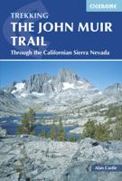
Wandelgids The John Muir Trail | Cicerone

0
Een uitstekende beschrijving van het beroemde lange afstandspad in Californie. Guidebook to walking the John Muir Trail through California's High Sierra from Yosemite (El Capitan and Half Dome) to the summit of Mount Witney. The 216 mile hike is split into 21 daily stages, with full information on preparation, permits, wilderness, bears, water and...

Verkopers met dit product

Verkoper
Bezorging
Prijs
DeZwerver.nl logo
DeZwerver.nl
2,95
25,95

Anderen bekeken ook

Wandelgids The John Muir Trail | Cicerone
Een uitstekende beschrijving van het beroemde lange afstandspad in Californie. Guidebook to walking the John Muir Trail through California's High Sierra from Yosemite (El Capitan and Half Dome) to the summit of Mount Witney. The 216 mile hike is split into 21 daily stages, with full information on preparation, permits, wilderness, bears, water and trekking skills. Part of the Pacific Crest Trail. The John Muir Trail (JMT) is one of the world’s most spectacular treks and is North America’s best known mid-distance walking trail. It runs for 216 miles through the high Sierra Nevada mountains of California, from Yosemite Valley to the summit of Mount Whitney (14, 496ft), the highest peak in the USA outside Alaska. The walking trail, which is named after the great 19th-century Scottish naturalist, conservationist and writer John Muir, is entirely through the unspoilt wilderness of the American West and passes through three national parks: Yosemite, Kings Canyon and Sequoia National Parks. …
25,95
Wandelgids Walking the John o' Groats Trail | Cicerone
Guide to the John o' Groats Trail, a 233km walking route linking Inverness with John o' Groats on the northeast tip of mainland Britain. Much of the walking is coastal, with the northern half characterised by its spectacular seacliffs; however, there is some inland walking too, and the scenery is varied, ranging from dunes and deserted sandy beaches to beautiful woodland. With rough ground and some exposed clifftop walking, the route is suited to experienced hikers.   It takes around a fortnight to complete. The route is described in 14 stages, each of which includes: an overview map; step-by-step route description illustrated with custom mapping; details of accommodation, facilities and transport links; and information on local points of interest. While the main route description is from south to north, notes are supplied for southbound walkers.   Also included is a bonus route linking the trail with the Great Glen, for the benefit of walkers undertaking the Land's End to John o' Gro…
23,95
Wandelgids The Cape Wrath Trail | Cicerone
Uitstekende wandelgids die in etappes de route nauwkeurig beschijft.  A guidebook to the Cape Wrath Trail, a long-distance trek through the Scottish Highlands from Fort William to Cape Wrath. The Cape Wrath Trail is a 230-mile, three-week challenge through wild and magnificent landscapes, such as Morar, Knoydart, Torridon and Assynt. Crossing such empty country, it is for the experienced backpacker only. Activities Long-distance walking and backpacking   Seasons April, May and June are ideal months to walk the trail. September and October are also good, but there may be diversions due to deer stalking and military operations at the cape. In July and August the days are superbly long and the weather can be fine, but midges will be in full flight. The limited accommodation along the trail may also be booked up at this time of year   Centres Fort William, Glenfinnan, Barisdale, Kinloch Hourn, Shiel Bridge, Strathcarron, Kinlochewe, Dundonnell, Ullapool, Bridge of Orchy, Inchnadamph, Kyle…
25,95
Wandelgids Walking The End to End Trail | Cicerone
Een droomroute voor velen: helemaal van het zuidelijkste puntje van Engeland naar het noordelijkste puntje van Schotland, zo'n slordige 1956 km door fabelachtig mooie afwisselende landschappen. Zeer gedetailleerd beschreven met alle noodzakelijke informatie! Kaartmateriaal - zelf gemaakt door de schijver - werkt zeer verhelderend en voldoet uitstekend ter plaatse. Je hebt alle informatie in één boek! This guidebook to UK's ultimate challenge walk, the End to End, describes a 1956km (1215 mile) walking route from Land's End in Cornwall to John o' Groats in Scotland's far north - the two points on mainland Britain that are the furthest apart. The recommended route avoids road walking as much as possible and frequently takes advantage of existing long-distance trails, including the South West Coast Path, Pennine Way and West Highland Way. Passing through remote terrain at times and keeping to the hills where practical, it is intended for experienced hill-walkers.   The guide includes rou…
27,95
Wandelgids Switzerland's Jura Crest Trail | Cicerone
Uitstekende wandelgids van de Jura Crest Trail, ook wel bekend als de Jura High Route. Goed beschreven met veel praktische informatie om de route te kunnen lopen, inclusief redelijke kaarten. This guide presents Switzerland's Jura Crest Trail. Also known as the Jura High Route (Swiss national route 5), this 310km long-distance route traverses the sub-alpine mountains of the Swiss Jura from Dielsdorf near Zurich to Nyon on the shores of Lac Léman (Lake Geneva), running roughly parallel to the Swiss-French border. With over 13,500m of ascent, the trail demands a moderate level of fitness and can be comfortably completed in around a fortnight. The Jura Crest Trail is easily accessed from Zurich and Geneva. The region boasts excellent walking infrastructure and facilities, and although the trail crosses the mountains, you are seldom too far from civilisation. The guide contains all the information you need to plan and walk the route. You'll find advice on transport and comprehensive deta…
23,95
Wandelgids The Slovene Mountain Trail | Cicerone
Uitstekende wandelgids van de Slovenska Planinska Pot. Goed beschreven met veel praktische informatie om de route te kunnen lopen, inclusief redelijke kaarten. A guidebook to trekking the Slovene Mountain Trail, crossing Slovenia from Austria to the Adriatic. The 550km route is presented in a series of 12 3 to 6-day treks of all levels of difficulty, all featuring start and finish points that can be accessed by public transport. They can be completed as single sections or linked to create a longer trip. Each day is graded: low-grade walking is mostly on tracks or lanes with no steep ascents, whereas the most difficult stages may involve steep and technical terrain including fixed protection or sections of via ferrata, for which a helmet, self-belaying equipment and the appropriate experience are required.   In addition to clear route description and mapping, the guide provides all the practical information you will need to plan your trip, covering transport, accommodation and safet…
23,95
Wandelgids The GR5 Trail Benelux and Lorraine | Cicerone
Engelsetalige wandelgids van het noordelijke deel van het beroemde GR 5 pad. Dezse gids beschrijft de gehele route van de GR 5 van Hoek van Holland tot aan Schirmeck in de Vogezen. Goede beschrijvingen en informatie; kaartmateriaal is vrij beperkt. Guidebook to walking the northern section of the GR5 - 1000km starting in Hoek van Holland and passing through the Netherlands, Belgium, Luxembourg and Lorraine to Schirmeck in France. A long-distance route covering a variety of cultures and landscapes. The full GR5 from the North Sea to the Mediterranean is one of the world's greatest trails. Guidebook to the northernmost section of the GR5 - from Hoek van Holland in the Netherlands, through Belgium and Luxembourg, to Schirmeck in the northeast of France. Described over 49 stages, this 1000 kilometre section of the GR5 is relatively easy and ideal for those who don't want to hike up and down steep mountains - or not just yet.   Clear route description is accompanied by 1:100K mapping, toge…
24,95
Wandelgids The Ridgeway | Cicerone
Uitstekende wandelgids van de Ridgeway, waarbij naast alle noodzakelijke informatie ook gebruik gemaakt wordt van de echte topografische kaart. Inclusief gidsje met routekaarten van 1:25000   This guidebook - which includes both a guide to the route and a separate OS map booklet - describes the Ridgeway National Trail, an 87 mile (139km) route through southern England from Avebury in Wiltshire to Ivinghoe Beacon in Buckinghamshire. Typically walked in 6 or 8 days, this is a low-level waymarked route suitable for all abilities and for year round walking.   The guidebook details the trail in both directions, west to east and east to west. Step-by-step route descriptions are accompanied by 1:100,000 OS mapping and a separate OS 1:25,000 map booklet showing the entire route is included. Packed with details on points of interest and a trek planner giving at-a-glance information about facilities, public transport and accommodation available along the way, this book is an indispensable guide…
23,95
Wandelgids Trekking Slovenia's Juliana Trail | Cicerone
The Juliana Trail is a 330-km-long circular long-distance hiking trail through the Julian Alps in Triglav National Park, Slovenia. The trek takes in some less familiar valleys along with well-known spots such as Lake Bohinj and Bled, swings briefly through the corner of Italy, and into the Brda wine region. Accessible by public transport, the trek is straightforward and relatively easy, perfect for hikers of various skill levels.   The guidebook offers route description for every stage of this 20-day trekking route, along with providing background information on local history, geology, and wildlife, as well as planning details on when to go, where to stay, and what facilities are available along the trail. 1:50,000 mapping is provided for each stage. Designed to promote sustainable tourism this trail is a true gem of Slovenia's Julian Alps.
26,50
Wandelgids The Skye Trail | Cicerone
Guidebook to the Skye Trail, a challenging 80-mile (128km) trek that snakes its way north–south across the largest island in Scotland’s Inner Hebrides. This unofficial, week-long route is ideal for backpacking, camping wild each night, but can also be walked between overnight accommodation.   Unwaymarked route on sometimes-pathless terrain requires navigational skill, fitness and self-reliance, so is suitable for experienced mountain walkers Seven daily stages of 7–18 miles (11–29km) in length, with an optional 6-mile (11km) alternative route via the summit of Bla Bheinn, one of Skye’s most spectacular Munros Starts at Rubha Hunish at the northern tip of Skye, visits the capital Portree, follows Glen Sligachan between the Black Cuillin and Red Hills, before finishing in the south at Broadford Highlights include the Trotternish Ridge, the Quiraing, the Old Man of Storr, the mighty Cuillin and the abandoned village of Boreraig Clear route descriptions with full 1:50,000 OS mapping and e…
20,95

Klanten-reviews van Wandelgids The John Muir Trail | Cicerone

Er zijn nog geen beoordelingen voor dit productBen jij de eerste die een review plaatst?

Meer over Wandelgids The John Muir Trail | Cicerone

Productomschrijving

Een uitstekende beschrijving van het beroemde lange afstandspad in Californie.

Guidebook to walking the John Muir Trail through California's High Sierra from Yosemite (El Capitan and Half Dome) to the summit of Mount Witney. The 216 mile hike is split into 21 daily stages, with full information on preparation, permits, wilderness, bears, water and trekking skills. Part of the Pacific Crest Trail.

The John Muir Trail (JMT) is one of the world’s most spectacular treks and is North America’s best known mid-distance walking trail. It runs for 216 miles through the high Sierra Nevada mountains of California, from Yosemite Valley to the summit of Mount Whitney (14, 496ft), the highest peak in the USA outside Alaska. The walking trail, which is named after the great 19th-century Scottish naturalist, conservationist and writer John Muir, is entirely through the unspoilt wilderness of the American West and passes through three national parks: Yosemite, Kings Canyon and Sequoia National Parks.

To walk the John Muir Trail successfully thorough planning is required. All you need to know to plan and prepare for your trip is contained within these pages, from obtaining trekking permits to buying trek food and forwarding food caches along the trail. Abundant advice is given on such topics as dealing with inquisitive bears, coping with altitude, negotiating river crossings, as well as tips on booking transport to and from the trailheads and on what equipment to take. In addition there is a detailed description of the flora and fauna of this remarkable region.

Steden en Dorpen

Starts Yosemite and finishes at Whitney Portal; Tuolmmne, Vermilion Resort and Muir Trail Range along the way; access through San Francisco or Los Angeles

Productinformatie

    Verken gerelateerde categorieën

    Webshop.nl maakt gebruik van cookies. Ga je verder op onze website, ga dan akkoord met het plaatsen van cookies en de verwerking van deze data door ons en vermelde partners.