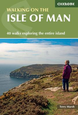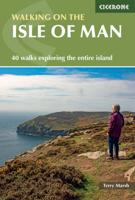
Wandelgids The Isle of Man | Cicerone

0
Wandelgids met 40 wandelingen op het eiland Man dat tussen Engeland en Ierland in ligt. De wandelingen variëren van zo'n 2 tot 22 km. Kaartmateriaal voldoende. Engelstalig. A guidebook to 40 walking routes on the Isle of Man. The varied selection of day walks, which range from 1 to 14 miles long (2 and 22km) take in the best scenic routes right a...

Verkopers met dit product

Verkoper
Bezorging
Prijs
DeZwerver.nl logo
DeZwerver.nl
2,95
20,95

Anderen bekeken ook

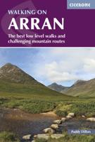
Wandelgids Walking on Arran | Cicerone
Uitstekende wandelgids voor dit uitdagende wandelgebied in Schotland. Dagtochten. The 45 walking routes in this Isle of Arran guidebook range from easy 3km (2 miles) nature trails to long arduous mountain routes with scrambles (up to 32km) providing thorough coverage of Arran, including the ascent of Goatfell and nearby Holy Isle. Most routes are 10km to 15km long but many give opportunities to create longer cross island walks. This guidebook presents a selection of 45 day walks on the popular and accessible Isle of Arran. The routes are between 2 miles (3km) and 20 miles (32km) in length, from easy waymarked forest trails to more arduous mountain walks, exposed ridge routes and scrambles. There are linear and circular walks to choose from, and opportunities to link routes together and create longer walks across the length and breadth of the island. With highlights including Goatfell, Beinn Tarsuinn, the Sannox Horseshoe, Glen Rosa and the Cock of Arran, there's something here to suit…
23,95
Wandelgids The Isle of Skye | Cicerone
Uitstekende wandelgids, sommige meerdaags, voor dit uitdagende wandelgebied in Schotland. This third edition of Terry Marsh’s walking and scrambling guide to Skye, the Hebrides, northwest Scotland, updated using digital mapping and GPS. 87 walks and scrambles in Sleat and South-East Skye, Strath, Minginish, Duirinish, Waternish and Trotternish for all abilities. Each route describes local historical and geological points of interest. The fame of Skye, the most scenically awe-inspiring of Scotland's many islands, is widespread; you either love it, or hate it. There is no neutrality. For walkers and climbers this is the Promised Land, a place of raw elemental forces, a land barely scratched by man. Over-riding everything hangs an indefinable, almost supernatural, charisma that evokes a deep and abiding affection among those privileged to share Skye's secrets. To go in search of those secrets there is no better way than on foot, and in this collection of walks, Terry Marsh visits all cor…
22,50
Wandelgids Walking guide Isle of Man Coastal Path | Cicerone
Perfect wandelgidsje met geweldige routes op dit prachtige eiland tussen Engeland en Ierland. Goed beschreven, met veel details om de wandelingen te kunnen volgen, kaartmateriaal voldoende. Guidebook to walking the Isle of Man coastal path, the Way of the Gull (Raad ny Foillan). The spectacular 98 mile route is described in 9 stages and takes in beaches, glens, moorland and rugged sea cliffs. It can be walked in around a week. Two other paths, the Millennium Way (Bayr ny Ree) and the Herring Way (Bayr ny Skeddan), are also described.   Seasons  Year-round walking on the Isle of Man is possible, although spring and summer weather is best. April, May and June are driest; May, June and July are sunniest; July and August are warmest.   Centres   Douglas, Ramsey, Castletown, Port Erin, Peel, Kirk Michael   Difficulty Mainly coastal walking with short ups and downs. Stages up to 15 miles long.   Must See   Point of Ayre, historic Laxey, the cliffs and secluded bays and inlets of the south a…
18,50
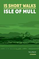
Wandelgids Isle of Mull, Coll and Tiree | Hallewell Publications
Rewalked and revised in 2015, Walks Isle of Mull, Coll & Tiree including Iona & Ulva includes walks on the Inner Hebridean island of Mull and the nearby islands. Mull is typified by spectacular coastal scenery and fine hill climbs, while the other islands are lower and gentler in character. The 29 walks featured range from 1 mile to 10.5 miles (1.6-17km). Routes on Mull include: Ben More, Carsaig Arches and two walks from Tobermory. The guide also features walks on the marvellous island of Ulva, two fine walks on Iona plus routes on the rugged island of Coll and the wide sand beaches of Tiree. Now on its 3rd edition, this guide is part of a popular series of A6 pocket walking guides which describe routes which are suitable for walkers of all abilities and to suit all tastes. Route descriptions are accompanied by 2-colour sketch maps. The guides are illustrated with line illustrations, and will provide walkers with a good introduction to what each area covered has to offer.  
5,95
Wandelgids The high mountains of Crete - Kreta | Cicerone
Guidebook to walking and trekking the high mountains of Crete. The largest of the Greek Islands, Crete's mountains provide breathtaking walking and wilderness to this popular island. The routes in this guidebook are graded for difficulty and range from short, easy strolls to challenging, multi-day treks and summit climbs, so there are options for walkers of all abilities.    All the mountain ranges of Crete feature high plains, gorges and ravines, but in the heart of the Lefka Ori there is something else. High above the treeline snow thaws by July to reveal a great circle of massive barren peaks, interspersed with ‘moonscape’ outcrops, or depressions, of sinkholes in black, grey or red rock. This high desert wilderness is seldom visited but covers some 960sqkm.   In central Crete, where the island is at its widest, the huge mass of Psiloritis (Mount Ida) dominates the whole region. Covering about 560sqkm this massif is different in that a single huge, partly scree-surfaced summit ridg…
26,50
Wandelgids Isle of Arran | Hallewell Publications
Rewalked and updated in 2015, Walks Isle of Arran features 24 walks on the mountainous island of Arran in the Firth of Clyde. Known as `Scotland in miniature', the island provides a fine range of coastal, moorland, woodland and hill walks. The 24 walks featured range from 0.75 miles to 9 miles (1-14.5km). Routes include: Goatfell from Brodick, Brodick Country Park, Cock of Arran, Machrie Moor Stone Circles and a path over the twin peaks of Holy Island. The guide is part of a popular series of A6 pocket walking guides which describe routes which are suitable for walkers of all abilities and to suit all tastes. Route descriptions are accompanied by 2-colour sketch maps. The guides are illustrated with line illustrations, and will provide walkers with a good introduction to what each area covered has to offer.  
5,95
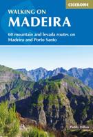
Wandelgids Walking on Madeira | Cicerone
Zeer goede wandelgids van deze gerenommeerde Engelse uitgever. Met veel detail worden de wandelingen beschreven, voorzien van goede kaarten en ook nog praktische informatie. Veelal veel keuze uit het grote aantal dagtochten dat beschreven wordt. De afstand is tussen de 5 en 18 kilometer, al naar gelang wat je als wandelaar in gedachte hebt.    This guide describes a varied selection of 57 walks on the Portuguese island of Madeira, exploring the dramatic cliff coastline, scenic levadas (irrigation channels), dense laurisilva 'cloud' forests and high mountain peaks, plus three walks on neighbouring Porto Santo. There are routes to suit all abilities, from easy, level levada walks to steep and rugged mountain paths – some with exposed sections calling for a sure foot and good head for heights. Since the steep terrain of Madeira does not easily support circular walks, many of the routes are linear, however most can be accessed by public transport and there is the option to link routes to …
24,95
Wandelgids Walks Isle of Man | Hallewell Publications
The Isle of Man is a Crown Dpendency in the Irish Sea, equidistant from the UK and Ireland and is a terrific walking destination. Though the island is only 32 miles/51km long, it contains a wealth of different landscapes and walking types (moorland hills, coastal cliffs, woodland, farmland, sand dunes and beaches). There is a good network of signposted paths including a 102 mile/164km coastal path (Raad ny Foillan) and handsome towns and villages besides. This new guide features walks ranging from 1.5 - 11 miles (2.5 - 18kms) - highlights include the climb up Snaefell and the sea cliffs of Bradda Head and Spanish Head. This guide is part of a popular series of A6 pocket walking guides which describe routes which are suitable for walkers of all abilities and to suit all tastes. Route descriptions are accompanied by 2-colour sketch maps. The guides are illustrated with line illustrations, and will provide walkers with a good introduction to what each area covered has to offer.
5,95
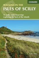
Wandelgids Walking in the Isles of Scilly | Cicerone
Uitstekende wandelgids van dit geweldige gebied. goed beschreven met veel praktische informatie om de route te kunnen lopen, inclusief redelijke kaarten. This guidebook to walking on the Scilly Isles at the south-western edge of Britain includes 11 day walks and 4 boat trips, perfect for a fortnight away from it all. The walks are between 2 and 16km long, and explore the larger islands such as Tresco, St Martin's, St Mary's, St Agnes and Bryher as well as smaller islands in the archipelago. Alongside the walks, which are suitable for walkers of all abilities, are 4 Boat Trips which explore Annet and the Western Rocks, the Norrard Rocks, St Helens and Teän as well as the Eastern Isles.   With their mild climate and relaxing atmosphere, the Isles make an ideal destination for a retreat, with stunning scenery, rich bird life and myriad wildflowers. Basking in sunshine, rising green and pleasant from the blue Atlantic Ocean, fringed by rugged cliffs and sandy beaches, they reveal their ch…
12,95
Wandelgids 1 Walking The Munros Vol 1 Southern, Central and Western Highlands - Schotland | Cicerone
Uitstekende wandelgids van het zuiden, midden en westen van de Schotse Hooglanden. Goed beschreven met veel praktische informatie om de route te kunnen lopen, inclusief redelijke kaarten. Guidebook to walking the Munros in southern, central and western Highlands. Describes 69 challenging routes across 139 of the iconic 3000ft+ mountains covering areas such as Glencoe, Bridge of Orchy and Mull. Includes routes up Ben More, Ben Alder, Ben Lomond and Ben Nevis, the highest mountain in the British Isles. Volume 1 of two guidebooks.   Seasons The guide is intended for summer hillwalkers (usually April/May to October in Scotland). In winter conditions the routes become more serious mountaineering expeditions requiring appropriate skills, equipment and experience.   Centres Arrochar, Crianlarich, Killin, Pitlochry, Tyndrum, Glencoe, Fort William, Spean Bridge, Dalwhinnie, Braemar, Glenshee   Difficulty Most of the Munros are straightforward walks but some involve ridge walking, sc…
20,95

Klanten-reviews van Wandelgids The Isle of Man | Cicerone

Er zijn nog geen beoordelingen voor dit productBen jij de eerste die een review plaatst?

Meer over Wandelgids The Isle of Man | Cicerone

Productomschrijving

Wandelgids met 40 wandelingen op het eiland Man dat tussen Engeland en Ierland in ligt. De wandelingen variëren van zo'n 2 tot 22 km. Kaartmateriaal voldoende. Engelstalig.

A guidebook to 40 walking routes on the Isle of Man. The varied selection of day walks, which range from 1 to 14 miles long (2 and 22km) take in the best scenic routes right across this delightful island. Many routes can be combined to create longer more ambitious walks.   The Isle of Man offers the walker a wonderfully diverse range of landscapes within a relatively compact island setting, and the routes reflect this diversity - scale the highest point Snaefell (620m), cross wide-open moorlands, drift over beaches and climb coastal clifftops. The assortment provides walkers with fantastic trails, along with detail on the wildlife, wild flowers, unique history and points of interest encountered. Alongside detailed route descriptions and OS 1:50,000 maps (blown up to 1:40,000 for greater clarity), there is plenty of practical information on getting to and around the Manx Isle and advice on making the most out of any exploration of the Isle of Man.


Verken gerelateerde categorieën

Webshop.nl maakt gebruik van cookies. Ga je verder op onze website, ga dan akkoord met het plaatsen van cookies en de verwerking van deze data door ons en vermelde partners.