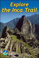
Wandelgids The Inca Trail | Rucksack Readers

0
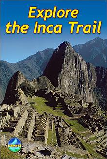
Uitgevoerd in de vorm van een klapper, met ringband geeft deze gids een goede beschrijving van de lange afstands route. De kaarten zijn schetsmatig maar wel duidelijk. This edition of our popular guidebook contains everything you need to plan and enjoy hiking a choice of three Inca Trails to Machu Picchu in Peru. Step-by-step sections cover the Cl...

Verkopers met dit product

Verkoper
Bezorging
Prijs
DeZwerver.nl logo
DeZwerver.nl
2,95
19,50

Anderen bekeken ook

Wandelgids Peru - Hiking and Biking Peru's Inca Trails | Cicerone
The eastern slope of the Peruvian Andes is one of the most dramatic and diverse places on the planet, dropping from over 6000m (20,000ft) to just 200m above sea level. This dramatic drop in elevation produces a wide range of constantly changing climactic and vegetative zones – it is often possible to hike from the base of a glacier down to the jungle in just a day or two. Combined with the countless Inca sites and ubiquitous Inca roads, this makes the Sacred Valley one of the best trekking and mountain biking destinations in the world.    Machu Picchu is well known as one of the Seven Wonders of the World, and the Inca Trail trek that leads there is nearly as famous. What is less known, however, is the vast choice of other epic adventure trips that exist in the region – treks through soaring Andean glaciers and Incan ruins, bike rides through stunning alpine and jungle scenery. Nearly every route in this book uses an Inca road or visits an Inca ruin – and most do both. The majority of…
22,95
Reisgids Machu Picchu - Peru | Moon Travel Guides
Uitstekende Amerikaanse reisgids van uitgever Moon. De gids is vergelijkbaar met Lonely Planet en Rough guide en is voor de backpacker - zelfstandige reiziger geschreven; toch is deze door de grote mate van details en achtergronden geschikt voor alle reizigers! De gids onderscheidt zich door gedegen en uitgebreide achtergrondinformatie over bijvoorbeeld natuur en cultuur. Mystical, timeless, and full of adventure: embark on the trip of a lifetime to the jewel of Peru with Moon Machu Picchu. Inside you'll find: Strategic trekking guides, including two to four days on the Inca Trail, five days on the Salcantay, and an Inca Jungle Trail itinerary, plus focused coverage of Cusco, the Sacred Valley, and Lima Unique experiences beyond the beaten path: Explore seldom-seen ruins like the Ollantaytambo Temple and visit remote Quechua-speaking villages. Go horseback riding on a caballo de paso in the Sacred Valley, mountain biking to the hilltop fortress of Sacsayhuamán, or set up camp on th…
20,95
Wandelgids The Cateran Trail | Rucksack Readers
Uitgevoerd in de vorm van een klapper, met ringband geeft deze gids een goede beschrijving van de lange afstands route. De kaarten zijn schetsmatig maar wel duidelijk. The Cateran Trail is one of Scotland’s Great Trails – a circular walk of 64 miles (104 km) starting in Blairgowrie, near Perth, following in the footsteps of cattle-rustlers (caterans). This waymarked Trail follows ancient paths through glens, mountains and farmland of Highland Perthshire, with fine scenery, heritage and wildlife. The nearest village is never more than 7 miles (11 km) away, and gradients are easy to moderate. The Trail can be completed comfortably within 4-5 days, and several route variants are described, including the option for a weekend Minitrail.   Our third edition has been fully revised in June 2024 with details of six route changes, updated mapping and many new photos. It is lighter and more pocketable than before, with perfect binding (glued and sewn).   This guidebook contains all you need to p…
24,50
Wegenkaart - landkaart Peru | Borch
Mooie geplasticieerde kaart van Peru. Deze kaart biedt een goed overzicht van het land met detailkaarten.   Our soft-laminated folded map of Peru shows: Peru North 1:1 750 000, Peru South 1:1 750 000, Amazonian Peru 1:2 500 000, Central Lima 1:18 000, Greater Lima 1:150 000, Central Cuzco 1:12 000, Greater Cuzco 1:50 000, Ayacucho 1:20 000, Arequipa 1:17 000, Chan Chan 1:40 000, Trujillo 1:20 000, Sacsayhuaman 1:10 000, Machu Picchu 1:44 000, Peru administrative & time zones. Borch Maps are easy to fold, durable and water-repellent with a wipeable surface. Borch Maps show hotels, museums, monuments, markets, public transport, top sights and points of interest, useful statistics, conversion charts for temperatures, weights and measurements, climate charts showing temperatures, sunshine hours, precipitation and humidity, overview maps, time zones, and much more...   Bordering Brazil, Bolivia, Chile, Colombia, Ecuador and the Pacific Ocean, the Republic of Peru is the cradle of the Inca …
11,50
Wandelgids Snowdonia Slate Trail | Rucksack Readers
The Snowdonia Slate Trail is a waymarked trail that runs for 83 miles from Bangor on the North Wales coast, making a circuit through the heart of Snowdonia to end at Bethesda. The trail joins up villages with a choice of welcoming accommodation. The walking is varied, ranging from easy valleys to mountain passes, from wild moorland to river gorges.   Highlights include the National Slate Museum of  Wales, stunning views of Snowdon and nearby mountains, and abandoned slate villages high in the hills. The trail also passes the Penrhyn quarry with its impressive galleries of slate crossed by the longest, fastest zip-wire in Europe.   This guidebook is in rucksack-friendly format and printed on rainproof paper.  Lavishly illustrated with 95 colour photos, it contains large-scale mapping and all you need to plan and enjoy your holiday:   14 pages with clear mapping of the route at 1: 40,000 practical information about public transport and travel section with inside knowledge on h…
22,50
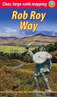
Wandelgids The Rob Roy Way | Rucksack Readers
Deze gids geeft een goede beschrijving van de lange afstands route. De kaarten zijn schetsmatig maar wel duidelijk. The Rob Roy Way is one of Scotland's Great Trails and is very popular with both walkers and cyclists. It runs through many places linked with Scotland's most famous outlaw, Rob Roy MacGregor (1671-1734). The route starts at Drymen (near Glasgow) and ends at Pitlochry in the eastern Highlands, so it takes you away from the crowds following the West Highland Way to some of Scotland's finest lochs and glens.   Its main spine runs for 79 miles (127 km) and is waymarked. There is an optional extra 17 miles if you take the wilderness extension through Glen Almond and Glen Quaich. Most walkers complete it in 6-8 days and most cyclists in 3-4 days.   The main route goes through Loch Ard forest to Aberfoyle, goes beside Lochs Venachar, Lubnaig and Tay and passes through superb scenery, with interesting aqueducts, viaducts and a 3600 year-old stone circle. The terrain is a mi…
22,50
Wandelgids The Dales Way | Rucksack Readers
This charming walk runs for 79 miles (127 km) from Ilkley in the Yorkshire Dales to Bowness in the Lake District. The route heads north through Wharfedale, crisscrossing the river, and rises over high moorland to pick up River Dee through Dentdale. It joins River Lune briefly before heading west to Bowness on Lake Windermere. The LDWA has documented Link Routes for walkers beginning in Leeds, Harrogate and Bradford.   Along the Way, you’ll see impressive railway viaducts and fine stone bridges; Bolton Priory and many small churches; limestone scenery with stone walls, hay meadows and lime kilns; and heritage centres you can visit. Above all, the route is blessed with many small villages with B&Bs and welcoming pubs at strategic intervals. Gradients are modest and most people will complete it comfortably in 6 or 7 days.   This guidebook has all you need to plan and enjoy the Dales Way:   detailed directions for the main Way walked south to north detailed directions for the Bradfor…
17,50
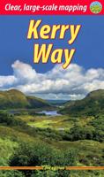
Wandelgids The Kerry Way | Rucksack Readers
Beschrijving van de Kerry Way, een bekend lange afstands pad in Ierland. Goede beschrijvingen / Engels. "An eye-catching, colourful publication with clear directions" - Irish Mountain Log   The Kerry Way runs for about 130 miles (210 km) through Ireland’s most spectacular mountain landscapes, starting and finishing in the town of Killarney. Dramatic peaks and glens, wild moorlands, lakes and windswept passes blend magnificently with extensive coastal panoramas. The complete walk takes about nine days, but it can easily be shortened. The third edition of our guidebook was fully revised in 2021 with updates to the route options and the step-by-step directions. It has customised mapping at 1:45,000, a better scale than the OSI Discovery maps, and it contains 100 colour photos, many of them new.   This book is in our lighter, more pocket-friendly format, with perfect binding instead of concealed wiro.   This guidebook contains all you need to plan and enjoy the Kerry Way:   the Way in…
22,50
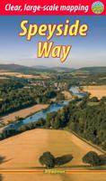
Wandelgids The Speyside Way | Rucksack Readers
Deze gids een goede beschrijving van de lange afstands route. De kaarten zijn schetsmatig maar wel duidelijk. The Speyside Way is one of Scotland’s Great Trails. It runs for 80 miles (128 km) from the fishing port of Buckie to Aviemore in the foothills of the Cairngorms. Following the lovely valley of the River Spey, you walk through countryside rich in malt whisky and wildlife, along riverside paths, railway trackbed and forest and moorland tracks.   The second edition was fully revised, with mapping from Footprint in six panels, updated plans of villages along the Way, including a fresh Grantown plan and directions from the terminus in Buckie. In 2016 we released the revised version of this essential trail guide, with fresh photos, new mapping and many other updates. These included documenting the 6.5-mile route extension to Kincraig, which opened in 2015, and 11-mile Badenoch Way.   This guidebook contains all you need to plan and enjoy the Speyside Way:   the Way step-by-step,…
22,50
Wandelgids Moray Coast Trail | Rucksack Readers
The Mary Queen of Scots Way stretches across central Scotland from coast to coast, linking many places associated with Mary Queen of Scots. It runs for 107 miles (172 km) from Arrochar on Loch Long in the west to St Andrews on the Fife coast, and links with four of Scotland’s Great Trails: the Loch Lomond & Cowal Way, the West Highland Way, the Rob Roy Way and the Fife Coastal Path. This route, however, has no official status: there is no dedicated MQS waymarking, although the guidebook gives detailed directions and parts of it are easy to follow. Some sections are unsuitable for novice walkers unless accompanied by somebody with map and compass skills.   The Way goes through richly varied scenery, starting from a rugged sea loch, crossing Loch Lomond and traversing its National Park to the hills of central Scotland, ending on a sandy beach on the Fife coast. It passes mountains, lochs and waterfalls; castles, hill forts and aqueducts; and is broken into manageable sections which end …
19,95

Klanten-reviews van Wandelgids The Inca Trail | Rucksack Readers

Er zijn nog geen beoordelingen voor dit productBen jij de eerste die een review plaatst?

Meer over Wandelgids The Inca Trail | Rucksack Readers

Productomschrijving

Uitgevoerd in de vorm van een klapper, met ringband geeft deze gids een goede beschrijving van de lange afstands route. De kaarten zijn schetsmatig maar wel duidelijk.

This edition of our popular guidebook contains everything you need to plan and enjoy hiking a choice of three Inca Trails to Machu Picchu in Peru. Step-by-step sections cover the Classic trail (4-5 days), the longer, more strenuous trek from Mollepata (6-7 days) and the Shortest option (2 days).

This guidebook contains all you need to plan and enjoy trekking the Inca Trail, including  
  • site plan of Machu Picchu ruins
  • description of Machu Picchu, with side-trips and photographs
  • background on Inca culture and stonework, and on modern Peru
  • extended section on Andean wildlife
  • advice on planning and preparation, including packing checklist
  • updated details on recent Trail regulations
  • medical advice on how to prevent and manage altitude symptoms
  • phrasebook in Spanish, Quechua and English
  • drop-down map showing three variants of the Inca Trail
  • in full colour, with 80 photographs
  • on water-resistant paper.

Productinformatie

    Verken gerelateerde categorieën

    Webshop.nl maakt gebruik van cookies. Ga je verder op onze website, ga dan akkoord met het plaatsen van cookies en de verwerking van deze data door ons en vermelde partners.