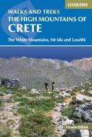
Wandelgids The high mountains of Crete - Kreta | Cicerone

0
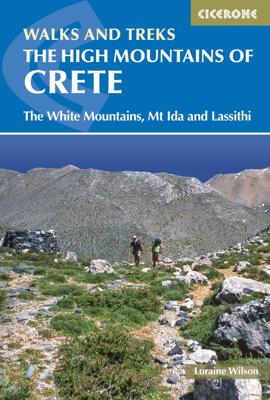
Guidebook to walking and trekking the high mountains of Crete. The largest of the Greek Islands, Crete's mountains provide breathtaking walking and wilderness to this popular island. The routes in this guidebook are graded for difficulty and range from short, easy strolls to challenging, multi-day treks and summit climbs, so there are options for ...

Verkopers met dit product

Verkoper
Bezorging
Prijs
DeZwerver.nl logo
DeZwerver.nl
2,95
26,50

Anderen bekeken ook

Wandelgids The high mountains of Crete - Kreta | Cicerone
Guidebook to walking and trekking the high mountains of Crete. The largest of the Greek Islands, Crete's mountains provide breathtaking walking and wilderness to this popular island. The routes in this guidebook are graded for difficulty and range from short, easy strolls to challenging, multi-day treks and summit climbs, so there are options for walkers of all abilities.    All the mountain ranges of Crete feature high plains, gorges and ravines, but in the heart of the Lefka Ori there is something else. High above the treeline snow thaws by July to reveal a great circle of massive barren peaks, interspersed with ‘moonscape’ outcrops, or depressions, of sinkholes in black, grey or red rock. This high desert wilderness is seldom visited but covers some 960sqkm.   In central Crete, where the island is at its widest, the huge mass of Psiloritis (Mount Ida) dominates the whole region. Covering about 560sqkm this massif is different in that a single huge, partly scree-surfaced summit ridg…
26,50
Wandelgids Crete - Kreta | Rother Bergverlag
Uitstekende wandelgids met een groot aantal dagtochten in dal en hooggebergte. Met praktische informatie en beperkt kaartmateriaal! Wandelingen in verschillende zwaarte weergegeven in rood/blauw/zwart. Crete offers an incredibly multifaceted realm for walkers. Many areas of the island are still rugged and pristine. The island’s terrain is dominated by three mighty mountain ranges, furrowed by deep gorges. Lofty mountains and a deep-blue sea are in close proximity – an ideal combination for any holiday. The finest coastal and mountain walks on Greece’s largest and most diverse island can be found in the Rother Walking Guide »Crete«. The choice ranges from a pleasant walk across foothills through vineyards and sprawling groves of olive trees all the way up to the highest panoramic summits. There are even some demanding peaks, over 2000 metres in height, to climb. Breathtaking canyons can be traversed and isolated, dripstone caves are waiting to be explored. Everywhere you look, you’ll f…
17,50
Wandelgids The Mountains of Romania - Roemenië | Cicerone
Guidebook to walks and multi-day treks in the Carpathian mountains of Romania. Includes routes in the Maramures and Bucovina regions, Piatra Craiului ridge, and the Retezat and Fagaras mountains. This guide describes 27 short treks of 2-6 days and 10 day walks in the mountains of Romania. Although there is a slight focus on Transylvania, most of the main massifs are included, with chapters covering the Mountains of Maramures, the Eastern Carpathians, the mountains around Brasov, the Fagara?, the region between the Olt and the Jiu, the Retezat, the mountains of Banat and the Apuseni. Also included is an ascent of Moldoveanu, Romania's highest peak at 2544m.   There is a wealth of advice to help you plan your trip and organise the logistics of your walk or trek. Some routes avail of the network of mountain huts; others offer opportunities to camp in attractive wild locations. Overviews and a route summary table make it easy to choose an appropriate excursion. Each route includes clear d…
26,50
Wandelgids Western Crete - Kreta west | Sunflower books
Wandelgids voor het westen van Kreta: vele dagtochten worden degelijk beschreven met openbaar vervoer informatie, goede routebeschrijvingen en kaartmateriaal. Tevens enkele autotochten. Deze gids staat goed bekend! Engelstalig, want Nederlandstalige is uitverkocht en niet meer leverbaar. Crete is a large island so we've divided it into two halves. Only the western half of the island is covered in this book. Mountains rearing straight up from the sea, deep wooded gorges, ravines and valleys and yet more glorious mountains, standing proud and acting as a magnet to the eye and the imagination that's western Crete, or real Crete, as some would say. Its strong, dramatic scenery and colours create sweeping landscapes of harsh but beautiful countryside countryside that has been the backdrop for heroic deeds, ancient civilisations and constant intrigue for thousands of years, and the home of obdurate, tough people made so by their labours on the land and their experiences. Western Crete is re…
23,50
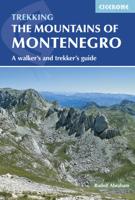
Wandelgids The Mountains of Montenegro | Cicerone
Bijzondere wandelgids van een bijzonder land in opkomst: goed beschreven, met veel informatie en details, dus zeer bruikbaar! This guidebook includes a range of day-walks and multi-day treks throughout the Dinaric Alps of Montenegro. These mountains are some of the wildest, most spectacular, and least visited in Europe. Nevertheless they are easily accessible, and many areas have well-marked trails. They present an opportunity to travel through outstandingly beautiful and remarkably unspoilt natural scenery, which sees few visitors. The guide covers the most spectacular mountain areas in Montenegro, with a selection of circular and linear routes, with variants and extensions.   The guide also includes generous background information, including mountain huts and shelters, travel to and within the country, history and language, as well as what to expect in the various mountains and National Parks the routes explore. This is the first comprehensive English-language guide to walking in th…
25,95
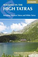
Wandelgids The High Tatras - Hoge Tatra | Cicerone
Uitstekende wandelgids van dit geweldige gebied. goed beschreven met veel praktische informatie om de route te kunnen lopen, inclusief redelijke kaarten. Guidebook detailing walks and scrambles in the High Tatras mountains of Poland and Slovakia. Varied routes among the strikingly beautiful craggy peaks of the High, Western and White Tatras range from easy to strenuous. Includes useful lists of summits as well as practical advice on accommodation and facilities, travel, mapping and language. With breathtaking scenery, some 600km of well-maintained, waymarked paths and a selection of characterful resorts, the Tatras mountains have all the elements of a perfect walking holiday. Straddling the border between Slovakia and Poland, the region boasts stunning mountain landscapes: rocky pinnacles, craggy peaks, jagged ridges and towering cliffs, mirror-surfaced tarns and dancing waterfalls.    This comprehensive guidebook contains all the information you need to plan a successful trip to the …
24,95
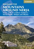
Wandelgids The Mountains Around Nerja | Cicerone
Uitstekende wandelgids van een gerenommeerde Engelse uitgever. De tochten zijn met zorg beschreven en voorzien van allerhande nuttige informatie. Aanbevolen wandelkaarten A guidebook to 32 day walks in and around the coastal town of Nerja, Spain. Exploring the mountains, gorges and white mountain villages of the Sierras Tejeda and Almijara and Alhama Natural Park in southern Andalucia, there are routes for walkers of all levels of fitness and experience.   The walks are graded by difficulty and range from 3–22km (2–14 miles) in length, covering 110–1420m of ascent and taking between 1hr 30min and 7hr 30min to complete.   Clear description of the route alongside 1:50,000 or 1:25,000 maps Highlights include ascents of La Maroma, Cisne and Navachica Packed with information on local history, geology and wildlife Each walk features detailed instructions on getting to the start, plus where to find refreshments and water sources Some routes visit sections of the 700km (430 mile) Gran Senda d…
24,95
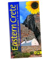
Wandelgids Eastern Crete - Kreta oost | Sunflower books
Wandelgids voor het oosten van Kreta: vele dagtochten worden degelijk beschreven met openbaar vervoer informatie, goede routebeschrijvingen en kaartmateriaal. Tevens enkele autotochten. Deze gids staat goed bekend! Engelstalig, want Nederlandstalige is uitverkocht en niet meer leverbaar. Whether you walk, drive or picnic in eastern Crete, the mountains will be your constant companions, changing colour and mood from dawn to dusk, as you move through them, round them and over them. You cannot fail to feel their dramatic attraction. The stunning colours and heady scent of flowers and herbs, tucked into rough ground or splashed across a hillside, the warm-sounding buzz of hovering bees, and the massed band of a thousand cicadas will all leave a lasting impression – the ‘special effects’ of the total scene. You may share this rural bliss only with a solitary shepherd, his flocks and dogs, as you walk the hillsides of eastern Crete. Greeks, on the whole, don’t walk — unless they have to for…
23,50
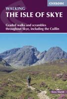
Wandelgids The Isle of Skye | Cicerone
Uitstekende wandelgids, sommige meerdaags, voor dit uitdagende wandelgebied in Schotland. This third edition of Terry Marsh’s walking and scrambling guide to Skye, the Hebrides, northwest Scotland, updated using digital mapping and GPS. 87 walks and scrambles in Sleat and South-East Skye, Strath, Minginish, Duirinish, Waternish and Trotternish for all abilities. Each route describes local historical and geological points of interest. The fame of Skye, the most scenically awe-inspiring of Scotland's many islands, is widespread; you either love it, or hate it. There is no neutrality. For walkers and climbers this is the Promised Land, a place of raw elemental forces, a land barely scratched by man. Over-riding everything hangs an indefinable, almost supernatural, charisma that evokes a deep and abiding affection among those privileged to share Skye's secrets. To go in search of those secrets there is no better way than on foot, and in this collection of walks, Terry Marsh visits all cor…
22,50
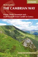
Wandelgids The Cambrian Way | Cicerone
Uitstekende wandelgids van de Cambrian Way, waarbij naast alle noodzakelijke informatie ook gebruik gemaakt wordt van de echte topografische kaart.  Dubbed 'the mountain connoisseurs' walk', the Cambrian Way stretches 479km between the mighty castles of Cardiff in the south and Conwy on the north coast. Traversing the heartland of Wales, the challenging route crosses the Brecon Beacons, the Cambrian Mountains and Snowdonia, passing through two national parks and visiting many of the country's iconic summits, including Pen y Fan, Pumlumon, Cadair Idris and Snowdon itself. It can be walked in three weeks (or in shorter sections) and is suitable for experienced hillwalkers with sound navigational skills.   The guide presents the route in 21 stages, offering comprehensive route description illustrated with OS 1:50,000 mapping and elevation profiles. Details of accommodation and facilities are provided, along with a helpful trek planner showing their distribution along the route: although …
20,95

Klanten-reviews van Wandelgids The high mountains of Crete - Kreta | Cicerone

Er zijn nog geen beoordelingen voor dit productBen jij de eerste die een review plaatst?

Meer over Wandelgids The high mountains of Crete - Kreta | Cicerone

Productomschrijving

Guidebook to walking and trekking the high mountains of Crete. The largest of the Greek Islands, Crete's mountains provide breathtaking walking and wilderness to this popular island. The routes in this guidebook are graded for difficulty and range from short, easy strolls to challenging, multi-day treks and summit climbs, so there are options for walkers of all abilities.    All the mountain ranges of Crete feature high plains, gorges and ravines, but in the heart of the Lefka Ori there is something else. High above the treeline snow thaws by July to reveal a great circle of massive barren peaks, interspersed with ‘moonscape’ outcrops, or depressions, of sinkholes in black, grey or red rock. This high desert wilderness is seldom visited but covers some 960sqkm.   In central Crete, where the island is at its widest, the huge mass of Psiloritis (Mount Ida) dominates the whole region. Covering about 560sqkm this massif is different in that a single huge, partly scree-surfaced summit ridge rises above massive cliffs on one side and a large area of lower peaks and forested foothills on the other. The summit of Mount Ida, at 2456m is the highest point in Crete. It offers several challenging linear walking routes including the high level Nida Plain.   The Lassithi Mountains cover about 780sqkm and virtually divide central Crete from the eastern end of the island. It is not only the largest of the high mountain plains but also the largest flat area in Crete. About 820m in altitude, it is oval in shape, more than 9km across west-east, and 5km north-south.   In Crete the E4 starts at Kastelli and takes in several of the less-visited archaeological sites on its journey east. Although the main trail follows the mountainous backbone of Crete, Cretan branches of the Hellenic Alpine Association have also designated good route ‘variations’ either along the coast, or as branches that lead to the main trail.   There is also lots of general information provided on walking in Crete, getting there and getting around and advice on making the most out of exploring the island's mountains. With its dramatic gorges and numerous peaks rising to over 2100m, high mountain plains, forested crags, massive cliffs and remote beaches, Crete offers a wide range of landscapes and challenges for walkers. A combination of the climate and its ancient historical sites make the Greek island of Crete a great destination to explore on foot.   walking routes range from 2 to 28km all routes are graded for difficulty: Grade A refers to short walks that are easy underfoot, to Grades D and E which are more demanding day walks on remote and rugged terrain which require good navigational and walking experience stunning photography and maps throughout  
Productinformatie

    Verken gerelateerde categorieën

    Webshop.nl maakt gebruik van cookies. Ga je verder op onze website, ga dan akkoord met het plaatsen van cookies en de verwerking van deze data door ons en vermelde partners.