webshop.nl
Categorieën
  Sluiten

Meer Pocket Mountains

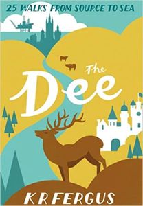
Wandelgids The Dee | Pocket Mountains

Handige compacte wandelgids met 40 dagwandelingen. Deze gids bevat kleine kaartjes en leuke uitgebreide informatie over wat er langs de route te zien is. Goede wandelkaarten zijn echter we noodzakelijk voor deze tochten: de Ordnance Survey explorer maps of Landanger maps zijn zeer geschikt.     Bounded by the highest mountains in Britain, the maje...
10,95

Webshops met dit product

Webshop
Bezorging
Prijs

Anderen bekeken ook

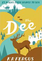
Wandelgids The Dee | Pocket Mountains
Handige compacte wandelgids met 40 dagwandelingen. Deze gids bevat kleine kaartjes en leuke uitgebreide informatie over wat er langs de route te zien is. Goede wandelkaarten zijn echter we noodzakelijk voor deze tochten: de Ordnance Survey explorer maps of Landanger maps zijn zeer geschikt.     Bounded by the highest mountains in Britain, the majestic River Dee winds its way through some of Scotland's most celebrated scenery. From its source in the shadow of Ben Macdui and Braeraich high in the Cairngorm mountains, the Dee cascades over waterfalls and meanders through the remnants of the ancient Caledonian forest before making its way to Aberdeen and the North Sea. There is no better way to discover the wildlife, architecture and history of this area of Scotland than to walk.   Whatever your ability - walking at high or low level, following tough terrain or level paths - the 25 routes in this guide offer something for everyone.
10,95
Wandelgids The Spey | Pocket Mountains
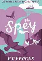
Handige compacte wandelgids met 40 dagwandelingen. Deze gids bevat kleine kaartjes en leuke uitgebreide informatie over wat er langs de route te zien is. Goede wandelkaarten zijn echter we noodzakelijk voor deze tochten: de Ordnance Survey explorer maps of Landanger maps zijn zeer geschikt.     Best known for salmon fishing and whisky production, the restless River Spey is Scotland's fastest, as well as second longest, river and passes through some of the Highland's finest scenery as it weaves its way to the sea from its source in the shadow of the Monadhliath mountains. As well as mighty mountains and ancient forest, the Spey passes the popular settlements of Kingussie, Aviemore, Grantown-on-Spey, Fochabers, Elgin and Portgordon on its jouney to the Moray Firth. There is no better way to discover the wildlife, architecture and history of this area of Scotland than to walk.   Whatever your ability walking at high or low level, following tough terrain or level paths the 25 routes in th…
10,95
Wandelgids The Tweed | Pocket Mountains
Handige compacte wandelgids met 40 dagwandelingen. Deze gids bevat kleine kaartjes en leuke uitgebreide informatie over wat er langs de route te zien is. Goede wandelkaarten zijn echter we noodzakelijk voor deze tochten: de Ordnance Survey explorer maps of Landanger maps zijn zeer geschikt.   One of the world’s great salmon rivers, the Tweed cuts through the heart of the Scottish Borders and, in part, forms the historic boundary between Scotland and England. Rising in the rolling hills near Moffat, it weaves through a cherished landscape on its way to Berwick-upon-Tweed and the North Sea, passing through the proud Border towns of Peebles, Galashiels, Melrose, Kelso and Coldstream on the way.   There is no better way to discover the wildlife, architecture and history of this area of Scotland than to walk. Whatever your ability – walking at high or low level, following tough terrain or level paths – the 25 routes in this guide offer something for everyone.   Plaatsen in het boekje Abbots…
10,95
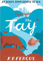
Wandelgids The Tay | Pocket Mountains
Handige compacte wandelgids met 40 dagwandelingen. Deze gids bevat kleine kaartjes en leuke uitgebreide informatie over wat er langs de route te zien is. Goede wandelkaarten zijn echter we noodzakelijk voor deze tochten: de Ordnance Survey explorer maps of Landanger maps zijn zeer geschikt.     As well as being Scotland's longest river, the Tay also carries the largest volume of water of any river in the UK more than the Thames and Severn combined when it reaches the Firth of Tay. From its source high up the slopes of Ben Lui near Tyndrum, the Tay makes its way through Stirlingshire and Perthshire to meet the North Sea near Dundee. As one of the best salmon rivers in Europe, every year it lures anglers from around the world and countless more come to explore the glorious hills and glens it passes.   There is no better way to discover the wildlife, architecture and history of this area of Scotland than to walk. Whatever your ability walking at high or low level, following tough terrain…
10,95
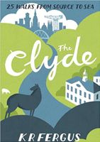
Wandelgids The Clyde | Pocket Mountains
Handige compacte wandelgids met 40 dagwandelingen. Deze gids bevat kleine kaartjes en leuke uitgebreide informatie over wat er langs de route te zien is. Goede wandelkaarten zijn echter we noodzakelijk voor deze tochten: de Ordnance Survey explorer maps of Landanger maps zijn zeer geschikt.     From source to sea, the River Clyde passes through some of southern Scotland's finest scenery. Rising in the shadow of the Lowther Hills, the country's third longest river winds through rolling Lanarkshire farmland and past historic market towns on its way to the fertile Clyde Valley and the former industrial heartlands of Scotland before it reaches the city of Glasgow and the Firth of Clyde. There is no better way to discover the wildlife, architecture and history of this area of Scotland than to walk.   Whatever your ability - walking at high or low level, following tough terrain or level paths - the 25 routes in this guide offer something for everyone.
10,95
Wandelgids The high mountains of Crete - Kreta | Cicerone
Guidebook to walking and trekking the high mountains of Crete. The largest of the Greek Islands, Crete's mountains provide breathtaking walking and wilderness to this popular island. The routes in this guidebook are graded for difficulty and range from short, easy strolls to challenging, multi-day treks and summit climbs, so there are options for walkers of all abilities.    All the mountain ranges of Crete feature high plains, gorges and ravines, but in the heart of the Lefka Ori there is something else. High above the treeline snow thaws by July to reveal a great circle of massive barren peaks, interspersed with ‘moonscape’ outcrops, or depressions, of sinkholes in black, grey or red rock. This high desert wilderness is seldom visited but covers some 960sqkm.   In central Crete, where the island is at its widest, the huge mass of Psiloritis (Mount Ida) dominates the whole region. Covering about 560sqkm this massif is different in that a single huge, partly scree-surfaced summit ridge…
26,50

Klanten-reviews van Wandelgids The Dee | Pocket Mountains

Er zijn nog geen beoordelingen voor dit productBen jij de eerste die een review plaatst?

Meer over Wandelgids The Dee | Pocket Mountains

Productomschrijving

Handige compacte wandelgids met 40 dagwandelingen. Deze gids bevat kleine kaartjes en leuke uitgebreide informatie over wat er langs de route te zien is. Goede wandelkaarten zijn echter we noodzakelijk voor deze tochten: de Ordnance Survey explorer maps of Landanger maps zijn zeer geschikt.     Bounded by the highest mountains in Britain, the majestic River Dee winds its way through some of Scotland's most celebrated scenery. From its source in the shadow of Ben Macdui and Braeraich high in the Cairngorm mountains, the Dee cascades over waterfalls and meanders through the remnants of the ancient Caledonian forest before making its way to Aberdeen and the North Sea. There is no better way to discover the wildlife, architecture and history of this area of Scotland than to walk.   Whatever your ability - walking at high or low level, following tough terrain or level paths - the 25 routes in this guide offer something for everyone.

Productspecificaties

Artikelnummer(s)
Brand
Pocket Mountains
Webshop.nl maakt gebruik van cookies. Ga je verder op onze website, ga dan akkoord met het plaatsen van cookies en de verwerking van deze data door ons en vermelde partners.