Wandelgids The Cotswold Way | Cicerone
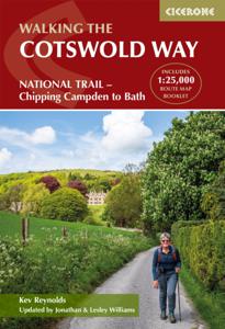
Uitstekende wandelgids van de Cotswolds Way, waarbij naast alle noodzakelijke informatie ook gebruik gemaakt wordt van de echte topografische kaart. inclusief gidsje met routekaarten van 1:25000 (deze is hier ook los te bestellen) Guidebook to walking the 102 mile (163km) Cotswold Way National Trail between Chipping Campden and Bath, across the Cotswolds AONB. The guidebook - which includes both a guide to the route and a separate OS 1:25,000 map booklet - describes the route in both directions. The route is described over 13 stages, each following the Cotswold escarpment, with dramatic and far-reaching views across the Severn Vale towards the Welsh hills, plunging down to visit honey-coloured villages, old market towns and the elegant and historic city of Bath. The longest of the 13 stages is 10 miles, the shortest 6 miles: these are dictated by the existence of overnight accommodation. For the determined, the trail can be walked in as little as five days. The Cotswold Way offers …
23,50


