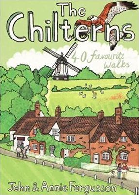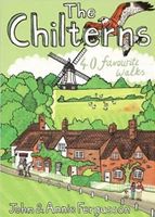
Wandelgids The Chilterns | Pocket Mountains

0
Handige compacte wandelgids met 40 dagwandelingen. Deze gids bevat kleine kaartjes en leuke uitgebreide informatie over wat er langs de route te zien is. Goede wandelkaarten zijn echter we noodzakelijk voor deze tochten: de Ordnance Survey explorer maps of Landanger maps zijn zeer geschikt.     With some of the most picturesque countryside in En...

Verkopers met dit product

Verkoper
Bezorging
Prijs
DeZwerver.nl logo
DeZwerver.nl
niet bekend
2,95
10,95

Anderen bekeken ook

Wandelgids The Chilterns | Pocket Mountains
Handige compacte wandelgids met 40 dagwandelingen. Deze gids bevat kleine kaartjes en leuke uitgebreide informatie over wat er langs de route te zien is. Goede wandelkaarten zijn echter we noodzakelijk voor deze tochten: de Ordnance Survey explorer maps of Landanger maps zijn zeer geschikt.     With some of the most picturesque countryside in England, yet only a short hop from London, the Chiltern Hills are just waiting to be explored. The glorious views from high ridges, ancient woodlands brimming with wildlife and downs alive with wild flowers and butterflies make the Chilterns and the communities within them English to the core. The vast network of well-established paths provides a wonderful walking country with history and nature keeping you company at every step.   If you are planning to get away from it all in the Chilterns, this collection of 40 moderate walks is your perfect guide.
10,95
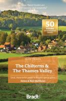
Reisgids Slow Travel The Chilterns & the Thames Valley | Bradt Travel Guides
Een bijzondere serie van Bradt guides, waarin een gedeelte van Engeland of Schotland uitgebreid beschreven wordt. Met veel aandacht voor kleine details die je niet al gauw elders zult vinden. Naast de beschrijvende informatie vind je ook een schat aan praktische informatie als accommodatie-adressen of leuke pubs. Een aanrader! This new title from Bradt forms part of its distinctive 'Slow Travel' series and is the only title available to cover the Chilterns and Thames Valley in depth. The Chilterns and the Thames Valley do not correspond to the specific boundaries of one county or region, old or new. Bedfordshire, Berkshire, Buckinghamshire, Hertfordshire and Oxfordshire all have a share.  Divided into six easily manageable sections, Bradt's The Chilterns and Thames Valley lifts the lid on what makes this area so distinctive. Chalk grasslands, beech woods, streams and wooded valleys provide a perfect landscape for walking and are easily accessible from London. About half of the area ha…
24,95
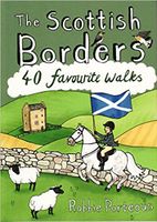
Wandelgids The Scottish Borders | Pocket Mountains
Handige compacte wandelgids met 40 dagwandelingen. Deze gids bevat kleine kaartjes en leuke uitgebreide informatie over wat er langs de route te zien is. Goede wandelkaarten zijn echter we noodzakelijk voor deze tochten: de Ordnance Survey explorer maps of Landanger maps zijn zeer geschikt.   The Scottish Borders cover a vast area, stretching from the east coast to rural Dumfriesshire and from the more populous Lothians to the border with England. Although there are no very high mountains, the Borders have always attracted walkers keen to explore the quiet moorlands, rolling hills, ancient woodland and rugged coast, as well as the romantic ruins of abbeys and castles, grand estates and rich literary heritage of the area.Ancient native tribes and Roman legions left their mark on this landscape, as did years of fierce warfare with our southern neighbours and raiding by ruthless Border Reivers. These 40 walks will introduce you to some of the fascinating history which shaped this most in…
10,95
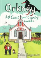
Wandelgids Orkney | Pocket Mountains
Handige compacte wandelgids met 40 dagwandelingen. Deze gids bevat kleine kaartjes en leuke uitgebreide informatie over wat er langs de route te zien is. Goede wandelkaarten zijn echter we noodzakelijk voor deze tochten: de Ordnance Survey explorer maps of Landanger maps zijn zeer geschikt.   The 40 walks in this guide range from a short stroll to hikes of several hours, but most can be completed in half a day or less. The majority are circular, several are lollipop-shaped and some require you to return by the same route. They all, however, end up back where they started, so you will not find yourself miles from your car. Each route is prefaced by an indication of the distance involved and the time it is likely to take. The latter is estimated on the time it took the author to walk the route (averaging around 3.5km per hour) before adding a little for tea, toilet and tourism stops. The timings should be regarded as a rough guide, and if you have to catch a bus or boat at the end of th…
10,95
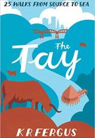
Wandelgids The Tay | Pocket Mountains
Handige compacte wandelgids met 40 dagwandelingen. Deze gids bevat kleine kaartjes en leuke uitgebreide informatie over wat er langs de route te zien is. Goede wandelkaarten zijn echter we noodzakelijk voor deze tochten: de Ordnance Survey explorer maps of Landanger maps zijn zeer geschikt.     As well as being Scotland's longest river, the Tay also carries the largest volume of water of any river in the UK more than the Thames and Severn combined when it reaches the Firth of Tay. From its source high up the slopes of Ben Lui near Tyndrum, the Tay makes its way through Stirlingshire and Perthshire to meet the North Sea near Dundee. As one of the best salmon rivers in Europe, every year it lures anglers from around the world and countless more come to explore the glorious hills and glens it passes.   There is no better way to discover the wildlife, architecture and history of this area of Scotland than to walk. Whatever your ability walking at high or low level, following tough terra…
10,95
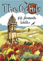
Wandelgids The Ochils | Pocket Mountains
Handige compacte wandelgids met 40 dagwandelingen. Deze gids bevat kleine kaartjes en leuke uitgebreide informatie over wat er langs de route te zien is. Goede wandelkaarten zijn echter we noodzakelijk voor deze tochten: de Ordnance Survey explorer maps of Landanger maps zijn zeer geschikt.   40 easy short walks with a very cute cartoonish style Known to the ancient people of Central Scotland as uchel – ‘the high place’ – the long upland massif of the Ochils rises between the River Forth and the Southern Highlands, with a dramatic escarpment running between the cities of Stirling and Perth. The high rounded hills are cleaved by steep-sided ravines and dotted with castles, standing stones, burial mounds, hillforts and battlesites, making the Ochils a walker’s paradise. This collection of 40 routes covers all the main summits, as well as the magnificent glens and the two rivers, the Allan and the Devon, which transect them.  
10,95
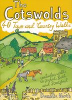
Wandelgids The Cotswolds | Pocket Mountains
Handige compacte wandelgids met 40 dagwandelingen. Deze gids bevat kleine kaartjes en leuke uitgebreide informatie over wat er langs de route te zien is. Goede wandelkaarten zijn echter we noodzakelijk voor deze tochten: de Ordnance Survey explorer maps of Landanger maps zijn zeer geschikt.   From upland outlooks and secret valleys to rolling pastures and honey stone villages, nature and history weave together in the Cotswolds to create a landscape that is the epitome of rural England. In these 40 walks Dominic North unlocks the secrets of the Cotswolds, from the hills and lanes in the north to the languid riverbanks and ancient woods of the south. Along the way discover sleepy villages, grand country houses and architectural curiosities, and then reach out to explore three of England's most celebrated cities, Bath, Oxford and Stratford-upon-Avon. Plaatsen in het boekje Bath, Bathampton, Batsford, Belas Knap, Bibury, Blenheim Park, Blockley, Bourton-on-the-Hill, Bourton-on-the-Water, …
10,95
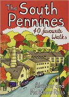
Wandelgids The South Pennines | Pocket Mountains
Handige compacte wandelgids met 40 dagwandelingen. Deze gids bevat kleine kaartjes en leuke uitgebreide informatie over wat er langs de route te zien is. Goede wandelkaarten zijn echter we noodzakelijk voor deze tochten: de Ordnance Survey explorer maps of Landanger maps zijn zeer geschikt.     The home of Heathcliffe and Nora Batty, the wild and wuthering South Pennines is where Yorkshire and Lancashire collide, a watershed landscape of great natural beauty which is home to proud and welcoming communities with a heritage of rugged farming and industrial hard graft. This collection of forty walks explores the steep-sided valleys, heather moorlands, craggy hills and gritsone villages which have inspired and attracted writers and artists for generations to this unspoilt upland haven just a stone's throw from some of northern England's largest towns and cities.  
10,95
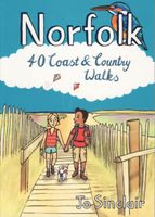
Wandelgids Norfolk | Pocket Mountains
Handige compacte wandelgids met 40 dagwandelingen. Deze gids bevat kleine kaartjes en leuke uitgebreide informatie over wat er langs de route te zien is. Goede wandelkaarten zijn echter we noodzakelijk voor deze tochten: de Ordnance Survey explorer maps of Landanger maps zijn zeer geschikt.   Pinpointing favourite treks, rambles and family trips, these 40 walks visit Norfolk in all its variety. From wild and windswept coast, Fens and Breckland to sheltered inland woods, broads and valleys, they offer geographical impact and a strong sense of history. Treading in the footsteps of warriors, drovers, pilgrims, weavers and reedcutters, this selection links to the county's extensive network of long-distance routes.   You'll find Norfolk at its most photogenic, with swallowtail butterflies and wherry boats, windpumps, seals and sailing boats, round tower churches and medieval architecture. From coast road to historic villages, towns and cities, many of the walks start near public transport.
10,95
Wandelgids Shetland | Pocket Mountains
Handige compacte wandelgids met 40 dagwandelingen. Deze gids bevat kleine kaartjes en leuke uitgebreide informatie over wat er langs de route te zien is. Goede wandelkaarten zijn echter we noodzakelijk voor deze tochten: de Ordnance Survey explorer maps of Landanger maps zijn zeer geschikt. The most northerly of Britain's island groups, Shetland is so far removed from the rest of the UK that it usually appears as an inset on maps. Although relatively little known to those from outside the islands, Shetland is a magnificent terrain for walkers, especially those who love to really explore and get away from the beaten track. The coastal walking here includes some of the finest in the country, with superb cliffs, towering sea stacks, caves and natural arches seemingly around every corner. Added to this is Shetland's better known claim to fame for its spectacular seabird colonies, huge gannetries, moorland packed with arctic and great skuas, arctic terns in the more sheltered spots, and ev…
10,95

Klanten-reviews van Wandelgids The Chilterns | Pocket Mountains

Er zijn nog geen beoordelingen voor dit productBen jij de eerste die een review plaatst?

Meer over Wandelgids The Chilterns | Pocket Mountains

Productomschrijving

Handige compacte wandelgids met 40 dagwandelingen. Deze gids bevat kleine kaartjes en leuke uitgebreide informatie over wat er langs de route te zien is. Goede wandelkaarten zijn echter we noodzakelijk voor deze tochten: de Ordnance Survey explorer maps of Landanger maps zijn zeer geschikt.     With some of the most picturesque countryside in England, yet only a short hop from London, the Chiltern Hills are just waiting to be explored. The glorious views from high ridges, ancient woodlands brimming with wildlife and downs alive with wild flowers and butterflies make the Chilterns and the communities within them English to the core. The vast network of well-established paths provides a wonderful walking country with history and nature keeping you company at every step.   If you are planning to get away from it all in the Chilterns, this collection of 40 moderate walks is your perfect guide.

Productinformatie

    Verken gerelateerde categorieën

    Webshop.nl maakt gebruik van cookies. Ga je verder op onze website, ga dan akkoord met het plaatsen van cookies en de verwerking van deze data door ons en vermelde partners.