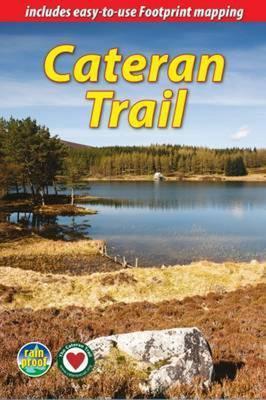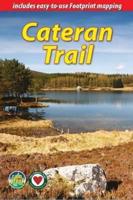
Wandelgids The Cateran Trail | Rucksack Readers

0
Uitgevoerd in de vorm van een klapper, met ringband geeft deze gids een goede beschrijving van de lange afstands route. De kaarten zijn schetsmatig maar wel duidelijk. The Cateran Trail is one of Scotland’s Great Trails – a circular walk of 64 miles (104 km) starting in Blairgowrie, near Perth, following in the footsteps of cattle-rustlers (catera...

Verkopers met dit product

Verkoper
Bezorging
Prijs
DeZwerver.nl logo
DeZwerver.nl
2,95
24,50

Anderen bekeken ook

Nieuw
Wandelgids The Inca Trail | Rucksack Readers
Uitgevoerd in de vorm van een klapper, met ringband geeft deze gids een goede beschrijving van de lange afstands route. De kaarten zijn schetsmatig maar wel duidelijk. This edition of our popular guidebook contains everything you need to plan and enjoy hiking a choice of three Inca Trails to Machu Picchu in Peru. Step-by-step sections cover the Classic trail (4-5 days), the longer, more strenuous trek from Mollepata (6-7 days) and the Shortest option (2 days). This guidebook contains all you need to plan and enjoy trekking the Inca Trail, including   site plan of Machu Picchu ruins description of Machu Picchu, with side-trips and photographs background on Inca culture and stonework, and on modern Peru extended section on Andean wildlife advice on planning and preparation, including packing checklist updated details on recent Trail regulations medical advice on how to prevent and manage altitude symptoms phrasebook in Spanish, Quechua and English drop-down map showing three va…
19,50
Nieuw
Wandelgids The Speyside Way | Rucksack Readers
Deze gids een goede beschrijving van de lange afstands route. De kaarten zijn schetsmatig maar wel duidelijk. The Speyside Way is one of Scotland’s Great Trails. It runs for 80 miles (128 km) from the fishing port of Buckie to Aviemore in the foothills of the Cairngorms. Following the lovely valley of the River Spey, you walk through countryside rich in malt whisky and wildlife, along riverside paths, railway trackbed and forest and moorland tracks.   The second edition was fully revised, with mapping from Footprint in six panels, updated plans of villages along the Way, including a fresh Grantown plan and directions from the terminus in Buckie. In 2016 we released the revised version of this essential trail guide, with fresh photos, new mapping and many other updates. These included documenting the 6.5-mile route extension to Kincraig, which opened in 2015, and 11-mile Badenoch Way.   This guidebook contains all you need to plan and enjoy the Speyside Way:   the Way step-by-step,…
22,50
Nieuw
Wandelgids Snowdonia Slate Trail | Rucksack Readers
The Snowdonia Slate Trail is a waymarked trail that runs for 83 miles from Bangor on the North Wales coast, making a circuit through the heart of Snowdonia to end at Bethesda. The trail joins up villages with a choice of welcoming accommodation. The walking is varied, ranging from easy valleys to mountain passes, from wild moorland to river gorges.   Highlights include the National Slate Museum of  Wales, stunning views of Snowdon and nearby mountains, and abandoned slate villages high in the hills. The trail also passes the Penrhyn quarry with its impressive galleries of slate crossed by the longest, fastest zip-wire in Europe.   This guidebook is in rucksack-friendly format and printed on rainproof paper.  Lavishly illustrated with 95 colour photos, it contains large-scale mapping and all you need to plan and enjoy your holiday:   14 pages with clear mapping of the route at 1: 40,000 practical information about public transport and travel section with inside knowledge on h…
22,50
Nieuw
Wandelgids The Arran Coastal Way | Rucksack Readers
The Arran Coastal Way is perhaps Scotland's finest circular long-distance trail, running 65 miles (105 km) around the Isle of Arran in a memorable week-long hike from Brodick. It's accessible from near Glasgow by the Ardrossan ferry. Famous as`Scotland in miniature', Arran is rich in scenery, castles, caves and standing stones. The walking is varied, from mountain paths to deserted beaches, from minor road-walking to boulder-hopping, and in places it is refreshingly rugged. Arran's wildlife is uniquely approachable, and its residents welcoming. Our second edition was thoroughly updated during 2017 with many route changes and extra options. This guidebook contains all you need to plan and enjoy the Arran Coastal Way, including:   detailed description of the route walked anticlockwise, updated for 2021 background on geology, pre-history and history whisky-making, wildlife and habitats boat trip to the Holy Isle Foreword by wilderness walker Cameron McNeish clear mapping of the …
22,50
Nieuw
Wandelgids The Rob Roy Way | Rucksack Readers
Deze gids geeft een goede beschrijving van de lange afstands route. De kaarten zijn schetsmatig maar wel duidelijk. The Rob Roy Way is one of Scotland's Great Trails and is very popular with both walkers and cyclists. It runs through many places linked with Scotland's most famous outlaw, Rob Roy MacGregor (1671-1734). The route starts at Drymen (near Glasgow) and ends at Pitlochry in the eastern Highlands, so it takes you away from the crowds following the West Highland Way to some of Scotland's finest lochs and glens.   Its main spine runs for 79 miles (127 km) and is waymarked. There is an optional extra 17 miles if you take the wilderness extension through Glen Almond and Glen Quaich. Most walkers complete it in 6-8 days and most cyclists in 3-4 days.   The main route goes through Loch Ard forest to Aberfoyle, goes beside Lochs Venachar, Lubnaig and Tay and passes through superb scenery, with interesting aqueducts, viaducts and a 3600 year-old stone circle. The terrain is a mi…
22,50
Wandelgids The Great Glen Way | Rucksack Readers
Uitgevoerd in de vorm van een klapper, met ringband geeft deze gids een goede beschrijving van de lange afstands route. De kaarten zijn schetsmatig maar wel duidelijk. The Great Glen Way is one of Scotland’s Great Trails and offers a superb experience for both walkers and cyclists. The Way runs for 77 miles (124 km) along Scotland’s Great Glen between Fort William and Inverness. It follows the scenic Caledonian Canal and runs beside four of the Highlands’ loveliest lochs – including Loch Ness, famous for its monster legend and for Urquhart Castle.   This new edition of our popular guidebook has been fully revised in 2019-20 after extensive fieldwork. It includes new large-scale mapping (1:38,000) with mileage markers and a kilometre grid, many updates and fresh photos, and is in our slim pocket-friendly format, still on rainproof paper.   This guidebook contains all you need to plan and enjoy the Great Glen Way – on foot or on a bike:   detailed mapping on 13 pages at 1:38,000 hi…
24,95
Nieuw
Wandelgids Land's End Circuit | Rucksack Readers
The South West Coast Path is the longest National Trail in the UK, and its full 630 miles is off-putting to most recreational walkers. This carefully selected section from St Ives to Penzance provides a superb taster experience that readily fits inside one week. Enjoy some of the UK's finest coastal scenery including around Land's End, its wild south-western extreme. This part of Cornwall is surprisingly accessible by mainline railway, and it offers plenty of charming places to stay and eat. This 72-page guidebook contains all you need to plan and enjoy the Land’s End Circuit: the route in sections, with summaries of distance, terrain and altitude gain/loss where to find food and drink, accommodation and how to split the distance concise background on the geology, history, mining and wildlife how and when to visit St Michael’s Mount planning information for travel by train, bus, car or plane 15 pages with detailed route mapping at 1:35,000 in full colour, with 100 photographs …
19,95
Nieuw
Wandelgids Cleveland Way | Rucksack Readers
“A testament to excellent research, writing and photography” - Malcolm Hodgson, Trail Manager   The Cleveland Way is one of England’s oldest and best-loved National Trails. It runs for 108 miles (174 km) around the North York Moors National Park, starting inland at Helmsley, offering panoramic views over the vales of York and Mowbray and from the Cleveland Hills. After reaching the coast at Saltburn, it heads south along the dramatic sea cliffs, with their tales of shipwrecks and smugglers, to end at Filey.   The route features ancient burial mounds, ruined castles, abbeys and Roman remains, with more recent traces of industrial history. Vast areas of heather moorland are host to a wide range of wildlife. The Cleveland Way is easily accessible by public transport and is divided into easy stages by villages of character with friendly pubs and accommodation. Above all, walkers are welcomed with warm Yorkshire hospitality.   Our new second edition has larger-scale mapping, several route …
19,95
Nieuw
Wandelgids The Kintyre Way | Rucksack Readers
Deze gids geeft een goede beschrijving van de lange afstands route. De kaarten zijn schetsmatig maar wel duidelijk. This fully waymarked trail runs for 101 miles/162 km southward from the beautiful natural harbour of Tarbert to Macrihanish, near the Mull of Kintyre. Criss-crossing the entire peninsula, you pass castles, abbeys and prehistoric remains, sometimes walking along rugged coastline, sometimes high on forestry tracks with glorious views over Arran, the Firth of Clyde and towards Ireland. You will enjoy many wildlife sightings in this peaceful area, famous as Scotland only "mainland island".   Since it opened (2006) the route has changed in places. The 2023 edition of this essential guidebook contains all you need to plan and enjoy your holiday: 11 pages with mapping showing the whole route (1:70,000); the Way step-by-step, with summaries of distance, terrain and refreshment stops; habitats and wildlife; whisky-making in Kintyre; side-trip to the island of Gigha; and planni…
23,95
Nieuw
Wandelgids - Fietsgids Hiking and Cycling the California Missions Trail - Californie | Cicerone
Guidebook to hiking or cycling the 800 mile (1289km) California Missions Trail between San Francisco Bay and San Diego. The pilgrimage trail takes in 21 historic Spanish missions and can be completed in 50-60 walking days or 2-3 weeks cycling. With 1:100,000 mapping, route description, and details of accommodation and facilities for each stage. Ancient footpaths became connecting routes between the Spanish missions, pueblos, and presidios in the period 1769 to 1823. Over time these routes became automobile roadways and were marked with bells starting in 1906 to promote and preserve the El Camino Real. Today, the California Missions Trail follows a pedestrian route through urban cities and historic towns, through forest paths and country lanes, to each of the twenty-one historic Spanish missions. The 800-mile California Missions Trail leads walkers and cyclists through some of the most scenic and historic sites of one of America's most beautiful states. The 21 missions, founded 200-250…
26,50

Klanten-reviews van Wandelgids The Cateran Trail | Rucksack Readers

Er zijn nog geen beoordelingen voor dit productBen jij de eerste die een review plaatst?

Meer over Wandelgids The Cateran Trail | Rucksack Readers

Productomschrijving

Uitgevoerd in de vorm van een klapper, met ringband geeft deze gids een goede beschrijving van de lange afstands route. De kaarten zijn schetsmatig maar wel duidelijk.

The Cateran Trail is one of Scotland’s Great Trails – a circular walk of 64 miles (104 km) starting in Blairgowrie, near Perth, following in the footsteps of cattle-rustlers (caterans). This waymarked Trail follows ancient paths through glens, mountains and farmland of Highland Perthshire, with fine scenery, heritage and wildlife. The nearest village is never more than 7 miles (11 km) away, and gradients are easy to moderate. The Trail can be completed comfortably within 4-5 days, and several route variants are described, including the option for a weekend Minitrail.   Our third edition has been fully revised in June 2024 with details of six route changes, updated mapping and many new photos. It is lighter and more pocketable than before, with perfect binding (glued and sewn).   This guidebook contains all you need to plan and enjoy the Cateran Trail:   • detailed description of each route section, updated in 2024 • Foreword by explorer and adventurer Polly Murray • concise directions for variants, including a two-day Minitrail • side-trips including Mount Blair (744 m/2440 ft) • information on transport and accommodation • background on caterans, farming and wildlife • lavishly illustrated with 96 colour photographs • 8 pages of Footprint mapping of the Cateran Trail (scale 1:50,000) • rucksack-friendly and on rainproof paper.

Verken gerelateerde categorieën

Webshop.nl maakt gebruik van cookies. Ga je verder op onze website, ga dan akkoord met het plaatsen van cookies en de verwerking van deze data door ons en vermelde partners.