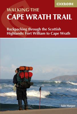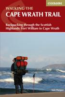
Wandelgids The Cape Wrath Trail | Cicerone

0
Uitstekende wandelgids die in etappes de route nauwkeurig beschijft.  A guidebook to the Cape Wrath Trail, a long-distance trek through the Scottish Highlands from Fort William to Cape Wrath. The Cape Wrath Trail is a 230-mile, three-week challenge through wild and magnificent landscapes, such as Morar, Knoydart, Torridon and Assynt. Crossing such...

Verkopers met dit product

Webshop
Bezorging
Prijs
DeZwerver.nl logo
DeZwerver.nl
2,95
25,95

Anderen bekeken ook

Wandelkaart Cape Wrath Trail North | Harvey Maps
Een bijzonder handige kaart van dit lange-afstands-wandelpad. Op waterafstotend papier met veel details. Het enige dat je eigenlijk een beetje mist is een overzicht. Verder uitstekend en voldoende voor de route.   XT40 - Leap forward in technical excellence. Tough, light and 100% waterproof   Compact and light - the map itself weighs just 60gms - a third of the weight of a laminated map, and much less bulky. And you can fold or refold it time and again, or stuff it in your back pocket and it won't fall to pieces. Shows the entire route on one sheet.   The Cape Wrath Trail is a challenging route from Fort William to Cape Wrath. It is around 200 miles long and passes through some of Scotland's wildest and most spectacular scenery.   This map covers the northern section of the route, from Strathcarron to Cape Wrath.   The trail has evolved from use and is not an officially recognised National Trail. There is no single definitive route. There are various ways of tackling the traverse all …
28,50
Wandelkaart Cape Wrath Trail South | Harvey Maps
Een bijzonder handige kaart van dit lange-afstands-wandelpad. Op waterafstotend papier met veel details. Het enige dat je eigenlijk een beetje mist is een overzicht. Verder uitstekend en voldoende voor de route. XT40 - Leap forward in technical excellence. Tough, light and 100% waterproof   Compact and light - the map itself weighs just 60gms - a third of the weight of a laminated map, and much less bulky. And you can fold or refold it time and again, or stuff it in your back pocket and it won't fall to pieces. Shows the entire route on one sheet.   The Cape Wrath Trail is a challenging route from Fort William to Cape Wrath. It is around 200 miles long and passes through some of Scotland's wildest and most spectacular scenery.   This map covers the southern section of the route, from Fort William to Strathcarron.   The trail has evolved from use and is not an officially recognised National Trail. There is no single definitive route. There are various ways of tackling the traverse all …
28,50
Wandelgids Great Scottish Walks | Vertebrate Publishing
Great Scottish Walks by Helen and Paul Webster, founders of Walkhighlands, is a comprehensive guide to the 26 best long-distance hiking trails in Scotland. Whether you're keen to experience classic trails such as the West Highland Way, discover more accessible trails like the Forth & Clyde Union Canal Towpath in the Central Belt or yearn for the remote wilderness of walks like the Cape Wrath Trail and Skye Trail, this book offers inspiration for long-distance walkers of all experience levels who want to challenge themselves on Scotland's greatest trails (and even those who wish to tackle the trails as day walks or in shorter sections). The walks are illustrated with stunning photography, showcasing the incredibly varied Scottish mainland and island landscapes that you can discover, from the remote mountains and glens, coastal sea stacks and beaches, to the lush farmland and canals of the lowlands.   There are countless towns, villages and historical sites that you'll want to stop and …
27,95
Wandelgids Via Egnatia on Foot 2 | Via Egnatia Foundation
Via Egnatia on foot, Part 2, covers a distance of more than 550 kilometers. The book starts just as our first book with practical tips for travellers (chapter 1) and a description of the history of the Via Egnatia (chapter 2). In chapter 3 all relevant aspects of the trail are described in a general way. For instance conditions of the road, description of the landscape and the practical use of the maps. In chapter 4 you will find detailed information on the original Via Egnatia stages of the trail; long distances are cut up into separate walking sections. Each stage/section provides a description and a map of the track, interesting historical and cultural facts and monuments, illustrated with beautiful pictures. At the end we present the traveller two options to enter Turkey: one leads you to Edirne, the other one crosses the border to Ipsala.   In general this trail is not difficult for walkers, although after heavy rain it may be less easy and circumstances may differ considerably, …
22,95
Wandelgids St. Paul Trail | Kate Clow
De St Paul Trail is een nieuw bewegwijzerd pad in Turkije. Zoals het eerste GR-pad in Turkije, de Lycian Way, is ook dit pad vooral de creatie van de onvermoeibare Kate Clow, een engelse vrouw die al meer dan 15 jaar in Turkije woont. De afstand bedraagt ruwweg 600 km en het pad is volledig gemarkeerd vanaf 2003 en beschreven. Bovendien wordt alles “op de voet” gevolgd en begeleid met een uitstekende website. Erg uitgebreid gaat het boek in op de geschiedenis en exploratie van een aantal archeologische plaatsen die je op de tocht passeert. Hierdoor is het boek ook bruikbaar voor zij die niet zo geïnteresseerd zijn in wandelen maar wel in afgelegen en eerder onbekende vergane steden uit de klassieke periode. Het boek staat bol van praktische info en tips verzameld door jaren te wandelen in dit gebied. The landscape of Turkey's Toros mountains and lake district contrasts and combines inA brand new edition of the St Paul Trail guidebook, following the saint's journey from Perge, near Ant…
25,95
Wandelgids Canadian Rockies Trail Guide | Summerthought
The best loved and most detailed Canadian Rockies hiking guidebook is now in full color.   First published in 1971 and now in its 10th edition, the Canadian Rockies Trail Guide was the original guidebook with accurate distances and detailed descriptions to the trails of the Canadian Rockies.   Whether you’re a Canadian Rockies local or a visitor, the Canadian Rockies Trail Guide provides the best resource for hiking in the region, with everything from short interpretive trails to week-long backcountry treks. Now in its 10th edition and known affectionately as the “Bible” by outdoor enthusiasts, the popular tome is the most comprehensive and well-known guidebook to hiking in the region.   Having spent their entire adult lives hiking in the Canadian Rockies and writing about their experiences, authors Brian Patton and Bart Robinson are regarded as the ultimate authority on hiking in the Canadian Rockies. The Canadian Rockies Trail Guide is the only hiking guide to the region recommended…
29,95
Wandelgids GR221 Mallorca's Long Distance Trail | Discovery Walking Guides
Gedetailleerde beschrijving van de GR 221 op Mallorca, met veel praktische informatie, hoogteprofielen, goed kaartmateriaal etc. Achterin ook nog eens veel GPS - waypoints. Bijna onmisbaar bij het lopen van de route! Walk! GR221 Mallorca's Long Distance Trail - The Dry Stone Way. If you want to get away from it all , there is no surer way than strapping on your boots, shouldering your backpack, and embarking on a long distance path; and there are few long distance paths more beguiling and more crammed with adventure than Mallorca s GR221, La Ruta de Pedra en Sec or The Dry Stone Way. Anybody who has visited Mallorca will appreciate the justice of the GR221's title. Following ancient bridleways along the length of the Tramuntana range, from Port d'Andratx in the southwest to Pollenca in the northeast, the GR221 touches on dry stone in its every manifestation, from the raw rock of the peaks and sweeping fields of karst to the tailored stones that have always been the island's building m…
18,50
Fietskaart Reivers Cycle Routes | Northern Heritage Services
The long-distance Reivers Cycle Routes are two intertwining signed / waymarked bi-directional ‘coast to coast’ cycle routes between the North Sea and the Irish Sea.   The original Reivers Cycle Route was created in 1998 eventually becoming NCN Route 10 with interlinking on-road and off-road sections but this soon morphed into a one-size-fits-all route which never worked well. The regenerated re-launched Reivers Cycle Routes are two intertwining route options – one which is as much off-road as possible suitable for gravel and cross bikes, hybrids and mountain bikes and a version designed for capable road cyclists 100% on tarmac.   The routes are bi-directional and continuously reward the rider with beautiful views of the constantly changing terrain, provide many places of interest to pass by or call in and many lovely villages and quiet hamlets to cycle through or stay the night. Most importantly, there is a supply of excellent on route or close-to-route refreshments stops.   The off-r…
16,50
Wandelgids Thames Path | Trailblazer Guides
This book follows the Thames Path National Trail from the river's source in Gloucestershire to the Thames Barrier in London. Officially 184 miles (294km) in length (although the actual distance you walk will depend on a number of decisions you make en route), the path meanders, accompanied by its watery muse, through pristine and tranquil countryside, past historic sites and buildings, via pub, lock, weir, and the occasional scattering of waterfowl, to a city, once the fulcrum of an empire, and now the heart of modern day England. The river, responsible for the metropolis' very being, tells tales, inspires artists, accommodates swans, geese, and water voles, reflects the silhouettes of red kites and kingfishers, provides employment, entices adventure, and allows time for carefree pilgrims to procrastinate and think. Following its banks is a grand way to go for a ramble. The path begins, as the river does, in a meadow in the Cotswolds; its upper reaches lonely and wild, the meadows and…
19,95
Wandelgids 9 The South West Coast Path National Trail Guide | Aurum Press
Goede beschrijving van een deel van het beroemde South West Coast path in Cornwall. Men heeft gebruik gemaakt van zeer gedetailleerde kaarten van Ordnance Survey. Part two of the official four-part series covering Britain's longest National Trail in detail. Contains easy to follow Ordnance Survey mapping for individual sections, detailed route descriptions for the National Trail and shorter, circular walks off it. Full colour throughout. The South West Coast Path is the spectacular 630-mile (1008 km) National Trail around the tip of Britain. This volume features the section of the Path from Padstow to Falmouth, a distance of 169 miles (271 km). Following Natural England's acorn waymarks, the route hugs the coast right around Land's End and the Lizard, via the ports of St Ives and Penzance, This is the complete, official guide for the long-distance walker or the weekend stroller. National Trail Guides are the official guidebooks to the fifteen National Trails in England and Wales and a…
20,95

Klanten-reviews van Wandelgids The Cape Wrath Trail | Cicerone

Er zijn nog geen beoordelingen voor dit productBen jij de eerste die een review plaatst?

Meer over Wandelgids The Cape Wrath Trail | Cicerone

Productomschrijving

Uitstekende wandelgids die in etappes de route nauwkeurig beschijft. 

A guidebook to the Cape Wrath Trail, a long-distance trek through the Scottish Highlands from Fort William to Cape Wrath. The Cape Wrath Trail is a 230-mile, three-week challenge through wild and magnificent landscapes, such as Morar, Knoydart, Torridon and Assynt. Crossing such empty country, it is for the experienced backpacker only.

Activities Long-distance walking and backpacking   Seasons April, May and June are ideal months to walk the trail. September and October are also good, but there may be diversions due to deer stalking and military operations at the cape. In July and August the days are superbly long and the weather can be fine, but midges will be in full flight. The limited accommodation along the trail may also be booked up at this time of year   Centres Fort William, Glenfinnan, Barisdale, Kinloch Hourn, Shiel Bridge, Strathcarron, Kinlochewe, Dundonnell, Ullapool, Bridge of Orchy, Inchnadamph, Kylesku, Rhiconich, Kinlochbervie, Durness   Difficulty The Cape Wrath Trail is regarded as the toughest long distance backpacking trail in Britain. It crosses remote, sparsely populated, potentially dangerous mountain country. There are no pack carrying services and often no clear paths. Limited re-supply points require self sufficiency for many days together. Not a route for beginners or those unfamiliar with remote, rugged mountain areas   Must See Glenfinnan monument and viaduct, the gloriously remote rough bounds of Knoydart, Barisdale, Forcan ridge, Falls of Glomach, Beinn Eighe, Lochan Fada, Shenavall, An Teallach, Glen Douchary, Glen Oykel, Ben More, Glencoul, Arkle, Foinaven, Sandwood Bay, Cape Wrath lighthouse
Webshop.nl maakt gebruik van cookies. Ga je verder op onze website, ga dan akkoord met het plaatsen van cookies en de verwerking van deze data door ons en vermelde partners.