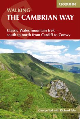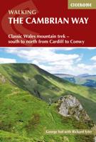
Wandelgids The Cambrian Way | Cicerone

0
Uitstekende wandelgids van de Cambrian Way, waarbij naast alle noodzakelijke informatie ook gebruik gemaakt wordt van de echte topografische kaart.  Dubbed 'the mountain connoisseurs' walk', the Cambrian Way stretches 479km between the mighty castles of Cardiff in the south and Conwy on the north coast. Traversing the heartland of Wales, the chall...

Verkopers met dit product

Verkoper
Bezorging
Prijs
DeZwerver.nl logo
DeZwerver.nl
2,95
20,95

Anderen bekeken ook

Nieuw
Wandelkaart Cambrian Way North XT40 | Harvey Maps
The first dedicated maps for "The Mountain Connoisseur's Walk"   The Cambrian Way is a challenging mountain trail that runs from Cardiff Castle in South Wales to Conwy Castle in North Wales.   This map is Cambrian Way North - it covers the route from Devil's Bridge to Conwy.   The entire route is 479km (298 miles) long and has nearly 24,000 metres of elevation - the route goes over many of Wales' major mountains and takes in some of the country's finest scenery, traversing both Bannau Brycheiniog (Brecon Beacons) and Eryri (Snowdonia) National Parks.   The route takes approximately 3 weeks to walk and is covered on 2 separate waterproof maps - Cambrian Way South (Cardiff to Devil's Bridge) and Cambrian Way North (Devil's bridge to Conwy).   As this is often a remote route, a map and compass are essential for the long, un-waymarked stretches of exposed and unspoiled wilderness. If you like peace and quiet then this is the walk for you! Tough, light, durable and 100% waterproof Includ…
29,95
Wandelkaart Cumbria Way South XT40 | Harvey Maps
The first dedicated maps for "The Mountain Connoisseur's Walk"   The Cambrian Way is a challenging mountain trail that runs from Cardiff Castle in South Wales to Conwy Castle in North Wales.   This map is Cambrian Way South - it covers the route from Cardiff to Devil's Bridge.   The entire route is 479km (298 miles) long and has nearly 24,000 metres of elevation - the route goes over many of Wales' major mountains and takes in some of the country's finest scenery, traversing both Bannau Brycheiniog (Brecon Beacons) and Eryri (Snowdonia) National Parks.   The route takes approximately 3 weeks to walk and is covered on 2 separate waterproof maps - Cambrian Way South (Cardiff to Devil's Bridge) and Cambrian Way North (Devil's bridge to Conwy).   As this is often a remote route, a map and compass are essential for the long, un-waymarked stretches of exposed and unspoiled wilderness. If you like peace and quiet then this is the walk for you!   Tough, light, durable and 100% waterproof In…
29,95
Nieuw
Wandelgids The Reivers Way - Walking Through Historic Northumberland | Cicerone
A guide to walking The Reivers Way, through Northumberland, northern England, from Corbridge to Alnmouth for 150 miles (240km) through the wildest parts of Northumberland - the North Pennines, Hadrian’s Wall, Tynedale, Redesdale, the Simonside Hills, Coquetdale and the Cheviot Hills. Includes a national park, AONBs and a fine heritage coast. Activities walking, backpacking, trekking, bird-watching (Farne Islands)Seasons spring can be the most attractive time; in summer accommodation needs to be booked ahead but ferries will be running to the Farne Islands; weather is less reliable in the autumn; in winter some accommodation providers will be closed and walking may be harder (in deep snow or after prolonged rain)Centres Newcastle-upon-Tyne, Corbridge, Rothbury, Bamburgh, Alnwick, AlnmouthDifficulty walking is straightforward but sometimes remote and not specifically waymarked so navigation skills are required; terrain is varied; the route is described in 9 day stages but experienced lo…
15,50
Wandelgids Portugal's Rota Vicentina | Cicerone
This guidebook follows the Rota Vicentina, a 224km walking route along the marvellous Atlantic coastline in the Alentejo and Algarve regions of Portugal. The 12-stage trek combines two well-marked routes, the Caminho Histórico (the Historical Way) and the Trilho dos Pescadores (the Fishermen's Trail), to create a hike starting in Santiago do Cacém and ending at Cabo de São Vicente. The guide also describes an alternative circular route for those who would prefer an 11-stage loop, moving inland from Odeceixe and back up to Santiago de Cacém. Whichever route is chosen, the Rota Vicentina is ideal for a two-week holiday in spring or late summer to autumn, offering walkers a remarkable range of landscapes from coastal fishing villages to wooded river valleys. The guidebook includes advice about accommodation options along the route, information about the surrounding area, and a glossary of Portuguese terms to aid with reading signs and maps. Along the Rota Vicentina are many delights fo…
24,95
Nieuw
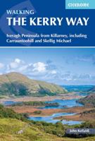
Wandelgids the Kerry Way | Cicerone
A guidebook to walking Ireland’s Kerry Way. Covering 190km (117 miles), this circular route from Killarney takes around 10 days to hike and is suitable for walkers of most abilities.   The route is described anti-clockwise in 10 stages of between 13 and 25km (8–16 miles). Also included are a number of side-trips in the area, including an ascent of Carrauntoohil (Ireland’s highest mountain), the Cnoc na dTobar pilgrim’s path and a marine landing on UNESCO-listed Skellig Michael.   1:50,000 maps included for each stage Handy route summary tables and accommodation listings help you plan your itinerary Refreshment and accommodation information given for each trek stage Advice on planning and preparation GPX files available to download
25,95
Nieuw
Wandelgids The Peddars Way and Norfolk Coast Path | Cicerone
Uitstekende wandelgids van de Peddars Way en de Norfolk Coast Path, waarbij naast alle noodzakelijke informatie ook gebruik gemaakt wordt van de echte topografische kaart. The Peddars Way and Norfolk Coast Path National Trail is an easy-to-follow 130-mile trail that combines the best of inland and coastal walking in Norfolk, and one that, being well waymarked, largely flat and within easy reach of public transport for most of its length, is ideal for people new to long-distance walks.   Described here in 11 stages, the route can be walked in just over a week but also easily split into day walks or over a series of weekends, with full information about access to start and finish points for each stage by public transport. This handy guidebook is illustrated throughout with extracts of OS 1:50,000 mapping and stunning photographs depicting the Trail in all seasons and describes points of interest along the way, including the Nofolk Songlines sculptures, and also facilities available in t…
18,50
Nieuw
Wandelgids Snowdonia: North - Low-level and easy walks | Cicerone
This guidebook describes 30 low level and easy walks that are suitable for all abilities. The hikes covered are in the northern part of Snowdonia National Park, close to Conwy, Betws-y-Coed, Llanberis and Porthmadog. Most of the walks take around two hours, with others ranging from two to six hours.   Each walk has an accompanying Ordnance Survey 1:25,000 or 1:50,000 map showing the route, easy to follow route descriptions and information on distance, time, ascent, refreshments and where to park. The guide also includes more general advice on walking in the area, historical and flora & fauna information, and facts about all the points of interest seen on each walk.   In this part of Wales, neolithic settlements and Roman ruins stand beside the medieval castles of Welsh Princesses and the modern remnants of the mining industry. Myths and legends abound, and many walks relate to the stories of King Arthur and Merlin, Anfanc and Welsh fairies   Steden en Dorpen Conwy, Betws-y-Coed, Llanb…
13,95
Nieuw
Wandelgids St Oswald's Way and Northumberland Coast Path | Cicerone
This guidebook describes the St Oswald's Way and Northumberland Coast Paths, both long-distance trails through Northumberland. St Oswald's Way (156km, 97 miles) begins in Heavenfield and traverses parts of Northumberland National Park and visits Hadrian's Wall, the Simonside Hills and the beautiful Coquet Valley, before continuing up the coast to Lindisfarne (Holy Island). The Northumberland Coast Path (100km, 62 miles) takes in the whole of the Northumberland Coast AONB with its breathtaking coastal scenery and birdlife.   Both trails converge on Holy Island, with the Coast Path continuing up to Berwick-upon-Tweed. Each trail can be walked in a week. The guide includes practical advice on when to go and what to take, and information on the region, its weather, wildlife, history and heritage.   Detailed route descriptions and clear, step-by-step instructions are accompanied by 1:50K OS mapping. Public transport options and accommodation listings are also given. Described as the cradle…
23,95
Nieuw
Wandelgids The Ridgeway | Cicerone
Uitstekende wandelgids van de Ridgeway, waarbij naast alle noodzakelijke informatie ook gebruik gemaakt wordt van de echte topografische kaart. Inclusief gidsje met routekaarten van 1:25000   This guidebook - which includes both a guide to the route and a separate OS map booklet - describes the Ridgeway National Trail, an 87 mile (139km) route through southern England from Avebury in Wiltshire to Ivinghoe Beacon in Buckinghamshire. Typically walked in 6 or 8 days, this is a low-level waymarked route suitable for all abilities and for year round walking.   The guidebook details the trail in both directions, west to east and east to west. Step-by-step route descriptions are accompanied by 1:100,000 OS mapping and a separate OS 1:25,000 map booklet showing the entire route is included. Packed with details on points of interest and a trek planner giving at-a-glance information about facilities, public transport and accommodation available along the way, this book is an indispensable guide…
23,95
Nieuw
Wandelgids Walking in the Auvergne | Cicerone
Uitgebreide wandelgids van de Auvergne: goede beschrijvingen, veel keuze, kaarten wat minder goed. This handy guidebook offers the finest day walks in five different areas of the Auvergne, an often-forgotten region in central France perfect for accessible day walking in a unique and spectacular landscape. Towns such as Vichy, Clermont-Ferrand and Puy-en-Velay also offer delightful places to base yourself for that perfect walking holiday. The ridges, rocky peaks and verdant valleys of the Cantal supervolcano dominate south-western Auvergne. The centre of the region hosts the unique chain of 'puys' with their pudding bowl forms and the pristine crater lakes of the Sancy massif. In the north, the Montagne Bourbonnaise preserves a pastoral way of life which is quintessentially French while the Haute Loire's rivers and medieval abbeys reward those venturing further off the beaten track. Notes on the geology and history of points of interest passed en route help you to get the most out of y…
19,95

Klanten-reviews van Wandelgids The Cambrian Way | Cicerone

Er zijn nog geen beoordelingen voor dit productBen jij de eerste die een review plaatst?

Meer over Wandelgids The Cambrian Way | Cicerone

Productomschrijving

Uitstekende wandelgids van de Cambrian Way, waarbij naast alle noodzakelijke informatie ook gebruik gemaakt wordt van de echte topografische kaart. 

Dubbed 'the mountain connoisseurs' walk', the Cambrian Way stretches 479km between the mighty castles of Cardiff in the south and Conwy on the north coast. Traversing the heartland of Wales, the challenging route crosses the Brecon Beacons, the Cambrian Mountains and Snowdonia, passing through two national parks and visiting many of the country's iconic summits, including Pen y Fan, Pumlumon, Cadair Idris and Snowdon itself. It can be walked in three weeks (or in shorter sections) and is suitable for experienced hillwalkers with sound navigational skills.   The guide presents the route in 21 stages, offering comprehensive route description illustrated with OS 1:50,000 mapping and elevation profiles. Details of accommodation and facilities are provided, along with a helpful trek planner showing their distribution along the route: although the trail passes through remote areas, it is possible to stay under a roof every night – though camping is also a possibility, should you prefer. There are background notes on Wales's history and geology and local points of interest, and a glossary of Welsh place-names, useful contacts and accommodation listings can be found in the appendices.   From the Black Mountains to the Rhinogs, Glyderau and Carneddau, the route takes in lofty ridges, striking peaks and picturesque lakes. There are also fascinating glimpses into the country's ancient and more recent past: Iron Age hillforts, Norman castles, a Cistercian abbey, the Chartist Cave and relics from the mining industry. Offering superlative scenery, the Cambrian Way is a celebration of some of the best mountain walking Wales has to offer and promises a unique opportunity to immerse yourself in these celebrated landscapes.   Steden en Dorpen Cardiff, Pontypool, Abergavenny, Crickhowell, Llandovery, Strata Florida, Devil's Bridge, Ponterwyd, Dinas Mawddwy, Barmouth, Beddgelert, Pen-y-Pass, Ogwen, Conwy

Verken gerelateerde categorieën

Webshop.nl maakt gebruik van cookies. Ga je verder op onze website, ga dan akkoord met het plaatsen van cookies en de verwerking van deze data door ons en vermelde partners.