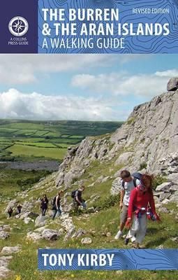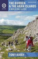
Wandelgids The Burren & the Aran Islands | The Collins Press

0
Duidelijke wandelgids van dit specifieke deel van Ierland. Goede praktische informatie en zeker voor de GPS wandelaar handig met vermelde waypoints. Kaarten zijn schetsmatig, maar er wordt verwezen naar de benodigde topografische kaarten van Ierland.  The Burren and the Aran Islands, with their unique combination of flora, fauna and landscape, are...

Verkopers met dit product

Verkoper
Bezorging
Prijs
DeZwerver.nl logo
DeZwerver.nl
2,95
22,50

Anderen bekeken ook

Wandelgids The Burren & the Aran Islands | The Collins Press
Duidelijke wandelgids van dit specifieke deel van Ierland. Goede praktische informatie en zeker voor de GPS wandelaar handig met vermelde waypoints. Kaarten zijn schetsmatig, maar er wordt verwezen naar de benodigde topografische kaarten van Ierland.  The Burren and the Aran Islands, with their unique combination of flora, fauna and landscape, are explored by large numbers of walkers annually. This is a revised guide to some of the best walking routes in the region, with lucid descriptions and additional information to enhance the walkers' enjoyment and appreciation of the place. From the rugged interior to spectacular coastal scenery, from challenging upland walks to shorter road and waterside excursions, this selection has something for everyone. Every part of the region is covered. Walks vary from two-hour strolls to the longer Burren Way, a six-hour walk from Lisdoonvarna to Ballyvaughan.   The author has put his considerable experience and detailed knowledge of the area to great …
22,50
Wandelgids Killarney to Valentia Island - The Iveragh Peninsula | The Collins Press
Duidelijke wandelgids van dit specifieke deel van Ierland. Goede praktische informatie en zeker voor de GPS wandelaar handig met vermelde waypoints. Kaarten zijn schetsmatig, maar er wordt verwezen naar de benodigde topografische kaarten van Ierland.  The Iveragh Peninsula, the largest in southwest Ireland, stretches from Killarney to Bolus Head and attracts thousands of visitors annually. The Ring of Kerry coastal road winds along its fringes and sandstone peaks soar high above. It is a landscape of raw and stunning beauty from the lakes that fill the corries to the spectacular cliff scenery along its coast. There is no better way to explore this landscape than on foot. This book helps you do just that with routes ranging from a few hours to full-day walks. Explore Valentia Island, the majestic MacGillycuddy’s Reeks and sections of The Kerry Way. Go off the beaten track and explore the coast, hills and woodlands from Killarney to Cahersiveen to Kenmare. Each route is prefaced with a …
22,50
Wandelgids Dublin & Wicklow | The Collins Press
Duidelijke wandelgids van dit specifieke deel van Ierland. Goede praktische informatie en zeker voor de GPS wandelaar handig met vermelde waypoints. Kaarten zijn schetsmatig, maar er wordt verwezen naar de benodigde topografische kaarten van Ierland.  This guidebook describes the best walking routes in Dublin and Wicklow. From mountain landscape to scenic coastal paths, from woodland trails to challenging hill-walks, there are routes here for everyone. Trips vary from two-hour strolls to eight-hour treks, and are illustrated with sketch maps and colour photographs. This is an area of great scenic variety with countless hidden gems to discover - sheer cliffs, dramatic corries, secluded lakes and charming forests. As well as inspiring you to visit the region's natural attractions, the guide provides a host of practical and background information. Each route is prefaced with a quick-reference summary, and descriptions include detailed access notes and navigational guidance. Points of int…
22,50
Wandelgids The Comeragh, Galtee, Knockmealdown & Slieve Bloom Mountains | The Collins Press
The Comeragh, Galtee, Knockmealdown & Slieve Bloom Mountains : A Walking Guide John G. O’Dwyer’s comprehensive guide to the best walks in Tipperary and Waterford has now been updated and expanded to include Laois and Offaly. From the rugged Comeragh coums to the stately peaks of the Galtees, and from myth-laden Slievenamon to the sequestered glens of the popular Slieve Bloom Mountains, there are walks to suit all tastes in these uplands. The most captivating outings the region has to offer are shared here, along with all the necessary practical information such as maps, directions, the degree of difficulty and estimated duration.    But this is more than just a walking guide. Each route gets beneath the skin of this ancient landscape littered with historic artifacts. A booley on a hillside tells how the uplands contributed to human survival; a working farmstead demonstrates the continuation of this tradition; a ruined cottage confirms a battle lost. This guidebook will appeal to commi…
22,50
Wandelgids Donegal, Sligo & Leitrim | The Collins Press
The northwest of Ireland provides a diversity of walks, from the wild, untamed landscape of Donegal to the gentler hills and green valleys of Sligo and Leitrim. This guidebook describes 30 walks of various difficulties, accompanied by quality photographs The northwest of Ireland provides a diversity of walks, from the wild, untamed landscape of Donegal, with its mountains, sea-cliffs and glens, to the gentler hills, green valleys and picturesque escarpments of Sligo and Leitrim. This guidebook describes 30 walks of various grades in this fascinating part of Ireland that has inspired poets, and is rich in folklore and history. Quality photographs and specially-drawn maps will inspire one to get the walking boots on and start exploring this majestic landscape. Since most routes are not signposted or way-marked, an up-to-date guidebook is essential. Walk descriptions also include material on the natural history, folklore, geology and place-names of the area.
22,50
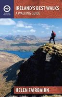
Wandelgids Ireland's Best Walks | The Collins Press
Duidelijke wandelgids van Ierland:  Goede praktische informatie en zeker voor de GPS wandelaar handig met vermelde waypoints. Kaarten zijn schetsmatig, maar er wordt verwezen naar de benodigde topografische kaarten van Ierland.  In a country richly endowed with wild mountain ranges, secluded valleys and untamed coastlines, the best natural landscapes can only be explored on foot. Here are over sixty of the greatest one-day walking routes in Ireland, varying from short strolls to full-day treks. Every part of the Republic and Northern Ireland is featured. From rugged peaks and chiselled ridge lines to towering sea cliffs and sheltered loughs, these routes take you past all the country’s finest scenery. Many of the routes are hill-walks, with clear descriptions of the country’s classic mountain ascents. Even seasoned hillwalkers will find challenging outings.   Each walk is illustrated with sketch maps and colour photos and is prefaced with a quick-reference summary and access notes. Ro…
22,50
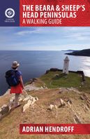
Wandelgids The Beara & Sheep´s Head Peninsulas | The Collins Press
Duidelijke wandelgids van dit specifieke deel van Ierland. Goede praktische informatie en zeker voor de GPS wandelaar handig met vermelde waypoints. Kaarten zijn schetsmatig, maar er wordt verwezen naar de benodigde topografische kaarten van Ierland.  The Beara and Sheep’s Head Peninsulas lie in the southwest of Ireland, pointed fingers of land wedged between the Kenmare River, Bantry Bay and Dunmanus Bay. They are peaceful, unspoiled peninsulas where the wild and largely untamed nature of the landscape immediately casts its magical spell. There is no better way to explore and experience this stunning landscape than on foot.   This guidebook describes some of the best walking routes in the area: from Dursey Island and Bear Island to the Caha and Shehy Mountains, from the forest trails of Glengarriff to the lakes of Glaninchiquin,and from the tip of the Sheep’s Head to the ridges of Peakeen and Seefin. The routes range from short hikes to longer treks, coastal and inland, something to …
22,50
Wandelgids Ireland's Wild Atlantic Way | The Collins Press
Duidelijke wandelgids van dit specifieke deel van Ierland. Goede praktische informatie en zeker voor de GPS wandelaar handig met vermelde waypoints. Kaarten zijn schetsmatig, maar er wordt verwezen naar de benodigde topografische kaarten van Ierland.  The Wild Atlantic Way follows the magnificent west coast of Ireland, passing golden beaches, thrusting headlands and soaring sea cliffs. Renowned walking-guide author Helen Fairbairn explores the best walking routes of the region, recommending trips to uninhabited islands, coastal mountains and much more. Routes vary from two to six hours, and are illustrated with colour photos and detailed maps. Whatever your level of expertise, this comprehensive guide is all you need to discover the real wonders of the Wild Atlantic Way.
22,50

Klanten-reviews van Wandelgids The Burren & the Aran Islands | The Collins Press

Er zijn nog geen beoordelingen voor dit productBen jij de eerste die een review plaatst?

Meer over Wandelgids The Burren & the Aran Islands | The Collins Press

Productomschrijving

Duidelijke wandelgids van dit specifieke deel van Ierland. Goede praktische informatie en zeker voor de GPS wandelaar handig met vermelde waypoints. Kaarten zijn schetsmatig, maar er wordt verwezen naar de benodigde topografische kaarten van Ierland. 

The Burren and the Aran Islands, with their unique combination of flora, fauna and landscape, are explored by large numbers of walkers annually. This is a revised guide to some of the best walking routes in the region, with lucid descriptions and additional information to enhance the walkers' enjoyment and appreciation of the place. From the rugged interior to spectacular coastal scenery, from challenging upland walks to shorter road and waterside excursions, this selection has something for everyone. Every part of the region is covered. Walks vary from two-hour strolls to the longer Burren Way, a six-hour walk from Lisdoonvarna to Ballyvaughan.   The author has put his considerable experience and detailed knowledge of the area to great use in putting together an easy-to-use guide that introduces the best of this region for locals and visitors alike. Each route, prefaced with a quick-reference summary, is illustrated with a clear sketch map; descriptions include detailed access information while points of interest are highlighted – geology, flora and fauna, history, archaeology and folklore.

Productinformatie

    Verken gerelateerde categorieën

    Webshop.nl maakt gebruik van cookies. Ga je verder op onze website, ga dan akkoord met het plaatsen van cookies en de verwerking van deze data door ons en vermelde partners.