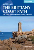
Wandelgids The Brittany Coast Path | Cicerone

0
Uitstekende wandelgids van deze mooie route. goed beschreven met veel praktische informatie om de route te kunnen lopen, inclusief redelijke kaarten This guide describes a 624km section of French long-distance route the GR34, following the north coast of Brittany from ever-popular Mont-Saint-Michel to the port of Roscoff. (The full GR34--also know...

Verkopers met dit product

Verkoper
Bezorging
Prijs
DeZwerver.nl logo
DeZwerver.nl
2,95
23,95

Anderen bekeken ook

Nieuw
Wandelgids Walking the Wales Coast Path | Cicerone
The Wales Coast Path offers an unparalleled opportunity to walk a nation's coastline in its entirety. Stretching 1400km (870 miles) from Chester to Chepstow, including Anglesey, the waymarked trail takes 2-3 months to complete but can easily be broken into shorter sections. The walking is generally not difficult, although there are occasional rugged sections, steep ascents and descents and more remote stretches with fewer facilities.   The route is presented in 57 stages, ranging from 16 to 32km, each featuring clear route description illustrated with 1:100,000 mapping, overview statistics and notes on the availability of accommodation, facilities and public transport links. You'll find plenty of helpful advice for planning your walk, plus background information on Welsh history, geology, plants, wildlife and local points of interest.   Passing through the Snowdonia and Pembrokeshire Coast National Parks, as well as numerous AONBs and sections of Heritage Coast, the Wales Coast Path t…
22,50
Nieuw
Wandelgids The South West Coast Path | Cicerone
Goede wandelgids van het langste gemarkeerde wandelpad van Groot Brittanië; 1015 km! Uit de bekende Cicerone serie, dus met mooie foto's en duidelijke routebeschrijvingen en kaartjes. The South West Coast Path is Britain's longest way-marked trail, measuring a staggering 1015km (630 miles). Written by the well-known outdoor writer, Paddy Dillon, the guide provides a wealth of detailed knowledge to help tackle this immense route with confidence. It describes the way-marked trail from Minehead to Poole along the north Devon, Cornish and south Devon coastline to finish at Poole Harbour. A full introduction provides the route's historical background, advice on accommodation along the route and details on travelling to and around the South West.There is detailed information on how to use this guide to make the most of your walk, whether you choose to walk the whole route in one go or decide to achieve sections at intervals.Day-by-day route summaries accompany the 45-day stages and the fina…
24,95
Wandelgids Wales Coast Path: Pembrokeshire | Northern Eye Books
Official Guide: Wales Coast Path: Pembrokeshire   One of seven Official Guides to the Wales Coast Path   The 186 mile/300km long Pembrokeshire section of the Wales Coast Path runs through some of Wales’ most varied and dramatic coastal scenery — high, rugged cliffs and long sandy bays, Pembroke Castle, St David’s cathedral and St Govan’s remote cliff-wrapped chapel, with several large offshore islands. Pembrokeshire is also Britain’s only coastal National Park.   This Official Guide splits the route into 14 convenient day sections, each of about 10-17 miles / 16-27 kilometres. It contains everything local and long-distance walkers need to enjoy the path and includes:   An overview of Pembrokeshire with dedicated history and wildlife sections Fourteen day-walk sections with detailed route descriptions and full, enhanced Ordnance Survey mapping Distance charts, section overviews, background information and interpretation of places of interest Stunning professional photographs throughout…
22,50
Nieuw
Wandelgids Wales: The Ceredigion and Snowdonia Coast Paths | Cicerone
As part of the Wales Coast Path, the Ceredigion Coast Path and Snowdonia Coast Path trace a curve of 233km (145 miles) of coastal and inland walking down Cardigan Bay. This guidebook describes a 16-stage guide to the walk from Porthmadog to St Dogmaels covering the trail between the Llyn Peninsula and the Pembrokeshire Coast Path. .In 16 day stages from Porthmadog to St Dogmaels, this guidebook offers all the information walkers need to complete the 233km (145 miles) section of the Wales Coast Path that curve down Cardigan Bay, passing through a range of contrasting landscapes.   Six days are spent on the Snowdonia Coast Path, two around the Dyfi Estuary, seven on the Ceredigion Coast Path and one from Cardigan to St Dogmaels.   Linking the Llyn Peninsula Coast Path with that of the Pembrokeshire Coastal Path, this section takes in Snowdonia National Park’s splendid coastal plains, leads inland through beautiful hill country around the Dyfi Estuary and follows some of the finest coast…
18,50
Nieuw
Wandelgids The Slovene Mountain Trail | Cicerone
Uitstekende wandelgids van de Slovenska Planinska Pot. Goed beschreven met veel praktische informatie om de route te kunnen lopen, inclusief redelijke kaarten. A guidebook to trekking the Slovene Mountain Trail, crossing Slovenia from Austria to the Adriatic. The 550km route is presented in a series of 12 3 to 6-day treks of all levels of difficulty, all featuring start and finish points that can be accessed by public transport. They can be completed as single sections or linked to create a longer trip. Each day is graded: low-grade walking is mostly on tracks or lanes with no steep ascents, whereas the most difficult stages may involve steep and technical terrain including fixed protection or sections of via ferrata, for which a helmet, self-belaying equipment and the appropriate experience are required.   In addition to clear route description and mapping, the guide provides all the practical information you will need to plan your trip, covering transport, accommodation and safet…
23,95
Wandelgids Wales Coast Path: Snowdonia and Ceredigion | Northern Eye Books
Official Guide: Wales Coast Path: Snowdonia & Ceredigion Coast One of seven Official Guides to the Wales Coast Path This Official Guide to the Snowdonia & Ceredigion Coast section of the Wales Coast Path contains everything local and long-distance walkers need to enjoy the path.   Cardigan Bay probably offers a more diverse walking experience than any other section of the Wales Coast Path. The stretch covered in this book – from Porthmadog in the north to Cardigan in the south – largely covers two contrasting Welsh counties.   The first 97 kilometres pass through Gwynedd, along the western edge of the Snowdonia National Park. Here, just before the rivers that rise in the highest of the Welsh mountains reach the sea, they fan out to form broad estuaries that provide rich pickings for waders and other birdlife. The estuaries of the Dwyryd, the Mawddach and the Dyfi are the largest of these. Between them are some very large dune systems, including Morfa Harlech and Morfa Dyffryn – home t…
23,95
Nieuw
Wandelgids Walking the Pembrokeshire Coast Path | Cicerone
Engelstalige beschrijving van een mooie wandeltocht in Wales. De gids voldoet aan alle verwachtingen die je kunt hebben. Met apart gidsje met prima wandelkaarten.  This guidebook describes the Pembrokeshire Coast Path National Trail, a scenic 180-mile long-distance walk from Amroth, near Tenby, to St Dogmaels, north of Newport. The route, which takes roughly two weeks to complete, is divided into 14 stages of between 9 and 16 miles. Neither technically demanding nor difficult to navigate, the trail is suitable both for experienced distance walkers and those looking to cut their teeth on a long-distance route.   Detailed two-way route instructions are accompanied by 1:100,000 OS mapping. A route summary table and comprehensive trek planner are also included, with invaluable information on transport, accommodation and facilities en route. The guidebook is packed with interesting snippets of information about the places, landscapes and wildlife encountered along the way. It also includes…
25,95
Reisgids The England Coast Path | gritstone Publishing
The England Coast Path is a new long distance path around the whole coast of England. At 2,88 miles, it is the longest coastal path in the world and provides an important opportunity for exploring the peripheral landscape of this maritime country.   This is the first in a series of four guidebooks, providing the most thorough information for walking the entire route. It covers over 700 miules along the south coast of England from the River Thames in London to the River Exe at Exmouth. Tracing the coastlines of Kent, Sussex, Hampshire, Dorset and the Isle of Wight, this varied route takes in dizzying chalk cliffs, estuarine marshes, long beachfront promenades, densely wooded undercliffs and many more rewarding landscapes.    While the whole route has yet to be fully opened, the south coast section is almost entirely accessible and this book provides alternatives to those few streches that are not. There is information on public transport, parking, accommodation, campsites, refreshments…
22,50
Nieuw
Wandelgids - Fietsgids Hiking and Cycling the California Missions Trail - Californie | Cicerone
Guidebook to hiking or cycling the 800 mile (1289km) California Missions Trail between San Francisco Bay and San Diego. The pilgrimage trail takes in 21 historic Spanish missions and can be completed in 50-60 walking days or 2-3 weeks cycling. With 1:100,000 mapping, route description, and details of accommodation and facilities for each stage. Ancient footpaths became connecting routes between the Spanish missions, pueblos, and presidios in the period 1769 to 1823. Over time these routes became automobile roadways and were marked with bells starting in 1906 to promote and preserve the El Camino Real. Today, the California Missions Trail follows a pedestrian route through urban cities and historic towns, through forest paths and country lanes, to each of the twenty-one historic Spanish missions. The 800-mile California Missions Trail leads walkers and cyclists through some of the most scenic and historic sites of one of America's most beautiful states. The 21 missions, founded 200-250…
26,50
Wandelgids Wales Coast Path Carmarthen Bay & Gower | Northern Eye Books
Official Guide: Wales Coast Path: Carmarthen Bay & Gower   One of seven Official Guides to the Wales Coast Path   The Carmarthen Bay and Gower section of the Wales Coast Path runs for 120 miles/193 kilometres between the popular seaside town of Tenby, via Amroth on the eastern edge of the Pembrokeshire Coast National Park, to Swansea, on the landward side of the Gower Peninsula.   This Official Guide splits the route into 12 convenient day sections, each of about 10-17 miles / 16-27 kilometres. It contains everything local and long-distance walkers need to enjoy the path and includes:   An overview of Carmarthen Bay and Gower with dedicated history and wildlife sections Twelve day-walk sections with detailed route descriptions and full, enhanced Ordnance Survey mapping Distance charts, section overviews, background information and interpretation of places of interest Stunning professional photographs throughout Information on accommodation, public transport, local information, weather…
22,50

Klanten-reviews van Wandelgids The Brittany Coast Path | Cicerone

Er zijn nog geen beoordelingen voor dit productBen jij de eerste die een review plaatst?

Meer over Wandelgids The Brittany Coast Path | Cicerone

Productomschrijving

Uitstekende wandelgids van deze mooie route. goed beschreven met veel praktische informatie om de route te kunnen lopen, inclusief redelijke kaarten

This guide describes a 624km section of French long-distance route the GR34, following the north coast of Brittany from ever-popular Mont-Saint-Michel to the port of Roscoff. (The full GR34--also known as 'Sentier des Douaniers, ' the Customs Officers Path--totals some 2000km and follows in the footsteps of customs officers of old who patrolled the coast in attempt to curb smuggling.) The trail is waymarked and well maintained, offering mainly easy hiking, though there are a few more strenuous sections and some short steep ascents and descents. It takes around a month to complete but the guide also includes suggestions for four five-day 'highlight' sections. The route is described from east to west and presented in 28 stages. For each stage, you will find clear route description and mapping, summary statistics and notes on facilities, accommodation, public transport connections, and local points of interest. The introduction offers plenty of practical advice for planning and undertaking your trip, as well as overviews of Brittany's fascinating history and culture. Selected accommodation listings, useful contacts, and a glossary can be found in the appendices.

Verken gerelateerde categorieën

Webshop.nl maakt gebruik van cookies. Ga je verder op onze website, ga dan akkoord met het plaatsen van cookies en de verwerking van deze data door ons en vermelde partners.