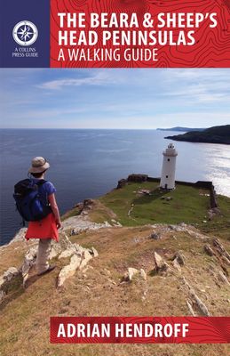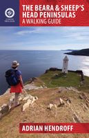
Wandelgids The Beara & Sheep´s Head Peninsulas | The Collins Press

0
Duidelijke wandelgids van dit specifieke deel van Ierland. Goede praktische informatie en zeker voor de GPS wandelaar handig met vermelde waypoints. Kaarten zijn schetsmatig, maar er wordt verwezen naar de benodigde topografische kaarten van Ierland.  The Beara and Sheep’s Head Peninsulas lie in the southwest of Ireland, pointed fingers of land we...

Verkopers met dit product

Verkoper
Bezorging
Prijs
DeZwerver.nl logo
DeZwerver.nl
niet bekend
22,50

Anderen bekeken ook

Wandelgids Killarney to Valentia Island - The Iveragh Peninsula | The Collins Press
Duidelijke wandelgids van dit specifieke deel van Ierland. Goede praktische informatie en zeker voor de GPS wandelaar handig met vermelde waypoints. Kaarten zijn schetsmatig, maar er wordt verwezen naar de benodigde topografische kaarten van Ierland.  The Iveragh Peninsula, the largest in southwest Ireland, stretches from Killarney to Bolus Head and attracts thousands of visitors annually. The Ring of Kerry coastal road winds along its fringes and sandstone peaks soar high above. It is a landscape of raw and stunning beauty from the lakes that fill the corries to the spectacular cliff scenery along its coast. There is no better way to explore this landscape than on foot. This book helps you do just that with routes ranging from a few hours to full-day walks. Explore Valentia Island, the majestic MacGillycuddy’s Reeks and sections of The Kerry Way. Go off the beaten track and explore the coast, hills and woodlands from Killarney to Cahersiveen to Kenmare. Each route is prefaced with a …
22,50
Wandelgids Dublin & Wicklow | The Collins Press
Duidelijke wandelgids van dit specifieke deel van Ierland. Goede praktische informatie en zeker voor de GPS wandelaar handig met vermelde waypoints. Kaarten zijn schetsmatig, maar er wordt verwezen naar de benodigde topografische kaarten van Ierland.  This guidebook describes the best walking routes in Dublin and Wicklow. From mountain landscape to scenic coastal paths, from woodland trails to challenging hill-walks, there are routes here for everyone. Trips vary from two-hour strolls to eight-hour treks, and are illustrated with sketch maps and colour photographs. This is an area of great scenic variety with countless hidden gems to discover - sheer cliffs, dramatic corries, secluded lakes and charming forests. As well as inspiring you to visit the region's natural attractions, the guide provides a host of practical and background information. Each route is prefaced with a quick-reference summary, and descriptions include detailed access notes and navigational guidance. Points of int…
22,50
Wandelgids The Burren & the Aran Islands | The Collins Press
Duidelijke wandelgids van dit specifieke deel van Ierland. Goede praktische informatie en zeker voor de GPS wandelaar handig met vermelde waypoints. Kaarten zijn schetsmatig, maar er wordt verwezen naar de benodigde topografische kaarten van Ierland.  The Burren and the Aran Islands, with their unique combination of flora, fauna and landscape, are explored by large numbers of walkers annually. This is a revised guide to some of the best walking routes in the region, with lucid descriptions and additional information to enhance the walkers' enjoyment and appreciation of the place. From the rugged interior to spectacular coastal scenery, from challenging upland walks to shorter road and waterside excursions, this selection has something for everyone. Every part of the region is covered. Walks vary from two-hour strolls to the longer Burren Way, a six-hour walk from Lisdoonvarna to Ballyvaughan.   The author has put his considerable experience and detailed knowledge of the area to great …
22,50
Wandelgids - Fietsgids Hiking and Cycling the California Missions Trail - Californie | Cicerone
Guidebook to hiking or cycling the 800 mile (1289km) California Missions Trail between San Francisco Bay and San Diego. The pilgrimage trail takes in 21 historic Spanish missions and can be completed in 50-60 walking days or 2-3 weeks cycling. With 1:100,000 mapping, route description, and details of accommodation and facilities for each stage. Ancient footpaths became connecting routes between the Spanish missions, pueblos, and presidios in the period 1769 to 1823. Over time these routes became automobile roadways and were marked with bells starting in 1906 to promote and preserve the El Camino Real. Today, the California Missions Trail follows a pedestrian route through urban cities and historic towns, through forest paths and country lanes, to each of the twenty-one historic Spanish missions. The 800-mile California Missions Trail leads walkers and cyclists through some of the most scenic and historic sites of one of America's most beautiful states. The 21 missions, founded 200-250…
26,50
Wandelgids Walking in the Auvergne | Cicerone
Uitgebreide wandelgids van de Auvergne: goede beschrijvingen, veel keuze, kaarten wat minder goed. This handy guidebook offers the finest day walks in five different areas of the Auvergne, an often-forgotten region in central France perfect for accessible day walking in a unique and spectacular landscape. Towns such as Vichy, Clermont-Ferrand and Puy-en-Velay also offer delightful places to base yourself for that perfect walking holiday. The ridges, rocky peaks and verdant valleys of the Cantal supervolcano dominate south-western Auvergne. The centre of the region hosts the unique chain of 'puys' with their pudding bowl forms and the pristine crater lakes of the Sancy massif. In the north, the Montagne Bourbonnaise preserves a pastoral way of life which is quintessentially French while the Haute Loire's rivers and medieval abbeys reward those venturing further off the beaten track. Notes on the geology and history of points of interest passed en route help you to get the most out of y…
19,95
Wandelgids The high mountains of Crete - Kreta | Cicerone
Guidebook to walking and trekking the high mountains of Crete. The largest of the Greek Islands, Crete's mountains provide breathtaking walking and wilderness to this popular island. The routes in this guidebook are graded for difficulty and range from short, easy strolls to challenging, multi-day treks and summit climbs, so there are options for walkers of all abilities.    All the mountain ranges of Crete feature high plains, gorges and ravines, but in the heart of the Lefka Ori there is something else. High above the treeline snow thaws by July to reveal a great circle of massive barren peaks, interspersed with ‘moonscape’ outcrops, or depressions, of sinkholes in black, grey or red rock. This high desert wilderness is seldom visited but covers some 960sqkm.   In central Crete, where the island is at its widest, the huge mass of Psiloritis (Mount Ida) dominates the whole region. Covering about 560sqkm this massif is different in that a single huge, partly scree-surfaced summit ridg…
26,50
Wandelgids Walk! La Gomera | Discovery Walking Guides
La Gomera is the ultimate get-away-from-it-all island: easy-going, unspoilt, friendly, isolated from the hustle and bustle of modern living, and so laid back it’s virtually supine - even the volcanoes have been dormant for millions of years. The walks, however, are a bit more energetic. For the new 4th edition of Walk! La Gomera Charles Davis has teamed up with Jan Kostura. Jan brings his wide experience and passion for the Canaries, checking, re-walking and revising existing routes, and adding a couple of his own adventures, including a new Top Three Gomeran walk. Two routes have been dropped as having become too dangerous, but the good news is that many of the more harum-scarum walks have been improved through path clearing and the addition of railings to the vertiginous stretches. Other good news is that the devastating forest fires of 2012 have proved not nearly as damaging as we feared, leaving most of our itineraries unscathed. In short, there is every reason to take off and ex…
17,50
Wandelkaart Tour & Trail Mallorca - Tramuntana South | Discovery Walking Guides
For your best adventures, use the best map. Water-proof, split-proof, tear-proof, adventure-proof. Mallorca's Tramuntana South Tour & Trail Super-Durable Map is simply the toughest, most accurate, easy-to-read, easy-to-use multi-purpose map that you can get.   Whether you plan to walk, or explore southern Tramuntana by car or the bus, this is the map for you. A large 960mm by 694mm double sided map sheet covers southern half of Serra de Tramuntana at 1:30,000 scale. This 8th edition sees a significant upgrade from the previous Mallorca North & Mountains Tour & Trail Map, as we have split Serra de Tramuntana in two halves to produce TWO much more detailed maps of larger scale, now also including all the popular tourist resorts on the southern coast.   This map covers a continuous area from Tramuntana's southern-most point Cap de Cala Figuera, including all the coastal resorts such as Magaluf, Santa Ponca and Peguera, with Port d'Andratx and Sa Dragonera islet also covered, all the way …
18,95
Wandelgids The Swiss Alps | Cicerone
  The Swiss Alps are home to the highest and most spectacular mountains in Western Europe. This stunning guidebook describes each mountain area throughout Switzerland – the peaks, passes, valleys and bases – to help you identify the best destinations to plan your trip.   Questions such as ‘Where to walk, climb or ski?’, ‘What multi-day treks are available’ and ‘Where do they go?’, ‘Where are the mountain huts, what are their facilities, which peaks do they serve?’ And where are the most suitable valley bases?’ – all these and more are addressed in detail in this essential guidebook.   The Swiss Alps does not give detailed route directions but information is given about all the guides and maps available for every region.   The Swiss Alps by Kev Reynolds is the third book in Cicerone’s World Mountain Ranges series, which include The Pyrenees and Scotland.   descriptions of all the Swiss Alps, area-by-area from the Chablais Alps in the south west to the Silvretta in the north east classi…
34,95
Wandelgids Donegal, Sligo & Leitrim | The Collins Press
The northwest of Ireland provides a diversity of walks, from the wild, untamed landscape of Donegal to the gentler hills and green valleys of Sligo and Leitrim. This guidebook describes 30 walks of various difficulties, accompanied by quality photographs The northwest of Ireland provides a diversity of walks, from the wild, untamed landscape of Donegal, with its mountains, sea-cliffs and glens, to the gentler hills, green valleys and picturesque escarpments of Sligo and Leitrim. This guidebook describes 30 walks of various grades in this fascinating part of Ireland that has inspired poets, and is rich in folklore and history. Quality photographs and specially-drawn maps will inspire one to get the walking boots on and start exploring this majestic landscape. Since most routes are not signposted or way-marked, an up-to-date guidebook is essential. Walk descriptions also include material on the natural history, folklore, geology and place-names of the area.
22,50

Klanten-reviews van Wandelgids The Beara & Sheep´s Head Peninsulas | The Collins Press

Er zijn nog geen beoordelingen voor dit productBen jij de eerste die een review plaatst?

Meer over Wandelgids The Beara & Sheep´s Head Peninsulas | The Collins Press

Productomschrijving

Duidelijke wandelgids van dit specifieke deel van Ierland. Goede praktische informatie en zeker voor de GPS wandelaar handig met vermelde waypoints. Kaarten zijn schetsmatig, maar er wordt verwezen naar de benodigde topografische kaarten van Ierland. 

The Beara and Sheep’s Head Peninsulas lie in the southwest of Ireland, pointed fingers of land wedged between the Kenmare River, Bantry Bay and Dunmanus Bay. They are peaceful, unspoiled peninsulas where the wild and largely untamed nature of the landscape immediately casts its magical spell. There is no better way to explore and experience this stunning landscape than on foot.   This guidebook describes some of the best walking routes in the area: from Dursey Island and Bear Island to the Caha and Shehy Mountains, from the forest trails of Glengarriff to the lakes of Glaninchiquin,and from the tip of the Sheep’s Head to the ridges of Peakeen and Seefin. The routes range from short hikes to longer treks, coastal and inland, something to suit everyone’s interest. Each route is prefaced with a reference summary and illustrated with maps and photographs. Route descriptions include GPS coordinates, navigation guidance, access notes and short variations. There is also material on the fauna, flora, folklore, history, geology and place names of each area. 

Verken gerelateerde categorieën

Webshop.nl maakt gebruik van cookies. Ga je verder op onze website, ga dan akkoord met het plaatsen van cookies en de verwerking van deze data door ons en vermelde partners.