Wandelgids The Adlerweg | Cicerone

0
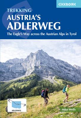
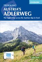
A guidebook to Austria's Adlerweg (the Eagle's way) a long-distance trail from St Johann in Tirol in the east, passing through the historic town of Innsbruck at its mid-point before continuing to St Anton am Arlberg in the west. This waymarked 324km trek is presented in 24 stages ranging between 7 and 32km in length, with easier alternate routes p...

Verkopers met dit product

Verkoper
Bezorging
Prijs
DeZwerver.nl logo
DeZwerver.nl
2,95
26,50

Anderen bekeken ook

Nieuw
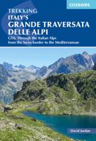
Wandelgids Italy's Grande Traversata delle Alpi GTA | Cicerone
Uitstekende beschrijving van de Grande Traversata della Alpi, een doorgaande meerdaagse wandeltocht door de Italiaanse ALpen aan de westkant. Goede routebeschrijving, schetsmatige kaarten, vol met nuttige en praktische informatie. A guidebook to Italy's Grande Traversata Delle Alpi (GTA) trek through the western Italian Alps. The 809km (503 mile) route is presented in 55 stages with each stage ranging from 7-26km (4-16 miles). Beginning at the Nufenen pass at the Swiss border the route traverses the Lepontine, Pennine, Graian, Cottian and Maritime Alps to finish at Ventimiglia on the Mediterranean coast. With nearly 60,000m of ascent this route is suitable for fit and experienced alpine trekkers. This guidebook contains route description and 1:00,000 mapping for each stage as well as information on the region's history, culture and wildlife. Accommodation, facilities and public transport information is also given to help with trek planning. Italy's western Alps is an area of high moun…
26,50
Nieuw
Wandelgids Walking the GR7 in Andalucia | Cicerone
Uitstekende wandelgids van een gerenommeerde Engelse uitgever. De tochten zijn met zorg beschreven en voorzien van allerhande nuttige informatie. With its white sandy beaches, pine forests, snow-capped peaks, traditional villages, lush river valleys and olive groves, the GR7 in Andalucía takes you on a journey through the most geographically diverse region on the Iberian peninsula. This wonderfully varied route starts at the southernmost tip of Spain at Tarifa, and meanders through the provinces of Cádiz and Málaga before dividing. The northern route heads through Córdoba and Jaén provinces (711km in total), whilst the southern route passes through Almería and Granada (720km). The route crosses seven stunning natural parks and the Sierra Nevada national park. • The first guide to cover the whole of the GR7 in Andalucía. • Detailed route description for around 60 days of walking, with options for creating shorter sections and days. • Information on all the villages en route offering ac…
26,50
Nieuw
Wandelgids Julian Alps of Slovenia - Julische Alpen | Cicerone
Engelstalige wandelgids met 57 dagtochten en 4 trekkings door de Julische Alpen. Goede omschrijvingen van de tochten met alle noodzakelijke praktische info alsmede - beperkt - kaartmateriaal. Aanbevolen wandelkaarten bij deze gids Gebied 1 Wandelkaart 064 Julische Alpen - Alpi Giulie | Kompass 1:25.000 Wandelkaart Triglav - Kranjska Gora – Bohinj – Julische Alpen | Sidarta 1:25.000 Gebied 2 Wandelkaart Bohinj Triglav, Krn, Crna prst – Julische Alpen | Sidarta 1:25.000 Gebied 3 Wandelkaart Bovec Trenta - Julische Alpen | Sidarta Gebied 4 Wandelkaart 2 Pocketmap Bled | Kartografija Gebied 5 Wandelkaart - Fietskaart Posocje | Kartografija 1:40.000 Of Voor vrijwel het hele gebied beschreven in de gids. Wandelkaart 141 WK Julische Alpen | Freytag & Berndt  1:50.000   Over 60 walks which bring the best of Slovenia’s Julian Alps to the English-speaking walker. The walks are organized around five bases – Kranjska Gora, Bovec, Kobarid, Bled and Bohinj. The routes range from easy valley walks a…
26,95
Wandelgids - Pelgrimsroute Via Francigena part 2 | Cicerone
Guidebook to the Via Francigena pilgrim route from Lausanne to Lucca. Starting at Lake Geneva (Lac Léman), the 725km route crosses the Alps at historic Great Saint Bernard Pass, descends the Po Valley, then climbs to cross the Cisa Pass into Tuscany. Described in 32 stages, with information on facilities and pilgrim hostels.   Seasons Suitable for walking in spring, summer and autumn. The Great Saint Bernard Pass is fully open to hikers only in August and September.   Centres Lausanne, Martigny, Great Saint Bernard Pass, Aosta, Ivrea, Vercelli, Pavia, Piacenza, Pontremoli, Pietrasanta, Lucca.   Difficulty Each stage is graded for difficulty (1-4). A few mountainous stages include steep and slippery slopes. No special gear is required to walk the Via Francigena in season, but off-season crossings of the Great Saint Bernard Pass require winter mountain gear and careful attention to changing mountain conditions.   Must See Dazzling Lake Geneva, the 1500-year-old Abbey of Sai…
24,95
Nieuw
Wandelgids Walking in Italy's Stelvio National Park | Cicerone
Wandelgids voor de Stelvio Nationaal Park in de Rätische Alpen ( Alpi Retiche ) ten zuiden van de Splügenpas op de grens met het Zwitserse Graubünden. Engelstalige beschrijving van 38 dagwandelingen.   Aanbevolen wandelkaarten 1:25.000 voor deze gids Wandelkaart 008 Ortles - Cevedale - Ortlergebiet | Tabacco Editrice   Wandelkaart 045 Latsch - Martell - Schlanders- Laces - Val Martello - Silandro | Tabacco Editrice   Wandelkaart 048 Val di Peio - Val di Rabbi - Val di Sole | Tabacco Editrice   The wide range of 38 summer day walks in this guide explore the renowned Stelvio National Park in the Italian Rhaetian Alps. Bordering the Dolomites to the east, and Switzerland to the west, the Stelvio is one of the largest protected areas in all of the Alps. Its unspoilt landscape ranges from valley farmland to forested hillsides and alpine meadows, and up to a wilderness of rugged glaciated summits and ridges, the highest of which is Ortler, at 3905m.   The walks, a selection of routes from e…
20,95
Wandelgids - Klimgids - Klettersteiggids Via Ferratas of the French Alps | Cicerone
This guidebook covers 66 varied via ferratas in the French Alps. The routes are spread over six areas: Geneva and the Northern Alps, Chambéry, Tarentaise and Maurienne valleys, Grenoble and Briançon, amid the Mont Blanc, Vanoise and Queyras ranges. Difficulty ranges from easy, protected routes through to exposed, technical challenges. With some of the most beautiful scenery in the world, the French Alps have long been a popular destination for a wide range of outdoor activities. In recent years, the region has seen the arrival of a growing number of via ferrata routes.   Via ferrata climbing – using fixed cables, bridges and ladders to explore terrain that is normally only accessible to experienced rock climbers – combines elements of scrambling, mountaineering and rock climbing, yet is a very distinct pursuit. Increasingly popular, recent years have seen a surge in the number of routes being established in these iconic mountains.   The routes in this guidebook range from straightforw…
25,95
Nieuw
Wandelgids Walking the Dartmoor Way | Cicerone
This guidebook presents the Dartmoor Way, a 175km (109 mile) walk around Dartmoor National Park in Devon. Walked in 10 day-long stages between 12.75 and 20.5km (8 and 12.75 miles) in length, this waymarked route skirts the edge of England's largest granite moorland, passing through towns including Ivybridge, Ashburton, Okehampton and Tavistock. Also included is the 2-day High Moor Link, which crosses the moor's higher ground.   With 1:50,000 scale OS maps for each stage, the book includes notes on nature, history and local landmarks such as Haytor Rocks, the Teign gorge and Dewerstone crags. Taking in ancient paths, tracks and quiet lanes, the route is mostly at low level and is suitable for most walkers, although some stages involve short, steep climbs and descents. Accommodation, parking and public transport are covered, allowing walkers to choose whether to tackle the route in one go or as individual day walks.   Each stage includes low-level detours in case of bad weather, as well…
23,95
Nieuw
Wandelgids 100 Hut Walks In The Alps | Cicerone
This guidebook has route descriptions for 100 day walks to suit alpine walkers of all abilities, with suggestions for some hut-to-hut tours. These routes take you through breathtaking scenery in the Maritime Alps, Julian Alps, Gran Paradiso, the Turnitzer Alps, Bernese Oberland, the Kitzbuheler Alps and the Dolomites of South Tirol. Extending in huge arc of more than 1000km (620 miles) from the Mediterranean coast near Nice to the low, wooded foothills outside Vienna, the Alps display the full gamut of mountain landscape features. All of the routes in this guide have been specially selected to show the amazing diversity of this wonderful mountain chain.   There are walks to suit every taste: gentle and undemanding, long and tough, and everything in between. Most of the routes avoid climbing of a technical nature except the odd scramble aided by a fixed rope. Glacier crossings where crevasses lurk for the unwary have also been avoided in the main, although just a small handful of walks…
22,95
Nieuw
Wandelgids Chamonix to Zermatt | Cicerone
Uitstekende wandelgids die in etappes de route nauwkeurig beschrijft; ook de zijtakken en alternatieve routes koman aan bod. Kaarten zijn schetsmatig en in onze ogen onvoldoende, zeker bij slechte weersomstandigheden. Wij raden dan ook om er losse kaarten bij te kopen. A guidebook to the classic Chamonix to Zermatt trek from Mont Blanc to the Matterhorn. The 225km Walker's Haute Route through the French and Swiss Alps crosses 11 passes, gains more than 14,000m in height and is a strong contender for the title of Most Beautiful Walk in Europe. The high-level route is described in 14 day stages, with optional variants, and is suitable for walkers with a good level of fitness and some previous alpine trekking experience. The final approach to Zermatt adopts the dramatic Europaweg, a high-level traverse of the east wall of the Mattertal, crossing the 500-metre suspension bridge at Randa. An alternative valley route to Zermatt can be taken if this does not appeal. Alongside clear route des…
22,95
Nieuw
Fietsgids The Rhine Cycle route | Cicerone
This comprehensive guidebook offers a detailed stage-by-stage description of an epic 1370km route along the Rhine, one of Europe's great rivers, which passes through six countries on its way from Switzerland to the North Sea. The cycling is easy, downhill and along dedicated cycle routes, the countries visited are very cycle-friendly and the waymarking is excellent. The whole trip can be completed in two weeks by a fit cyclist.   The guide includes plenty of information to help you plan your trip, with advice on travel, accommodation and facilities. The full route is then presented in 27 stages of 32-69km, with step-by-step route description, 1:100,000 mapping and notes on local points of interest. A facilities table, glossary and list of useful contacts can be found in the appendices.   On its way, the Rhine Cycle Route passes the remains of Roman cities, medieval towns, castles, cathedrals, palaces, great cities of the industrial revolution and relics of 20th-century warfare – and i…
23,95

Klanten-reviews van Wandelgids The Adlerweg | Cicerone

Er zijn nog geen beoordelingen voor dit productBen jij de eerste die een review plaatst?

Meer over Wandelgids The Adlerweg | Cicerone

Productomschrijving

A guidebook to Austria's Adlerweg (the Eagle's way) a long-distance trail from St Johann in Tirol in the east, passing through the historic town of Innsbruck at its mid-point before continuing to St Anton am Arlberg in the west. This waymarked 324km trek is presented in 24 stages ranging between 7 and 32km in length, with easier alternate routes provided for the most difficult stages. This guide features 1:50,000 mapping, accommodation details for the start and end points of each stage, which serve hearty meals and refreshments, and details on local transport, planning and local history.   Traversing the North Kakalpen Alps the route passes through the Wilderkaiser, Bradenberger Alpen, Rofangebirge, Karwendelgebirge, Wettersteinebirge and the Lechtaler Alpen ranges, enjoying views as far as Munich and the Swiss Alps. It is the perfect adventure for those looking for an alpine challenge.

Verken gerelateerde categorieën

Webshop.nl maakt gebruik van cookies. Ga je verder op onze website, ga dan akkoord met het plaatsen van cookies en de verwerking van deze data door ons en vermelde partners.