Wandelgids Tea Shop Walks | Northern Eye Books

0
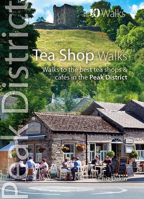
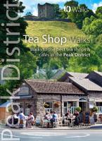
The Peak District abounds with cafes and tea shops offering fabulous, freshly brewed coffee and a mouthwatering variety of speciality teas.   This pocket-size guide picks carefully selected cafés across the Peak District — in locations ranging from former stations to community cafés, National Trust properties to hillside farms, and bakeries on tow...

Verkopers met dit product

Webshop
Bezorging
Prijs
DeZwerver.nl logo
DeZwerver.nl
niet bekend
10,95

Anderen bekeken ook

Wandelgids Tea Shop Walks | Northern Eye Books
A visit to a tea shop adds something special to a walk. It’s always a treat to sit down to coffee and cake at the end of an afternoon stroll or to tuck into a hearty lunch half-way through a gorgeous hike.   From quaint little tea rooms that still serve drinks in china cups to modern cafés staffed by trained baristas, the Lake District has plenty to offer — and all surrounded by a truly breathtaking UNESCO World Heritage landscape.   The ten tea shops in this book have been chosen partly on the basis of the excellent walking that can be enjoyed from their doors, and partly on the basis of the fare and ambience they have to offer.    They occupy village, lakeside and woodland locations. The walks themselves take in hidden valleys, low fells, lakes, waterfalls, riverside paths, fabulous viewpoints and wildflower-filled woods — a tremendous array of the sort of scenery for which the Lake District has become world famous.
10,95
Wandelgids Pembrokeshire | Northern Eye Books
OS Map Books: Wales Coast Path: Pembrokeshire Coast Path Map Atlas | Ordnance Survey ‘Explorer’ Large-scale 1:25,000 maps for the Pembrokeshire Coast in compact book format | Pocket Atlas | Walking Wales | UK Long-Distance Trails | Hiking | Adventure   One of seven handy Ordnance Survey Map Books covering the entire 870 mile/1400 kilometre-long, world-class Wales Coast Path — from Chester in the north to Chepstow in the south.   Enjoy enhanced, large scale (1:25,000) Ordnance Survey Explorer mapping in compact atlas format with all the detailed mapping you need to walk the Pembrokeshire Coast section of the Wales Coast Path.   Continuous, full colour OS mapping covering the Wales Coast Path between Cardigan and Amroth. Contains extracts from large scale Explorer maps OL 35 and OL 36. The enhanced OS 1:25,000 maps are accurate, up-to-date and reliable. Additional map symbols show tea shops, cafes, extra parking, and public toilets.   A brief introduction to Pembrokeshire Coast includes…
17,50
Wandelgids Yorkshire Dales Tea Shop Walks | Northern Eye Books
This attractive and cleverly structured guide gives walkers the ten best walks based around the loveliest tea shops, cafes and delis of the Yorkshire Dales National Park in a popular pocketable format. With clear information, an overview and introduction for each walk, expertly written numbered directions, large scale Ordnance Survey maps, superb eye-grabbing panoramic photographs, and interpretation of points of interest along the way, these guides set a new standard in clarity and ease-of-use. Featured walks include: Churchmouse Tea Room, Barbon; Three Hares Cafe, Sedbergh; Village Store & Tea Shop, Muker; Herriots Kitchen & Cafe, Hawes; Mill Race Tea Shop,Aysgarth; Elaine's Tea Rooms, Feizor; Town End Farm Shop, Malham; & Then Teashop & Deli, Kettlewell; Old School Tearoom, Hebden and Tea Cottage, Bolton Abbey  
10,95
Wandelgids Mysterious Walks in the Peak District | Northern Eye Books
Even the Peak District’s name conceals a mystery. Forget the obvious: a visitor expecting towering peaks will be disappointed, as the name comes from the Pecsaetan tribe who once lived here. But there’s a twist: the Anglo-Saxon means “settlers of the Pec”…and that word pec has the same root as our peak, the dialect pike and the Pyrenean pic. So, ultimately, the Peak District is named after its peaks, after all.   The Peak District is broadly defined by the conurbations at its corners: Manchester, Sheffield, Derby and Stoke. Within this rectangle, the National Park forms a rough oval of around 550 square miles.   The area is traditionally divided into the Dark Peak – peat moorland edged by gritstone, with rugged villages in the valleys — and the softer White Peak – upland pastures defined by drystone walls, divided by gorges and limestone villages. The eastern and western moors are similar to the Dark Peak, but have their own subtly distinctive characters.   The Peak District was occup…
10,95
Wandelgids Peak District: Walks to Viewpoints | Northern Eye Books
This handy pocket size book will take you on short circular walks to the ten finest views and viewpoints in the Peak District.   Views are why many of us venture into the hills and countryside in the first place. Nothing beats a sweeping view from a moorland edge or hill, or an arching panorama over a pleasant valley. Sometimes it’s just the simple pleasure of the patterns of light and shade, the textures and colours of the woodland or the flowing beauty of the stream we’re walking beside. But typically there’s a feeling that you’ve earned a great view through sheer effort – even if the easiest approach had been taken to reach it.   Perhaps that’s why so many of the great Peak District views are atop minor summits, at moorland edges, or overlooking deep valleys.
10,95
Wandelgids National Parks: Pembrokeshire | Northern Eye Books
This superbly-written and good looking book will take you on ten short circular walks to the very best stretches of coast, pubs, tea shops, and viewpoints that the beautiful Pembrokeshire coast, in West Wales, has to offer.   Defining the south-westernmost tip of Wales, Pembrokeshire’s coastline is arguably the most beautiful and varied in the British Isles. Virtually all of it lies within the Pembrokeshire Coast National Park. Relative isolation has left it largely untouched by modern development and most of its length is a wild frontier where the endless confrontation between sea and land is played out. Long stretches of coast face the fury of Atlantic storms and weakness and faults in the high cliffs are eroded into caves, coves and inlets. However, the harder rock, some of which is 700 million years old, resists the onslaught and stands out in rugged promontories and headlands.   Elsewhere, sheltered landings and harbours, fine beaches and secluded bays reveal other aspects of thi…
10,95
Reisgids Rough Guide Pocket Peak District (Travel Guide with Free EBook) | Rough Guides
Image for Pocket Rough Guide British Breaks Peak District (Travel Guide with Free eBook) Click to enlarge Pocket Rough Guide British Breaks Peak District (Travel Guide with Free eBook) by Rough Guides (Author)   Series:Pocket Rough Guides British Breaks Format:Paperback / softback 152 pages Publisher:APA Publications Imprint:APA Publications ISBN:9781839057885 Published:15 Oct 2022 Classifications:England, Travel & holiday guides Readership:General (US: Trade) Weight:202g Dimensions:100 x 190 x 11 (mm) Pub. Country:United Kingdom Country of Origin:GB Tariff Codes:49019900 For sale in: All countries Description Discover the best of The Peak District with this compact, practical, entertaining Pocket Rough Guide with a free eBook. This slim, trim treasure trove of trustworthy travel information is ideal for travellers on short trips, and covers all the key sights such as Buxton, Castleton and Bakewell, restaurants, shops, cafes and bars, plus inspired ideas for day-trips, with honest ind…
12,50
Wandelkaart North Wales Coast Path Map | Northern Eye Books
Enhanced, large scale (1: 25,000) Ordnance Survey mapping in a handy atlas format with all the mapping you need to walk a complete North Wales Coast section of the Wales Coast Path.   Continuous OS mapping covering the complete route from Chester to Bangor, on the Menai Strait. Contains generous coastal extracts from large-scale OS Explorer maps 266, 265, 264 and OL17.   The North Wales Coast Ordnance Survey mapping book is part of a series of map atlases covering the whole of the 870-mile long Wales Coast Path. The enhanced OS 1:25,000 maps are accurate, up-to-date and reliable. Additional map symbols show tea shops, cafes, extra parking, and public toilets.   A brief introduction to the North Wales Coast includes a fascinating photo mosaic highlighting notable views, places of interest and wildlife you’ll meet along the way. There is also a section of detailed Useful Information at the back of the atlas.   Laminated flapped covers showing Wales Coast Path signs and waymarkers, route…
16,50
Wandelatlas Wales Coast Path Llyn Peninsula Map | Northern Eye Books
Enhanced, large scale (1: 25,000) Ordnance Survey mapping in a handy atlas format with all the mapping you need to walk a complete circuit of the Anglesey section of the Wales Coast Path.   Continuous OS mapping covering the complete route from Bangor to Porthmadog. Contains coastal extracts from large scale Explorer maps 253 and 254.   The Llyn Peninsula Ordnance Survey mapping book is part of a series of map atlases covering the whole of the 870-mile long Wales Coast Path. The enhanced OS 1:25,000 maps are accurate, up-to-date and reliable. Additional map symbols show tea shops, cafes, extra parking, and public toilets.   A brief introduction to the Llyn Peninsula includes a fascinating photo mosaic highlighting notable views, places of interest and wildlife you’ll meet along the way. There is also a section of detailed Useful Information at the back of the atlas.   Laminated flapped covers showing Wales Coast Path signs and waymarkers, route details and map symbols make these atlas…
13,95
Wandelatlas Wales Coast Path: Isle of Anglesey | Northern Eye Books
Enhanced, large scale (1: 25,000) Ordnance Survey mapping in a handy atlas format with all the mapping you need to walk a complete circuit of the Anglesey section of the Wales Coast Path.   Continuous OS mapping covering the complete circuit from Menai Bridge. Contains coastal extracts from large scale Explorer maps 262 and 263.   The Isle of Anglesey/Ynys Mon Ordnance Survey mapping book is part of a series of map atlases covering the whole of the 870-mile long Wales Coast Path. The enhanced OS 1:25,000 maps are accurate, up-to-date and reliable. Additional map symbols show tea shops, cafes, extra parking, and public toilets.   A brief introduction to Anglesey includes a fascinating photo mosaic highlighting notable views, places of interest and wildlife you’ll meet along the way. There is also a section of detailed Useful Information at the back of the atlas.   Laminated flapped covers showing Wales Coast Path signs and waymarkers, route details and map symbols make these atlases si…
13,95

Klanten-reviews van Wandelgids Tea Shop Walks | Northern Eye Books

Er zijn nog geen beoordelingen voor dit productBen jij de eerste die een review plaatst?

Meer over Wandelgids Tea Shop Walks | Northern Eye Books

Productomschrijving

The Peak District abounds with cafes and tea shops offering fabulous, freshly brewed coffee and a mouthwatering variety of speciality teas.   This pocket-size guide picks carefully selected cafés across the Peak District — in locations ranging from former stations to community cafés, National Trust properties to hillside farms, and bakeries on town streets to tearooms tucked down alleyways.   All of them offer a great choice of often home-baked or locally sourced produce, and a pleasant place to relax after a refreshing walk.   This handy pocket size book will take you on short circular walks to the ten friendliest and most fantastic cafes and tea shops in the Peak District.

Verken gerelateerde categorieën

Webshop.nl maakt gebruik van cookies. Ga je verder op onze website, ga dan akkoord met het plaatsen van cookies en de verwerking van deze data door ons en vermelde partners.