webshop.nl
Categorieën
  Sluiten

Meer Pocket Mountains
Meer Pocket Mountains in Literatuur boeken

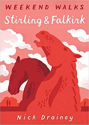
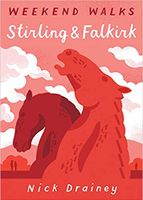
Wandelgids Stirling & Falkirk : Weekend Walks | Pocket Mountains

Handige compacte wandelgids met 40 dagwandelingen. Deze gids bevat kleine kaartjes en leuke uitgebreide informatie over wat er langs de route te zien is. Goede wandelkaarten zijn echter we noodzakelijk voor deze tochten: de Ordnance Survey explorer maps of Landanger maps zijn zeer geschikt.     Between Edinurgh and Glasgow is an area resonant in r...
10,95

Webshops met dit product

Webshop
Bezorging
Prijs

Anderen bekeken ook

Wandelgids Stirling & Falkirk : Weekend Walks | Pocket Mountains
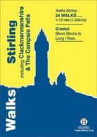
Handige compacte wandelgids met 40 dagwandelingen. Deze gids bevat kleine kaartjes en leuke uitgebreide informatie over wat er langs de route te zien is. Goede wandelkaarten zijn echter we noodzakelijk voor deze tochten: de Ordnance Survey explorer maps of Landanger maps zijn zeer geschikt.     Between Edinurgh and Glasgow is an area resonant in romance, history and invention. The moors above Stirling and the carseland surrounding its magnificent castle set the scene for a number of landmark battles, while Falkirk played a leading role in Scotland's Industrial Revolution and is today the home of some of the country's most innovative and popular attractions. These 25 walks explore the picturesque places round Stirling and Falkirk, from the windswept drama of bare hills to the tranquill setting of canals, lochs, reservoirs and riversides.
10,95
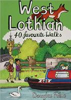
Wandelgids West Lothian | Pocket Mountains
Handige compacte wandelgids met 40 dagwandelingen. Deze gids bevat kleine kaartjes en leuke uitgebreide informatie over wat er langs de route te zien is. Goede wandelkaarten zijn echter we noodzakelijk voor deze tochten: de Ordnance Survey explorer maps of Landanger maps zijn zeer geschikt.     Midway between Glasgow and Edinburgh on the southern shore of the Firth of Forth, West Lothian has a surprising number of country parks, craggy hills and wildlife havens and is home to several prehistoric burial sites, ruined castles and palaces and stately homes as well as the remains of the Antonine Wall, the Roman Empire's northernmost frontier. Although the area is predominantly rural there were also extensive coal, iron and shale oil mining operations in the 18th and 19th centuries which left behind distinctive red spoil heaps, or bings, as they are known in Scotland, and the Union Canal which linked Falkirk to the capital via some of the county's most impressive aqueducts.
10,95
Wandelgids The Ochils | Pocket Mountains
Handige compacte wandelgids met 40 dagwandelingen. Deze gids bevat kleine kaartjes en leuke uitgebreide informatie over wat er langs de route te zien is. Goede wandelkaarten zijn echter we noodzakelijk voor deze tochten: de Ordnance Survey explorer maps of Landanger maps zijn zeer geschikt.   40 easy short walks with a very cute cartoonish style Known to the ancient people of Central Scotland as uchel – ‘the high place’ – the long upland massif of the Ochils rises between the River Forth and the Southern Highlands, with a dramatic escarpment running between the cities of Stirling and Perth. The high rounded hills are cleaved by steep-sided ravines and dotted with castles, standing stones, burial mounds, hillforts and battlesites, making the Ochils a walker’s paradise. This collection of 40 routes covers all the main summits, as well as the magnificent glens and the two rivers, the Allan and the Devon, which transect them.
10,95
Wandelgids Norfolk | Pocket Mountains
Handige compacte wandelgids met 40 dagwandelingen. Deze gids bevat kleine kaartjes en leuke uitgebreide informatie over wat er langs de route te zien is. Goede wandelkaarten zijn echter we noodzakelijk voor deze tochten: de Ordnance Survey explorer maps of Landanger maps zijn zeer geschikt.   Pinpointing favourite treks, rambles and family trips, these 40 walks visit Norfolk in all its variety. From wild and windswept coast, Fens and Breckland to sheltered inland woods, broads and valleys, they offer geographical impact and a strong sense of history. Treading in the footsteps of warriors, drovers, pilgrims, weavers and reedcutters, this selection links to the county's extensive network of long-distance routes.   You'll find Norfolk at its most photogenic, with swallowtail butterflies and wherry boats, windpumps, seals and sailing boats, round tower churches and medieval architecture. From coast road to historic villages, towns and cities, many of the walks start near public transport.
10,95
Wandelgids The Ochils | Pocket Mountains
Handige compacte wandelgids met 40 dagwandelingen. Deze gids bevat kleine kaartjes en leuke uitgebreide informatie over wat er langs de route te zien is. Goede wandelkaarten zijn echter we noodzakelijk voor deze tochten: de Ordnance Survey explorer maps of Landanger maps zijn zeer geschikt.   40 easy short walks with a very cute cartoonish style Known to the ancient people of Central Scotland as uchel – ‘the high place’ – the long upland massif of the Ochils rises between the River Forth and the Southern Highlands, with a dramatic escarpment running between the cities of Stirling and Perth. The high rounded hills are cleaved by steep-sided ravines and dotted with castles, standing stones, burial mounds, hillforts and battlesites, making the Ochils a walker’s paradise. This collection of 40 routes covers all the main summits, as well as the magnificent glens and the two rivers, the Allan and the Devon, which transect them.
10,95
Wandelgids The Campsies and the Kilpatrick Hills | Pocket Mountains
Handige compacte wandelgids met 40 dagwandelingen. Deze gids bevat kleine kaartjes en leuke uitgebreide informatie over wat er langs de route te zien is. Goede wandelkaarten zijn echter we noodzakelijk voor deze tochten: de Ordnance Survey explorer maps of Landanger maps zijn zeer geschikt.   The Campsie Fells, along with the Kilpatrick, Kilsyth, Fintry and Gargunnock Hills, form a sprawling upland range which stretches eastwards from Dumbarton, passing to the north of the city of Glasgow and across the narrow waist of Scotland towards Stirling. It is often said that Glasgow is one of the easiest cities to get away from and the Campsies and theKilpatrick Hills, a few short miles north of the city, are the first port of call. This guide covers all of the major hills within both ranges, as well as low-level walks around and between the villages which lie on their perimeters.   Many of these 40 walks make use of both the West Highland Way and the John MuirWay which cut through the heart o…
10,95
Wandelgids Loch Lomond and the Trossachs | Pocket Mountains
Handige compacte wandelgids met 40 dagwandelingen. Deze gids bevat kleine kaartjes en leuke uitgebreide informatie over wat er langs de route te zien is. Goede wandelkaarten zijn echter we noodzakelijk voor deze tochten: de Ordnance Survey explorer maps of Landanger maps zijn zeer geschikt.     The new Loch Lomond National Park has ensured protection for what is not only Britain's largest freshwater lake, but one of its most beautiful, celebrated in ballad and song. West of Loch Lomond are the steep Arrochar Alps towering above Loch Long together with scores of much less visited lower hills stretching down to the seaboard. To the east is the Trossachs - a delightful landscape of forests, lochs and hills that has long been known as Scotland in miniature.   This latest pocket guide features 40 of the best walks in this popular area in an attractive and accessible format.
10,95

Klanten-reviews van Wandelgids Stirling & Falkirk : Weekend Walks | Pocket Mountains

Er zijn nog geen beoordelingen voor dit productBen jij de eerste die een review plaatst?

Meer over Wandelgids Stirling & Falkirk : Weekend Walks | Pocket Mountains

Productomschrijving

Handige compacte wandelgids met 40 dagwandelingen. Deze gids bevat kleine kaartjes en leuke uitgebreide informatie over wat er langs de route te zien is. Goede wandelkaarten zijn echter we noodzakelijk voor deze tochten: de Ordnance Survey explorer maps of Landanger maps zijn zeer geschikt.     Between Edinurgh and Glasgow is an area resonant in romance, history and invention. The moors above Stirling and the carseland surrounding its magnificent castle set the scene for a number of landmark battles, while Falkirk played a leading role in Scotland's Industrial Revolution and is today the home of some of the country's most innovative and popular attractions. These 25 walks explore the picturesque places round Stirling and Falkirk, from the windswept drama of bare hills to the tranquill setting of canals, lochs, reservoirs and riversides.

Productspecificaties

Artikelnummer(s)
Brand
Pocket Mountains

Verken gerelateerde categorieën

Webshop.nl maakt gebruik van cookies. Ga je verder op onze website, ga dan akkoord met het plaatsen van cookies en de verwerking van deze data door ons en vermelde partners.