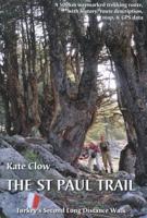
Wandelgids St. Paul Trail | Kate Clow

0
De St Paul Trail is een nieuw bewegwijzerd pad in Turkije. Zoals het eerste GR-pad in Turkije, de Lycian Way, is ook dit pad vooral de creatie van de onvermoeibare Kate Clow, een engelse vrouw die al meer dan 15 jaar in Turkije woont. De afstand bedraagt ruwweg 600 km en het pad is volledig gemarkeerd vanaf 2003 en beschreven. Bovendien wordt alle...

Verkopers met dit product

Verkoper
Bezorging
Prijs
DeZwerver.nl logo
DeZwerver.nl
niet bekend
25,95

Anderen bekeken ook

Wandelgids Walking and Trekking in Iceland - IJsland | Cicerone
Wandelgids met beschrijvingen, kaarten en praktische informatie zoals bussen, overnachten, etc. voor meerdaagse wandelroutes en dagwandeltochten op IJsland. A country of extraordinary beauty, Iceland’s incredible variety of volcanic and glacial landscapes makes it a unique destination for walking and trekking holidays. Its three national parks include the mighty Vatnajökull, largest national park in Europe.   The wide range of routes in this book introduce walkers and backpackers to this ‘Land of Ice and Fire’. There are 100 days of walking in this guidebook, stretching over 1722km, split between 49 day walks and 10 multi-stage treks. They climb mountains, cross glaciers, pass lakes and explore coastlines and geothermal areas, and range from easy nature trails to challenging treks. So, there is enough variation to satisfy all kinds of walkers. The routes are spread all around Iceland, grouped into twelve regions. Detailed information is given at the start of each route or trekking sta…
26,95
Wandelgids GR221 Mallorca's Long Distance Trail | Discovery Walking Guides
Gedetailleerde beschrijving van de GR 221 op Mallorca, met veel praktische informatie, hoogteprofielen, goed kaartmateriaal etc. Achterin ook nog eens veel GPS - waypoints. Bijna onmisbaar bij het lopen van de route! Walk! GR221 Mallorca's Long Distance Trail - The Dry Stone Way. If you want to get away from it all , there is no surer way than strapping on your boots, shouldering your backpack, and embarking on a long distance path; and there are few long distance paths more beguiling and more crammed with adventure than Mallorca s GR221, La Ruta de Pedra en Sec or The Dry Stone Way. Anybody who has visited Mallorca will appreciate the justice of the GR221's title. Following ancient bridleways along the length of the Tramuntana range, from Port d'Andratx in the southwest to Pollenca in the northeast, the GR221 touches on dry stone in its every manifestation, from the raw rock of the peaks and sweeping fields of karst to the tailored stones that have always been the island's building m…
18,50
Wandelgids Switzerland's Jura Crest Trail | Cicerone
Uitstekende wandelgids van de Jura Crest Trail, ook wel bekend als de Jura High Route. Goed beschreven met veel praktische informatie om de route te kunnen lopen, inclusief redelijke kaarten. This guide presents Switzerland's Jura Crest Trail. Also known as the Jura High Route (Swiss national route 5), this 310km long-distance route traverses the sub-alpine mountains of the Swiss Jura from Dielsdorf near Zurich to Nyon on the shores of Lac Léman (Lake Geneva), running roughly parallel to the Swiss-French border. With over 13,500m of ascent, the trail demands a moderate level of fitness and can be comfortably completed in around a fortnight. The Jura Crest Trail is easily accessed from Zurich and Geneva. The region boasts excellent walking infrastructure and facilities, and although the trail crosses the mountains, you are seldom too far from civilisation. The guide contains all the information you need to plan and walk the route. You'll find advice on transport and comprehensive deta…
23,95
Wandelgids Thames Path | Trailblazer Guides
This book follows the Thames Path National Trail from the river's source in Gloucestershire to the Thames Barrier in London. Officially 184 miles (294km) in length (although the actual distance you walk will depend on a number of decisions you make en route), the path meanders, accompanied by its watery muse, through pristine and tranquil countryside, past historic sites and buildings, via pub, lock, weir, and the occasional scattering of waterfowl, to a city, once the fulcrum of an empire, and now the heart of modern day England. The river, responsible for the metropolis' very being, tells tales, inspires artists, accommodates swans, geese, and water voles, reflects the silhouettes of red kites and kingfishers, provides employment, entices adventure, and allows time for carefree pilgrims to procrastinate and think. Following its banks is a grand way to go for a ramble. The path begins, as the river does, in a meadow in the Cotswolds; its upper reaches lonely and wild, the meadows and…
19,95
Wandelgids - Fietsgids Hiking and Cycling the California Missions Trail - Californie | Cicerone
Guidebook to hiking or cycling the 800 mile (1289km) California Missions Trail between San Francisco Bay and San Diego. The pilgrimage trail takes in 21 historic Spanish missions and can be completed in 50-60 walking days or 2-3 weeks cycling. With 1:100,000 mapping, route description, and details of accommodation and facilities for each stage. Ancient footpaths became connecting routes between the Spanish missions, pueblos, and presidios in the period 1769 to 1823. Over time these routes became automobile roadways and were marked with bells starting in 1906 to promote and preserve the El Camino Real. Today, the California Missions Trail follows a pedestrian route through urban cities and historic towns, through forest paths and country lanes, to each of the twenty-one historic Spanish missions. The 800-mile California Missions Trail leads walkers and cyclists through some of the most scenic and historic sites of one of America's most beautiful states. The 21 missions, founded 200-250…
26,50
Wandelgids GR 70: The Robert Louis Stevenson Trail van Le Puy tot St-Jean du Gard | Cicerone
Uitstekende wandelgids van een gerenommeerde Engelse uitgever. De tochten zijn met zorg beschreven en voorzien van allerhande nuttige informatie. Met beperkt kaartmateriaal. Aanbevolen wandelkaarten bij deze gids 1:100.000 Wandelkaart GR 70 The Stevenson Trail | IGN - Institut Géographique National Als overzichtskaart Of Wegenkaart 156 Le Puy en Velay - Privas - Mende | IGN - Institut Géographique National Wegenkaart 163 Avignon - Nimes | IGN - Institut Géographique National  of 1:25.000 1. Wandelkaart - Topografische kaart 2835OT Le Puy-en-Velay | IGN - Institut Géographique National 2. Wandelkaart - Topografische kaart 2836OT Gerbier de Jonc | IGN - Institut Géographique National 3. Wandelkaart - Topografische kaart 2736SB Monistrol d'Allier, Solignac-sur-Loire, Cayres | IGN - Institut Géographique National 4. Wandelkaart - Topografische kaart 2737SB Langogne - Grandrieu | IGN - Institut Géographique National 5. Wandelkaart - Topografische kaart 2738SB Le Bleymard | IGN - Institut G…
23,95
Wandelgids The GR5 Trail Benelux and Lorraine | Cicerone
Engelsetalige wandelgids van het noordelijke deel van het beroemde GR 5 pad. Dezse gids beschrijft de gehele route van de GR 5 van Hoek van Holland tot aan Schirmeck in de Vogezen. Goede beschrijvingen en informatie; kaartmateriaal is vrij beperkt. Guidebook to walking the northern section of the GR5 - 1000km starting in Hoek van Holland and passing through the Netherlands, Belgium, Luxembourg and Lorraine to Schirmeck in France. A long-distance route covering a variety of cultures and landscapes. The full GR5 from the North Sea to the Mediterranean is one of the world's greatest trails. Guidebook to the northernmost section of the GR5 - from Hoek van Holland in the Netherlands, through Belgium and Luxembourg, to Schirmeck in the northeast of France. Described over 49 stages, this 1000 kilometre section of the GR5 is relatively easy and ideal for those who don't want to hike up and down steep mountains - or not just yet.   Clear route description is accompanied by 1:100K mapping, toge…
24,95
Wandelgids Camino Ignaciano Loyola - Manresa 675 km | Bradt Travel Guides
In 1522 Ignatius of Loyola made a pilgrimage from his home in Spain's Basque country to Montserrat and Manresa. This new guide from Bradt provides all the information needed to follow in his footsteps in a neat, easy-to-carry portable format, including an essential mix of practicalities, such as when to go, where to stay along the route, national parks and public transport, and a detailed breakdown of the route's 27 stages. Start and finish points, level of difficulty, duration, distance, ascent and descent, and route descriptions are all included, as well as elevation charts, maps and what to see along the way. This is a unique secular walking guide to a religious-themed walk which takes intrepid hikers from the imposing tower house and sanctuary of Loyola in the Basque Country, up through the stunning Basque mountains and down to the beautiful town of Laguardia with its myriad wine caves. Through the vineyards of Alava and world-famous La Rioja, the trail visits lively Logroño and f…
23,95
Wandelkaart Tour & Trail Mallorca - Tramuntana South | Discovery Walking Guides
For your best adventures, use the best map. Water-proof, split-proof, tear-proof, adventure-proof. Mallorca's Tramuntana South Tour & Trail Super-Durable Map is simply the toughest, most accurate, easy-to-read, easy-to-use multi-purpose map that you can get.   Whether you plan to walk, or explore southern Tramuntana by car or the bus, this is the map for you. A large 960mm by 694mm double sided map sheet covers southern half of Serra de Tramuntana at 1:30,000 scale. This 8th edition sees a significant upgrade from the previous Mallorca North & Mountains Tour & Trail Map, as we have split Serra de Tramuntana in two halves to produce TWO much more detailed maps of larger scale, now also including all the popular tourist resorts on the southern coast.   This map covers a continuous area from Tramuntana's southern-most point Cap de Cala Figuera, including all the coastal resorts such as Magaluf, Santa Ponca and Peguera, with Port d'Andratx and Sa Dragonera islet also covered, all the way …
18,95
Wandelkaart Tour & Trail Mallorca - Tramuntana North | Discovery Walking Guides
Let op: deze kaart dekt het noordelijke deel van Mallorca.   For your best adventures, use the best map. Water-proof, split-proof, tear-proof, adventure-proof. Mallorca's Tramuntana North Tour & Trail Super-Durable Map is simply the toughest, most accurate, easy-to-read, easy-to-use multi-purpose map that you can get.   Whether you plan to walk, or explore northern Tramuntana by car or the bus, this is the map for you. A large 960mm by 694mm double sided map sheet covers northern half of Serra de Tramuntana at 1:30,000 scale. This 8th edition sees a significant upgrade from the previous Mallorca North & Mountains Tour & Trail Map, as we have split Serra de Tramuntana in two halves to produce TWO much more detailed maps of larger scale.   This map covers a continuous area from Tramuntana's northern-most Cap de Formentor, including all the coastal resorts such as Port de Pollenca and Port d'Alcudia, all the way to Soller and Deia at the opposite end of the map (for the area from S…
18,95

Klanten-reviews van Wandelgids St. Paul Trail | Kate Clow

Er zijn nog geen beoordelingen voor dit productBen jij de eerste die een review plaatst?

Meer over Wandelgids St. Paul Trail | Kate Clow

Productomschrijving

De St Paul Trail is een nieuw bewegwijzerd pad in Turkije. Zoals het eerste GR-pad in Turkije, de Lycian Way, is ook dit pad vooral de creatie van de onvermoeibare Kate Clow, een engelse vrouw die al meer dan 15 jaar in Turkije woont. De afstand bedraagt ruwweg 600 km en het pad is volledig gemarkeerd vanaf 2003 en beschreven. Bovendien wordt alles “op de voet” gevolgd en begeleid met een uitstekende website. Erg uitgebreid gaat het boek in op de geschiedenis en exploratie van een aantal archeologische plaatsen die je op de tocht passeert. Hierdoor is het boek ook bruikbaar voor zij die niet zo geïnteresseerd zijn in wandelen maar wel in afgelegen en eerder onbekende vergane steden uit de klassieke periode. Het boek staat bol van praktische info en tips verzameld door jaren te wandelen in dit gebied.

The landscape of Turkey's Toros mountains and lake district contrasts and combines inA brand new edition of the St Paul Trail guidebook, following the saint's journey from Perge, near Antalya, Turkey to Antioch in Pisidia. This book is the essential guide and map to Turkey's second long-distance walking route. St Paul Trail consists of about 500km of waymarked walking trail following Roman roads, village paths and medieval trails through the Toros mountains. The book is complemented by a map (included with the book), a website with updates to the trail (www.cultureroutesinturkey.com), an iphone app and downloadable GPS points.    The landscape of Turkey's Toros mountains and lake district contrasts and combines in a jumbled geography of forest, canyon and ridges; the byways resound in history; hospitality is a natural instinct in every home. This enticing combination will delight any walker on Turkey's second long-distance trekking and Cultural Route. The peaks, lakes and valleys on this route offer a different perspective on Turkey from the Aegean and Mediterranean coastlines which draw so many tourists. Unlike the mountains of Eastern Turkey - the fabulous Kackar and the Aladaglar which attract adrenaline-fuelled adventure seekers during a short trekking season - the Toros mountains and lake district are easily accessible. Most importantly, the area has a visible, walkable history with some interesting challenges thrown in. St Paul's travels in the area provided the inspiration for this walking route.   Turkey now has 15 long-distance routes for walkers, through a variety of terrain, and welcomes both day walkers and long-distance hikers. Both independent walkers and those walking with a group or agency will find the background information in this book adds to the enjoyment of their holiday.

Verken gerelateerde categorieën

Webshop.nl maakt gebruik van cookies. Ga je verder op onze website, ga dan akkoord met het plaatsen van cookies en de verwerking van deze data door ons en vermelde partners.