webshop.nl
Categorieën
  Sluiten

Meer Cicerone

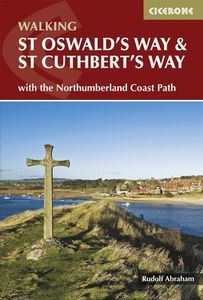
Wandelgids St Oswald's Way and St Cuthbert's Way | Cicerone

0
Uitstekende wandelgids die in etappes de route nauwkeurig beschrijft. This guide describes two long-distance trails through the unspoilt scenery of Northumberland and the Borders. St Oswald's Way begins at Heavenfield and its 97 miles take in rolling farmland and the Simonside Hills before reaching the vast sandy beaches of the coast. The 62 mile S...

Webshops met dit product

Webshop
Bezorging
Prijs

Anderen bekeken ook

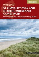
Wandelgids St Oswald's Way and Northumberland Coast Path | Cicerone
This guidebook describes the St Oswald's Way and Northumberland Coast Paths, both long-distance trails through Northumberland. St Oswald's Way (156km, 97 miles) begins in Heavenfield and traverses parts of Northumberland National Park and visits Hadrian's Wall, the Simonside Hills and the beautiful Coquet Valley, before continuing up the coast to Lindisfarne (Holy Island). The Northumberland Coast Path (100km, 62 miles) takes in the whole of the Northumberland Coast AONB with its breathtaking coastal scenery and birdlife.   Both trails converge on Holy Island, with the Coast Path continuing up to Berwick-upon-Tweed. Each trail can be walked in a week. The guide includes practical advice on when to go and what to take, and information on the region, its weather, wildlife, history and heritage.   Detailed route descriptions and clear, step-by-step instructions are accompanied by 1:50K OS mapping. Public transport options and accommodation listings are also given. Described as the cradle …
23,95
Fietsgids Cycling the Reivers Route | Cicerone
Guidebook to the Reivers Route, a 173 mile (280km) coast-to-coast cycle route across northern England and into Scotland from Tynemouth to Whitehaven. Exploring the rich history of traditional border territory, it is suitable for cyclists of all abilities and most commonly tackled on hybrid or sturdy touring bikes. Road alternatives are available. As the wildest of the northern coast-to-coast cycle routes, the Reivers Route explores the rich Border Reiving history of northern England and the Scottish Borders. Travelling 173 mile (280km) from Whitehaven to Tynemouth, this four-day cycle tour takes in the Cumbrian coast, northern Lake District, Northumberland National Park and North Tynedale, offering memorable off-road cycling through Kershope Forest and around Kielder Water. The route offers both on and off-road cycling, and is suitable for cyclists using touring or hybrid bikes. Places to stay overnight include Carlisle, Bailey Mill and Bellingham.   The guidebook also offers the Borde…
16,50
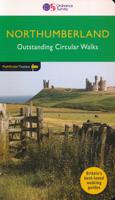
Wandelgids 87 Pathfinder Guides Northumberland | Ordnance Survey
Pathfinder® Guide to Northumberland, featuring 28 outstanding walks designed for a range of abilities covering 180 miles of walking.   Features:   28 guided walks for a range of abilities Large detailed Ordnance Survey map extracts Key information such as parking and type of terrain GPS waypoints for each route Weather-resistant book cover Durable rounded corners   This new guide to Northumberland has ten brand-new Pathfinder walks across the county. There are new short walks at Berwick-upon-Tweed, Almouth and Bellingham. There are new half-day walks in the Coquet Valley at Felton, in the Humbleton Hills from Wooler, exploring the countryside south of the River Tyne from Hexham, and taking you along the scenic Wansbeck Valley to Morpeth from Bothal. And there are new longer walks in Hulne Park, Alnwick; along the coast and inland from Bamburgh; and a lengthy but hugely enjoyable ramble in a circuit from Druridge Bay to Warkworth and a return via Amble along the Northumberlan…
18,50
Wandelkaart Northumberland Coast Path and Berwickshire Coastal Path |
Mooie, duidelijke kaart van de Northumberland Coast Path en het vervolg daarop de Berwickshire Coastal Path in Noord-Engeland en Schotland. Geplastificeerd met veel extra informatie en uitsnedes van de route.    The Northumberland Coast Path stretches for 103km (64m) from Cresswell in the south to Berwick-upon-Tweed in the north. The Berwickshire Coastal Path stretches for 48km (28m) and continues this route from Berwick-upon-Tweed to Cockburnspath. These routes are part of the North Sea Trail and offer some of the finest coastal walking in the country with rugged coastline, stunning cliff scenery and panoramic views.   XT40 - These maps are a leap forward in technical excellence. They are tough, durable, light and 100% waterproof - virtually indestructible in normal use.   They are light to carry, and compact - not the great bulky package you get with a laminated map.   The map is detailed, with the routes clearly marked. It also contains general information, useful telephone numbers …
25,95
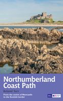
Wandelgids Northumberland Coast Path | Aurum Press
Goede beschrijving van de aantrekkelijke route. Kaartmateriaal van Ordnance Survey - de Engelse topografische dienst op een schaal van 1:25.000. Praktische info voor overnachten ed. niet altijd uitgebreid, maar die is op de site van de Ramblers (de engelse wandelorganisatie) te vinden. The Northumberland coastline stretches from the outskirts of Newcastle up to the Scottish border at Berwick-upon-Tweed – a popular holiday destination for its wild and sweeping landscape of endless beaches of pale sand, succession of spectacular castles like Bamburgh and Dunstanburgh, congenial resorts like Alnmouth, and unique offshore attractions like Holy Island and the Farne Islands. Now, Roland Tarr’s new Trail Guide maps out the walker’s route along the entire coast, starting from the centre of Newcastle and including an extension beyond Berwick to the seabird crags of St Abb’s Head.   Along the way the guide covers the remarkable industrial heritage of this coastline – the coalmining town of Ashin…
20,95

Klanten-reviews van Wandelgids St Oswald's Way and St Cuthbert's Way | Cicerone

Er zijn nog geen beoordelingen voor dit productBen jij de eerste die een review plaatst?

Meer over Wandelgids St Oswald's Way and St Cuthbert's Way | Cicerone

Productomschrijving

Uitstekende wandelgids die in etappes de route nauwkeurig beschrijft. This guide describes two long-distance trails through the unspoilt scenery of Northumberland and the Borders. St Oswald's Way begins at Heavenfield and its 97 miles take in rolling farmland and the Simonside Hills before reaching the vast sandy beaches of the coast. The 62 mile St Cuthbert's Way begins at Melrose and crosses the rugged crags and heather moorland of the Cheviot Hills. Both trails pass through Northumberland National Park to converge on atmospheric Holy Island, before continuing up the coast to Berwick-upon-Tweed. Each can be walked within a week, though there is scope for  shortening or lengthening the stages to suit different itineraries. Also shown is the 64 mile the Northumberland Coast Path from Cresswell to Berwick, which covers the entire length of the Northumberland Coast AONB. The guidebook is crammed with interesting snippets of information, alongside indispensable practical details of transport and accommodation in the area. With varied scenery and a rich history encompassing spectacular castles, medieval abbeys and Roman remains, this is one of Britain's most beautiful corners to explore on foot. Steden en Dorpen Holy Island (Lindisfarne), Bamburgh, Craster, Cresswell, Berwick-Upon-Tweed, Rothbury, Heavenfield, Melrose, Wooler

Productspecificaties

Artikelnummer(s)
Brand
Cicerone
Webshop.nl maakt gebruik van cookies. Ga je verder op onze website, ga dan akkoord met het plaatsen van cookies en de verwerking van deze data door ons en vermelde partners.