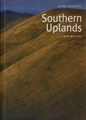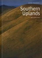
Wandelgids Southern Uplands | Pocket Mountains

0
Mooi uitgevoerde wandelgids in een handzaam formaat: 15 x 10 cm. De wandelingen zijn duidelijk beschreven, soms een beetje summier. This Pocket Mountains guide to the Southern Uplands of Scotland contains 40 hill walks, trademark photography and inventive circular routes. Each route is accompanied by a full colour photograph, contoured map and add...

Verkopers met dit product

Verkoper
Bezorging
Prijs
DeZwerver.nl logo
DeZwerver.nl
2,95
10,95

Anderen bekeken ook

Wandelgids Southern Uplands | Pocket Mountains
Mooi uitgevoerde wandelgids in een handzaam formaat: 15 x 10 cm. De wandelingen zijn duidelijk beschreven, soms een beetje summier. This Pocket Mountains guide to the Southern Uplands of Scotland contains 40 hill walks, trademark photography and inventive circular routes. Each route is accompanied by a full colour photograph, contoured map and additional facts about the history, geology and wildlife. Coverage of The Galloway Hills, Lowther and Moffat Hills, Clyde and Tweed, Edinburgh and Lothian, Cheviot and Langholm Hills.  
10,95
Wandelgids Southern Highlands | Pocket Mountains
Mooi uitgevoerde wandelgids in een handzaam formaat: 15 x 10 cm. De wandelingen zijn duidelijk beschreven, soms een beetje summier. This Pocket Mountains guide to the Southern Highlands of Scotland covers Glenlyon to Rannoch, Kinross to Callander, The Arrochar Alps, The Trossachs to the Mamlorn Hills, Hills of Crianlarich and Tyndrum -40 circular routes with 45 full colour maps -Each route is circular and takes into account the environmental impact of the walker -The routes vary in difficulty from easy half-day walks to longer, more challenging hikes -Original full colour maps for each route -Stunning colour photography throughout - Covers all the Munros (peaks over 3000 feet) and the best Corbetts (peaks over 2500 feet) in the area) - Designed in durable pocket format to take into the hills - Notes on history, geology and wildlife accompany each section of the book  
10,95
Wandelgids The Southern Upland Way | Cicerone
Uitstekende wandelgids van de Southern Upland Way, waarbij naast alle noodzakelijke informatie ook gebruik gemaakt wordt van de echte topografische kaart.   The Southern Upland Way is Scotland's coast-to-coast walk and the longest of the nation's Great Trails. 215 miles long, it links the pretty harbour village of Portpatrick on the west coast with Cockburnspath, a little south of Dunbar, in the east. The walk is at times a strenuous one, crossing the remote high moorland of the Galloway Hills, Carsphairn range, Lowthers, Ettrick Hills and Lammermuirs, calling for competence, fitness and self-reliance.    This guide presents advice on how best to plan and tackle this challenging but highly rewarding journey. The waymarked trail is presented in fourteen stages of 9–19 miles and suggestions for a rest day exploring Moffat and its environs are also included. It is possible either to backpack, taking advantage of five bothies and unlimited wild camping possibilities, or to stay in town…
20,95
Wandelgids Walking in the Southern Uplands | Cicerone
This guidebook describes 44 routes and over 100 summits stretching across the Southern Uplands of Scotland, stretching south-west from Edinburgh to the English border, including the Galloway and Pentland Hills. The walks range between 2 and 29km, suitable for walkers of all abilities.   The Scottish Southern Uplands is a range that is about as big as the English Pennines. It is wild hill country, with over 80 hills of 2000ft or more, and it boasts a real remoteness that is difficult to find elsewhere. All hillwalkers should experience these wonderfully characterful landscapes: green and gentle, but with hidden surprises and remote escapes.   The routes are suitable from spring to autumn, and on winter days with good weather and snow conditions. Each route provides OS mapping, information on distance, ascent, time, maximum altitude and terrain, as well as details of any variants or shortcuts. With notes on points of interest along the way as well as on transport and accommodation, the …
21,95
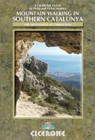
Wandelgids Mountain Walking in Southern Catalunya | Cicerone
First English-language guide to mountain and coastal walking near Tortosa, Southern Catalunya, Spain, in the Parc Natural dels Ports, on the Card and Montsia massifs and along the coast. All easily accessible from Barcelona, Valencia and Reus but unknown outside the region. 30 idyllic winter routes for walkers of all experience and abilities.Seasonsgood walking from October through to May; when strong winds or the occasional dusting of snow arrive on the high ridges the sheltered coastal slopes provide good routesCentresTortosaDifficultyfrom broad tracks to airy scrambles round huge cliffs; walks graded for routefinding, scrambling and exposure; all within capabilities of experienced hill walkers rockclimbing skills and equipment are not neededMust SeeParc Natural dels Ports, herb-covered hillsides, high pine forest, Templar castles, picturesque hill villagesA dramatic coastal mountain region of great natural beauty, Southern Catalunya is mysteriously unknown outside Spain. In the moun…
20,50
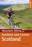
Fietsgids - Mountainbikegids Mountain Biking in Southern and Central Scotland | Cicerone
Degelijke fietsgids met 21 mountainbike routes in zuid en midden Schotland. Goede beschrijvingen en duidelijke kaarten.   This guidebook describes 21 mountain biking routes in central and southern Scotland. It includes the 7stanes trail centre in Dumfries and Galloway, as well as cross-country routes in the Campsie Fells, Pentland Hills and Lammermuirs, the Galloway Forest, Tweed Valley, Cheviots and Lowther Hills. The routes range from 16.5 to 66km and are graded from moderate to very hard. Taking between 2 and 7 hours to complete, they are intended for reasonably fit mountain bikers with at least some experience.   Detailed route descriptions are accompanied by 1:50,000 OS mapping, and the selected routes set out from various points across the area, including Greenock, Glentrool, Peebles and Milngavie, with good access from both Glasgow and Edinburgh. The guidebook also gives an overview of what the region's MTB trail centres have to offer, including the famous 7stanes trail cent…
24,95
Wandelkaart Southern Upland Way | Harvey Maps
Southern Upland Way is Britain's first official coast to coast long distance footpath and is one of Scotland's Great Trails. It runs 340km (212 miles) from Portpatrick on the south west coast of Scotland to Cockburnspath on the eastern seaboard. It offers superb and varied walking country, still undiscovered by many enthusiasts. The Way provides a real challenge for the experienced walker, yet some of the shorter stretches are suitable for families and the less ambitious.
28,50
Wandelgids The Tweed | Pocket Mountains
Handige compacte wandelgids met 40 dagwandelingen. Deze gids bevat kleine kaartjes en leuke uitgebreide informatie over wat er langs de route te zien is. Goede wandelkaarten zijn echter we noodzakelijk voor deze tochten: de Ordnance Survey explorer maps of Landanger maps zijn zeer geschikt.   One of the world’s great salmon rivers, the Tweed cuts through the heart of the Scottish Borders and, in part, forms the historic boundary between Scotland and England. Rising in the rolling hills near Moffat, it weaves through a cherished landscape on its way to Berwick-upon-Tweed and the North Sea, passing through the proud Border towns of Peebles, Galashiels, Melrose, Kelso and Coldstream on the way.   There is no better way to discover the wildlife, architecture and history of this area of Scotland than to walk. Whatever your ability – walking at high or low level, following tough terrain or level paths – the 25 routes in this guide offer something for everyone.   Plaatsen in het boekje Abbot…
10,95
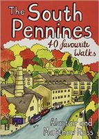
Wandelgids The South Pennines | Pocket Mountains
Handige compacte wandelgids met 40 dagwandelingen. Deze gids bevat kleine kaartjes en leuke uitgebreide informatie over wat er langs de route te zien is. Goede wandelkaarten zijn echter we noodzakelijk voor deze tochten: de Ordnance Survey explorer maps of Landanger maps zijn zeer geschikt.     The home of Heathcliffe and Nora Batty, the wild and wuthering South Pennines is where Yorkshire and Lancashire collide, a watershed landscape of great natural beauty which is home to proud and welcoming communities with a heritage of rugged farming and industrial hard graft. This collection of forty walks explores the steep-sided valleys, heather moorlands, craggy hills and gritsone villages which have inspired and attracted writers and artists for generations to this unspoilt upland haven just a stone's throw from some of northern England's largest towns and cities.  
10,95
Wandelgids West Lothian | Pocket Mountains
Handige compacte wandelgids met 40 dagwandelingen. Deze gids bevat kleine kaartjes en leuke uitgebreide informatie over wat er langs de route te zien is. Goede wandelkaarten zijn echter we noodzakelijk voor deze tochten: de Ordnance Survey explorer maps of Landanger maps zijn zeer geschikt.     Midway between Glasgow and Edinburgh on the southern shore of the Firth of Forth, West Lothian has a surprising number of country parks, craggy hills and wildlife havens and is home to several prehistoric burial sites, ruined castles and palaces and stately homes as well as the remains of the Antonine Wall, the Roman Empire's northernmost frontier. Although the area is predominantly rural there were also extensive coal, iron and shale oil mining operations in the 18th and 19th centuries which left behind distinctive red spoil heaps, or bings, as they are known in Scotland, and the Union Canal which linked Falkirk to the capital via some of the county's most impressive aqueducts.  
10,95

Klanten-reviews van Wandelgids Southern Uplands | Pocket Mountains

Er zijn nog geen beoordelingen voor dit productBen jij de eerste die een review plaatst?

Meer over Wandelgids Southern Uplands | Pocket Mountains

Productomschrijving

Mooi uitgevoerde wandelgids in een handzaam formaat: 15 x 10 cm. De wandelingen zijn duidelijk beschreven, soms een beetje summier.

This Pocket Mountains guide to the Southern Uplands of Scotland contains 40 hill walks, trademark photography and inventive circular routes. Each route is accompanied by a full colour photograph, contoured map and additional facts about the history, geology and wildlife. Coverage of The Galloway Hills, Lowther and Moffat Hills, Clyde and Tweed, Edinburgh and Lothian, Cheviot and Langholm Hills.


Productinformatie

    Verken gerelateerde categorieën

    Webshop.nl maakt gebruik van cookies. Ga je verder op onze website, ga dan akkoord met het plaatsen van cookies en de verwerking van deze data door ons en vermelde partners.