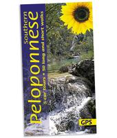
Wandelgids southern Peloponnese - Peloponnessos | Sunflower books

0
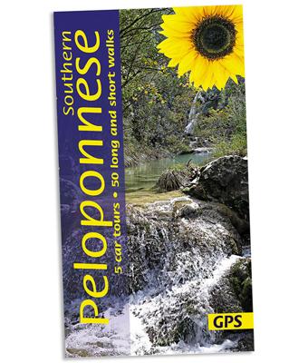
Wandelgids: vele dagtochten worden degelijk beschreven met openbaar vervoer informatie, goede routebeschrijvingen en kaartmateriaal. Tevens enkele autotochten. Deze gids staat goed bekend! Engelstalig 5 car tours (each with picnic suggestions), 50 long and short walks 152 pages + 2 touring maps (eastern and western Peloponnese), 1:50,000 topo maps...

Verkopers met dit product

Verkoper
Bezorging
Prijs
DeZwerver.nl logo
DeZwerver.nl
2,95
21,95

Anderen bekeken ook

Wandelgids southern Peloponnese - Peloponnessos | Sunflower books
Wandelgids: vele dagtochten worden degelijk beschreven met openbaar vervoer informatie, goede routebeschrijvingen en kaartmateriaal. Tevens enkele autotochten. Deze gids staat goed bekend! Engelstalig 5 car tours (each with picnic suggestions), 50 long and short walks 152 pages + 2 touring maps (eastern and western Peloponnese), 1:50,000 topo maps   There are hidden landscapes throughout mainland Greece, but the region which packs the most variety into the smallest space is the Peloponnese. From the beaches of Arcadia to the fir forests of Mt Parnon, from the olive groves of Kalamata to the pyramidal peak of Prophet Elijah, from classical Sparta to medieval Mani, this compact semi-island has it all. Though the ancients called it ‘the island of Pelops’, after their mythical king, this three-fingered landmass is joined to the mainland by a narrow isthmus at Corinth. Only in the 19th century was a canal finally cut through the isthmus, but it retains the cultural diversity and spectacula…
21,95
Wegenkaart - landkaart 2 Peloponnese - Peloponnesos | Anavasi
De nieuwe editie van de kaart van de Peloponnesus komt met veel verbeteringen. De grotere schaal maakt het veel leesbaarder en laat gedetailleerde informatie van de kaart zien: Uitgebreid weg- en vestigingsnetwerk. Tal van archeologische sites die voor het eerst op een kaart worden gepubliceerd. Stranden, kamperen, jachthavens, berghutten en de loop van de E4 en de belangrijkste nationale paden 31, 32 en 33. En een innovatie: 10 suggesties voor unieke sites om te bezoeken aan de zijkant van de kaart. Road and touring map of the Peloponnese in scale 1:200 000. On the map find ideas for 10 top nature destinations. Planning a road trip in the Peloponnese? This is the map to take with you. It shows all road categories, to the last dirt road. Every settlement, stating their original name, when known. Plenty of archaeological sites published for the first time on a map. Beaches, camping, marinas, mountain refuges and the course of the E4 and the major national paths 31, 32 and 33. Map corre…
11,95
Reisgids Greece: The Peloponnese - Griekenland: Peloponnesos | Bradt Travel Guides
Voor vele landen net zo goed, zo niet beter dan de Planet. Beduidend soberder uitgevoerd, maar ook met veel informatie voor backpackers en met veel kaartmateriaal. Een aanrader! Engels. This new, thoroughly updated fifth edition of Bradt's Greece: The Peloponnese with Athens, Delphi and Kythira remains the only dedicated guidebook to the southern part of the Greek mainland. It provides more detailed coverage than any other rival guide, making it indispensable for independent and group travellers visiting a fascinating area slightly smaller than Wales. It also incorporates focussed mini-guides to the Greek capital of Athens and the world-famous site of Delphi.   The Peloponnese contains a huge diversity of cultural landscapes, from sleepy, white-washed villages to Byzantine churches, medieval fortresses and ancient archaeological sites such as Olympia and Mycenae. In addition to a long Mediterranean coast lined with classic white sandy beaches, the peninsula incorporates towering mount…
27,50
Wegenatlas Peloponnese | Anavasi
Paperback, 237-page road atlas of the Peloponnese with detailed contoured mapping at 1;50,000 showing place names in Greek and Roman alphabets and providing a 2km UTM grid for GPS use. The main section of the atlas has 178 pages of detailed maps with contours at 100m intervals, altitude colouring and relief shading to provide a vivid representation of the terrain. Nearly all names: town and villages, geographical features, etc., are given in both Greek and Roman alphabets, with just minor local churches shown in Greek only. Names of most archeological sites and many other places of interest are given in Greek and in English. Road classification has 10 different grades, from toll motorways to minor dirt roads in poor condition and 4WD tracks. Intermediate driving distances are shown on main and secondary roads. The maps also indicate locations of petrol stations (with names of oil companies) and tire repairs facilities. Local footpaths are also marked, with the E4 trans-European long-d…
26,95
Wegenkaart - landkaart - Fietskaart 6 Touring Map Peloponnese - Peloponnesos | Terrain maps
Scheur- en watervaste wegenkaart van de Peloponnesos.De plaatsnamen op de kaart zijn in het Grieks en het Engels. This is the best map of Peloponnese on the market in every respect. Here’s what makes it so special:  Excellent map composition and spatial distribution. The scale of 1:200.00 is extremely demanding in regards to map composition. If you squeeze in too much information you get a user-unfriendly, chaotic map. If you make it too roomy, you get a substandard map unable to satisfy demanding travelers. TERRAIN’s map of Peloponnese is the map with the most ‘practiced’ composition, and the final result is impressive: all roads, villages and sights that a 1:200.00 scale can ‘tolerate’ are so meticulously placed on the map that using it is a piece of cake!  G.I.S. mapping technology in two geodetic reference systems (ΕΓΣΑ 87 and WGS 84.)  Waterproof Polyart paper, which doesn’t rip. You can fold and unfold your map as many times as you want, in any shape or form, and it’s indestr…
13,50
Reisgids Reise-Taschenbuch Peloponnes - Peloponnesos | Dumont
Goede, fraai ogende gids, handzaam formaat en toch behoorlijk uitgebreid over de Peloponnessos. Deze serie reisgidsen zijn algemene reisgidsen en bevatten een brede selectie aan bezienswaardigheden, excursies, achtergronden, praktische tips en een uitneembare kaart. Über das Buch In der griechischen Region Peloponnes, zwischen der Großstadt Patras im Nordwesten und der kargen Halbinsel Máni im Süden, erwarten uns erstaunliche Entdeckungen und unerwartete Erlebnisse. Hier blieben viele Traditionen der Griechen noch fast unberührt erhalten. Zwischen langen Sandstränden, wild-einsamen Bergregionen wie dem Parnon und vielen romantischen Landstädtchen gibt es unendlich viele Möglichkeiten zur Entschleunigung: alte Orte wie Náfplio mit Bilderbuchflair, historische Burgen der Kreuzritter, antike Ruinen wie Olympia, Korinth oder Mykene - also fast eine echte Zeitreise. Natururlauber können sich an feinsandigen Stränden, auf Berg-Trails, in grünen Tälern voller Wasserfälle und sogar auf dem …
22,50
Reisverhaal Mani - Travels in the Southern Peloponnessos | Patrick Leigh Fermor
Mani is het meest afgelegen, meest geïsoleerde en wildste gebied van Griekenland. Van de rest van het land afgesneden door de torenhoge bergketen van de Taygetos en ingeklemd tussen de Egeïsche en Ionische Zee, is deze rotsgie centrale uitloper van de Peloponnesus het zuidelijkste punt van mediterraan Europa. Tussen Kaap Matapan, het antieke Tenaron, en de kust van Afrika liggen alleen nog een paar verspreide eilanden. Dicht bij de laatste kaap ligt de grot die naar Hades leidt. Deze bergen waren volgens de bewoners het toevluchtsoord van hun voorouders, de Spartanen, toen er aan hun hegemonie achter de Taygetos een einde werd gemaakt. Het is een gebied vol peilloze afgronden, desolaat en ondoordringbaar, en de paar reizigers die zich er hebben gewaagd, wijzen steeds op een overeenkomst tussen de grillige rotsen en de mensen die er wonen. Mani is het verslag van het verblijf van Patrick Leigh Fermor in deze ruige streek, waarin hij op onnavolgbare wijze het heden en het verleden bij e…
15,50
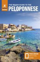
Reisgids The Rough Guide to the Peloponnese: Travel Guide with EBook | Rough Guides
Ideal for independent travellers, this guidebook to the Peloponnese, written by destination experts, combines must-see sights with hidden gems and offers essential tips for both planning and on-the-ground adventures. It's sustainably printed to ensure environmental responsibility. Inside this Peloponnese travel book, you'll find: Regional deep dive - coverage of key regions, offering a rich selection of places and experiences, and honest reviews of each one Itinerary samples - designed for various durations and interests Practical information - tips on how to get there and get around, use public transport, beat the crowds, save time and money, travel responsibly and more Expert recommendations - insider advice on where to eat, drink, and stay, alongside tips for nightlife and outdoor activities Seasonal tips - when to go to the Peloponnese, climate details, and festival highlights to plan your perfect trip Must-See pick - a curated selection of not-to-miss sights as chosen …
20,95

Klanten-reviews van Wandelgids southern Peloponnese - Peloponnessos | Sunflower books

Er zijn nog geen beoordelingen voor dit productBen jij de eerste die een review plaatst?

Meer over Wandelgids southern Peloponnese - Peloponnessos | Sunflower books

Productomschrijving

Wandelgids: vele dagtochten worden degelijk beschreven met openbaar vervoer informatie, goede routebeschrijvingen en kaartmateriaal. Tevens enkele autotochten. Deze gids staat goed bekend! Engelstalig

5 car tours (each with picnic suggestions), 50 long and short walks 152 pages + 2 touring maps (eastern and western Peloponnese), 1:50,000 topo maps   There are hidden landscapes throughout mainland Greece, but the region which packs the most variety into the smallest space is the Peloponnese. From the beaches of Arcadia to the fir forests of Mt Parnon, from the olive groves of Kalamata to the pyramidal peak of Prophet Elijah, from classical Sparta to medieval Mani, this compact semi-island has it all. Though the ancients called it ‘the island of Pelops’, after their mythical king, this three-fingered landmass is joined to the mainland by a narrow isthmus at Corinth. Only in the 19th century was a canal finally cut through the isthmus, but it retains the cultural diversity and spectacular scenery of the mainland. Area covered: Because there’s so much to discover, the author has drawn an east-west line roughly through the middle of the Peloponnese, and limited the book to the southern half. By good fortune, this contains its highest mountain range (Mt Taygetus), its finest Byzantine chapels and medieval forts (in the Mani), its wildest seascapes (Capes Tainaron and Maleas), its largest forest (Mt Parnon) and, arguably, some of its loveliest beaches (Pylos, Kiparissi and Elafonisos, to name just a few. The best months for walking in the Peloponnese are April and May, late September and October.   THE WALKS (n see explanation of symbols on page 35)   1 Around ancient Messene 42 2 Stenosia • Kalamaris Waterfall • Yialova 45 3 Golden Beach • Paliokastro • Voidokilia Beach • Profitis Ilias • Golden Beach 48 4 Polilimnio Waterfalls 52 5 Kato Karveli • Karveli • Lada • Artemisia 55 6 Profitis Ilias • Pigadiotiko Bridge • Pigadia • (Koskarakas Gorge) • Profitis Ilias 59 7 Sotirianika • Kambos • (Zarnatas Castle) • Kardamyli 64 8 Exohori • Sotiros Monastery • Tseria • Viros Gorge • Exohori 72 9 Kardamyli • Petrovouni • Proastio • Kalamitsi Beach • Kardamyli 79 10 Milia • Panayia Yiatrissa Monastery • Milia 67 11 Milia • Eleohori • Riglia • Pantazi Beach • Ayios Nikolaos • (Stoupa) 82 12 Neo Itilo Beach • Areopolis • Diros Sea Caves 86 13 Three grassy meadows: Thalames • Somatiana • Langada • Thalames 89 14 Two short walks near Stavri 92 15 Gerolimenas • Pepon • Leontakis • (Mountanistika) • Gerolimenas 95 16 Paliros • Vathy Bay • Kokkinoyia • Temple of Poseidon • Cape Tainaron • Kokkinoyia 98 17 Ascent of Mt Taygetus: Profitis Ilias (Aï Lias) Peak 101 18 Ayios Georgios Chapel • Anavriti • Soha • Kalivia Sohas 105 19 Mystras • Taygeti • Zoodochou Pigis Monastery • Pergandeïka • Faneromeni Monastery • Langadiotissa Gorge • Mystras 110 20 Mount Parnon — from the EOS mountain refuge to Malevis Nunnery 116 21 Mouria Valley • Taxiarches Monastery • Paliohori 120 22 Leonidio• Melana • Paralia Livadi 124 23 Circuit from Leonidio 127 24 From Pigadi to Poulithra 130 25 From Kremasti to Kiparissi 133 26 Around Monemvasia 136 27 Ayios Nikolaos to Monemvasia 139 28 Ayia Katerini chapel from the Vavila road pass 142 29 Velanidia • Ayios Thomas • Cape Maleas lighthouse • Velanidia 144 30 Ayia Marina • Ayia Irini • Ayia Marina 147
 

Productinformatie

    Verken gerelateerde categorieën

    Webshop.nl maakt gebruik van cookies. Ga je verder op onze website, ga dan akkoord met het plaatsen van cookies en de verwerking van deze data door ons en vermelde partners.