Wandelgids South West Coast Path Map Booklet | Cicerone

0
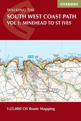
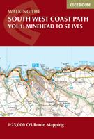
A booklet of all the mapping needed to walk the South West Coast Path between Minehead and St Ives. Covering the northern section of this 1014km (630 mile) National Trail along the north Devon and Cornish coastline.   The full route is shown on 1:25,000 OS maps Route passes through Lynmouth, Westward Ho!, Clovelly, Bude, Padstow, Newquay The map b...

Verkopers met dit product

Verkoper
Bezorging
Prijs
DeZwerver.nl logo
DeZwerver.nl
2,95
19,50

Anderen bekeken ook

Nieuw
Wandelatlas South West Coast Path Map Booklet - Vol 3 | Cicerone
This booklet of Ordnance Survey 1:25,000 Explorer maps shows the full line of the section of the National Trail between Plymouth and Poole, providing all the mapping you need to walk the trail in either direction. It is conveniently sized for slipping into a jacket pocket or top of a rucksack. Two separate booklets cover the route from Minehead to St Ives and from St Ives to Plymouth.   The map booklets accompany the Cicerone guidebook - The South West Coast Path - which describes the full National Trail in 45 stages, with lots of other practical information and local points of interest. The South West Coast Path is Britain's longest National Trail, stretching some 630 miles (1014km) between Minehead in Somerset and Poole in Dorset.  
17,95
Reisgids The South West Coast Path | Bloomsbury
Often featuring in lists of the world's best walks, the South West Coast Path is 630 miles long, and passes through two World Heritage Sites. This guide to the path is a modern take on the traditional (turn right at the stile, and follow the footpath to the bridge) guidebook: instead of telling readers where to go step by step, Stephen gives fantastic ideas for what to do as they travel along the path. There are so many amazing adventures and places to visit (some 'secret' and some well known) and this guide highlights 1,000 of them, all situated along the route.   After an Introduction giving a history of the path and the stories of the people who made it (Why is this path the most popular National Trail? Why is it so closely associated with tales of King Arthur? When is the best time to visit?) the bulk of the book focuses on all the amazing things you can do along the path itself. It is divided into regions, with over 70 adventures/highlights per region: West Somerset, North Devon,…
27,95
Wandelatlas Hadrian's Wall Path Map Booklet | Cicerone
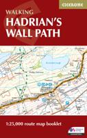
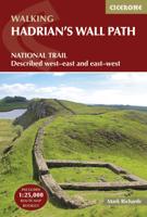
All the mapping you need to walk the 84 mile (135km) Hadrian's Wall Path from Bowness-on-Solway in Cumbria to Wallsend, Newcastle. This booklet of Ordnance Survey 1:25,000 Explorer maps has been designed for convenient use on the trail. It shows the full and up-to-date line of the Hadrian's Wall Path, along with the relevant extract from the OS Explorer map legend. It can be used when walking the trail west-east or east-west, and includes an extension to the east coast at South Shields. It is conveniently sized for slipping into a jacket pocket or top of a rucksack. This booklet is included with the Cicerone guidebook to Hadrian's Wall Path National Trail.
17,95
Wandelgids 8 The South West Coast Path | Aurum Press
Goede beschrijving van een deel van het beroemde South West Coast path in Cornwall. Men heeft gebruik gemaakt van zeer gedetailleerde kaarten van Ordnance Survey. Part one of the official four-part series covering Britain's longest National Trail in detail. Contains easy to follow Ordnance Survey mapping for individual sections, detailed route descriptions for the National Trail and shorter, circular walks off it. Full colour throughout. The South West Coast Path is the spectacular 630-mile (1008-km) National Trail around the tip of Britain. This volume features the section of the Path from Minehead to Padstow, a distance of 163 miles (262 km). The Trail traces the beautiful coastline, through Exmoor National Park, Clovelly and Tintagel, following Natural England's acorn waymarks. This is the complete, official guide for the long distance walker or the weekend stroller. All you need is this one book. National Trail Guides are the official guidebooks to the fifteen National Trails in E…
20,95
Wandelgids Cornwall Coast Path | Trailblazer Guides
Wandelgids met uitgebreide beschrijvingen wandelingen en praktische informatie met eenvoudige kaarten van de wandelroutes. Practical, complete hiking route guide, with maps and accommodation for the 288-mile footpath that runs around the entire coastline of Cornwall, from Bude to Plymouth; Part 2 of the South-West-Coast Path, a 630-mile National Trail from Minehead to Poole. Includes * 142 large-scale walking maps in TWO-COLOUR style (3 1/8inches to 1 mile), 15 town plans, guides to 81 towns and villages, 24 stage maps and overview map. * Itineraries for all walkers - whether walking the route in its entirety over a week to 10 days or sampling the highlights on day walks and short breaks * GPS waypoints * Practical information for all budgets - camping, bunkhouses, hostels, B&Bs, pubs and hotels; where to stay, where to eat, what to see.   * Comprehensive public transport information - for all access points on the coast path * Flora and fauna - 6 page full colour, flower, butterfly, b…
20,95
Wandelgids Dorset and South Devon Coast Path - South West Coast Path | Trailblazer Guides
Wandelgids van de South West Coast Path  met uitgebreide beschrijvingen wandelingen en praktische informatie met eenvoudige maar zeer accurate kaarten van de wandelroutes. This guide covers the third and last section of the South West Coast Path, from Plymouth to Poole Harbour (217 miles). This beautiful route includes 95 miles within England's only Natural World Heritage Site, the Jurassic Coast, and passes dramatic cliffs and headlands, Chesil Bank's impressive spit and Lulworth Cove, winding through idyllic seaside villages such as Beer and Lyme Regis. - 97 maps large-scale walking maps - at just under 1:20,000 - with unique mapping features: walking times, directions, tricky junctions, places to stay and eat, points of interest. These are not general-purpose maps but fully-edited maps drawn by walkers for walkers. - Itineraries for all walkers - whether walking the route in its entirety or sampling the highlights on day walks and short breaks - Practical information for all budget…
19,95
Wandelgids Wales Coast Path: Snowdonia and Ceredigion | Northern Eye Books
Official Guide: Wales Coast Path: Snowdonia & Ceredigion Coast One of seven Official Guides to the Wales Coast Path This Official Guide to the Snowdonia & Ceredigion Coast section of the Wales Coast Path contains everything local and long-distance walkers need to enjoy the path.   Cardigan Bay probably offers a more diverse walking experience than any other section of the Wales Coast Path. The stretch covered in this book – from Porthmadog in the north to Cardigan in the south – largely covers two contrasting Welsh counties.   The first 97 kilometres pass through Gwynedd, along the western edge of the Snowdonia National Park. Here, just before the rivers that rise in the highest of the Welsh mountains reach the sea, they fan out to form broad estuaries that provide rich pickings for waders and other birdlife. The estuaries of the Dwyryd, the Mawddach and the Dyfi are the largest of these. Between them are some very large dune systems, including Morfa Harlech and Morfa Dyffryn – home t…
23,95
Wandelkaart North Wales Coast Path Map | Northern Eye Books
Enhanced, large scale (1: 25,000) Ordnance Survey mapping in a handy atlas format with all the mapping you need to walk a complete North Wales Coast section of the Wales Coast Path.   Continuous OS mapping covering the complete route from Chester to Bangor, on the Menai Strait. Contains generous coastal extracts from large-scale OS Explorer maps 266, 265, 264 and OL17.   The North Wales Coast Ordnance Survey mapping book is part of a series of map atlases covering the whole of the 870-mile long Wales Coast Path. The enhanced OS 1:25,000 maps are accurate, up-to-date and reliable. Additional map symbols show tea shops, cafes, extra parking, and public toilets.   A brief introduction to the North Wales Coast includes a fascinating photo mosaic highlighting notable views, places of interest and wildlife you’ll meet along the way. There is also a section of detailed Useful Information at the back of the atlas.   Laminated flapped covers showing Wales Coast Path signs and waymarkers, route…
16,50
Wandelgids Pembrokeshire | Northern Eye Books
OS Map Books: Wales Coast Path: Pembrokeshire Coast Path Map Atlas | Ordnance Survey ‘Explorer’ Large-scale 1:25,000 maps for the Pembrokeshire Coast in compact book format | Pocket Atlas | Walking Wales | UK Long-Distance Trails | Hiking | Adventure   One of seven handy Ordnance Survey Map Books covering the entire 870 mile/1400 kilometre-long, world-class Wales Coast Path — from Chester in the north to Chepstow in the south.   Enjoy enhanced, large scale (1:25,000) Ordnance Survey Explorer mapping in compact atlas format with all the detailed mapping you need to walk the Pembrokeshire Coast section of the Wales Coast Path.   Continuous, full colour OS mapping covering the Wales Coast Path between Cardigan and Amroth. Contains extracts from large scale Explorer maps OL 35 and OL 36. The enhanced OS 1:25,000 maps are accurate, up-to-date and reliable. Additional map symbols show tea shops, cafes, extra parking, and public toilets.   A brief introduction to Pembrokeshire Coast includes…
17,50
Wandelatlas Wales Coast Path Llyn Peninsula Map | Northern Eye Books
Enhanced, large scale (1: 25,000) Ordnance Survey mapping in a handy atlas format with all the mapping you need to walk a complete circuit of the Anglesey section of the Wales Coast Path.   Continuous OS mapping covering the complete route from Bangor to Porthmadog. Contains coastal extracts from large scale Explorer maps 253 and 254.   The Llyn Peninsula Ordnance Survey mapping book is part of a series of map atlases covering the whole of the 870-mile long Wales Coast Path. The enhanced OS 1:25,000 maps are accurate, up-to-date and reliable. Additional map symbols show tea shops, cafes, extra parking, and public toilets.   A brief introduction to the Llyn Peninsula includes a fascinating photo mosaic highlighting notable views, places of interest and wildlife you’ll meet along the way. There is also a section of detailed Useful Information at the back of the atlas.   Laminated flapped covers showing Wales Coast Path signs and waymarkers, route details and map symbols make these atlas…
13,95

Klanten-reviews van Wandelgids South West Coast Path Map Booklet | Cicerone

Er zijn nog geen beoordelingen voor dit productBen jij de eerste die een review plaatst?

Meer over Wandelgids South West Coast Path Map Booklet | Cicerone

Productomschrijving

A booklet of all the mapping needed to walk the South West Coast Path between Minehead and St Ives. Covering the northern section of this 1014km (630 mile) National Trail along the north Devon and Cornish coastline.   The full route is shown on 1:25,000 OS maps Route passes through Lynmouth, Westward Ho!, Clovelly, Bude, Padstow, Newquay The map booklet can be used to walk the path in either direction Sized to easily fit in a jacket pocket The relevant extract from the OS Explorer map legend is included An accompanying Cicerone guidebook – The South West Coast Path – is also available

Verken gerelateerde categorieën

Webshop.nl maakt gebruik van cookies. Ga je verder op onze website, ga dan akkoord met het plaatsen van cookies en de verwerking van deze data door ons en vermelde partners.