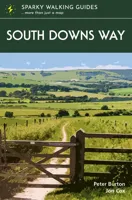
Wandelgids South Downs Way | Sparky Books

0
The magnificent South Downs Way traverses the chalk hills of Hampshire and Sussex for 100 miles between Winchester and Eastbourne, building in drama from west to east. Cosy rolling countryside, wooded escarpment slopes and rolling grassland downs - this national trail has it all, including the dazzling spectacle of the world-famous Seven Sisters a...

Verkopers met dit product

Verkoper
Bezorging
Prijs
DeZwerver.nl logo
DeZwerver.nl
2,95
20,95

Anderen bekeken ook

Wandelgids Cotswold Way | Sparky Books
The beauty of the Cotswolds is in no way lessened by its popularity, and the Cotswold Way leads you through the best of this most comforting of regions. The trail follows a snaking path along the western edge of the hills for 102 miles, from the pristine market town of Chipping Campden to the stately city of Bath – through deep-cut valleys and over beech-clad hills, across open pasture and past ancient barrows. You are never far from a view of the Severn Vale and the Welsh hills, or from a welcoming pub in a village of amber-hued stone.  * the latest 1:25,000 OS mapping, with the trail highlighted so you can see it at a glance * information nuggets throughout bring the countryside alive – past and present, seen and unseen * a handy slip-into-your-pocket design, with cover flaps to mark your page * planning info – practical help to plan your hike, including an overview map of the whole trail * stage descriptors, giving you an overview of what to expect on each leg * accommodation ideas…
20,95
Wandelgids The Ridgeway | Sparky Books
The Ridgeway - possibly the country’s oldest path - follows the central section of the mighty swathe of chalk that cuts across England from the Dorset to the Norfolk coasts. Between Avebury in Wiltshire and Ivinghoe Beacon in Buckinghamshire, it winds, undemandingly, for 87 miles along a trail of two halves, with the Thames providing its midpoint. The wide-open spaces of the bare North Wessex Downs are rich in prehistoric treasures and soul-cleansing views, while the Chilterns to the east are cosier, more populated, more heavily wooded. Step out and back in time on this classic ancient route.  * the latest 1:25,000 OS mapping, with the trail highlighted so you can see it at a glance * information nuggets throughout bring the countryside alive – past and present, seen and unseen * a handy slip-into-your-pocket design, with cover flaps to mark your page * planning info – practical help to plan your hike, including an overview map of the whole trail * stage descriptors, giving you an ove…
20,95
Wandelgids Capital Ring | Sparky Books
The Capital Ring traces a 78-mile loop between outer and inner London. Linking the city’s diverse communities and districts via green corridors, it provides a fascinating window into the ever-changing capital and the stories of those who have made it home. The variety is dizzying. Flitting between the urban and bucolic, you walk streets humble and high-class, across parks and woodlands, past palaces and factories, beside canals and rivers, taking in world-renowned sights and intriguing backwaters, and with frequent stunning views. No matter how well you think you know the metropolis, the Capital Ring will help you see London with fresh eyes. Guaranteed.   * super-clear OS town mapping, with the trail highlighted so you can see it at a glance * information nuggets throughout bring the city alive – past and present, seen and unseen * a handy slip-into-your-pocket design, with cover flaps to mark your page * planning info – practical help to plan your hike, including an overview map of t…
24,95
Wandelgids South Downs Way | Cicerone
Uitstekende wandelgids van dit geweldige gebied. goed beschreven met veel praktische informatie om de route te kunnen lopen, inclusief een apart boekje met zeer gedetaileerde kaarten. The South Downs Way National Trail is a 100 mile (160km) walk between Eastbourne and Winchester, staying within the glorious South Downs National Park for its entire length. Presented here in 12 stages of up to 12 miles (19km), the route is described in both east-west and west-east. A waymarked trail with very few stiles, it can be walked at any time of year and makes a good introduction to long-distance walking. Step-by-step route descriptions are illustrated with extracts from OS 1:50,000 mapping for every stage, and a separate, conveniently sized booklet with 1:25,000 maps for the entire route is included. The guide provides detailed practical information on getting to the trail, and facilities and accommodation en route. The South Downs Way offers easy walking on ancient and historical tracks, and sh…
24,95
Wandelgids South Downs Way | Trailblazer Guides
The South Downs Way is a 100-mile footpath which follows the line of chalk hills stretching from Winchester to Eastbourne. Walking the length of the Downs is the best way to experience this beautiful landscape with its mixture of rolling hills, steep hanging woodland and windswept fields. You'll also pass through picture-postcard villages with welcoming pubs, thatched cottages and country gardens. 1. Unique mapping features - In many walking guides the reader has to read a route description then try to relate it to the map. Our guides are easier to use because walking directions, tricky junctions, places to stay and eat, points of interest and walking times are all written onto the maps themselves in the places to which they apply. With their uncluttered clarity, these are not general-purpose maps but fully-edited maps drawn by walkers for walkers. Downloadable GPS waypoints also included. 2. The largest scale walking maps available - At just under 1:20,000 (8cm or 31/8 inches to 1 mi…
20,95
Wandelkaart South Downs Way | Vertebrate Publishing
The 162-kilometre South Downs Way begins in Winchester and traces a ridgeline along the rolling, green South Downs to the coast at Eastbourne. It is rightly regarded as one of the finest long-distance trails in England. Predominantly bridleway, the trail is generally wide and hard-surfaced and can be walked at any time of year.   The South Downs Way appeals to people who have different levels of experience and travel at all speeds, and this Vertebrate Publishing Guidemap is unique in that it caters for four categories of user, providing custom itineraries for walkers, trekkers, fastpackers and trail runners. This lightweight, waterproof, durable and easy-to-use folding map features all the essential information for a successful South Downs Way, including 1:40,000-scale mapping for the linear route starting in Winchester and finishing in Eastbourne. It also includes a detailed elevation profile and route planner, safety advice, terrain information and an accommodation directory, and a …
24,50
Wandelgids South Downs National Park | Ordnance Survey
Stroll up on the Downs, explore charming villages and wander woodland trails with ten hand-picked leisurely walks suitable for the whole family. Enjoy some of the loveliest and most accessible walks in the South Downs National Park and discover the benefits of being active outside.   South Downs Short Walks Made Easy include:   - Climb the Zig-Zag Path above charming Selborne, made famous by naturalist Gilbert White, for wonderful views - Explore the historic village of Bramber, once an important river port and full of intrigue, and enjoy the beautiful ‘Walk For All’ along the banks of the Adur - See the iconic Devil’s Dyke, offering great views in all directions from the hillfort above the longest and deepest dry valley in the country - Wander the Seven Sisters Country Park, part of the spectacular Sussex coastline between Eastbourne and Seaford - Follow the South Downs Way up Old Winchester Hill to find a hill-fort and barrows, as well as excellent views as far as the Solent and the…
10,95
Wandelgids The North Downs Way | Cicerone
Uitstekende wandelgids van de North Downs Way, waarbij naast alle noodzakelijke informatie ook gebruik gemaakt wordt van de echte topografische kaart. inclusief gidsje met routekaarten van 1:25000 A guidebook to walking the North Downs Way National Trail, a 130 mile (208km) walk between the high downland of Farnham and the historic city of Dover on the Kent coast, with an optional visit to Canterbury. The route is described in 11 stages, and is fully illustrated with colour photographs and OS map extracts. The North Downs Way is one of the easier national trails with a modest number of steep (but short) ascents and descents and long sections with no noticeable height gain or loss. Several historic sites including Neolithic burial chambers, Roman roads and Norman churches are passed and much of the route follows The Pilgrims' Way. The area also boasts many literary connections with some of the most celebrated voices in English literature. A separate pocket-sized map booklet is included…
23,95
Wandelgids Cleveland Way | Trailblazer Guides
All the information you need to enjoy your hiking adventure along the Cleveland Way in this fully revised and updated 2nd edition. In the beautiful, wild countryside of the North York Moors National Park in northern England lies this fabulous trail, the Cleveland Way. The 110-mile route runs from Helmsley near Thirsk around the western edge of the park to reach the coast at Saltburn-by-the-Sea.   It then continues along the eastern edge of the park south down the coast through Whitby, Robin Hood's Bay and Scarborough to finish in Filey. Combining moorland and coast there's wonderful scenic variety to this walk, with crumbling castles and idyllic fishing villages to explore. The guide includes:48 large-scale walking maps - at just under 1:20,000 - showing route times, places to stay, places to eat, points of interest, and 8 town plans10 colour stage maps to help plan your walk, including hills and descents, and two colour overview mapsPlaces to stay with reviews - campsites, bunkhouses…
21,95
Wandelgids North Downs Way national trail | Aurum Press
Goede engelstalige wandelgids van deze LAW in zuid oost Engeland, net onder Londen. Goede beschrijving en prima kaarten van Ordnance Survey, enigzins beperkte praktische tips, maar die zijn op de website van de route eenvoudig te vinden. This is the complete official guide to walking the well-loved and popular North Downs. Whether you're an experienced long distance walker or a weekend stroller, this is the only companion you need to this beautiful and scenic route. The North Downs Way is the National Trail that follows the official acorn waymarks from Farnham to the coast at Dover.   This picturesque trail takes in chalk ridges, river valleys and sections of the Pilgrims' Way. At the eastern end you can either walk via Canterbury (a total distance of 130 miles, 208 km) or follow the southern route (123 miles, 197 km). With Ordnance Survey mapping for the entire route, this is a superb guide to the North Downs Way National Trail which can be enjoyed by all.    
22,50

Klanten-reviews van Wandelgids South Downs Way | Sparky Books

Er zijn nog geen beoordelingen voor dit productBen jij de eerste die een review plaatst?

Meer over Wandelgids South Downs Way | Sparky Books

Productomschrijving

The magnificent South Downs Way traverses the chalk hills of Hampshire and Sussex for 100 miles between Winchester and Eastbourne, building in drama from west to east. Cosy rolling countryside, wooded escarpment slopes and rolling grassland downs - this national trail has it all, including the dazzling spectacle of the world-famous Seven Sisters and Beachy Head. Walk with the ghosts of our prehistoric ancestors across an arrestingly empty landscape, with breath-catching views at almost every step.  * the latest 1:25,000 OS mapping, with the trail highlighted so you can see it at a glance * information nuggets throughout bring the countryside alive – past and present, seen and unseen * a handy slip-into-your-pocket design, with cover flaps to mark your page * planning info – practical help to plan your hike, including an overview map of the whole trail * stage descriptors, giving you an overview of what to expect on each leg * accommodation ideas – B&Bs, hotels, pubs and campsites close to the path * links to inspirational resources – websites and books to help you dive deeper * flora & fauna – pictorial guides to nature’s riches along the trail

Productinformatie

    Verken gerelateerde categorieën

    Webshop.nl maakt gebruik van cookies. Ga je verder op onze website, ga dan akkoord met het plaatsen van cookies en de verwerking van deze data door ons en vermelde partners.