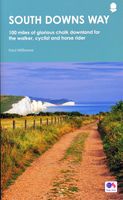
Wandelgids South Downs Way | Frances Lincoln

0
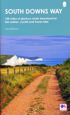
De officiële routegids: goede kaarten van Ordnance survey, schaal 1:25.000. Routebeschrijving behoorlijk uitgebreid. This is the complete, official guide by Paul Millmore for the long-distance walker or the weekend stroller. Includes colour extracts from the Ordnance Survey's Explorer series at 1:25,000 showing points along the route cross-referen...

Verkopers met dit product

Verkoper
Bezorging
Prijs
DeZwerver.nl logo
DeZwerver.nl
2,95
22,50

Anderen bekeken ook

Wandelgids South Downs Way | Frances Lincoln
De officiële routegids: goede kaarten van Ordnance survey, schaal 1:25.000. Routebeschrijving behoorlijk uitgebreid. This is the complete, official guide by Paul Millmore for the long-distance walker or the weekend stroller. Includes colour extracts from the Ordnance Survey's Explorer series at 1:25,000 showing points along the route cross-referenced to the text.   The route is described from east to west.   Ordnance Survey mapping for the entire route Background information on everything from archaeology to wildlife Comprehensive, up-to-date information on public transport, accommodation and places of interest Details of horsebox parking, vets, saddlers and farriers for horse riders Circular routes off the Trail for shorter walks or rides
22,50
Wandelgids South Downs Way | Cicerone
Uitstekende wandelgids van dit geweldige gebied. goed beschreven met veel praktische informatie om de route te kunnen lopen, inclusief een apart boekje met zeer gedetaileerde kaarten. The South Downs Way National Trail is a 100 mile (160km) walk between Eastbourne and Winchester, staying within the glorious South Downs National Park for its entire length. Presented here in 12 stages of up to 12 miles (19km), the route is described in both east-west and west-east. A waymarked trail with very few stiles, it can be walked at any time of year and makes a good introduction to long-distance walking. Step-by-step route descriptions are illustrated with extracts from OS 1:50,000 mapping for every stage, and a separate, conveniently sized booklet with 1:25,000 maps for the entire route is included. The guide provides detailed practical information on getting to the trail, and facilities and accommodation en route. The South Downs Way offers easy walking on ancient and historical tracks, and sh…
24,95
Wandelgids South Downs National Park | Ordnance Survey
Stroll up on the Downs, explore charming villages and wander woodland trails with ten hand-picked leisurely walks suitable for the whole family. Enjoy some of the loveliest and most accessible walks in the South Downs National Park and discover the benefits of being active outside.   South Downs Short Walks Made Easy include:   - Climb the Zig-Zag Path above charming Selborne, made famous by naturalist Gilbert White, for wonderful views - Explore the historic village of Bramber, once an important river port and full of intrigue, and enjoy the beautiful ‘Walk For All’ along the banks of the Adur - See the iconic Devil’s Dyke, offering great views in all directions from the hillfort above the longest and deepest dry valley in the country - Wander the Seven Sisters Country Park, part of the spectacular Sussex coastline between Eastbourne and Seaford - Follow the South Downs Way up Old Winchester Hill to find a hill-fort and barrows, as well as excellent views as far as the Solent and the…
10,95
Wandelgids South Downs Way | Trailblazer Guides
The South Downs Way is a 100-mile footpath which follows the line of chalk hills stretching from Winchester to Eastbourne. Walking the length of the Downs is the best way to experience this beautiful landscape with its mixture of rolling hills, steep hanging woodland and windswept fields. You'll also pass through picture-postcard villages with welcoming pubs, thatched cottages and country gardens. 1. Unique mapping features - In many walking guides the reader has to read a route description then try to relate it to the map. Our guides are easier to use because walking directions, tricky junctions, places to stay and eat, points of interest and walking times are all written onto the maps themselves in the places to which they apply. With their uncluttered clarity, these are not general-purpose maps but fully-edited maps drawn by walkers for walkers. Downloadable GPS waypoints also included. 2. The largest scale walking maps available - At just under 1:20,000 (8cm or 31/8 inches to 1 mi…
20,95
Wandelgids The Southern Fells | Lake District | Frances Lincoln
One name above all others has become associated with walking in the Lake District: Alfred Wainwright, whose seven-volume Pictorial Guide to the Lakeland Fells, first published in 1955–66, has become the definitive guidebook. Wainwright’s meticulously hand-drawn maps, diagrams and drawings take walkers up the 214 principal hills and mountains of the Lake District, describing the main routes of ascent from different starting points, as well as lesser-known variants, showing the summit viewpoint panoramas and the ridge routes that can be made to create longer walks. Every page combines words and illustrations to present the routes in a way that is original, visually appealing and easy to follow. This new edition of Wainwright’s Walking Guide to the Lake District Fells has been comprehensively revised. Paths, maps, diagrams and route descriptions have been checked and corrected throughout. These revisions have been undertaken by writer and designer Clive Hutchby, author of The Wainwright …
23,50
Wandelkaart - Kaart The South Downs Way Map Booklet | Cicerone
All the mapping you need to complete the 100 mile (160km) South Downs Way National Trail, between Eastbourne and Winchester. With easy walking on ancient trackways, the route features wooded areas, river valleys and attractive villages and is rich in natural, geological and historical interest. This booklet of Ordnance Survey 1:25,000 Explorer maps has been designed for convenient use on the trail.   It shows the full and up-to-date line of the route along with the relevant extract from the OS Explorer map legend, and can be used when walking the trail in either direction. Conveniently sized for slipping into a jacket pocket or the top of a rucksack, it comes in a clear PVC sleeve. An accompanying Cicerone guidebook - The South Downs Way - describes the full route in both directions and includes lots of other practical and historical information, for those who prefer a written guide.   The guidebook INCLUDES a copy of this map booklet.
18,50
Wandelgids North Downs Way national trail | Aurum Press
Goede engelstalige wandelgids van deze LAW in zuid oost Engeland, net onder Londen. Goede beschrijving en prima kaarten van Ordnance Survey, enigzins beperkte praktische tips, maar die zijn op de website van de route eenvoudig te vinden. This is the complete official guide to walking the well-loved and popular North Downs. Whether you're an experienced long distance walker or a weekend stroller, this is the only companion you need to this beautiful and scenic route. The North Downs Way is the National Trail that follows the official acorn waymarks from Farnham to the coast at Dover.   This picturesque trail takes in chalk ridges, river valleys and sections of the Pilgrims' Way. At the eastern end you can either walk via Canterbury (a total distance of 130 miles, 208 km) or follow the southern route (123 miles, 197 km). With Ordnance Survey mapping for the entire route, this is a superb guide to the North Downs Way National Trail which can be enjoyed by all.    
22,50
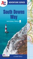
Wandelatlas Adventure Atlas South Downs Way | A-Z Map Company
AZ heeft de meest gedetailleerde wandelkaarten van de South Downs Way  gebundeld in een atlasje. Daardoor is het heel handig qua formaat. De kaarten zelf zijn perfect voor het wandelen. Schaal 1:25.000 The A-Z Adventure Series of maps combines the best of OS and A-Z, creating the perfect companion for walkers, off-road cyclists, horse riders and anyone wishing to explore the great outdoors.   The South Downs Way is a National Trail along the chalk escarpments and ridges of the South Downs. This undulating path begins in Winchester and finishes in Eastbourne covering 100 miles (160km) and lies completely within the South Downs National Park. The route on the map is clearly highlighted in yellow with mileage markers to gauge distances when planning sections of the walk to enjoy.   This official National Trail Map* of the South Downs Way features 44 pages of continuous Ordnance Survey Explorer** mapping providing complete coverage of the South Downs Way. This atlas includes a route plann…
17,95
Wandelgids Wainwright's Coast to Coast Walk | Frances Lincoln
This is the first fully revised and updated edition of A. Wainwright's pocket-sized guide to the Coast to Coast Walk which he devised in the early 1970s. Over the years, this 190-mile walk -- from St. Bees Head on the Irish Sea by way of the Lake District, the Pennines, Swaledale, and the North York Moors, ending at Robin Hood's Bay on the North Sea -- has become one of the best-loved long-distance routes in the world. It has prompted countless enthusiasts to lace up their walking boots and follow Wainwright's example, and inspired a TV series, too. This brand-new edition of the Pictorial Guide contains Wainwright's hand-drawn route maps and his inimitable commentary, completely revised where necessary by Chris Jesty. The route is picked out in red for greater visibility on the page, and every step of the walk has been checked and updated.
23,50
Wandelgids Central Fells | Lake District | Frances Lincoln
One name above all others has become associated with walking in the Lake District: Alfred Wainwright, whose seven-volume Pictorial Guide to the Lakeland Fells, first published in 1955-66, has become the definitive guidebook. Wainwright's meticulously hand-drawn maps, diagrams and drawings take walkers up the 214 principal hills and mountains of the Lake District, describing the main routes of ascent from different starting points, as well as lesser-known variants, showing the summit viewpoint panoramas and the ridge routes that can be made to create longer walks. Every page combines words and illustrations to present the routes in a way that is original, visually appealing and easy to follow. This new edition of Wainwright's Walking Guide to the Lake District Fells has been comprehensively revised. Paths, maps, diagrams and route descriptions have been checked and corrected throughout. These revisions have been undertaken by writer and designer Clive Hutchby, author of The Wainwright …
23,50

Klanten-reviews van Wandelgids South Downs Way | Frances Lincoln

Er zijn nog geen beoordelingen voor dit productBen jij de eerste die een review plaatst?

Meer over Wandelgids South Downs Way | Frances Lincoln

Productomschrijving

De officiële routegids: goede kaarten van Ordnance survey, schaal 1:25.000. Routebeschrijving behoorlijk uitgebreid.

This is the complete, official guide by Paul Millmore for the long-distance walker or the weekend stroller. Includes colour extracts from the Ordnance Survey's Explorer series at 1:25,000 showing points along the route cross-referenced to the text.   The route is described from east to west.   Ordnance Survey mapping for the entire route Background information on everything from archaeology to wildlife Comprehensive, up-to-date information on public transport, accommodation and places of interest Details of horsebox parking, vets, saddlers and farriers for horse riders Circular routes off the Trail for shorter walks or rides

Productinformatie

    Verken gerelateerde categorieën

    Webshop.nl maakt gebruik van cookies. Ga je verder op onze website, ga dan akkoord met het plaatsen van cookies en de verwerking van deze data door ons en vermelde partners.