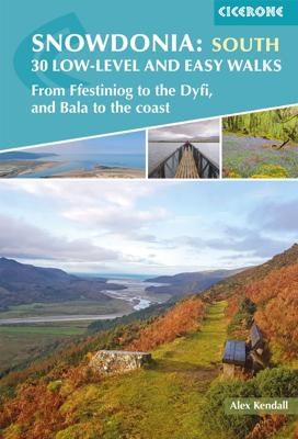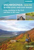
Wandelgids Snowdonia: South - Low-level and easy walks | Cicerone

0
Guidebook describing 30 walks in Snowdonia, Wales. Routes are mostly low level and on clear paths and showcase the region's beautiful scenery and rich history and culture. Part of a 2-volume set, this southern volume includes Trawsfynydd, Bala, Dolgellau, Machynlleth, the Harlech Coast and the valleys of the Mawddach and Dyfi. Through 30 day walks...

Verkopers met dit product

Verkoper
Bezorging
Prijs
DeZwerver.nl logo
DeZwerver.nl
2,95
13,95

Anderen bekeken ook

Wandelgids Wales Coast Path: Snowdonia and Ceredigion | Northern Eye Books
Official Guide: Wales Coast Path: Snowdonia & Ceredigion Coast One of seven Official Guides to the Wales Coast Path This Official Guide to the Snowdonia & Ceredigion Coast section of the Wales Coast Path contains everything local and long-distance walkers need to enjoy the path.   Cardigan Bay probably offers a more diverse walking experience than any other section of the Wales Coast Path. The stretch covered in this book – from Porthmadog in the north to Cardigan in the south – largely covers two contrasting Welsh counties.   The first 97 kilometres pass through Gwynedd, along the western edge of the Snowdonia National Park. Here, just before the rivers that rise in the highest of the Welsh mountains reach the sea, they fan out to form broad estuaries that provide rich pickings for waders and other birdlife. The estuaries of the Dwyryd, the Mawddach and the Dyfi are the largest of these. Between them are some very large dune systems, including Morfa Harlech and Morfa Dyffryn – home t…
23,95
Nieuw
Wandelgids Mountain walking Snowdonia | Cicerone
Uitstekende wandelgids voor dit uitdagende wandelgebied in Wales. 38 dagtochten en een tweedaagse tocht. This guidebook describes 40 day walks exploring Snowdonia. It showcases some of the best mountain walks in the area, with routes up Snowdon and Tryfan alongside other classic peaks like Y Garn, Cadair Idris and the Glyders. Routes are graded easy to strenuous and include airy and pulse-quickening scrambles such as Crib Goch and Bristly Ridge as well as the Snowdon Horseshoe, the Nantlle Ridge and a 2-day traverse of all 15 of Snowdon’s peaks over 3000ft.   Walks range in distance from 4 miles (6km) to 16 miles (26km). Clear route descriptions are accompanied by OS mapping, and for each walk there is key information about distance, grade, ascent, terrain, access and parking. With useful advice on where to stay and when to go, and an English-Welsh glossary, this book is an invaluable guide to discovering both the popular and less well-trodden corners of Snowdonia.   Snowdonia can jus…
23,50
Nieuw
Wandelgids Snowdonia: North - Low-level and easy walks | Cicerone
This guidebook describes 30 low level and easy walks that are suitable for all abilities. The hikes covered are in the northern part of Snowdonia National Park, close to Conwy, Betws-y-Coed, Llanberis and Porthmadog. Most of the walks take around two hours, with others ranging from two to six hours.   Each walk has an accompanying Ordnance Survey 1:25,000 or 1:50,000 map showing the route, easy to follow route descriptions and information on distance, time, ascent, refreshments and where to park. The guide also includes more general advice on walking in the area, historical and flora & fauna information, and facts about all the points of interest seen on each walk.   In this part of Wales, neolithic settlements and Roman ruins stand beside the medieval castles of Welsh Princesses and the modern remnants of the mining industry. Myths and legends abound, and many walks relate to the stories of King Arthur and Merlin, Anfanc and Welsh fairies   Steden en Dorpen Conwy, Betws-y-Coed, Llanb…
13,95
Nieuw
Wandelgids 014 Pathfinder Short Walks Snowdonia | Ordnance Survey
Wandelgids van een deel van Wales. Deze gids bevat 20 wandelingen, geschikt voor de hele familie. De bijbehorende kaarten zijn uitstekend: men heeft de topografische kaarten van Ordnance Survey gebruikt waarop de route is ingetekend. Daarnaast praktische informatie over de wandeling en wat beschrijvingen van het gebied. The Snowdonia short walks guidebook is ideal for all the family. Containing 20 splendid short walks ranging from 2 to 6 miles, this guide is perfect for newcomers to country walking and those that prefer gentler rambling. The mountains of Snowdonia are magnificent featuring row-upon-row of jagged peaks and ridges; However, there is more to Snowdonia than its mountains. The region offers the walker plenty of easy low-level walks through delightful valleys ranging from narrow and steep-sided to green and open.   The walks in this guide take in some of Snowdonia’s most famous features – castles, lakes, legends, forests, valleys and waterfalls. The only walk featured that …
11,50
Nieuw
Wandelgids Wales: The Ceredigion and Snowdonia Coast Paths | Cicerone
As part of the Wales Coast Path, the Ceredigion Coast Path and Snowdonia Coast Path trace a curve of 233km (145 miles) of coastal and inland walking down Cardigan Bay. This guidebook describes a 16-stage guide to the walk from Porthmadog to St Dogmaels covering the trail between the Llyn Peninsula and the Pembrokeshire Coast Path. .In 16 day stages from Porthmadog to St Dogmaels, this guidebook offers all the information walkers need to complete the 233km (145 miles) section of the Wales Coast Path that curve down Cardigan Bay, passing through a range of contrasting landscapes.   Six days are spent on the Snowdonia Coast Path, two around the Dyfi Estuary, seven on the Ceredigion Coast Path and one from Cardigan to St Dogmaels.   Linking the Llyn Peninsula Coast Path with that of the Pembrokeshire Coastal Path, this section takes in Snowdonia National Park’s splendid coastal plains, leads inland through beautiful hill country around the Dyfi Estuary and follows some of the finest coast…
18,50
Reisgids Snowdonia & North Wales | Rough Guides
Een kleinere versie in zakformaat van de grotere versies van de Rough Guides. Als altijd weer vol met goede informatie over cultuur en praktische zaken. Voorrin een kaart van de regio. This compact, pocket-sized Snowdonia & North Wales travel guidebook is ideal for travellers on weekend trips or shorter breaks in the UK. It includes ready-made walking and driving itineraries that allow you to organise your visit to Snowdonia & North Wales without losing time planning.   The Snowdonia & North Wales guide book covers: The North Coast and Carneddau Mountains, A Tour of Anglesey, Beddgelert and Porthmadog, Snowdon from Caernarfon, The Lleyn Peninsula, Tremadog Bay to the Mawddach Estuary, Wrexham to Bala - and Back, Dolgellau to Cadair Idris and the Aran Mountains, Cadair Idris to Machynlleth.   Inside this Snowdonia & North Wales travel book you will find:   - 9 ready-made walks and tours - easy-to-follow walking and driving tour itineraries featuring the best places to visit, as…
14,95
Nieuw
Wandelgids Scrambles in Scrambles in Snowdonia | Cicerone
This revised edition of Steve Ashton's classic guide presents 80 scrambles in the stunning Snowdonia National Park, offering challenge, adventure and exhilaration, but also breathtaking scenery and an unparalleled opportunity to connect with the mountains of North Wales. The graded routes range from introductory traverses to demanding climbs involving technicality and exposure, recommended only for those with considerable experience, a strong head for heights and solid grounding in basic rope technique.   It is now easier than ever to explore the Carneddau, Glyders and Snowdon Group, plus the finest scrambling in Eifionydd, the Moelwyns, Rhinogs and Cadair Idris. The favourites are all here – the Snowdon Horseshoe, North Ridge of Tryfan, Bristly Ridge and Cneifion and Cyfrwy Arêtes – as well as a number of lesser-known routes, including 16 not included in the previous guide.    Photo topos illustrate the ascent routes, alongside comprehensive route description detailing the preferred …
20,95
Nieuw
Wandelgids Snowdonia Way | Cicerone
Een beschrijving van de Snowdonia Way, goede beschrijving met gedetailleerd kaartmateriaal..Ook praktische informatie en hoogteprofielen per etappe.   This guidebook describes the Snowdonia Way in Wales, a long-distance route through Snowdonia National Park from Machynlleth to Conwy. A low-level route of 97 miles (in 6 stages of between 13 and 21 miles) passes through the heart of Snowdonia’s stunning mountain scenery and includes Pass of Aberglaslyn, Ogwen Valley and Aber Falls. It is suitable for walkers of average fitness and stamina, though days are long. An alternative mountain route covers 122 miles in 9 stages of 12–18 miles giving a spectacular journey over the most famous peaks such as Cadair Idris, Snowdon and Glyders. The high-level route is more physically challenging and requires good navigation skills. Full route descriptions for each stage are accompanied by OS maps and profiles. The guide also includes lists of accommodation and transport providers and a table of facil…
20,95
Wandelgids Day Walks in Snowdonia | Vertebrate Publishing
Day Walks in Snowdonia showcases 20 circular routes, between 5.5 and 12 miles (9km and 19km) in length, suitable for hillwalkers of all abilities. Additionally included in a Bonus Section are two of the UK's classic scrambles: The Bochlwyd Horseshoe and The Snowdon Horseshoe. The routes are split into three areas - Northern Snowdonia, Central Snowdonia and Southern Snowdonia - and include walks to the most iconic and beautiful peaks in the National Park, including; Snowdon, Y Glyderau, the Carneddau peaks, Moel Siabod, Cnicht, the Rhinogs, and Cadair Idris.   The author of this guidebook, Tom Hutton, is a Wales local, keen hillwalker and outdoors journalist. Each route in this guide is described with easy-to-follow directions and details of distance, navigation information, refreshment stops and public transport information, and is plotted on clear and easy to use Ordnance Survey 1:25,000 mapping. Also included is a detailed Appendix.
20,95
Nieuw
Wandelgids Walking in the Yorkshire Dales: South and West | Cicerone
Veelzijdige wandelgids van een deel van de Yorkshire Dales, goede kaarten en beschrijvingen en veel keuze uit een behoorlijk aantal wandelingen. Part of a two-book set, this guidebook describes 44 walks in the southern and western Yorkshire Dales, including the famous 23 mile Three Peaks circuit over Pen-y-Ghent, Whernside and Ingleborough. The other, mostly circular routes of 3½ to 13 miles cover the scenic region between Sedbergh, Kirkby Lonsdale, Settle, Skipton and Grassington. The Yorkshire Dales need little introduction: their picturesque scenery and hundreds of miles of footpaths, tracks and bridleways have been attracting walkers for decades. Part of a two-volume set, this guidebook presents over 40 routes in the south and west of the National Park, with bases including Sedburgh, Malham, Grassington, Skipton, Settle and Kirkby Lonsdale. The walks cover the valleys of Wharfedale, Littondale, Malhamdale, Ribblesdale and Dentdale – each with its own distinctive landscape and char…
19,95

Klanten-reviews van Wandelgids Snowdonia: South - Low-level and easy walks | Cicerone

Er zijn nog geen beoordelingen voor dit productBen jij de eerste die een review plaatst?

Meer over Wandelgids Snowdonia: South - Low-level and easy walks | Cicerone

Productomschrijving

Guidebook describing 30 walks in Snowdonia, Wales. Routes are mostly low level and on clear paths and showcase the region's beautiful scenery and rich history and culture. Part of a 2-volume set, this southern volume includes Trawsfynydd, Bala, Dolgellau, Machynlleth, the Harlech Coast and the valleys of the Mawddach and Dyfi.

Through 30 day walks ranging from 3km to 18km, this guide offers opportunities for walkers of all abilities to explore the lowlands, moorland and estuaries of Snowdonia National Park. The second of two volumes to low-level and easy walking in Snowdonia, this guide covers the southern region between Llan Ffestiniog and Machynlleth. Other centres include coastal towns of Harlech, Barmouth and Aberdyfi, and lakeside settlements of Trawsfynydd and Y Bala.   Famous for its northern mountains, the Snowdonia National Park also features an expansive coastline of sandy beaches and wildlife-rich estuaries. Inland, the landscape showcases mossy-banked rivers, gorges and thundering waterfalls in ancient broadleaved woodlands, while tranquil valleys and moorlands dotted with ruined castles, mines and forts provide panoramic views of surrounding mountains and lakes.   Each walk features in-depth route description and 1:25,000 or 1:50,000 OS mapping, alongside a wealth of insights into the history, geology and wildlife of the area. The guide supplies what3words addresses for start and finish points and postcodes for car parks, as well as refreshments and facilities available on each route and an appendix of useful contacts.
Webshop.nl maakt gebruik van cookies. Ga je verder op onze website, ga dan akkoord met het plaatsen van cookies en de verwerking van deze data door ons en vermelde partners.