Wandelgids Snowdonia Slate Trail | Rucksack Readers

0
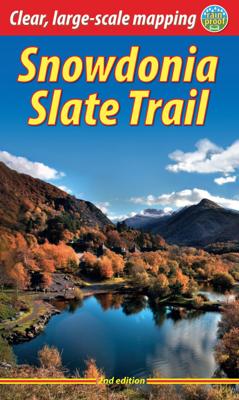
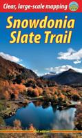
The Snowdonia Slate Trail is a waymarked trail that runs for 83 miles from Bangor on the North Wales coast, making a circuit through the heart of Snowdonia to end at Bethesda. The trail joins up villages with a choice of welcoming accommodation. The walking is varied, ranging from easy valleys to mountain passes, from wild moorland to river gorge...

Verkopers met dit product

Verkoper
Bezorging
Prijs
DeZwerver.nl logo
DeZwerver.nl
2,95
22,50

Anderen bekeken ook

Wandelgids Snowdonia Slate Trail | Rucksack Readers
The Snowdonia Slate Trail is a waymarked trail that runs for 83 miles from Bangor on the North Wales coast, making a circuit through the heart of Snowdonia to end at Bethesda. The trail joins up villages with a choice of welcoming accommodation. The walking is varied, ranging from easy valleys to mountain passes, from wild moorland to river gorges.   Highlights include the National Slate Museum of  Wales, stunning views of Snowdon and nearby mountains, and abandoned slate villages high in the hills. The trail also passes the Penrhyn quarry with its impressive galleries of slate crossed by the longest, fastest zip-wire in Europe.   This guidebook is in rucksack-friendly format and printed on rainproof paper.  Lavishly illustrated with 95 colour photos, it contains large-scale mapping and all you need to plan and enjoy your holiday:   14 pages with clear mapping of the route at 1: 40,000 practical information about public transport and travel section with inside knowledge on h…
22,50
Wandelgids The Cateran Trail | Rucksack Readers
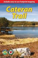
Uitgevoerd in de vorm van een klapper, met ringband geeft deze gids een goede beschrijving van de lange afstands route. De kaarten zijn schetsmatig maar wel duidelijk. The Cateran Trail is one of Scotland’s Great Trails – a circular walk of 64 miles (104 km) starting in Blairgowrie, near Perth, following in the footsteps of cattle-rustlers (caterans). This waymarked Trail follows ancient paths through glens, mountains and farmland of Highland Perthshire, with fine scenery, heritage and wildlife. The nearest village is never more than 7 miles (11 km) away, and gradients are easy to moderate. The Trail can be completed comfortably within 4-5 days, and several route variants are described, including the option for a weekend Minitrail.   Our third edition has been fully revised in June 2024 with details of six route changes, updated mapping and many new photos. It is lighter and more pocketable than before, with perfect binding (glued and sewn).   This guidebook contains all you need to p…
24,50
Wandelgids The Inca Trail | Rucksack Readers
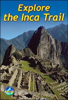
Uitgevoerd in de vorm van een klapper, met ringband geeft deze gids een goede beschrijving van de lange afstands route. De kaarten zijn schetsmatig maar wel duidelijk. This edition of our popular guidebook contains everything you need to plan and enjoy hiking a choice of three Inca Trails to Machu Picchu in Peru. Step-by-step sections cover the Classic trail (4-5 days), the longer, more strenuous trek from Mollepata (6-7 days) and the Shortest option (2 days). This guidebook contains all you need to plan and enjoy trekking the Inca Trail, including   site plan of Machu Picchu ruins description of Machu Picchu, with side-trips and photographs background on Inca culture and stonework, and on modern Peru extended section on Andean wildlife advice on planning and preparation, including packing checklist updated details on recent Trail regulations medical advice on how to prevent and manage altitude symptoms phrasebook in Spanish, Quechua and English drop-down map showing three va…
19,50
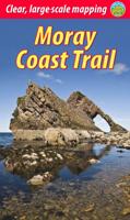
Wandelgids Moray Coast Trail | Rucksack Readers
The Mary Queen of Scots Way stretches across central Scotland from coast to coast, linking many places associated with Mary Queen of Scots. It runs for 107 miles (172 km) from Arrochar on Loch Long in the west to St Andrews on the Fife coast, and links with four of Scotland’s Great Trails: the Loch Lomond & Cowal Way, the West Highland Way, the Rob Roy Way and the Fife Coastal Path. This route, however, has no official status: there is no dedicated MQS waymarking, although the guidebook gives detailed directions and parts of it are easy to follow. Some sections are unsuitable for novice walkers unless accompanied by somebody with map and compass skills.   The Way goes through richly varied scenery, starting from a rugged sea loch, crossing Loch Lomond and traversing its National Park to the hills of central Scotland, ending on a sandy beach on the Fife coast. It passes mountains, lochs and waterfalls; castles, hill forts and aqueducts; and is broken into manageable sections which end …
19,95
Wandelgids Snowdonia | Ordnance Survey
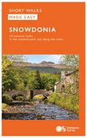
Everybody can explore Snowdonia, from England and Wales’ highest mountain to magical medieval castles and the spectacular Conwy coastline, with these accessible, family-friendly walks. Get outside and active with the whole family amidst the mysterious legends and natural beauty of Snowdonia.   Snowdonia Short Walks Made Easy include:   - Take Victorian tramcars or the chairlift to the summit of the Great Orme, then wander wildflower-rich meadows for incredible views of the mountains, the sea and the Isle of Anglesey - Follow the Lôn Gwyrfai trail round beautiful Llyn y Gader through Beddgelert Forest to the lovely village, with views of Snowdon and Y Garn throughout - Get off the beaten track in the valley of Cwm Penamnen with views of the cliffs of Moel Sabod and the 13th-century Dolwyddelan castle - Discover Porthmadog on a fascinating walk over Borth-y-Gest headland, the ingenious Cob and the salt marshes home to many seabirds - Explore Dolgellau and the riverside walk to Penmaenpo…
10,95
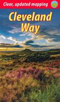
Wandelgids Cleveland Way | Rucksack Readers
“A testament to excellent research, writing and photography” - Malcolm Hodgson, Trail Manager   The Cleveland Way is one of England’s oldest and best-loved National Trails. It runs for 108 miles (174 km) around the North York Moors National Park, starting inland at Helmsley, offering panoramic views over the vales of York and Mowbray and from the Cleveland Hills. After reaching the coast at Saltburn, it heads south along the dramatic sea cliffs, with their tales of shipwrecks and smugglers, to end at Filey.   The route features ancient burial mounds, ruined castles, abbeys and Roman remains, with more recent traces of industrial history. Vast areas of heather moorland are host to a wide range of wildlife. The Cleveland Way is easily accessible by public transport and is divided into easy stages by villages of character with friendly pubs and accommodation. Above all, walkers are welcomed with warm Yorkshire hospitality.   Our new second edition has larger-scale mapping, several route …
19,95
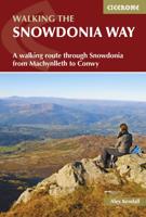
Wandelgids Snowdonia Way | Cicerone
Een beschrijving van de Snowdonia Way, goede beschrijving met gedetailleerd kaartmateriaal..Ook praktische informatie en hoogteprofielen per etappe.   This guidebook describes the Snowdonia Way in Wales, a long-distance route through Snowdonia National Park from Machynlleth to Conwy. A low-level route of 97 miles (in 6 stages of between 13 and 21 miles) passes through the heart of Snowdonia’s stunning mountain scenery and includes Pass of Aberglaslyn, Ogwen Valley and Aber Falls. It is suitable for walkers of average fitness and stamina, though days are long. An alternative mountain route covers 122 miles in 9 stages of 12–18 miles giving a spectacular journey over the most famous peaks such as Cadair Idris, Snowdon and Glyders. The high-level route is more physically challenging and requires good navigation skills. Full route descriptions for each stage are accompanied by OS maps and profiles. The guide also includes lists of accommodation and transport providers and a table of facil…
20,95
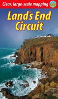
Wandelgids Land's End Circuit | Rucksack Readers
The South West Coast Path is the longest National Trail in the UK, and its full 630 miles is off-putting to most recreational walkers. This carefully selected section from St Ives to Penzance provides a superb taster experience that readily fits inside one week. Enjoy some of the UK's finest coastal scenery including around Land's End, its wild south-western extreme. This part of Cornwall is surprisingly accessible by mainline railway, and it offers plenty of charming places to stay and eat. This 72-page guidebook contains all you need to plan and enjoy the Land’s End Circuit: the route in sections, with summaries of distance, terrain and altitude gain/loss where to find food and drink, accommodation and how to split the distance concise background on the geology, history, mining and wildlife how and when to visit St Michael’s Mount planning information for travel by train, bus, car or plane 15 pages with detailed route mapping at 1:35,000 in full colour, with 100 photographs …
19,95
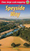
Wandelgids The Speyside Way | Rucksack Readers
Deze gids een goede beschrijving van de lange afstands route. De kaarten zijn schetsmatig maar wel duidelijk. The Speyside Way is one of Scotland’s Great Trails. It runs for 80 miles (128 km) from the fishing port of Buckie to Aviemore in the foothills of the Cairngorms. Following the lovely valley of the River Spey, you walk through countryside rich in malt whisky and wildlife, along riverside paths, railway trackbed and forest and moorland tracks.   The second edition was fully revised, with mapping from Footprint in six panels, updated plans of villages along the Way, including a fresh Grantown plan and directions from the terminus in Buckie. In 2016 we released the revised version of this essential trail guide, with fresh photos, new mapping and many other updates. These included documenting the 6.5-mile route extension to Kincraig, which opened in 2015, and 11-mile Badenoch Way.   This guidebook contains all you need to plan and enjoy the Speyside Way:   the Way step-by-step,…
22,50
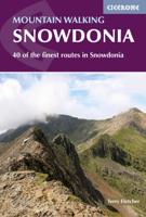
Wandelgids Mountain walking Snowdonia | Cicerone
Uitstekende wandelgids voor dit uitdagende wandelgebied in Wales. 38 dagtochten en een tweedaagse tocht. This guidebook describes 40 day walks exploring Snowdonia. It showcases some of the best mountain walks in the area, with routes up Snowdon and Tryfan alongside other classic peaks like Y Garn, Cadair Idris and the Glyders. Routes are graded easy to strenuous and include airy and pulse-quickening scrambles such as Crib Goch and Bristly Ridge as well as the Snowdon Horseshoe, the Nantlle Ridge and a 2-day traverse of all 15 of Snowdon’s peaks over 3000ft.   Walks range in distance from 4 miles (6km) to 16 miles (26km). Clear route descriptions are accompanied by OS mapping, and for each walk there is key information about distance, grade, ascent, terrain, access and parking. With useful advice on where to stay and when to go, and an English-Welsh glossary, this book is an invaluable guide to discovering both the popular and less well-trodden corners of Snowdonia.   Snowdonia can jus…
23,50

Klanten-reviews van Wandelgids Snowdonia Slate Trail | Rucksack Readers

Er zijn nog geen beoordelingen voor dit productBen jij de eerste die een review plaatst?

Meer over Wandelgids Snowdonia Slate Trail | Rucksack Readers

Productomschrijving

The Snowdonia Slate Trail is a waymarked trail that runs for 83 miles from Bangor on the North Wales coast, making a circuit through the heart of Snowdonia to end at Bethesda. The trail joins up villages with a choice of welcoming accommodation. The walking is varied, ranging from easy valleys to mountain passes, from wild moorland to river gorges.   Highlights include the National Slate Museum of  Wales, stunning views of Snowdon and nearby mountains, and abandoned slate villages high in the hills. The trail also passes the Penrhyn quarry with its impressive galleries of slate crossed by the longest, fastest zip-wire in Europe.   This guidebook is in rucksack-friendly format and printed on rainproof paper.  Lavishly illustrated with 95 colour photos, it contains large-scale mapping and all you need to plan and enjoy your holiday:  
  • 14 pages with clear mapping of the route at 1: 40,000
  • practical information about public transport and travel
  • section with inside knowledge on how best to climb Snowdon
  • detailed route descriptions including where to find refreshments and accommodation
  • background on the slate industry heritage, the ‘Great Little Trains of Wales’ and wildlife.


Productinformatie

    Verken gerelateerde categorieën

    Webshop.nl maakt gebruik van cookies. Ga je verder op onze website, ga dan akkoord met het plaatsen van cookies en de verwerking van deze data door ons en vermelde partners.