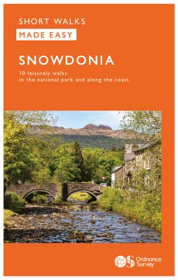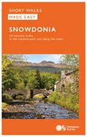
Wandelgids Snowdonia | Ordnance Survey

0
Everybody can explore Snowdonia, from England and Wales’ highest mountain to magical medieval castles and the spectacular Conwy coastline, with these accessible, family-friendly walks. Get outside and active with the whole family amidst the mysterious legends and natural beauty of Snowdonia.   Snowdonia Short Walks Made Easy include:   - Take Vict...

Verkopers met dit product

Verkoper
Bezorging
Prijs
DeZwerver.nl logo
DeZwerver.nl
2,95
10,95

Anderen bekeken ook

Wandelgids Snowdonia | Ordnance Survey
Everybody can explore Snowdonia, from England and Wales’ highest mountain to magical medieval castles and the spectacular Conwy coastline, with these accessible, family-friendly walks. Get outside and active with the whole family amidst the mysterious legends and natural beauty of Snowdonia.   Snowdonia Short Walks Made Easy include:   - Take Victorian tramcars or the chairlift to the summit of the Great Orme, then wander wildflower-rich meadows for incredible views of the mountains, the sea and the Isle of Anglesey - Follow the Lôn Gwyrfai trail round beautiful Llyn y Gader through Beddgelert Forest to the lovely village, with views of Snowdon and Y Garn throughout - Get off the beaten track in the valley of Cwm Penamnen with views of the cliffs of Moel Sabod and the 13th-century Dolwyddelan castle - Discover Porthmadog on a fascinating walk over Borth-y-Gest headland, the ingenious Cob and the salt marshes home to many seabirds - Explore Dolgellau and the riverside walk to Penmaenpo…
10,95
Wandelgids 078 Pathfinder Guides Anglesey, Lleyn and Snowdonia | Ordnance Survey
Fraaie, goed verzorgde wandelgidsjes met 28 wandelingen van max. een dag, (beginnend bij korte, eindigend bij langere wandelingen). Weergegeven op duidelijke topografische kaartjes (1:25.000). Bevat verder wetenswaardigheden en praktische informatie voor onderweg. Experience breathtaking north Wales with 28 unforgettable walks through Anglesey, the Lleyn Peninsula and the Snowdonia National Park. Find stunning views of the Welsh coast, the ‘holy isle’ of Ynys Mon and sublime Snowdonia with a range of walks graded by length and difficulty, from relaxed rambles to challenging climbs.   Featured Anglesey, Lleyn and Snowdonia walks include:   - Enjoy views of Snowdon from the shores of Llyn Padarn, dotted with remnants of the Llanberis slate quarries and a medieval castle - Climb to Holyhead Mountain, Anglesey’s highest point, through the South Stacks Cliff Nature Reserve - See the glorious Lleyn Heritage Coast from the headland of Trywn-y-Tâl, circling back to the pleasant village of Tre…
18,50
Wandelgids 014 Pathfinder Short Walks Snowdonia | Ordnance Survey
Wandelgids van een deel van Wales. Deze gids bevat 20 wandelingen, geschikt voor de hele familie. De bijbehorende kaarten zijn uitstekend: men heeft de topografische kaarten van Ordnance Survey gebruikt waarop de route is ingetekend. Daarnaast praktische informatie over de wandeling en wat beschrijvingen van het gebied. The Snowdonia short walks guidebook is ideal for all the family. Containing 20 splendid short walks ranging from 2 to 6 miles, this guide is perfect for newcomers to country walking and those that prefer gentler rambling. The mountains of Snowdonia are magnificent featuring row-upon-row of jagged peaks and ridges; However, there is more to Snowdonia than its mountains. The region offers the walker plenty of easy low-level walks through delightful valleys ranging from narrow and steep-sided to green and open.   The walks in this guide take in some of Snowdonia’s most famous features – castles, lakes, legends, forests, valleys and waterfalls. The only walk featured that …
11,50
Wandelgids 010 Pathfinder Guides Snowdonia | Ordnance Survey
Wandelgids van een deel van Wales. Deze gids bevat 28 dagwandelingen, variërend van korte tochten tot pittige dagtochten. De bijbehorende kaarten zijn uitstekend: men heeft de topografische kaarten van Ordnance Survey gebruikt waarop de route is ingetekend. Daarnaast praktische informatie over de wandeling en wat beschrijvingen van het gebied. Each of the Jarrold Pathfinder titles features 28 circular routes, all tried and tested by seasoned walkers. The routes range from extended strolls to exhilarating hikes, so there is something for everyone. They also contain: -Ordnance Survey mapping; -background details of each area; -details of refreshment stops and parking; -walking safety advice; and -information about walkers and the law  
18,50
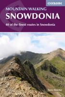
Wandelgids Mountain walking Snowdonia | Cicerone
Uitstekende wandelgids voor dit uitdagende wandelgebied in Wales. 38 dagtochten en een tweedaagse tocht. This guidebook describes 40 day walks exploring Snowdonia. It showcases some of the best mountain walks in the area, with routes up Snowdon and Tryfan alongside other classic peaks like Y Garn, Cadair Idris and the Glyders. Routes are graded easy to strenuous and include airy and pulse-quickening scrambles such as Crib Goch and Bristly Ridge as well as the Snowdon Horseshoe, the Nantlle Ridge and a 2-day traverse of all 15 of Snowdon’s peaks over 3000ft.   Walks range in distance from 4 miles (6km) to 16 miles (26km). Clear route descriptions are accompanied by OS mapping, and for each walk there is key information about distance, grade, ascent, terrain, access and parking. With useful advice on where to stay and when to go, and an English-Welsh glossary, this book is an invaluable guide to discovering both the popular and less well-trodden corners of Snowdonia.   Snowdonia can jus…
23,50
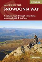
Wandelgids Snowdonia Way | Cicerone
Een beschrijving van de Snowdonia Way, goede beschrijving met gedetailleerd kaartmateriaal..Ook praktische informatie en hoogteprofielen per etappe.   This guidebook describes the Snowdonia Way in Wales, a long-distance route through Snowdonia National Park from Machynlleth to Conwy. A low-level route of 97 miles (in 6 stages of between 13 and 21 miles) passes through the heart of Snowdonia’s stunning mountain scenery and includes Pass of Aberglaslyn, Ogwen Valley and Aber Falls. It is suitable for walkers of average fitness and stamina, though days are long. An alternative mountain route covers 122 miles in 9 stages of 12–18 miles giving a spectacular journey over the most famous peaks such as Cadair Idris, Snowdon and Glyders. The high-level route is more physically challenging and requires good navigation skills. Full route descriptions for each stage are accompanied by OS maps and profiles. The guide also includes lists of accommodation and transport providers and a table of facil…
20,95
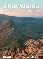
Wandelgids Snowdonia | Rockfax
This new book by Mark Reeves covers all the best mountain walks and scrambles in and around the Snowdonia area. The coverage is done in full Rockfax style with bigh overview photos, precise route descriptions and detailsed maps. It also has an extensive introduction covering some of the basic skills required for scrambling, route planning and navigation.The walks start from basic routes up to the summit of Snowdon like the Llanberis Path. The main information is focussed on the multitude of scrambling possibilities which range from long link-ups like the Snowdon Horshoe, steady ridges like Bristly Ridge and full rock climbs like Grooved Arete on the East Face of Tryfan. The walks are covered with a map, description and sometimes an overview photograph. The scrambles mostly have detailed overview photographs, descriptions and approach maps. The harder scrambles and climbs all have detailed description and photo topos.
34,95
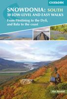
Wandelgids Snowdonia: South - Low-level and easy walks | Cicerone
Guidebook describing 30 walks in Snowdonia, Wales. Routes are mostly low level and on clear paths and showcase the region's beautiful scenery and rich history and culture. Part of a 2-volume set, this southern volume includes Trawsfynydd, Bala, Dolgellau, Machynlleth, the Harlech Coast and the valleys of the Mawddach and Dyfi. Through 30 day walks ranging from 3km to 18km, this guide offers opportunities for walkers of all abilities to explore the lowlands, moorland and estuaries of Snowdonia National Park. The second of two volumes to low-level and easy walking in Snowdonia, this guide covers the southern region between Llan Ffestiniog and Machynlleth. Other centres include coastal towns of Harlech, Barmouth and Aberdyfi, and lakeside settlements of Trawsfynydd and Y Bala.   Famous for its northern mountains, the Snowdonia National Park also features an expansive coastline of sandy beaches and wildlife-rich estuaries. Inland, the landscape showcases mossy-banked rivers, gorges and th…
13,95
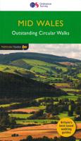
Wandelgids 041 Pathfinder Guides Mid Wales | Ordnance Survey
Wandelgids van midden Wales. Deze gids bevat 28 dagwandelingen, variërend van korte tochten tot pittige dagtochten. De bijbehorende kaarten zijn uitstekend: men heeft de topografische kaarten van Ordnance Survey gebruikt waarop de route is ingetekend. Daarnaast praktische informatie over de wandeling en wat beschrijvingen van het gebied. Explore Mid Wales over 28 walks with this walking guidebook from the Pathfinder series. Each walk is listed by distance and difficulty, and range from a family-friendly 4km (2.5 miles) to a challenging 20km (12 miles)   Often ignored in favour of the more popular Snowdonia and Brecon Beacons National Parks to the north and south, mid Wales still offers some stunning views and beautiful walks. Both coastal routes and upland walks are featured, and include Catti's Cave, Devil's Bridge and the Mynach Valley, The Claerwen Valley and the source of the river Severn   Each of the 28 circular walks has been created by experienced walkers, and includes a route…
18,50
Wandelgids Northumberland | Ordnance Survey
Explore the castles and coast of Northumberland from Dunstanburgh to Hadrian’s Wall with ten walks suitable for all ages and abilities. Discover England’s most northerly county from the North Sea coast to the North Pennines on hand-picked, leisurely rambles for the whole family.   Northumberland Short Walks Made Easy include:   - Circle dramatic Bamburgh Castle, looking out to the Farne Islands from wildlife-rich dunes, and see the grave of lifeboat heroine Grace Darling - Enjoy the tranquility of secluded Wooler Common with its wealth of wildlife and ancient remains on the edge of the Cheviots - Start at picturesque Craster and follow the coast path to Dunstanburgh Castle, a rugged ruin perched on a rocky, wave-battered headland - Ramble the shores of Kielder Water, spot nesting ospreys and stumble upon the fascinating artworks in the forest - Follow Hadrian’s Wall from Cawfields near Haltwhistle to see the iconic Roman structure close up, with stunning views in both directions - Str…
10,95

Klanten-reviews van Wandelgids Snowdonia | Ordnance Survey

Er zijn nog geen beoordelingen voor dit productBen jij de eerste die een review plaatst?

Meer over Wandelgids Snowdonia | Ordnance Survey

Productomschrijving

Everybody can explore Snowdonia, from England and Wales’ highest mountain to magical medieval castles and the spectacular Conwy coastline, with these accessible, family-friendly walks. Get outside and active with the whole family amidst the mysterious legends and natural beauty of Snowdonia.   Snowdonia Short Walks Made Easy include:   - Take Victorian tramcars or the chairlift to the summit of the Great Orme, then wander wildflower-rich meadows for incredible views of the mountains, the sea and the Isle of Anglesey - Follow the Lôn Gwyrfai trail round beautiful Llyn y Gader through Beddgelert Forest to the lovely village, with views of Snowdon and Y Garn throughout - Get off the beaten track in the valley of Cwm Penamnen with views of the cliffs of Moel Sabod and the 13th-century Dolwyddelan castle - Discover Porthmadog on a fascinating walk over Borth-y-Gest headland, the ingenious Cob and the salt marshes home to many seabirds - Explore Dolgellau and the riverside walk to Penmaenpool along the Mawddach Trail - Stroll through idyllic lakeside woods at Llyn Mair, listening out for the steam trains and glimpsing beautiful views of the Vale of Ffestiniog   OS Pathfinder Guides: Short Walks Made Easy:   - 10 accessible walks suitable for the whole family - All routes are between 2 to 5 miles and can be completed all year round - Know what to expect before you go: Information on locations of cafes/pubs and toilets, terrain, hilliness and accessibility for pushchairs and wheelchairs - Large-scale Ordnance Survey maps for ultra-easy navigation and route-finding, featuring intuitive pictorial symbols - Numbered points which tie maps to route descriptions and walk profiles - Route photographs for each numbered point so you know exactly where you’re going - Discover GPS waypoints, parking information and detailed route descriptions for foolproof navigation - Enhance your adventure with stories behind each walk and nature notes - Get active outside and enjoy the physical and mental health benefits

Productinformatie

    Verken gerelateerde categorieën

    Webshop.nl maakt gebruik van cookies. Ga je verder op onze website, ga dan akkoord met het plaatsen van cookies en de verwerking van deze data door ons en vermelde partners.