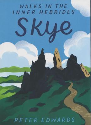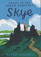
Wandelgids Skye | Pocket Mountains

0
The Isle of Skye is famed for its magnificent scenery and abundance of fine walking country. The awesome Cuillin Hills and the otherworldly realms of the Quiraing and the Storr Sanctuary are among Scotland's most recognisable landscapes, but the island also has much more to offer the adventurous walker, including some of the most dramatic coastlin...

Verkopers met dit product

Verkoper
Bezorging
Prijs
DeZwerver.nl logo
DeZwerver.nl
2,95
10,95

Anderen bekeken ook

Wandelgids Isle of Skye | Pocket Mountains
The Isle of Skye (or Ant-Eilean Sgitheanach in its native Gaelic tongue) occupies an almost mythical place in the minds of many Scots. Romantic castles, magnificent sea-scapes, the alpine peaks of the Cuillin Ridge, marching pipe bands, scattered white crofters' cottages and a bloody history; the island has all these and more. This book features 40 moderate walks that take in much of this celebrated landscape, but reveal hidden gems too.   In spite of its popularity Skye is still rich in undiscovered treasures, from coastal caves and arches, ruined villages cruelly cleared of their inhabitants, to fossilised dinosaur footprints and a rich array of wildlife. Written by Skye residents Paul and Helen Webster, these walks will reveal both the wild and gentler sides of this dramatic landscape.   Plaatsen in het boekje An Aird, An Corran, Ardnish, Armadale, Arnish, Bearreraig Bay, Bioda Buidhe, Boreraig, The Braes, Broadford, Brochel Castle, Brothers' Point, Burma Road, Caisteal Maol, Calum…
10,95
Wandelgids The Skye Trail | Cicerone
Guidebook to the Skye Trail, a challenging 80-mile (128km) trek that snakes its way north–south across the largest island in Scotland’s Inner Hebrides. This unofficial, week-long route is ideal for backpacking, camping wild each night, but can also be walked between overnight accommodation.   Unwaymarked route on sometimes-pathless terrain requires navigational skill, fitness and self-reliance, so is suitable for experienced mountain walkers Seven daily stages of 7–18 miles (11–29km) in length, with an optional 6-mile (11km) alternative route via the summit of Bla Bheinn, one of Skye’s most spectacular Munros Starts at Rubha Hunish at the northern tip of Skye, visits the capital Portree, follows Glen Sligachan between the Black Cuillin and Red Hills, before finishing in the south at Broadford Highlights include the Trotternish Ridge, the Quiraing, the Old Man of Storr, the mighty Cuillin and the abandoned village of Boreraig Clear route descriptions with full 1:50,000 OS mapping and e…
20,95
Wandelgids The Isle of Skye | Cicerone
Uitstekende wandelgids, sommige meerdaags, voor dit uitdagende wandelgebied in Schotland. This third edition of Terry Marsh’s walking and scrambling guide to Skye, the Hebrides, northwest Scotland, updated using digital mapping and GPS. 87 walks and scrambles in Sleat and South-East Skye, Strath, Minginish, Duirinish, Waternish and Trotternish for all abilities. Each route describes local historical and geological points of interest. The fame of Skye, the most scenically awe-inspiring of Scotland's many islands, is widespread; you either love it, or hate it. There is no neutrality. For walkers and climbers this is the Promised Land, a place of raw elemental forces, a land barely scratched by man. Over-riding everything hangs an indefinable, almost supernatural, charisma that evokes a deep and abiding affection among those privileged to share Skye's secrets. To go in search of those secrets there is no better way than on foot, and in this collection of walks, Terry Marsh visits all cor…
22,50
Wandelgids Shetland | Pocket Mountains
Handige compacte wandelgids met 40 dagwandelingen. Deze gids bevat kleine kaartjes en leuke uitgebreide informatie over wat er langs de route te zien is. Goede wandelkaarten zijn echter we noodzakelijk voor deze tochten: de Ordnance Survey explorer maps of Landanger maps zijn zeer geschikt. The most northerly of Britain's island groups, Shetland is so far removed from the rest of the UK that it usually appears as an inset on maps. Although relatively little known to those from outside the islands, Shetland is a magnificent terrain for walkers, especially those who love to really explore and get away from the beaten track. The coastal walking here includes some of the finest in the country, with superb cliffs, towering sea stacks, caves and natural arches seemingly around every corner. Added to this is Shetland's better known claim to fame for its spectacular seabird colonies, huge gannetries, moorland packed with arctic and great skuas, arctic terns in the more sheltered spots, and ev…
10,95
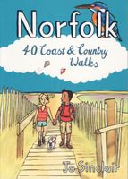
Wandelgids Norfolk | Pocket Mountains
Handige compacte wandelgids met 40 dagwandelingen. Deze gids bevat kleine kaartjes en leuke uitgebreide informatie over wat er langs de route te zien is. Goede wandelkaarten zijn echter we noodzakelijk voor deze tochten: de Ordnance Survey explorer maps of Landanger maps zijn zeer geschikt.   Pinpointing favourite treks, rambles and family trips, these 40 walks visit Norfolk in all its variety. From wild and windswept coast, Fens and Breckland to sheltered inland woods, broads and valleys, they offer geographical impact and a strong sense of history. Treading in the footsteps of warriors, drovers, pilgrims, weavers and reedcutters, this selection links to the county's extensive network of long-distance routes.   You'll find Norfolk at its most photogenic, with swallowtail butterflies and wherry boats, windpumps, seals and sailing boats, round tower churches and medieval architecture. From coast road to historic villages, towns and cities, many of the walks start near public transport.
10,95
Wandelgids Caithness and Sutherland | Pocket Mountains
Handige compacte wandelgids met 40 dagwandelingen. Deze gids bevat kleine kaartjes en leuke uitgebreide informatie over wat er langs de route te zien is. Goede wandelkaarten zijn echter we noodzakelijk voor deze tochten: de Ordnance Survey explorer maps of Landanger maps zijn zeer geschikt. The county of Ayrshire is located on the Firth of Clyde on the beautiful West Coast of Scotland and is known as one of the most fertile areas of the country, famed for its cattle and crops. Although more industrial to the north, it is in the main a landscape made for walking with an abundance of open countryside and rugged little hills, golden sandy beaches and beautiful sunsets. This guide features 40 mostly moderate walks full of interest which explore all aspects of the region, from craggy cliffs and caves to historic castles, ancient forests to sandy shorelines. Sutherland and Caithness are the most northerly parts of mainland Britain. Northwest Sutherland is a landscape of sandy beaches and …
10,95
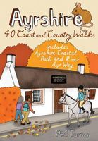
Wandelgids Ayrshire | Pocket Mountains
Handige compacte wandelgids met 40 dagwandelingen. Deze gids bevat kleine kaartjes en leuke uitgebreide informatie over wat er langs de route te zien is. Goede wandelkaarten zijn echter we noodzakelijk voor deze tochten: de Ordnance Survey explorer maps of Landanger maps zijn zeer geschikt.   The county of Ayrshire is located on the Firth of Clyde on the beautiful West Coast of Scotland and is known as one of the most fertile areas of the country, famed for its cattle and crops. Although more industrial to the north, it is in the main a landscape made for walking with an abundance of open countryside and rugged little hills, golden sandy beaches and beautiful sunsets. This guide features 40 mostly moderate walks full of interest which explore all aspects of the region, from craggy cliffs and caves to historic castles, ancient forests to sandy shorelines.
10,95
Wandelgids Oban and North Argyll | Pocket Mountains
This guidebook covers a large swathe of Mid and North Argyll, sweeping inland from the fractured western seaboard between Crinan and Appin to Arrochar and Bridge of Orchy on the region’s eastern periphery. Between these four points lies a landscape awash with sea lochs, with Inveraray roughly at the geographical centre. There are no large urban areas here and Oban is the largest settlement. Although the road network and public transport infrastructure are good, many routes feel off the beaten track. This is not only down to the low scattered population but also to the indented coast and its many islands, the sea lochs encroaching deep inland, the elongated freshwater lochs and the mountainous interior – making road travel much more convoluted than direct ‘as-the-crow-flies’ distances would suggest. As well as many great sea lochs, tumbling rivers and iconic mountains, Oban and North Argyll also boasts ancient, wildlife-rich woodlands and several fine gardens. Add to this the Crinan Ca…
10,95
Wandelgids 15 Short Walks Isle of Skye | Cicerone
Would you like to explore the best of the Isle of Skye? This guidebook covers 15 of the best short walks in the area (all under three hours), including the Old Man of Storr, the Quiraing pinnacles, Rubha Hunish and the Fairy Pools.   Why choose this guidebook?   Easy to moderate walks suitable for almost everyone Short climbs but no challenging terrain Numbered points which tie OS maps to clear route description Facilities, parking and highlights for every route Route Summary Table to help you choose your walk Cicerone’s Short Walks guidebooks contain everything you need to get outdoors and discover the best of an area. The routes are perfect if you’re new to walking or looking for something you can enjoy with the whole family. Let the adventures begin!
13,95
Wandelgids Weekend Walks Brighton and the South Downs | Pocket Mountains
Facing the sea and backed by rolling chalk downland, Brighton is a great place from which to explore one of England's most recognisable and best-loved landscapes. As well as the old chalk grasslands, the South Downs incorporate a variety of habitats, including deciduous, coniferous and mixed woodland, heathland, wetland, shingle beach and saltmarsh. The 40 walks in this guidebook cover the area of the Downs around Brighton, extending to Eastbourne in the east and as far as Worthing and the Findon Valley in the west, and from the Channel coast to the foot of the Downs' steep northern escarpment at the edge of the Sussex Weald.  
10,95

Klanten-reviews van Wandelgids Skye | Pocket Mountains

Er zijn nog geen beoordelingen voor dit productBen jij de eerste die een review plaatst?

Meer over Wandelgids Skye | Pocket Mountains

Productomschrijving

The Isle of Skye is famed for its magnificent scenery and abundance of fine walking country. The awesome Cuillin Hills and the otherworldly realms of the Quiraing and the Storr Sanctuary are among Scotland's most recognisable landscapes, but the island also has much more to offer the adventurous walker, including some of the most dramatic coastline in the British Isles. These 25 varied walks reflect Skye's diverse range of terrain and provide opportunities to experience the island's spectacular wildlife, its geological wonders and the physical traces of its often tumultuous history.

Productinformatie

    Verken gerelateerde categorieën

    Webshop.nl maakt gebruik van cookies. Ga je verder op onze website, ga dan akkoord met het plaatsen van cookies en de verwerking van deze data door ons en vermelde partners.