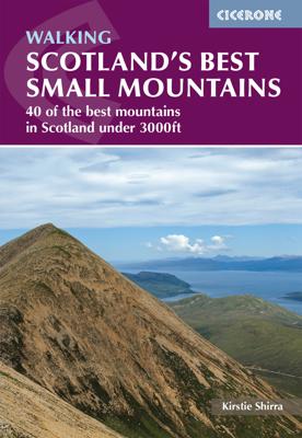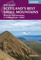
Wandelgids Scotland's Best Small Mountains | Cicerone

0
A guidebook to 40 of the best small mountains in Scotland under 3000ft. Explore the beautiful scenery of Sutherland and the far north, Torridon, Lochaber, the Great Glen, the Cairngorms, Glencoe, Arrochar, the Trossachs and the islands (Skye, Eigg, Mull, Arran). Routes for all seasons and all abilities.   Walks range from 5-25km and can be enjoyed...

Verkopers met dit product

Verkoper
Bezorging
Prijs
DeZwerver.nl logo
DeZwerver.nl
2,95
23,95

Anderen bekeken ook

Nieuw
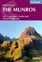
Wandelgids 1 Walking The Munros Vol 1 Southern, Central and Western Highlands - Schotland | Cicerone
Uitstekende wandelgids van het zuiden, midden en westen van de Schotse Hooglanden. Goed beschreven met veel praktische informatie om de route te kunnen lopen, inclusief redelijke kaarten. Guidebook to walking the Munros in southern, central and western Highlands. Describes 69 challenging routes across 139 of the iconic 3000ft+ mountains covering areas such as Glencoe, Bridge of Orchy and Mull. Includes routes up Ben More, Ben Alder, Ben Lomond and Ben Nevis, the highest mountain in the British Isles. Volume 1 of two guidebooks.   Seasons The guide is intended for summer hillwalkers (usually April/May to October in Scotland). In winter conditions the routes become more serious mountaineering expeditions requiring appropriate skills, equipment and experience.   Centres Arrochar, Crianlarich, Killin, Pitlochry, Tyndrum, Glencoe, Fort William, Spean Bridge, Dalwhinnie, Braemar, Glenshee   Difficulty Most of the Munros are straightforward walks but some involve ridge walking, sc…
20,95
Wandelgids The Munros | Pocket Mountains
The Munros are mountains in Scotland with a height of over 3000ft and take their name from the first list of such hills published in 1891 by Victorian mountaineer Sir Hugh Munro, 4th Baronet of Lindertis. Revised several times in the years since, the official list now features 282 peaks. This guide is for anyone who wants to climb these mountains and aims to provide reliable routes and tips for ascending them safely.   The Munros will ensure you reach parts of Scotland you might otherwise overlook, spend memorable evenings in pubs, bothies and wild camps, and have encounters with other walkers, locals and wildlife that enhance the adventure regardless of whether you get to the top of one Munro or all of them. Plaatsen in het boekje A’ Bhuidheanach Bheag, A’ Chailleach (Fannichs), A’ Chailleach (Monadhliath), A’ Chralaig, Ghlas-bheinn, A’ Mhaighdean, A’ Mharconaich, Am Basteir, Am Bodach, Am Faochagach, An Caisteal, An Coileachan, An Gearanach, An Riabhachan, An Sgarsoch, An Socach (De…
20,95
Wandelgids Fort William and Lochaber | Pocket Mountains
Handige compacte wandelgids met 40 dagwandelingen. Deze gids bevat kleine kaartjes en leuke uitgebreide informatie over wat er langs de route te zien is. Goede wandelkaarten zijn echter wel aan te raden voor deze tochten: de Ordnance Survey explorer maps of Landranger maps zijn zeer geschikt. With the historic town of Fort William at its heart, Lochaber boasts some of Scotland's most celebrated mountains and glens, beautiful sea lochs and, on the craggy west coast, dazzling white sandy beaches. Ben Nevis may draw the crowds, but with countless miles of lower-level paths and tracks to explore there is far more than Britain's highest mountain for walkers to enjoy in the region which lays claims to the title of 'The Outdoor Capital of the UK'. This guide features 40 varied walks that take in the very best of Lochaber. From the iconic Glencoe and Glen Nevis to the wild lands of Ardnamurchan and Moidart, there is something for everyone in this diverse selection of routes.
10,95
Wandelgids Walking Loch Lomond and The Trossachs | Cicerone
Uitstekende wandelgids, sommige meerdaags, voor dit uitdagende wandelgebied in Schotland. Guidebook to over 70 walking routes in the hills of Loch Lomond and the Trossachs National Park in Scotland's Southern Highlands. Including 21 Munros on less-popular routes, as well as plenty of Corbetts and Grahams. Hill summits of Ben Lomond, the Cobbler, Ben Lui and the Arrochar Alps have plenty of routes to explore. The routes in this guide range from 1 to 17 miles, and are clearly graded for distance and difficulty, as well as dividing between low-level, mid-level and mountain walks. From short, loch-side strolls suitable for all walkers, to long, challenging mountain routes with rocky scrambling, the Loch Lomond and Trossachs hills have plenty to offer.    The glens and mountains walks in this guide are divided into area: the Trossachs, Callander and Loch Lubnaig, Balquhidder and Lochearnhead, Crianlarich to Inveraran, Tyndrum, Ben Lomond, Loch Lomond West, Arrochar Alps and Glen Croe to Lo…
20,95
Nieuw
Wandelgids The Hebrides - De Hebriden Schotland | Cicerone
This inspirational guide offers 50 varied hiking and backpacking routes on the Scottish Hebrides islands, set out in a large guidebook to be savoured. The hikes highlight all the very best landscapes and scenery to be found on the spectacular islands of the Hebrides, a wonderland for adventurous walkers to return to time and time again. Inspirational guidebook to walking in Scotland's Hebrides islands. 50 adventurous walks on well-known and remote islands; from Syke, Mull, Rum, the Uists and Barra, Ulva, Iona, Eigg and Muck and more besides. Most of the walks provide a full day for experienced walkers, with a few multi-day adventures as well as some shorter routes. The terrain is often rough, rugged and pathless, while waymarking and public transport can, in many places, be hard to find. The challenge of wild walking, and the self-reliance needed to discover the best of the Hebrides, make the islands all the more appealing for adventurous walkers.   The walks also include Hebrides cla…
28,50
Wandelgids Southern Highlands | Pocket Mountains
Mooi uitgevoerde wandelgids in een handzaam formaat: 15 x 10 cm. De wandelingen zijn duidelijk beschreven, soms een beetje summier. This Pocket Mountains guide to the Southern Highlands of Scotland covers Glenlyon to Rannoch, Kinross to Callander, The Arrochar Alps, The Trossachs to the Mamlorn Hills, Hills of Crianlarich and Tyndrum -40 circular routes with 45 full colour maps -Each route is circular and takes into account the environmental impact of the walker -The routes vary in difficulty from easy half-day walks to longer, more challenging hikes -Original full colour maps for each route -Stunning colour photography throughout - Covers all the Munros (peaks over 3000 feet) and the best Corbetts (peaks over 2500 feet) in the area) - Designed in durable pocket format to take into the hills - Notes on history, geology and wildlife accompany each section of the book  
10,95
Reisfotografiegids Photographing Scotland | Fotovue
PHOTOGRAPHING SCOTLAND is a photography-location and visitor guidebook. If you are a keen photographer who can¿t miss a sunrise or are on holiday using a mobile phone camera, this guidebook will take you to the most beautiful and photogenic places in Scotland. In this extensive photo-location and visitor guidebook, award winning Scottish photographer Dougie Cunningham explores and describes the most beautiful places in Scotland to visit and photograph. From Glencoe to Glen Torridon, Skye to Shetland, Callanish to Cairngorm, this guidebook reveals the islands and mountains, glens and lochs, rivers and coastline and visits ancient stone circles, fortified houses, medieval castles, crofts and peel towers. The classic views are included and many more lesser known and hidden gems amongst the Lowlands, Highlands and Islands of this spectacular country. Also included are photographic tours of Edinburgh and Glasgow, and a handy list of the best Scottish whiskey distilleries to visit. This boo…
41,50
Nieuw
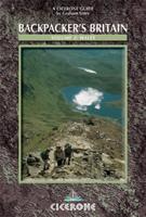
Wandelgids Backpacker's Britain | Cicerone
Guidebook includes 25 2 or 3-day walks taking walkers into the most scenic and wild parts of Wales, from Snowdon, the Glyderau and Carneddau in the north, down to the Black Mountains, Brecon Beacons and Fforest Fawr ranges in the south, including the ridges of the Arans, Arenigs, Berwyns and Cadair Idris, the Cwmdeuddwr hills and Plynlimon.   The mountains of Wales are a great place to get away from it all for a few days, and this book describes the very best backpacking routes throughout the principality. A total of 25 two- or three-day walks take you into the most scenic, beautiful and wild parts of Wales, each one with a night or more out among the mountains at wild camp sites, bothies or hostels. The routes cover all the main mountain ranges, from Snowdon, the Glyderau and Carneddau in the north, down to the Black Mountains, Brecon Beacons and Fforest Fawr ranges in the south. Everything in between is included too, such as the superb ridges of the Arans, Arenigs, Berwyns and Cadai…
18,95
Nieuw
Wandelgids 1 Walking the Corbetts: Volume 1 | Cicerone
Uitstekende wandelgids, goed beschreven met veel praktische informatie om de route te kunnen lopen, inclusief redelijke kaarten. This guide describes routes up all 112 Corbetts south of the Great Glen. The Corbetts offer challenging ascents and descents on steep slopes. The Corbetts (Scotland's 2500-2999ft mountains) are every bit as interesting as the Munros (3000ft and over), often clear when the Munros are in cloud, walkable on short winter days and free of the peak-bagging crowds of their taller neighbours.   Walking the Corbetts is divided into two volumes. This guide covers the Corbetts to the south of the Great Glen, which runs from Fort William to Inverness and includes the Southern Uplands, Southern Highlands, Cairngorms and also the islands of Arran and Jura. Choosing the best, rather than the quickest routes up each summit the author covers 112 Corbetts described in 95 routes, illustrated with custom 1:100,000 mapping.   South of Glasgow and Edinburgh are the moorland hills…
23,95
Nieuw
Wandelgids Snowdonia: South - Low-level and easy walks | Cicerone
Guidebook describing 30 walks in Snowdonia, Wales. Routes are mostly low level and on clear paths and showcase the region's beautiful scenery and rich history and culture. Part of a 2-volume set, this southern volume includes Trawsfynydd, Bala, Dolgellau, Machynlleth, the Harlech Coast and the valleys of the Mawddach and Dyfi. Through 30 day walks ranging from 3km to 18km, this guide offers opportunities for walkers of all abilities to explore the lowlands, moorland and estuaries of Snowdonia National Park. The second of two volumes to low-level and easy walking in Snowdonia, this guide covers the southern region between Llan Ffestiniog and Machynlleth. Other centres include coastal towns of Harlech, Barmouth and Aberdyfi, and lakeside settlements of Trawsfynydd and Y Bala.   Famous for its northern mountains, the Snowdonia National Park also features an expansive coastline of sandy beaches and wildlife-rich estuaries. Inland, the landscape showcases mossy-banked rivers, gorges and th…
13,95

Klanten-reviews van Wandelgids Scotland's Best Small Mountains | Cicerone

Er zijn nog geen beoordelingen voor dit productBen jij de eerste die een review plaatst?

Meer over Wandelgids Scotland's Best Small Mountains | Cicerone

Productomschrijving

A guidebook to 40 of the best small mountains in Scotland under 3000ft. Explore the beautiful scenery of Sutherland and the far north, Torridon, Lochaber, the Great Glen, the Cairngorms, Glencoe, Arrochar, the Trossachs and the islands (Skye, Eigg, Mull, Arran). Routes for all seasons and all abilities.   Walks range from 5-25km and can be enjoyed in 2-8 hours Highlights include Suilven, Quinag, the Pap of Glencoe, Beinn Damh, the Storr, Goatfell and the Cobbler One main ascent described for each with several alternatives for traverses, circuits and short-cuts Glossary of Gaelic words for mountain features and summary table for selecting your walk 1:50,000 OS mapping and beautiful photos are included for each route Detailed information on planning, access and profiles of the history and character of each mountains

Verken gerelateerde categorieën

Webshop.nl maakt gebruik van cookies. Ga je verder op onze website, ga dan akkoord met het plaatsen van cookies en de verwerking van deze data door ons en vermelde partners.